Àird Iain

Hill, Mountain in Argyllshire

Scotland

Àird Iain

Minor road to a public parking area at Arivegaig
Minor road to a public parking area at Arivegaig Credit: Steven Brown

Àird Iain is a prominent hill located in Argyllshire, Scotland. It is situated in a remote and picturesque area, offering stunning views of the surrounding landscapes. The hill stands at an elevation of approximately 762 meters (2,500 feet) above sea level, making it a popular destination for hikers and outdoor enthusiasts.

The terrain of Àird Iain is characterized by rugged and rocky slopes, with steep gradients in certain sections. Its summit provides a breathtaking panorama of the surrounding mountains, lochs, and glens, making it an ideal spot for photographers and nature enthusiasts. On a clear day, it is possible to see as far as the Isle of Mull and the Inner Hebrides.

The hill is covered in a variety of vegetation, including heather, grasses, and mosses, which add to its natural beauty. It is also home to a diverse range of wildlife, with species such as red deer, golden eagles, and ptarmigans often spotted in the area.

Access to Àird Iain is primarily by foot, with several well-marked trails leading to its summit. The most popular route starts from a nearby car park and follows a well-defined path that gradually ascends towards the top. The hike typically takes a few hours to complete, depending on the fitness level of the individual.

Àird Iain offers a unique opportunity to experience the wild and untamed beauty of the Scottish Highlands. Its challenging terrain and breathtaking vistas make it a must-visit destination for anyone seeking an adventure in the great outdoors.

If you have any feedback on the listing, please let us know in the comments section below.
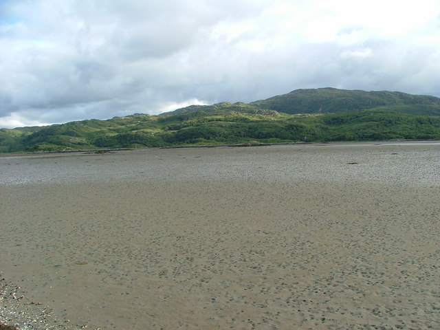
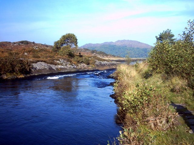
Àird Iain Images

Images are sourced within 2km of 56.726321/-5.8539077 or Grid Reference NM6466. Thanks to Geograph Open Source API. All images are credited.

Minor road to a public parking area at Arivegaig
No through road to Gorteneorn
Allt Beithe Seapool, Arivegaig
Camas Clachach in Kentra Bay 'Stony Bay' - but it looks muddy to me!
Camas Clachach in Kentra Bay
'Stony Bay' - but it looks muddy to me!
Bridge over the Allt Beithe Approaching the car park at Airigh Bheagaig after the long walk from Ockle.
Bridge over the Allt Beithe
Approaching the car park at Airigh Bheagaig after the long walk from Ockle.
Sign at Gorteneorn
Sign at Gorteneorn
Allt Eas an Taileir, Kentra Bay
Kentra Bay near Airigh Bheagaig Nearing our destination after our long walk from Ockle.
Kentra Bay near Airigh Bheagaig
Nearing our destination after our long walk from Ockle.
South of Kentra Bay View from a river crossing (of Allt Eas an Taileir?) showing the piers of a previous bridge and the ford beyond.  The view opens out to the mudflats of Kentra Bay in the distance.
South of Kentra Bay
View from a river crossing (of Allt Eas an Taileir?) showing the piers of a previous bridge and the ford beyond. The view opens out to the mudflats of Kentra Bay in the distance.
Near Arivegaig If you are going to visit the Singing Sands you have to pass this small bridge behind the parking place.
Near Arivegaig
If you are going to visit the Singing Sands you have to pass this small bridge behind the parking place.
Allt Beithe Seapool, Arivegaig
A sheep on salt marsh with Sea Pinks Like all hefted sheep these perform a regular daily pattern of movement, in unisex family groups, from one area of pasture to another. The fact that the pasture is tidal must influence this in interesting ways.
A sheep on salt marsh with Sea Pinks
Like all hefted sheep these perform a regular daily pattern of movement, in unisex family groups, from one area of pasture to another. The fact that the pasture is tidal must influence this in interesting ways.
Allt Beithe, Kentra Bay
Gorteneorn Ford Tidal influenced river ford on the way to the Singing Sands
Gorteneorn Ford
Tidal influenced river ford on the way to the Singing Sands
Allt Beithe, Ardnamurchan Allt Beithe flows N to Kentra Bay (3km). Main use of track is probably during the deer stalking season. There is a wooden footbridge in the valley before the track continues to centre horizon. Path to left is associated with new water supply works.
Allt Beithe, Ardnamurchan
Allt Beithe flows N to Kentra Bay (3km). Main use of track is probably during the deer stalking season. There is a wooden footbridge in the valley before the track continues to centre horizon. Path to left is associated with new water supply works.
Moorland and Allt Beithe, Ardnamurchan Valley of the Allt Beithe runs left to right (S to N) across centre of photo. Trees on right are in a tributary valley joining it from the SE.
Moorland and Allt Beithe, Ardnamurchan
Valley of the Allt Beithe runs left to right (S to N) across centre of photo. Trees on right are in a tributary valley joining it from the SE.
Moorland SW of Acharacle, Ardnamurchan Rough moorland on Glenborrodale to Acharacle path.
Moorland SW of Acharacle, Ardnamurchan
Rough moorland on Glenborrodale to Acharacle path.
Glenborrodale to Acharacle path, Ardnamurchan Isolated 285m high hill, S of Lochan Sligneach <a href="https://www.geograph.org.uk/gridref/NM6465">NM6465</a> and N of Loch Laga <a href="https://www.geograph.org.uk/gridref/NM6463">NM6463</a>
Glenborrodale to Acharacle path, Ardnamurchan
Isolated 285m high hill, S of Lochan Sligneach NM6465 and N of Loch Laga NM6463
Show me another place!

Àird Iain is located at Grid Ref: NM6466 (Lat: 56.726321, Lng: -5.8539077)

Unitary Authority: Highland

Police Authority: Highlands and Islands

What 3 Words

///dreading.corrode.lease. Near Drimnin, Highland

Related Wikis

Kentra Bay

Kentra Bay, also known as the Singing Sands, is a remote tidal, 306° orientated, coastal embayment located on the northern shore of the Ardnamurchan peninsula...

Kentra

Kentra is a hamlet overlooking the east coast of Kentra Bay, on the north east end of the Ardnamurchan peninsula near Acharacle, Scottish Highlands. It...

Eden (2016 TV series)

Eden is a British reality TV series; the first series was broadcast on Channel 4 from 18 July to 8 August 2016. It featured 23 participants living for...

Acharacle

Acharacle (, Scottish Gaelic: Àth Tharracail) is a village in Ardnamurchan, Lochaber, within the county of Argyll. It is in the Highland Council area of...

River Shiel

The River Shiel (Scottish Gaelic: Abhainn Seile) is a four kilometre long river in Acharacle, Highland. It flows out of the Loch Shiel into the sea at...

Newton of Ardtoe

Newton of Ardtoe is a scattered crofting hamlet near Acharacle in Lochaber, Scottish Highlands and is in the council area of Highland.

Ardshealach

Ardshealach (Scottish Gaelic:) is a small hamlet located close to the south west shore of Loch Shiel in Sunart, Lochaber, Highland, less than one mile...

Ardtoe

Ardtoe (Scottish Gaelic: Àird Tobha) is a place on the coast of Ardnamurchan, Lochaber, in the Highland council area of Scotland. It has sandy beaches...

Have you been to Àird Iain?

Leave your review of Àird Iain below (or comments, questions and feedback).