Biggins, High

Settlement in Westmorland South Lakeland

England

Biggins, High

Well Lane enclosed by hedge and wall Looking north-eastward in the direction of Tearnside.
Well Lane enclosed by hedge and wall Credit: Peter Wood

Biggins is a small village located in the county of Cumbria, in the North West of England. Specifically, it is situated in the district of South Lakeland, within the civil parish of Burton-in-Kendal. Biggins is part of the larger area known as High, Westmorland.

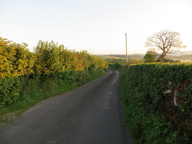
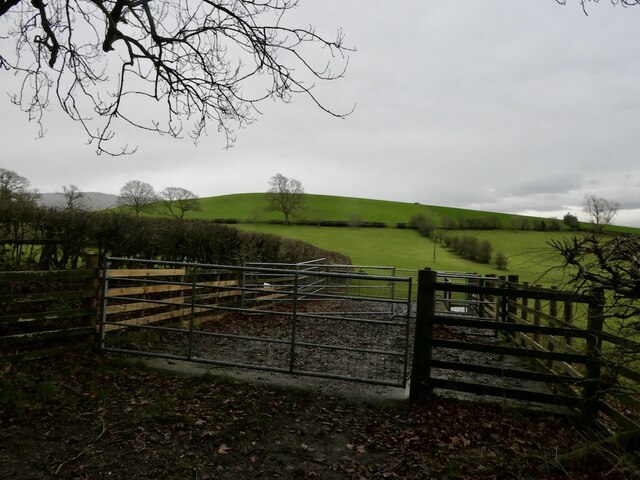
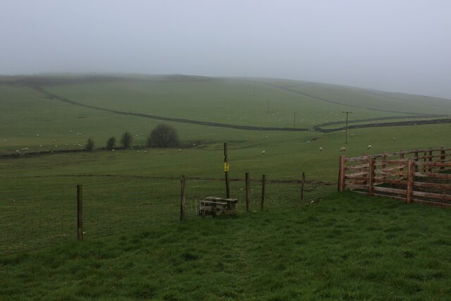
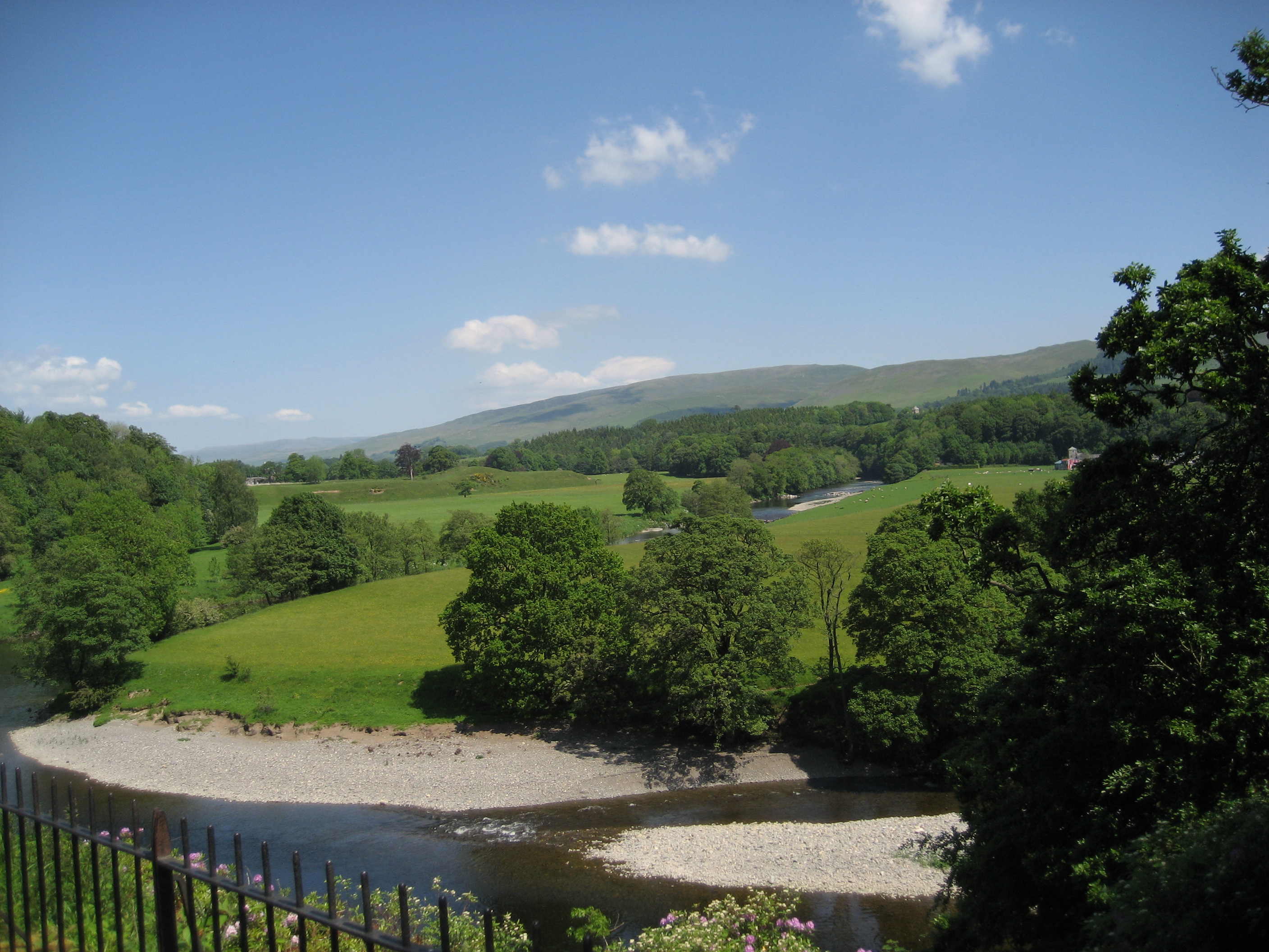
Nestled amidst the picturesque countryside of the Lake District National Park, Biggins boasts stunning views of rolling hills, lush green meadows, and charming farmlands. The village is surrounded by a tranquil and idyllic landscape, attracting visitors who seek to escape the hustle and bustle of city life.

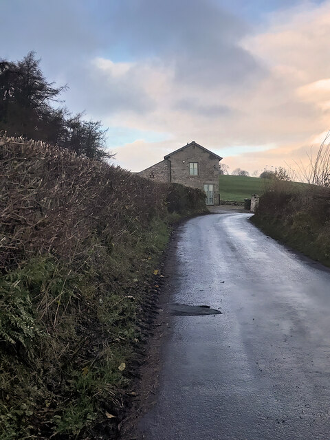
Although small in size, Biggins has a rich history dating back to the medieval period. The village features several traditional stone-built houses, some of which have been preserved as historical landmarks. These buildings showcase the architectural style prevalent in the region during the past centuries.

Biggins offers a peaceful and close-knit community environment. The village is home to a small number of residents who enjoy a quiet rural lifestyle. Amenities such as a local pub and a village hall contribute to the sense of community, providing gathering spaces for social interactions and events.

The location of Biggins also makes it an excellent base for outdoor activities. Hiking and walking trails are abundant in the area, allowing visitors to explore the stunning natural beauty of the Lake District. Additionally, the nearby market towns of Kendal and Kirkby Lonsdale offer further amenities and attractions for residents and tourists alike.

Overall, Biggins, High, Westmorland, with its charming countryside surroundings, rich history, and community spirit, provides a serene and welcoming destination for those seeking a peaceful retreat in the heart of the Lake District.

If you have any feedback on the listing, please let us know in the comments section below.

Biggins, High Images

Images are sourced within 2km of 54.196723/-2.616916 or Grid Reference SD5978. Thanks to Geograph Open Source API. All images are credited.

Well Lane enclosed by hedge and wall Looking north-eastward in the direction of Tearnside.
Well Lane enclosed by hedge and wall
Looking north-eastward in the direction of Tearnside.
Well Lane near Tearnside Hall Looking north-westward.
Well Lane near Tearnside Hall
Looking north-westward.
Pit Lane near Biggins, Kirkby Lonsdale Looking northward in dawn sunlight.
Pit Lane near Biggins, Kirkby Lonsdale
Looking northward in dawn sunlight.
Dykes off Gallowber Road Limestone walls.
Dykes off Gallowber Road
Limestone walls.
Sheep pens, Hosticle Lane
Hosticle Lane Passing Hagg Wood.
Hosticle Lane
Passing Hagg Wood.
Hosticle Lane
Hosticle Lane
Longbarn, Tearnside Hamlet of Tearnside as seen from Well Lane
Longbarn, Tearnside
Hamlet of Tearnside as seen from Well Lane
Well Lane, Tearnside
Small Roofless Laithe off the A65 Found opposite the junction of Hophouse Lane onto the A65, north west of Kirkby Lonsdale.
A submission of 12 years ago shows how much this building has deteriorated over time.
<a href="https://www.geograph.org.uk/photo/1829990">SD5979 : Barn south of Pells Yeat</a>
Small Roofless Laithe off the A65
Found opposite the junction of Hophouse Lane onto the A65, north west of Kirkby Lonsdale. A submission of 12 years ago shows how much this building has deteriorated over time. SD5979 : Barn south of Pells Yeat
Footpath heading for Pit Lane Very short public footpath leading from the A65 towards Pit Lane, crossing the corner of a pasture.
Footpath heading for Pit Lane
Very short public footpath leading from the A65 towards Pit Lane, crossing the corner of a pasture.
Gallowber Lane
Gallowber Lane
On the Footpath between High Biggins and Hutton Roof Little evidence of a footpath on the ground, although plastic indicators help walkers on the way.
Some maps show this as the Limestone Link long distance footpath.
On the Footpath between High Biggins and Hutton Roof
Little evidence of a footpath on the ground, although plastic indicators help walkers on the way. Some maps show this as the Limestone Link long distance footpath.
Stile on the Footpath between Hutton Roof and High Biggins Crossing a series of pastures on a misty morning.
The footpath is marked as the Limestone Link long distance footpath on some Ordnance Survey Maps.
Stile on the Footpath between Hutton Roof and High Biggins
Crossing a series of pastures on a misty morning. The footpath is marked as the Limestone Link long distance footpath on some Ordnance Survey Maps.
Bridleway heading for Gallowber Lane
Biggins, Pit Lane
Biggins, Pit Lane
Field off Biggins Lane
Biggins Lane
Biggins Lane
Show me another place!

Biggins, High is located at Grid Ref: SD5978 (Lat: 54.196723, Lng: -2.616916)

Administrative County: Cumbria

District: South Lakeland

Police Authority: Cumbria

What 3 Words

///cropping.smoke.routs. Near Kirkby Lonsdale, Cumbria

Related Wikis

Queen Elizabeth School, Kirkby Lonsdale

Queen Elizabeth School, also abbreviated to as QES, is a coeducational, comprehensive secondary school and sixth form with academy status. It is located...

Kirkby Lonsdale

Kirkby Lonsdale () is a town and civil parish in the Westmorland and Furness district of Cumbria, England, on the River Lune. Historically in Westmorland...

St Mary's Church, Kirkby Lonsdale

St Mary's Church is in the town of Kirkby Lonsdale, Cumbria, England. It is an active Anglican parish church in the deanery of Kendal, the archdeaconry...

St Michael's Church, Whittington

St Michael's Church is located in the settlement of Whittington, Lancashire, England. It is an active Anglican parish church in the deanery of Tunstall...

Nearby Amenities

Located within 500m of 54.196723,-2.616916
High Biggins
Is In: South Lakeland, Cumbria, England, UK
Place: hamlet
Source: npe
Lat/Long: 54.1984125/-2.6131695
Power: pole
Lat/Long: 54.1993581/-2.6114389
Power: pole
Lat/Long: 54.1995935/-2.6124957
Power: pole
Lat/Long: 54.2000673/-2.6140595
Power: pole
Lat/Long: 54.200425/-2.6151994
Power: pole
Lat/Long: 54.2008251/-2.616452
Power: pole
Lat/Long: 54.1980298/-2.6187466
Power: pole
Lat/Long: 54.1972588/-2.6184646
Power: pole
Lat/Long: 54.1964655/-2.6175458
Power: pole
Lat/Long: 54.1961411/-2.6172733
Power: pole
Lat/Long: 54.1958631/-2.6167379
Power: pole
Lat/Long: 54.1955758/-2.6162246
Power: pole
Lat/Long: 54.1952755/-2.615648
Power: pole
Lat/Long: 54.1950105/-2.6151474
Power: pole
Lat/Long: 54.1963824/-2.6114847
Power: pole
Lat/Long: 54.1957943/-2.6119509
Power: pole
Lat/Long: 54.1943054/-2.6130789
Power: pole
Lat/Long: 54.194725/-2.6137565
Power: pole
Lat/Long: 54.194523/-2.6131798
Power: pole
Lat/Long: 54.1940948/-2.6119758
Power: pole
Lat/Long: 54.2001484/-2.6183516
Power: pole
Lat/Long: 54.1991005/-2.6185157
Generator Method: photovoltaic
Generator Orientation: south_east
Generator Output Electricity: yes
Generator Solar Modules: 16
Generator Source: solar
Generator Type: solar_photovoltaic_panel
Location: roof
Power: generator
Lat/Long: 54.1981934/-2.6131085
Generator Method: photovoltaic
Generator Orientation: south
Generator Output Electricity: yes
Generator Solar Modules: 12
Generator Source: solar
Generator Type: solar_photovoltaic_panel
Location: roof
Power: generator
Lat/Long: 54.1972308/-2.6113213
Generator Method: photovoltaic
Generator Orientation: east
Generator Output Electricity: yes
Generator Solar Modules: 12
Generator Source: solar
Generator Type: solar_photovoltaic_panel
Location: roof
Power: generator
Lat/Long: 54.197342/-2.6108491
Generator Method: photovoltaic
Generator Orientation: south
Generator Output Electricity: yes
Generator Solar Modules: 16
Generator Source: solar
Generator Type: solar_photovoltaic_panel
Location: roof
Power: generator
Lat/Long: 54.1981698/-2.6179126
Power: pole
Lat/Long: 54.1968801/-2.6094261
Give Way
Direction: forward
Lat/Long: 54.1987178/-2.6134809
Give Way
Direction: backward
Lat/Long: 54.1989708/-2.6142429
Barrier: stile
Material: stone
Stile: squeezer
Lat/Long: 54.2001301/-2.6181721
Barrier: stile
Material: stone
Stile: squeezer
Lat/Long: 54.1995443/-2.6196382
The data included in this document is from www.openstreetmap.org. The data is made available under ODbL.

Have you been to Biggins, High?

Leave your review of Biggins, High below (or comments, questions and feedback).