An Stac
Hill, Mountain in Inverness-shire
Scotland
An Stac

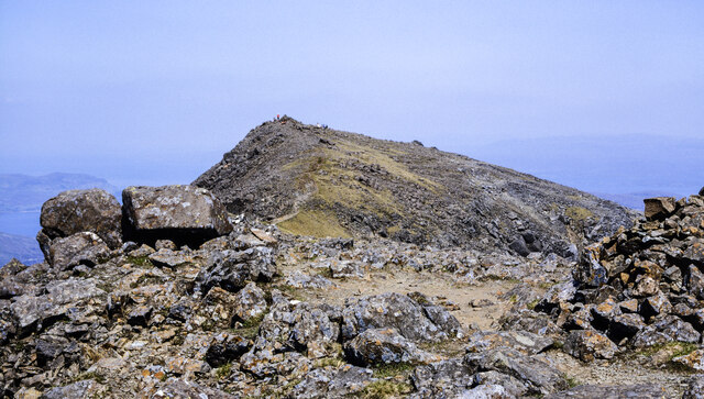
An Stac is a prominent hill located in the county of Inverness-shire, Scotland. Situated near the village of Newtonmore, it forms part of the Cairngorms National Park, renowned for its stunning landscapes and abundant wildlife.
Rising to an elevation of approximately 814 meters (2,670 feet), An Stac offers breathtaking panoramic views of the surrounding area. It is characterized by its steep slopes and rocky terrain, making it a popular destination for hikers and mountaineers seeking a challenging climb.
The hill is known for its diverse flora and fauna, with heather-covered moorlands, scattered birch trees, and patches of wildflowers adorning its slopes. It is also home to a variety of bird species, including ptarmigan, red grouse, and golden eagles, making it a haven for birdwatchers.
An Stac is often incorporated into longer hikes and trails within the Cairngorms National Park, such as the popular route known as the Newtonmore Round. This circular trail takes visitors on a journey through stunning landscapes, including forests, rivers, and open moorlands, culminating in a rewarding ascent of An Stac.
Due to its location within the Cairngorms National Park, An Stac offers visitors the opportunity to observe and appreciate Scotland's unique and unspoiled natural beauty. Whether seeking a challenging climb or simply wishing to immerse oneself in the tranquility of the Scottish Highlands, An Stac is a must-visit destination for nature lovers and outdoor enthusiasts alike.
If you have any feedback on the listing, please let us know in the comments section below.
An Stac Images
Images are sourced within 2km of 57.215635/-6.0731184 or Grid Reference NG5421. Thanks to Geograph Open Source API. All images are credited.


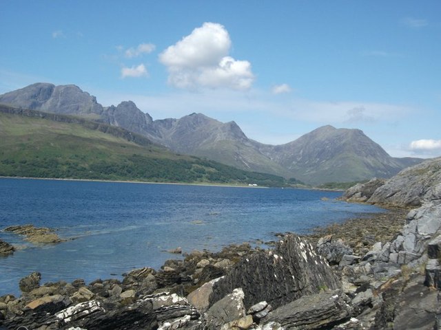


![Entering the John Muir Trust car park for Blaven The John Muir Trust own much of the Cuillin Hills on Skye, as well as other important, but remote areas in Scotland. In my personal view, they are the leading charity protecting wild land in Scotland while at the same time working with local interests as far as possible. For more information, see <span class="nowrap"><a title="http://www.johnmuirtrust.org" rel="nofollow ugc noopener" href="http://www.johnmuirtrust.org">Link</a><img style="margin-left:2px;" alt="External link" title="External link - shift click to open in new window" src="https://s1.geograph.org.uk/img/external.png" width="10" height="10"/></span> .
The car park (and path work on the hill) for Blaven is just one example. For some years they were reluctant even to mention their involvement, but they are a bit more relaxed now. The car park notice reads:
Welcome to Bla Bheinn
Please leave no trace
The nearest toilets are a short drive down the road at Elgol [I might quibble about the &#039;short&#039;, which may be true in distance but not always in time]
No overnight parking
Thank you for helping keep Skye beautiful
The JMT logo
Still fairly low-key, I think.](https://s0.geograph.org.uk/geophotos/05/84/62/5846272_44b102d7.jpg)


An Stac is located at Grid Ref: NG5421 (Lat: 57.215635, Lng: -6.0731184)
Unitary Authority: Highland
Police Authority: Highlands and Islands
What 3 Words
///divider.sneezing.potions. Near Elgol, Highland
Nearby Locations
Related Wikis
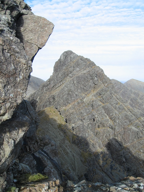
Clach Glas
Clach Glas is a mountain on the Black Cuillin of the Isle of Skye, Scotland. Its elevation is 786 m (2,579 ft) and the name translates as The Grey Stone...

Blà Bheinn
Blà Bheinn or Blàbheinn, also known as Blaven, is a mountain on the Isle of Skye in Scotland. It is usually regarded as an outlier of the Black Cuillin...

Garbh-bheinn (Skye)
Garbh-Bheinn (also known as Garven) (808 m), is a mountain in the Cuillin mountains of the Isle of Skye. It is located in the centre of the island, northeast...
Kilmaluag Formation
The Kilmaluag Formation is a Middle Jurassic geologic formation in Scotland. It was formerly known as the Ostracod Limestone for preserving an abundance...
Nearby Amenities
Located within 500m of 57.215635,-6.0731184Have you been to An Stac?
Leave your review of An Stac below (or comments, questions and feedback).