Aird of Kinloch

Hill, Mountain in Argyllshire

Scotland

Aird of Kinloch

Fences at Ardvergnish An isolated farmhouse below Ben More.
An old holiday picture from years ago, but more recent ones don't show much change.
Fences at Ardvergnish Credit: Des Blenkinsopp

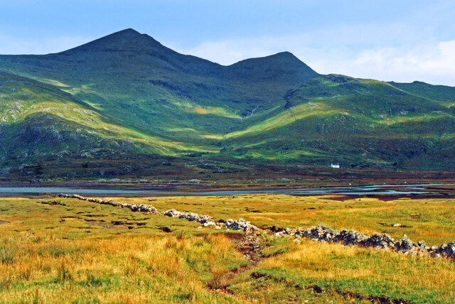
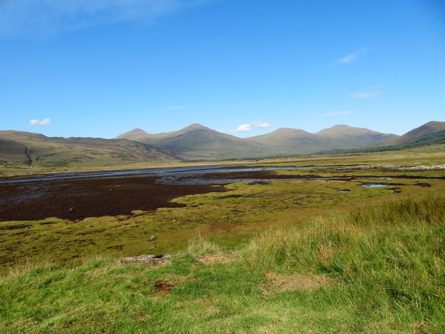
Aird of Kinloch, located in Argyllshire, Scotland, is a picturesque hill/mountain that offers breathtaking views of the surrounding landscape. Standing at an elevation of approximately 1,365 feet (416 meters), it is a prominent feature of the region and a popular destination for outdoor enthusiasts.

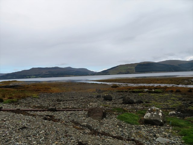
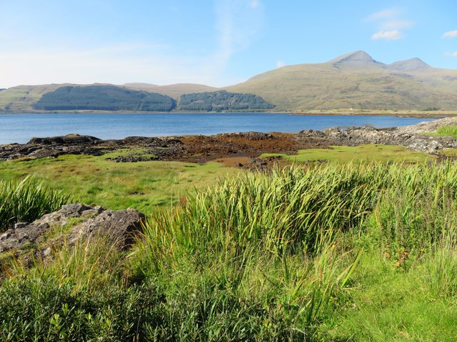
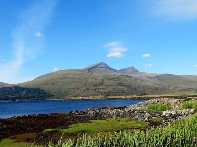
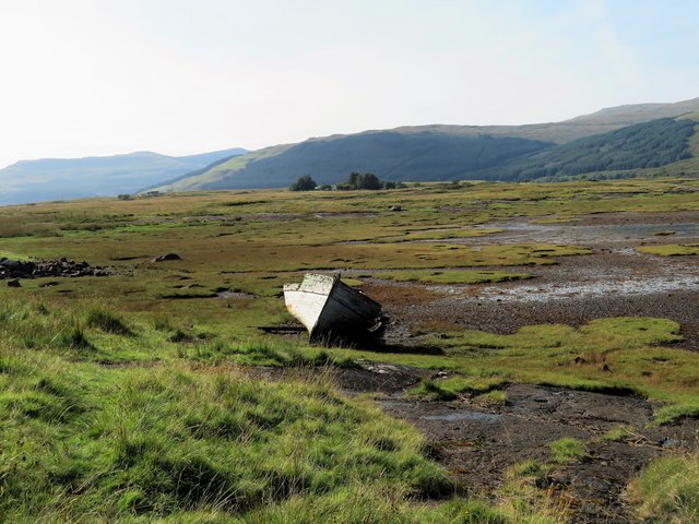
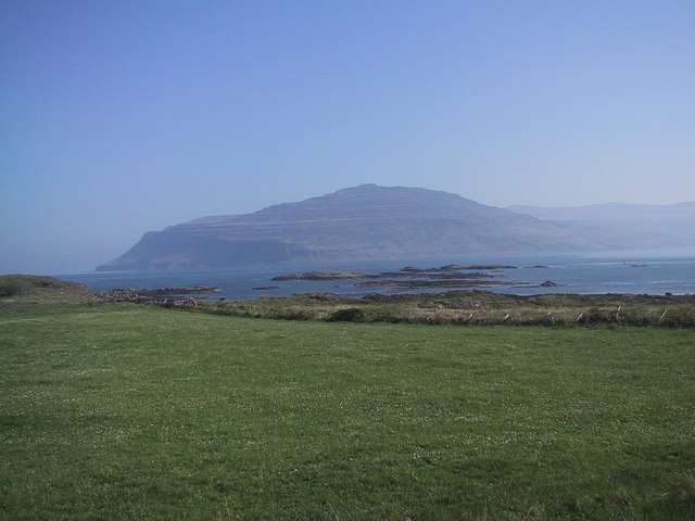
The hill boasts a rugged and rocky terrain, with patches of heather and grass covering its slopes. Its distinctive shape and steep inclines make it a challenging but rewarding area to explore for hikers and climbers. From the summit, visitors are treated to panoramic vistas of the nearby Loch Awe and the surrounding mountains, including the iconic Ben Cruachan.

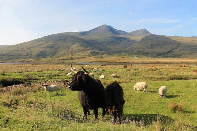
Aird of Kinloch is teeming with rich flora and fauna, making it a haven for nature lovers. The hill is home to a diverse range of plant species, including heather, bracken, and various wildflowers that add a burst of color to the landscape. It also supports a variety of bird species, such as golden eagles, buzzards, and peregrine falcons, which can often be spotted soaring through the skies above.

For those seeking solitude and tranquility, Aird of Kinloch offers a sense of peace and serenity. Its remote location ensures that visitors can immerse themselves in the natural beauty of the area without the distractions of modern life. Whether it is a challenging hike or a leisurely stroll, Aird of Kinloch provides an unforgettable experience for all who venture to its summit.

If you have any feedback on the listing, please let us know in the comments section below.

Aird of Kinloch Images

Images are sourced within 2km of 56.383745/-6.0114326 or Grid Reference NM5228. Thanks to Geograph Open Source API. All images are credited.

Fences at Ardvergnish An isolated farmhouse below Ben More.
An old holiday picture from years ago, but more recent ones don't show much change.
Fences at Ardvergnish
An isolated farmhouse below Ben More. An old holiday picture from years ago, but more recent ones don't show much change.
Towards Ben More Estuary and rough grazing south of Ben More.
Towards Ben More
Estuary and rough grazing south of Ben More.
View from Eilean a' Ghaill Today was one of those days of stunning clarity and I was lucky enough to be on Mull and took this view. The head of Loch Scridain, or Kinloch, can be seen beyond the solitary tree on Eilean a' Ghaill.
View from Eilean a' Ghaill
Today was one of those days of stunning clarity and I was lucky enough to be on Mull and took this view. The head of Loch Scridain, or Kinloch, can be seen beyond the solitary tree on Eilean a' Ghaill.
Dead boat below Kinloch Hotel
Tree beside the B8073
Pennyghael Hotel
Pennyghael Hotel
Benchmark by Loch Scridain The OS description is RIVET TOP S PARA BR 2.8M SW C STR. There is a fine view across Loch Scridain as the Allt na Coille Moire flows into it.
Benchmark by Loch Scridain
The OS description is RIVET TOP S PARA BR 2.8M SW C STR. There is a fine view across Loch Scridain as the Allt na Coille Moire flows into it.
Ridge rising towards Am Binnein Am Binnein is a location along the rising ridge. Beyond that, the ridge goes through convolutions ultimately reaching Ben More's summit which at the time the image was recorded was concealed by mist.
Ridge rising towards Am Binnein
Am Binnein is a location along the rising ridge. Beyond that, the ridge goes through convolutions ultimately reaching Ben More's summit which at the time the image was recorded was concealed by mist.
Leidle Mouth The Leidle flowing into Loch Scridain at Pennyghael.
Leidle Mouth
The Leidle flowing into Loch Scridain at Pennyghael.
Shoreline by Rubha Buidhe Rough grassland and rock by the shore of Loch Scridain.
Shoreline by Rubha Buidhe
Rough grassland and rock by the shore of Loch Scridain.
Scridain View A view across the shoreline of Loch Scridain and the sea loch itself to the mass of Ben More, the aptly named big hill behind.
Scridain View
A view across the shoreline of Loch Scridain and the sea loch itself to the mass of Ben More, the aptly named big hill behind.
Scridain Saltmarsh Saltmarsh by Kinloch with Ben More behind.
Scridain Saltmarsh
Saltmarsh by Kinloch with Ben More behind.
An Leth Fhonn The half land, this flat ground with a series of channels and covered by sea at high and spring tides. The translation, and description, comes from the original O/S survey notes and still applies.
An Leth Fhonn
The half land, this flat ground with a series of channels and covered by sea at high and spring tides. The translation, and description, comes from the original O/S survey notes and still applies.
Abandoned Boat An often photographed boat by Kinloch with the flat wet lowland of Aird of Kinloch behind.
Abandoned Boat
An often photographed boat by Kinloch with the flat wet lowland of Aird of Kinloch behind.
Kinloch Hotel Seen across the A849 is the Kinloch Hotel and Pennyghael Stores; both face across Loch Scridain to Ben More.
Kinloch Hotel
Seen across the A849 is the Kinloch Hotel and Pennyghael Stores; both face across Loch Scridain to Ben More.
Cattle before Ben More A highland cow and her suckler calf, with sheep, on grassland near the roadside across from Rossal Farm. Behind her lies part of An Leth Fonn, a low lying wetland prone to flooding with Ben More forming the horizon.
Cattle before Ben More
A highland cow and her suckler calf, with sheep, on grassland near the roadside across from Rossal Farm. Behind her lies part of An Leth Fonn, a low lying wetland prone to flooding with Ben More forming the horizon.
Ardvergnish Farm The farm of Ardvergnish below Ben More.
Ardvergnish Farm
The farm of Ardvergnish below Ben More.
Loch Beg The shoreline of Loch Beg. Seen across the loch is Kinloch hotel.
Loch Beg
The shoreline of Loch Beg. Seen across the loch is Kinloch hotel.
Show me another place!

Aird of Kinloch is located at Grid Ref: NM5228 (Lat: 56.383745, Lng: -6.0114326)

Unitary Authority: Argyll and Bute

Police Authority: Argyll and West Dunbartonshire

What 3 Words

///outdone.scanning.outboard. Near Lochbuie, Argyll & Bute

Related Wikis

Aird of Kinloch

Aird of Kinloch (Gaelic:An Àird) is a rocky outcrop between Loch Scridain and Loch Beg on the Isle of Mull, Argyll and Bute, Scotland. == References ==

Pennyghael

Pennyghael (Scottish Gaelic: Peighinn nan Gàidheal) is a small village in the Ross of Mull, Argyll and Bute, Scotland. It is located along the A849 road...

Tiroran

Tiroran is hamlet on the Isle of Mull in Argyll and Bute, Scotland. == History == In the late 18th century Tiroran House was associated with the McKinnon...

Ben More (Mull)

Ben More (Scottish Gaelic: Beinn Mhòr, meaning "great mountain") is the highest mountain and only Munro (mountains in Scotland that reach an elevation...

Loch Scridain

Loch Scridain is a 15-kilometre-long (9-mile) sea loch, with a west-south west aspect, on the western, or Atlantic coastline of the Isle of Mull, in the...

Ardmeanach

Ardmeanach in modern times refers to a peninsula on the Isle of Mull. It is the middle one out of three westward-facing peninsulas on the island, and the...

Carsaig Bay

Carsaig Bay is a cove on the Ross of Mull in the south of the Isle of Mull, off the west coast of Scotland. It is situated 5 kilometres (3 miles) eastward...

Isle of Mull

The Isle of Mull (Scottish Gaelic: An t-Eilean Muileach [əɲ ˈtʲʰelan ˈmuləx]) or just Mull (Scots pronunciation: [mʌl]; Scottish Gaelic: Muile [ˈmulə]...

Related Videos

Day 12 of 30 videos in 30 days. Isle of Mull & Iona, Scotland

Exploding toilets and an Island stroll on Iona.

Exploring the Tiroran Community Forest - Isle Of Mull West Coast Scotland - Free day trip.

An amazing find on the Isle of Mull. Something, for absolutely everyone and all free, (donations are welcome) Handcrafted ...

Nearby Amenities

Located within 500m of 56.383745,-6.0114326
Place: farm
Lat/Long: 56.3849228/-6.0069054
Place: farm
Lat/Long: 56.3857187/-6.0088473
Power: pole
Lat/Long: 56.3819011/-6.004422
Power: pole
Lat/Long: 56.3823826/-6.0058584
Power: pole
Lat/Long: 56.3828778/-6.0073236
Power: pole
Lat/Long: 56.3833753/-6.0088095
Power: pole
Lat/Long: 56.3837461/-6.0099574
Power: pole
Lat/Long: 56.3838841/-6.010318
Power: pole
Lat/Long: 56.3838316/-6.0111939
Power: pole
Lat/Long: 56.3838054/-6.0107425
Power: pole
Lat/Long: 56.3840495/-6.0098255
Power: pole
Lat/Long: 56.3842583/-6.0091887
Power: pole
Lat/Long: 56.384466/-6.0085354
Power: pole
Lat/Long: 56.3846793/-6.0078862
Power: pole
Lat/Long: 56.3850113/-6.0069733
The data included in this document is from www.openstreetmap.org. The data is made available under ODbL.

Have you been to Aird of Kinloch?

Leave your review of Aird of Kinloch below (or comments, questions and feedback).