Cnoc Eoin

Hill, Mountain in Ross-shire

Scotland

Cnoc Eoin

Coastline, Roisinis an Ear, Isle of Lewis The only land within the grid square is the tip of the grass bank from which the photo was taken and the rock platform below.
Coastline, Roisinis an Ear, Isle of Lewis Credit: Claire Pegrum

Cnoc Eoin is a prominent hill located in Ross-shire, Scotland. Standing at an elevation of approximately 526 meters (1,726 feet), it is often referred to as Cnoc Eoin Hill or Cnoc Eoin Mountain due to its size and grandeur. The hill is situated near the village of Evanton, about 20 kilometers (12 miles) north of the city of Inverness.

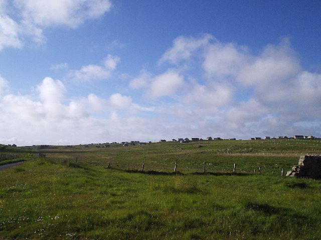
Cnoc Eoin offers breathtaking views of the surrounding Highland landscape, with its slopes covered in heather and scattered with rocky outcrops. The hill is a popular destination for outdoor enthusiasts, hikers, and hillwalkers who are eager to explore the natural beauty of the area. Its proximity to Evanton makes it easily accessible for both locals and tourists.

The ascent of Cnoc Eoin is relatively moderate, with a well-defined path leading to its summit. Once at the top, visitors are rewarded with panoramic views across the Cromarty Firth and the surrounding countryside, including the nearby Munros of Ben Wyvis and Little Wyvis. On clear days, it is even possible to catch a glimpse of the Moray Firth and the Black Isle.

The hill is also of historical significance, with traces of ancient settlements and fortifications found in the area. These archaeological sites add an extra layer of interest for those with an appreciation for history and heritage.

Overall, Cnoc Eoin in Ross-shire is a picturesque hill offering stunning views, a moderate hiking experience, and a glimpse into Scotland's rich history. Whether for outdoor enthusiasts or those seeking a peaceful escape in nature, this hill is a must-visit destination in the Scottish Highlands.

If you have any feedback on the listing, please let us know in the comments section below.
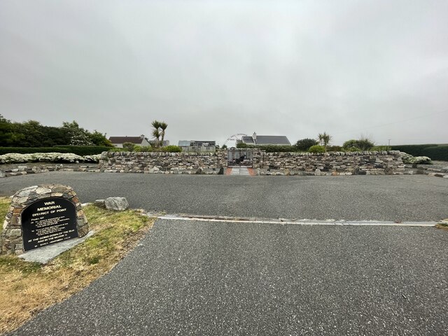
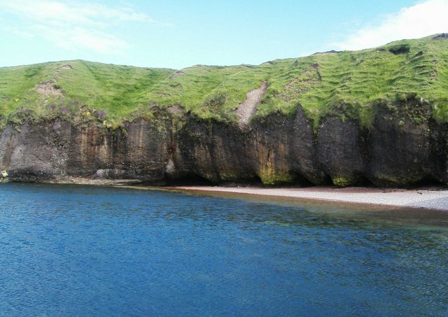
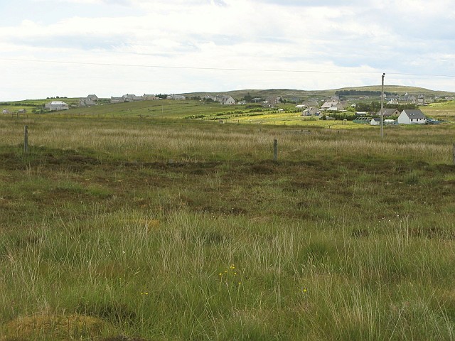
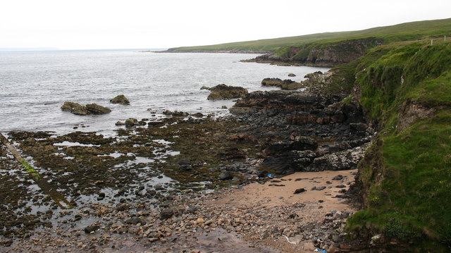
Cnoc Eoin Images

Images are sourced within 2km of 58.220814/-6.2268937 or Grid Reference NB5133. Thanks to Geograph Open Source API. All images are credited.

Coastline, Roisinis an Ear, Isle of Lewis The only land within the grid square is the tip of the grass bank from which the photo was taken and the rock platform below.
Coastline, Roisinis an Ear, Isle of Lewis
The only land within the grid square is the tip of the grass bank from which the photo was taken and the rock platform below.
Houses on the northern outskirts of Garrabost
Cemetery on An Rubha Geocaching is a type of global treasure hunt of people looking for caches, or hidden stashes of objects. Geocaching may also be described as a series of hide-and-seek games, where hiders provide online clues for seekers. Seekers use global positioning system (GPS) devices to find hidden caches
Cemetery on An Rubha
Geocaching is a type of global treasure hunt of people looking for caches, or hidden stashes of objects. Geocaching may also be described as a series of hide-and-seek games, where hiders provide online clues for seekers. Seekers use global positioning system (GPS) devices to find hidden caches
Roads around An Rubha In around 1999, the Ordnance Survey replaced English-language placenames in the Western Isles with Gaelic-language names. Some of the more prominent features (e.g. Isle of Barra; Stornoway; Sound of Harris) do have bilingual labels but, on the whole, villages, lochs, peaks etc. generally have the Gaelic names on the modern-day mapping.

Because the English versions have a tendency not to appear on the maps any more, I have decided to use them in my image titles and, as such, a translation will be readily available from the Gaelic labelling on the map. 

(NB I have not translated some of the more minor loch and river names, where I have not easily found the English version.)
Roads around An Rubha
In around 1999, the Ordnance Survey replaced English-language placenames in the Western Isles with Gaelic-language names. Some of the more prominent features (e.g. Isle of Barra; Stornoway; Sound of Harris) do have bilingual labels but, on the whole, villages, lochs, peaks etc. generally have the Gaelic names on the modern-day mapping. Because the English versions have a tendency not to appear on the maps any more, I have decided to use them in my image titles and, as such, a translation will be readily available from the Gaelic labelling on the map. (NB I have not translated some of the more minor loch and river names, where I have not easily found the English version.)
Roads around An Rubha Geocaching is a type of global treasure hunt of people looking for caches, or hidden stashes of objects. Geocaching may also be described as a series of hide-and-seek games, where hiders provide online clues for seekers. Seekers use global positioning system (GPS) devices to find hidden caches
Roads around An Rubha
Geocaching is a type of global treasure hunt of people looking for caches, or hidden stashes of objects. Geocaching may also be described as a series of hide-and-seek games, where hiders provide online clues for seekers. Seekers use global positioning system (GPS) devices to find hidden caches
Garrabost Road through Garrabost
Garrabost
Road through Garrabost
Garrabost Free Church The unadorned architecture of the Free Church is exemplified by the Church here in Garrabost, Lewis
Garrabost Free Church
The unadorned architecture of the Free Church is exemplified by the Church here in Garrabost, Lewis
Cliff Undercutting at Roisinis This picture, taken from a rocky outcrop, shows extensive undercutting of the cliffs.  Cliff erosion is a major problem in the local area but this photograph depicting the erosion along with the blue sea and grass creeping down the cliff shows the damage as attractive rather than destructive.
Cliff Undercutting at Roisinis
This picture, taken from a rocky outcrop, shows extensive undercutting of the cliffs. Cliff erosion is a major problem in the local area but this photograph depicting the erosion along with the blue sea and grass creeping down the cliff shows the damage as attractive rather than destructive.
Dibidale Burn The tiny Dibidale Burn flows into Broad Bay west of Garrabost.  The elevated pipeline appears to be some kind of water supply.
Dibidale Burn
The tiny Dibidale Burn flows into Broad Bay west of Garrabost. The elevated pipeline appears to be some kind of water supply.
Free Church of Scotland, Point A large modern building near the village of Garrabost.  Services are held in both English and Gaelic, as is common throughout Lewis.
Free Church of Scotland, Point
A large modern building near the village of Garrabost. Services are held in both English and Gaelic, as is common throughout Lewis.
Grazing land near Garrabost These sheep are grazing on land adjacent to the Free Church of Scotland <a href="https://www.geograph.org.uk/photo/494702">NB5132 : Free Church of Scotland, Point</a>.  This view looks towards the south west, to the village of Lower Bayble (Pabail Iarach).
Grazing land near Garrabost
These sheep are grazing on land adjacent to the Free Church of Scotland NB5132 : Free Church of Scotland, Point. This view looks towards the south west, to the village of Lower Bayble (Pabail Iarach).
Crofting land at Garrabost A maze of fences mark out the crofts on the north coast of the Eye Peninsula.
Crofting land at Garrabost
A maze of fences mark out the crofts on the north coast of the Eye Peninsula.
Gate and track to quarry This track and the quarry it leads to are not marked on the OS 1:50,000 map, although they do feature on the current 1:25,000 edition.
Gate and track to quarry
This track and the quarry it leads to are not marked on the OS 1:50,000 map, although they do feature on the current 1:25,000 edition.
View of Pabail crofting community Looking south over the crofts of Pabail
View of Pabail crofting community
Looking south over the crofts of Pabail
Rough grazing near Garrabost Newly shorn sheep in a field on the Eye Peninsula.
Rough grazing near Garrabost
Newly shorn sheep in a field on the Eye Peninsula.
Dumped car near Garrabost Not just the car, but a jumble of abandoned wire as well make this field a bit of a health and safety nightmare for these sheep.
Dumped car near Garrabost
Not just the car, but a jumble of abandoned wire as well make this field a bit of a health and safety nightmare for these sheep.
Rock and Sand, Eye peninsula. Looking along the coast from the end of a narrow lane that leads down to the shore from the A866 near Garrabost.
Rock and Sand, Eye peninsula.
Looking along the coast from the end of a narrow lane that leads down to the shore from the A866 near Garrabost.
A866 at Sulaisiadar The main road through this village on the Eye Peninsula of Lewis. On the left is an example of a Lewis shelter, four upright concrete slabs with a flat concrete 'roof'. Ugly, but possibly functional, and probably designed to offer some protection from the winds - though on Lewis they often seem to blow from four directions at once.
A866 at Sulaisiadar
The main road through this village on the Eye Peninsula of Lewis. On the left is an example of a Lewis shelter, four upright concrete slabs with a flat concrete 'roof'. Ugly, but possibly functional, and probably designed to offer some protection from the winds - though on Lewis they often seem to blow from four directions at once.
Show me another place!

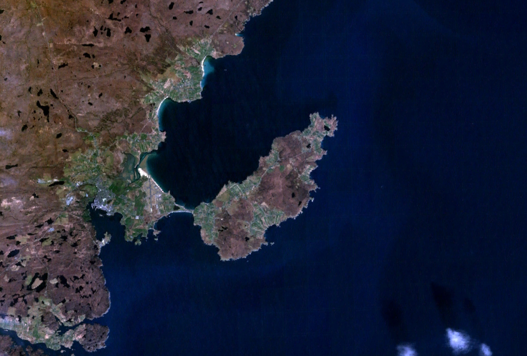
Cnoc Eoin is located at Grid Ref: NB5133 (Lat: 58.220814, Lng: -6.2268937)

Unitary Authority: Na h-Eileanan an Iar

Police Authority: Highlands and Islands

What 3 Words

///twisty.unsettled.sedated. Near Stornoway, Na h-Eileanan Siar

Nearby Locations

Cnoc an Oil Cnoc Eoin

Related Wikis

Garrabost

Garrabost (Scottish Gaelic: Garrabost) is a village in the Point (An Rubha) peninsula isthmus on the east coast of the Isle of Lewis, in the Outer Hebrides...

Point, Lewis

Point (Scottish Gaelic: An Rubha), also known as the Eye Peninsula, is a peninsula some 11 km long in the Outer Hebrides (or Western Isles), Scotland....

Bayble

Bayble (Scottish Gaelic: Pabail) is a village in Point (An Rubha), on the Isle of Lewis, 6 miles (10 kilometres) east of Stornoway. Bayble is also within...

Shulishader

Shulishader (Scottish Gaelic: Siadar an Rubha) is a small village with a population of around 120 people in Point, Outer Hebrides on the Isle of Lewis...

Nearby Amenities

Located within 500m of 58.220814,-6.2268937
Turning Circle
Turning Circle: knuckle
Lat/Long: 58.2200912/-6.2252403
GĂ rrabost
Name En: Garrabost
Name Gd: GĂ rrabost
Place: village
Wikidata: Q3778614
Wikipedia: en:Garrabost
Lat/Long: 58.2195272/-6.2315838
Passing Place
Lat/Long: 58.2224314/-6.2233532
Bus: yes
Public Transport: stop_position
Shelter: yes
Lat/Long: 58.2205467/-6.2261944
Passing Place
Lat/Long: 58.2235236/-6.224872
Turning Circle
Turning Circle: knuckle
Lat/Long: 58.2251112/-6.2282811
Power: pole
Lat/Long: 58.2174558/-6.2315263
Power: pole
Lat/Long: 58.2177614/-6.2307052
Power: pole
Lat/Long: 58.2180617/-6.2298695
Power: pole
Lat/Long: 58.2182292/-6.2312781
Power: pole
Lat/Long: 58.218473/-6.2320112
Power: pole
Lat/Long: 58.2183789/-6.2290066
Power: pole
Lat/Long: 58.2186819/-6.2281635
Power: pole
Lat/Long: 58.2189965/-6.227281
Power: pole
Lat/Long: 58.2190004/-6.2259388
Power: pole
Lat/Long: 58.2190107/-6.2246852
Power: pole
Lat/Long: 58.219379/-6.2235434
Power: pole
Lat/Long: 58.2197759/-6.2224261
Power: pole
Lat/Long: 58.2200982/-6.2214846
Power: pole
Lat/Long: 58.2204245/-6.2205603
Power: pole
Lat/Long: 58.2204796/-6.2226974
Power: pole
Lat/Long: 58.2212046/-6.2230105
Power: pole
Lat/Long: 58.221732/-6.2236288
Power: pole
Lat/Long: 58.2224824/-6.224113
Power: pole
Lat/Long: 58.2230885/-6.224383
Power: pole
Lat/Long: 58.2207404/-6.2196385
Power: pole
Lat/Long: 58.2211507/-6.2184463
Post Box
Operator: Royal Mail
Operator Wikidata: Q638098
Post Box Mounting: pier
Post Box Type: lamp
Ref: HS2 32
Royal Cypher: scottish_crown
Lat/Long: 58.2203676/-6.2271129
Noexit: yes
Lat/Long: 58.2207451/-6.2234943
Power: pole
Lat/Long: 58.2199128/-6.2240038
Street Lamp
Lamp Type: electric
Lat/Long: 58.219841/-6.225684
Street Lamp
Lamp Type: electric
Lat/Long: 58.218956/-6.224595
Street Lamp
Lamp Type: electric
Lat/Long: 58.2208923/-6.2240459
Street Lamp
Lamp Type: electric
Lat/Long: 58.2206543/-6.2239077
Street Lamp
Lamp Type: electric
Lat/Long: 58.2207138/-6.2234742
Street Lamp
Lamp Type: electric
Lat/Long: 58.2210311/-6.2241954
Street Lamp
Lamp Type: electric
Lat/Long: 58.2208722/-6.2249183
Street Lamp
Lamp Type: electric
Lat/Long: 58.2207359/-6.2255526
Street Lamp
Lamp Type: electric
Lat/Long: 58.2205982/-6.2261775
Street Lamp
Lamp Type: electric
Lat/Long: 58.2204428/-6.2267395
Access: private
Addr Housenumber: 2
Entrance: yes
Lat/Long: 58.2206464/-6.2233929
Access: private
Addr Housenumber: 4
Entrance: yes
Lat/Long: 58.2205922/-6.2236344
Power: pole
Lat/Long: 58.2236158/-6.2248881
Street Lamp
Lamp Type: electric
Lat/Long: 58.2219717/-6.2205632
Street Lamp
Lamp Type: electric
Lat/Long: 58.2217923/-6.2211921
Street Lamp
Lamp Type: electric
Lat/Long: 58.2223263/-6.2194044
Street Lamp
Lamp Type: electric
Lat/Long: 58.2216291/-6.221752
Street Lamp
Lamp Type: electric
Lat/Long: 58.2214674/-6.2223729
Street Lamp
Lamp Type: electric
Lat/Long: 58.221312/-6.2229884
Bus Stop
Garrabost Church
Bus: yes
Public Transport: platform
Lat/Long: 58.2216576/-6.2215136
Street Lamp
Lamp Type: electric
Lat/Long: 58.2230693/-6.2242017
Street Lamp
Lamp Type: electric
Lat/Long: 58.2239857/-6.2256923
The data included in this document is from www.openstreetmap.org. The data is made available under ODbL.

Have you been to Cnoc Eoin?

Leave your review of Cnoc Eoin below (or comments, questions and feedback).