Airighean Beinn nan Caorach

Hill, Mountain in Ross-shire

Scotland

Airighean Beinn nan Caorach

The Feadan Iosdail, Isle of Lewis
The Feadan Iosdail, Isle of Lewis Credit: Claire Pegrum

Airighean Beinn nan Caorach is a prominent hill located in Ross-shire, Scotland. With an elevation of approximately 500 meters (1,640 feet), it stands proudly in the scenic landscape of the Scottish Highlands. This hill is a part of the Beinn nan Caorach range, which stretches across the region.

Airighean Beinn nan Caorach offers breathtaking panoramic views of the surrounding area. On a clear day, one can see the picturesque valleys, rolling hills, and nearby lochs that make this region so captivating. The hill is covered in a blanket of lush green vegetation, comprising heather, grasses, and scattered patches of woodland.

Hiking enthusiasts are drawn to Airighean Beinn nan Caorach for its relatively accessible trails. There are several routes to reach the summit, accommodating both novice and experienced hikers. The trails meander through the rugged terrain, passing by rocky outcrops and glistening streams, adding to the natural beauty of the area.

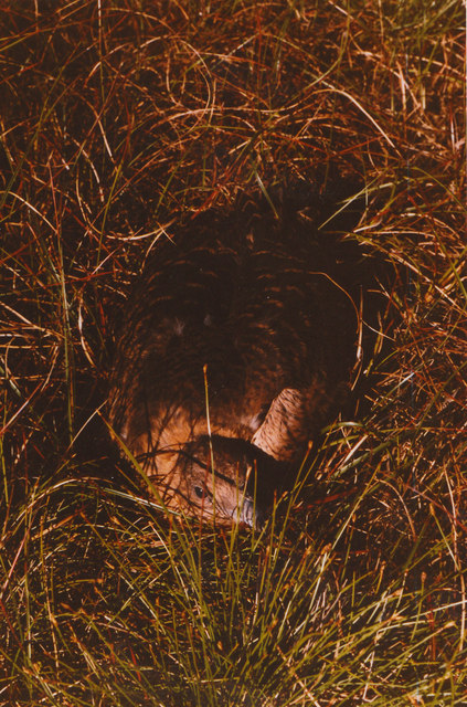
Wildlife enthusiasts will also find Airighean Beinn nan Caorach intriguing, as it is home to a variety of animal species. Red deer can often be spotted roaming the slopes, while golden eagles soar overhead. The hill is also known for its diverse bird population, including peregrine falcons, buzzards, and ptarmigans.

In conclusion, Airighean Beinn nan Caorach is a captivating hill in Ross-shire, Scotland, offering stunning views, diverse flora and fauna, and an array of hiking opportunities. It is a must-visit destination for nature lovers and outdoor enthusiasts seeking to immerse themselves in the beauty of the Scottish Highlands.

If you have any feedback on the listing, please let us know in the comments section below.

Airighean Beinn nan Caorach Images

Images are sourced within 2km of 58.426927/-6.2632154 or Grid Reference NB5156. Thanks to Geograph Open Source API. All images are credited.

The Feadan Iosdail, Isle of Lewis
Shieling, Iagro, Isle of Lewis This is one in a row of shielings.  Fifteen roofed and unroofed shielings are shown on the First Edition OS map, surveyed in 1852.  The Second Edition map, surveyed in 1895, shows only unroofed structures.

The course of the Abhainn Dhail can be seen below the peat bank in the photo.  It has this name on the First Edition map.  The Second Edition map and maps up until at least the 1950s show the Anglicised "Dell River".  More recent maps have reverted to the Gaelic name.
Shieling, Iagro, Isle of Lewis
This is one in a row of shielings. Fifteen roofed and unroofed shielings are shown on the First Edition OS map, surveyed in 1852. The Second Edition map, surveyed in 1895, shows only unroofed structures. The course of the Abhainn Dhail can be seen below the peat bank in the photo. It has this name on the First Edition map. The Second Edition map and maps up until at least the 1950s show the Anglicised "Dell River". More recent maps have reverted to the Gaelic name.
Bend in the Abhainn Dhail, Iagro, Isle of Lewis The burn is shown as the Abhainn Dhail on the First Edition OS map, surveyed in 1852. The Second Edition map, surveyed in 1895, and maps up until at least the 1950s show the Anglicised "Dell River". More recent maps have reverted to the Gaelic name.
Bend in the Abhainn Dhail, Iagro, Isle of Lewis
The burn is shown as the Abhainn Dhail on the First Edition OS map, surveyed in 1852. The Second Edition map, surveyed in 1895, and maps up until at least the 1950s show the Anglicised "Dell River". More recent maps have reverted to the Gaelic name.
Bend in the Abhainn Dhail, Iagro, Isle of Lewis The higher ground to the right is Tom Earsail.

The burn is shown as the Abhainn Dhail on the First Edition OS map, surveyed in 1852. The Second Edition map, surveyed in 1895, and maps up until at least the 1950s show the Anglicised "Dell River". More recent maps have reverted to the Gaelic name.
Bend in the Abhainn Dhail, Iagro, Isle of Lewis
The higher ground to the right is Tom Earsail. The burn is shown as the Abhainn Dhail on the First Edition OS map, surveyed in 1852. The Second Edition map, surveyed in 1895, and maps up until at least the 1950s show the Anglicised "Dell River". More recent maps have reverted to the Gaelic name.
Beinn Dhail Looking towards North Dell
Beinn Dhail
Looking towards North Dell
Cearc-fhraoich or Red Grouse on eggs, on Dell moor My collie dog Trixie can sniff them out otherwise i would never find them.

The Gaelic name of the bird, Cearc-fhraoich, translates as 'moor hen', not to be confused with the bird of this name in English.
Cearc-fhraoich or Red Grouse on eggs, on Dell moor
My collie dog Trixie can sniff them out otherwise i would never find them. The Gaelic name of the bird, Cearc-fhraoich, translates as 'moor hen', not to be confused with the bird of this name in English.
Airigh na Glaice
Airigh na Glaice
Show me another place!

Airighean Beinn nan Caorach is located at Grid Ref: NB5156 (Lat: 58.426927, Lng: -6.2632154)

Unitary Authority: Na h-Eileanan an Iar

Police Authority: Highlands and Islands

What 3 Words

///digests.harvest.stance. Near North Tolsta, Na h-Eileanan Siar

Related Wikis

Ness, Lewis

Ness (Scottish Gaelic: Nis) is the northernmost part of the Isle of Lewis, a community consisting of about 16 villages, including Lionel, Habost, Swainbost...

Cross, Lewis

Cross (Scottish Gaelic: Cros) is a township on the Isle of Lewis in the community of Ness, in the Outer Hebrides, Scotland. Cross is within the parish...

North Dell

North Dell (Scottish Gaelic: Dail bho Thuath) is a village on the Isle of Lewis in the community of Ness, in the Outer Hebrides, Scotland. North Dell is...

South Dell

South Dell (Scottish Gaelic: Dail-bho-Dheas) is a village on the Isle of Lewis in the community of Ness, in the Outer Hebrides, Scotland. South Dell is...

Have you been to Airighean Beinn nan Caorach?

Leave your review of Airighean Beinn nan Caorach below (or comments, questions and feedback).