Cnoc an da Lunnain

Hill, Mountain in Argyllshire

Scotland

Cnoc an da Lunnain

Fire station... Almost discernible track leading to gate which has two fire beaters and a shovel type thing to fire-fight with, should the forest go on fire. It would probably have to stop raining for a day or two before fire became a real concern.
Fire station... Credit: Alan Stewart

Cnoc an da Lunnain, located in Argyllshire, is a prominent and picturesque hill/mountain that attracts nature enthusiasts and hikers alike. Rising to an elevation of approximately 500 meters, it offers breathtaking views of the surrounding landscapes and is a popular destination for outdoor activities.

Situated in the western part of Scotland, Cnoc an da Lunnain is part of the scenic Argyll Forest Park. The mountain is characterized by its rugged terrain, with steep slopes covered in heather, grasses, and scattered boulders. Its distinctive shape and prominent position make it a recognizable landmark in the region.

The ascent to the summit of Cnoc an da Lunnain can be challenging, but the effort is rewarded with stunning panoramic vistas. On a clear day, one can see the vast expanse of Loch Fyne, the rolling hills of Argyll, and even glimpses of nearby islands in the distance.

The mountain offers various hiking trails catering to different levels of difficulty, from gentle walks to more demanding climbs. It is advisable for hikers to be well-prepared with appropriate gear and clothing, as the weather conditions can change rapidly in this region.

Wildlife enthusiasts will also find Cnoc an da Lunnain intriguing, as it is home to a diverse range of fauna and flora. Red deer, golden eagles, and peregrine falcons are often spotted in the area, making it a haven for birdwatchers and wildlife photographers.

Overall, Cnoc an da Lunnain in Argyllshire is a captivating destination that showcases the natural beauty and rugged charm of the Scottish Highlands.

If you have any feedback on the listing, please let us know in the comments section below.

Cnoc an da Lunnain Images

Images are sourced within 2km of 56.524978/-6.0640672 or Grid Reference NM5044. Thanks to Geograph Open Source API. All images are credited.

Fire station... Almost discernible track leading to gate which has two fire beaters and a shovel type thing to fire-fight with, should the forest go on fire. It would probably have to stop raining for a day or two before fire became a real concern.
Fire station...
Almost discernible track leading to gate which has two fire beaters and a shovel type thing to fire-fight with, should the forest go on fire. It would probably have to stop raining for a day or two before fire became a real concern.
Road up Glen Aros
Road up Glen Aros
Road up Glen Aros
Road up Glen Aros
Forest track in plantation in Glen Aros
Boggy moorland in the forest at Glen Aros
Remains of a shieling at Glac an da Lunnain
Felling operations at Glac an da Lunnain
Forestry in Aros The road to Dervaig. Coniferous plantations in the Aros River Valley.
Forestry in Aros
The road to Dervaig. Coniferous plantations in the Aros River Valley.
Forestry in Aros The road from Dervaig, looking to Salen.
Forestry in Aros
The road from Dervaig, looking to Salen.
Farmhouse at Tenga Quaint, ramshackle and apparently disused.
Farmhouse at Tenga
Quaint, ramshackle and apparently disused.
Forestry track Track heading south from Glen Aros road.
Forestry track
Track heading south from Glen Aros road.
Improvisation The small building in the left foreground appears to be made up by mixing together, a caravan, a small lean to shed and another (slightly) more substantial shed. Topped off by a makeshift power supply slung over the Aros river. In the background is Crannich farm.
Improvisation
The small building in the left foreground appears to be made up by mixing together, a caravan, a small lean to shed and another (slightly) more substantial shed. Topped off by a makeshift power supply slung over the Aros river. In the background is Crannich farm.
Road down Glen Aros
Road down Glen Aros
Access track off the road up Glen Aros
The weak road up Glen Aros
Col between Glen Aros and Glen Bellart An important pass linking Salen with the north of Mull without having to use the tortuous Tobermory to Dervaig road. The col between the glens is within a large Forestry Commission woodland.
Col between Glen Aros and Glen Bellart
An important pass linking Salen with the north of Mull without having to use the tortuous Tobermory to Dervaig road. The col between the glens is within a large Forestry Commission woodland.
Allt Gleann Mhic Caraidh An attractive watercourse with many waterfalls due to the resistant lava flows in this trap basalt landscape. Progress is easy up the wooded east side.
The view is changing; at the time of visit diggers were working either side of me, building a new forestry road. A bridge will be built in the foreground providing a route for timber lorries, independent of the public road which has a weight limit. Lorries just push the road into the bog leaving a sump killing crown on the road.
Allt Gleann Mhic Caraidh
An attractive watercourse with many waterfalls due to the resistant lava flows in this trap basalt landscape. Progress is easy up the wooded east side. The view is changing; at the time of visit diggers were working either side of me, building a new forestry road. A bridge will be built in the foreground providing a route for timber lorries, independent of the public road which has a weight limit. Lorries just push the road into the bog leaving a sump killing crown on the road.
Beinn nan Carn The north side of Beinn nan Carn. Grassy moorland, easily walked.
Beinn nan Carn
The north side of Beinn nan Carn. Grassy moorland, easily walked.
Show me another place!

Cnoc an da Lunnain is located at Grid Ref: NM5044 (Lat: 56.524978, Lng: -6.0640672)

Unitary Authority: Argyll and Bute

Police Authority: Argyll and West Dunbartonshire

What 3 Words

///meanings.trustees.prepped. Near Salen, Argyll & Bute

Related Wikis

Easan Labhar

Easan Labhar is a series of waterfalls on the island of Mull, Scotland. It lies on the Allt an Easain Labhair near Gruline west of Salen. There are also...

Loch Frisa

Loch Frisa (Scottish Gaelic: Loch Friosa) is a loch on the Isle of Mull, Inner Hebrides, Scotland. It falls within the Argyll and Bute unitary authority...

Inner Hebrides

The Inner Hebrides ( HEB-rid-eez; Scottish Gaelic: na h-Eileanan a-staigh, lit. 'the Inner Isles') is an archipelago off the west coast of mainland Scotland...

Aros Castle

Aros Castle, also known as Dounarwyse Castle, is a ruined 13th-century castle near Salen on the Isle of Mull, Scotland. The castle overlooks the Sound...
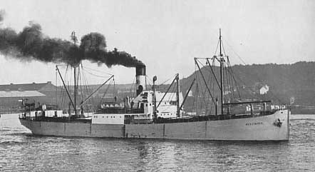
SS Hispania (1912)

SS Hispania was a Swedish 1,323 GRT triple-expansion engine steamer built in Belgium in 1912. She sank in the Sound of Mull on 18 December 1954 after striking...

Ulva Ferry

Ulva Ferry (Scottish Gaelic: Caolas Ulbha) is a hamlet on the Hebridean island of Mull, on its west coast. Ulva Ferry is on the shore of Ulva Sound (Caolas...
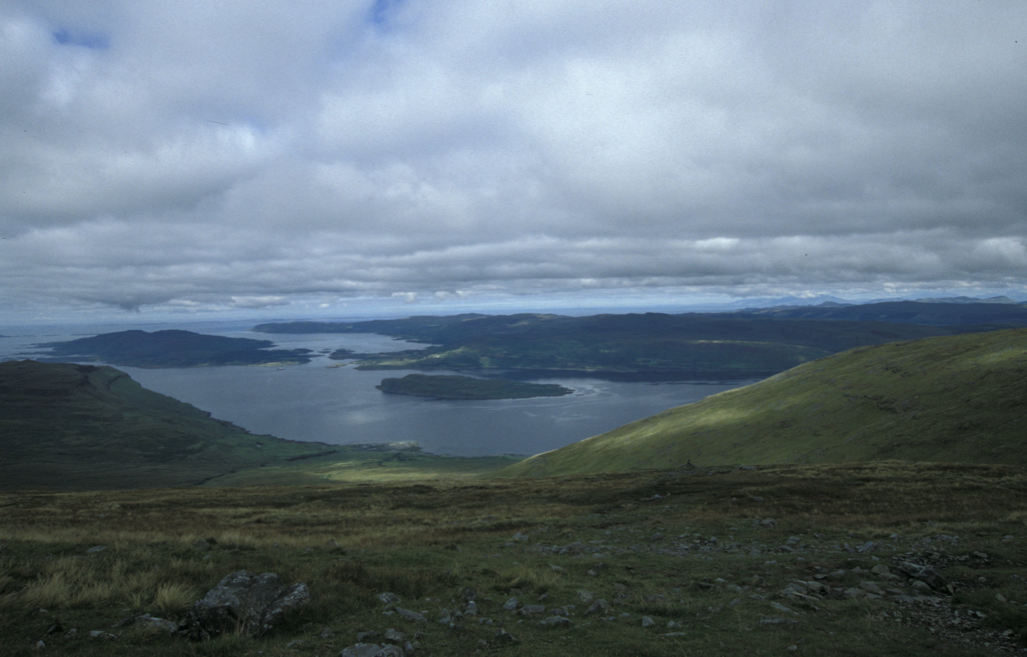
Loch na Keal

Loch na Keal (Scottish Gaelic: Loch na Caol), meaning Loch of the Kyle, or Narrows, also Loch of the Cliffs, is the principal sea loch on the western,...

Eorsa

Eorsa is an uninhabited island in the Inner Hebrides of Scotland. == Geography == Eorsa lies in Loch na Keal on the west coast of the Isle of Mull, to...

Have you been to Cnoc an da Lunnain?

Leave your review of Cnoc an da Lunnain below (or comments, questions and feedback).