Aberteifi
Settlement in Cardiganshire
Wales
Aberteifi
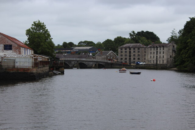
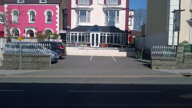
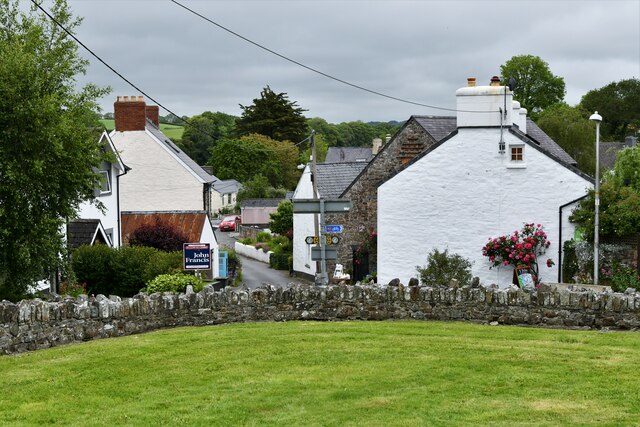
Aberteifi, also known as Cardigan, is a charming town located in the county of Ceredigion, in the historic county of Cardiganshire, Wales. Situated on the west coast of Wales, it lies at the confluence of the River Teifi and the Cardigan Bay.
Aberteifi has a rich history dating back to the 11th century when it was an important Norman trading post. The town grew in prominence during the 18th and 19th centuries as a vibrant port, exporting goods such as wool, leather, and timber. Today, remnants of its maritime past can be seen in the beautiful Georgian and Victorian architecture that lines the town's streets.
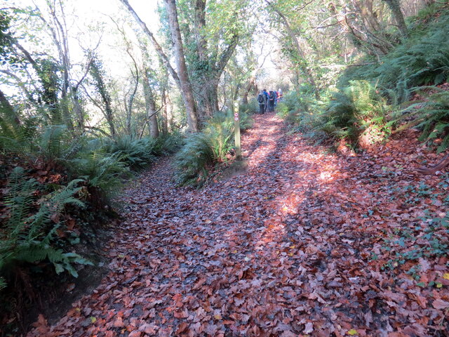
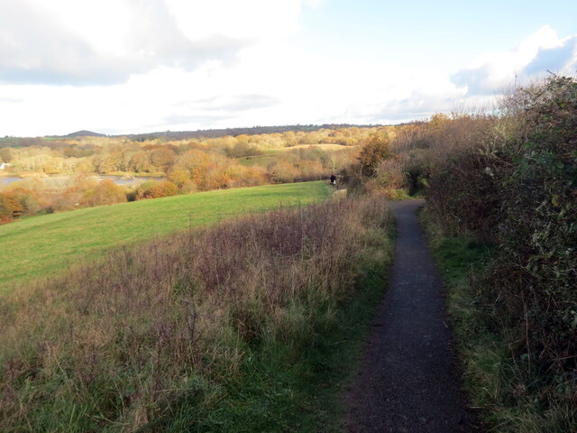
The town is known for its picturesque setting, surrounded by stunning natural beauty. The Teifi Estuary offers breathtaking views and is a popular spot for walking, boating, and fishing. The nearby Ceredigion Coast Path allows visitors to explore the rugged coastline, with its sandy beaches, dramatic cliffs, and hidden coves.
Aberteifi is also home to a vibrant arts and cultural scene. The town hosts various festivals throughout the year, including the Cardigan Bay Seafood Festival and the Cardigan Quays Festival, celebrating the town's maritime heritage. Theatr Mwldan, a modern arts venue, offers a diverse program of films, live music, and theater performances.
With a population of around 4,000, Aberteifi is a bustling town that boasts a range of amenities and services. It has a selection of independent shops, cafes, and restaurants, as well as supermarkets and leisure facilities. The town's friendly and welcoming atmosphere, combined with its stunning natural surroundings, make it a popular destination for tourists and locals alike.
If you have any feedback on the listing, please let us know in the comments section below.
Aberteifi Images
Images are sourced within 2km of 52.083553/-4.660918 or Grid Reference SN1746. Thanks to Geograph Open Source API. All images are credited.
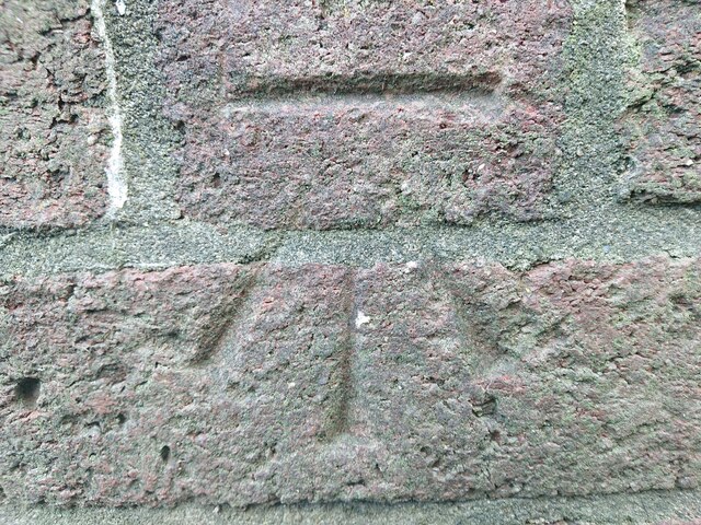
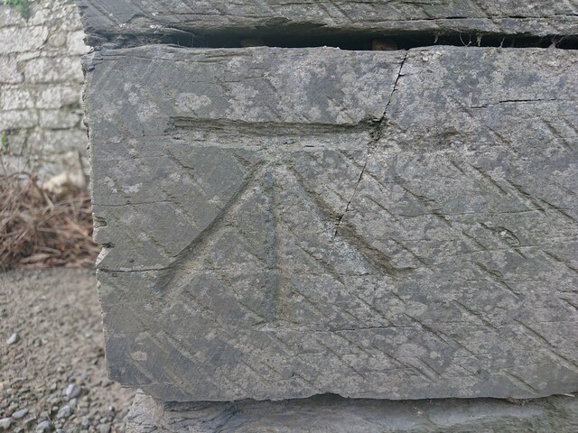
![OSBM Flush Bracket S0557 - Cardigan, St. Mary's School Ordnance Survey Benchmark (OSBM) used for levelling height above Ordnance Datum (OD).
Height (1954): 7.3333m OD (Newlyn). Mark verified by the Ordnance Survey in 1973. Description: FL BR S0557 S FACE 4.3M SW ANG SCH N SIDE RD. 1st Order BM.
The bracket was used on the Aberaeron to Carmarthen secondary line of the Second Geodetic Levelling of England &amp; Wales in 1927-1928. It was levelled with a height of 24.282&#039; above OD (Newlyn). Description: S face, 10&#039; from SW angle of school, N side of Pont-y-Cleifion, Cardigan. Abstract A 471: <span class="nowrap"><a title="http://discovery.nationalarchives.gov.uk/details/r/C11178815" rel="nofollow ugc noopener" href="http://discovery.nationalarchives.gov.uk/details/r/C11178815">Link</a><img style="margin-left:2px;" alt="External link" title="External link - shift click to open in new window" src="https://s1.geograph.org.uk/img/external.png" width="10" height="10"/></span> [OS 54/136].
The bracket was used on the Aberayron to Carmarthen secondary line of the Second Geodetic Levelling of England &amp; Wales in 1953-1954. It was levelled with a height of 24.117&#039; above OD (Newlyn). Abstract S 7: <span class="nowrap"><a title="http://discovery.nationalarchives.gov.uk/details/r/C11225155" rel="nofollow ugc noopener" href="http://discovery.nationalarchives.gov.uk/details/r/C11225155">Link</a><img style="margin-left:2px;" alt="External link" title="External link - shift click to open in new window" src="https://s1.geograph.org.uk/img/external.png" width="10" height="10"/></span> [OS 54/639].
The bracket was used on the Haverford West to Cardigan line (G077) of the Third Geodetic Levelling of England &amp; Wales in 1954. Abstract G 65: <span class="nowrap"><a title="http://discovery.nationalarchives.gov.uk/SearchUI/details?Uri=C11264473" rel="nofollow ugc noopener" href="http://discovery.nationalarchives.gov.uk/SearchUI/details?Uri=C11264473">Link</a><img style="margin-left:2px;" alt="External link" title="External link - shift click to open in new window" src="https://s1.geograph.org.uk/img/external.png" width="10" height="10"/></span> [OS 54/754].
Context: <a href="https://www.geograph.org.uk/photo/7106896">SN1846 : OSBM Flush Bracket S0557 - Cardigan, St. Mary's School</a>](https://s0.geograph.org.uk/geophotos/07/10/68/7106892_78427bcb.jpg)
![OSBM Flush Bracket S0557 - Cardigan, St. Mary's School Ordnance Survey Benchmark (OSBM) used for levelling height above Ordnance Datum (OD).
Height (1954): 7.3333m OD (Newlyn). Mark verified by the Ordnance Survey in 1973. Description: FL BR S0557 S FACE 4.3M SW ANG SCH N SIDE RD. 1st Order BM.
The bracket was used on the Aberaeron to Carmarthen secondary line of the Second Geodetic Levelling of England &amp; Wales in 1927-1928. It was levelled with a height of 24.282&#039; above OD (Newlyn). Description: S face, 10&#039; from SW angle of school, N side of Pont-y-Cleifion, Cardigan. Abstract A 471: <span class="nowrap"><a title="http://discovery.nationalarchives.gov.uk/details/r/C11178815" rel="nofollow ugc noopener" href="http://discovery.nationalarchives.gov.uk/details/r/C11178815">Link</a><img style="margin-left:2px;" alt="External link" title="External link - shift click to open in new window" src="https://s1.geograph.org.uk/img/external.png" width="10" height="10"/></span> [OS 54/136].
The bracket was used on the Aberayron to Carmarthen secondary line of the Second Geodetic Levelling of England &amp; Wales in 1953-1954. It was levelled with a height of 24.117&#039; above OD (Newlyn). Abstract S 7: <span class="nowrap"><a title="http://discovery.nationalarchives.gov.uk/details/r/C11225155" rel="nofollow ugc noopener" href="http://discovery.nationalarchives.gov.uk/details/r/C11225155">Link</a><img style="margin-left:2px;" alt="External link" title="External link - shift click to open in new window" src="https://s1.geograph.org.uk/img/external.png" width="10" height="10"/></span> [OS 54/639].
The bracket was used on the Haverford West to Cardigan line (G077) of the Third Geodetic Levelling of England &amp; Wales in 1954. Abstract G 65: <span class="nowrap"><a title="http://discovery.nationalarchives.gov.uk/SearchUI/details?Uri=C11264473" rel="nofollow ugc noopener" href="http://discovery.nationalarchives.gov.uk/SearchUI/details?Uri=C11264473">Link</a><img style="margin-left:2px;" alt="External link" title="External link - shift click to open in new window" src="https://s1.geograph.org.uk/img/external.png" width="10" height="10"/></span> [OS 54/754].
Close-up: <a href="https://www.geograph.org.uk/photo/7106892">SN1846 : OSBM Flush Bracket S0557 - Cardigan, St. Mary's School</a>](https://s0.geograph.org.uk/geophotos/07/10/68/7106896_ba61c266.jpg)
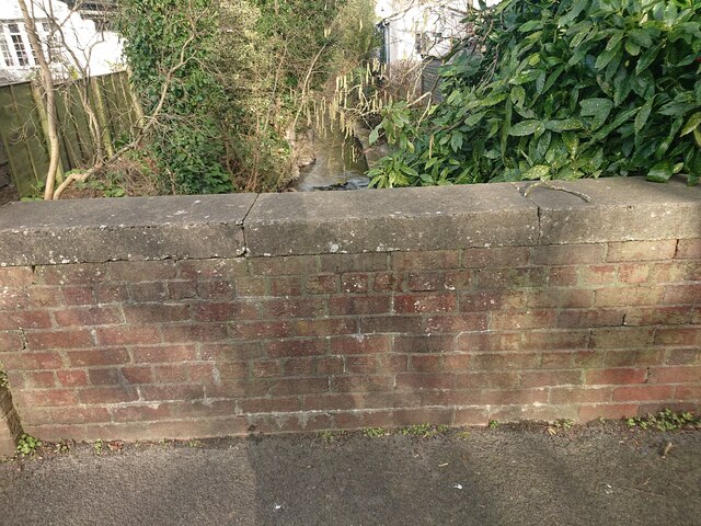
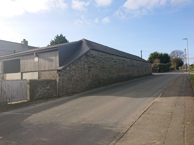
![Site of bridge, Grange Town, Cardigan There used to be a bridge at this location, over a small stream from the common, opposite. The drainage of the area was probably re-organised when the common was converted from allotments to King George’s Field c.1920. The bridge bore an Ordnance Survey benchmark:
The mark was used on the Warrington to Pembroke Docks line of the First Primary Levelling of England &amp; Wales in 1851-1852. It was levelled with a height of 75.663&#039; above OD (Liverpool). Description: 745. Mark on East battlement of small bridge ; 1.72 ft. below top of battlement. Page 536 of the abstract: <span class="nowrap"><a title="https://www.bench-marks.org.uk/abstract/ew1gl/1GLA_536.png" rel="nofollow ugc noopener" href="https://www.bench-marks.org.uk/abstract/ew1gl/1GLA_536.png">Link</a><img style="margin-left:2px;" alt="External link" title="External link - shift click to open in new window" src="https://s1.geograph.org.uk/img/external.png" width="10" height="10"/></span>
A mark at this location was used on the Aberaeron to Carmarthen secondary line of the Second Geodetic Levelling of England &amp; Wales in 1927-1928. Its height of 77.50&#039; above OD (Newlyn) suggests the original mark was replaced by a pivot on top of the parapet. Abstract A 471: <span class="nowrap"><a title="http://discovery.nationalarchives.gov.uk/details/r/C11178815" rel="nofollow ugc noopener" href="http://discovery.nationalarchives.gov.uk/details/r/C11178815">Link</a><img style="margin-left:2px;" alt="External link" title="External link - shift click to open in new window" src="https://s1.geograph.org.uk/img/external.png" width="10" height="10"/></span> [OS 54/136].](https://s3.geograph.org.uk/geophotos/07/10/70/7107051_75cf3c61.jpg)
![Castle Street, Cardigan There used to be a roadside house at this location which bore an Ordnance Survey benchmark.
The mark was used on the Warrington to Pembroke Docks line of the First Primary Levelling of England &amp; Wales in 1851-1852. It was levelled with a height of 56.910&#039; above OD (Liverpool). Description: 749. Mark on corner of James Thomas&#039;s house ; 2.75 ft. above surface. Page 536 of the abstract: <span class="nowrap"><a title="https://www.bench-marks.org.uk/abstract/ew1gl/1GLA_536.png" rel="nofollow ugc noopener" href="https://www.bench-marks.org.uk/abstract/ew1gl/1GLA_536.png">Link</a><img style="margin-left:2px;" alt="External link" title="External link - shift click to open in new window" src="https://s1.geograph.org.uk/img/external.png" width="10" height="10"/></span>
The mark was included on the Aberaeron to Carmarthen secondary line of the Second Geodetic Levelling of England &amp; Wales in 1927-1928. It was levelled with a height of 57.08&#039; above OD (Newlyn). Abstract A 471: <span class="nowrap"><a title="http://discovery.nationalarchives.gov.uk/details/r/C11178815" rel="nofollow ugc noopener" href="http://discovery.nationalarchives.gov.uk/details/r/C11178815">Link</a><img style="margin-left:2px;" alt="External link" title="External link - shift click to open in new window" src="https://s1.geograph.org.uk/img/external.png" width="10" height="10"/></span> [OS 54/136].](https://s0.geograph.org.uk/geophotos/07/10/82/7108200_793803eb.jpg)
Aberteifi is located at Grid Ref: SN1746 (Lat: 52.083553, Lng: -4.660918)
Unitary Authority: Ceredigion
Police Authority: Dyfed Powys
Also known as: Cardigan
What 3 Words
///bolt.newlywed.supreme. Near Cardigan, Ceredigion
Related Wikis
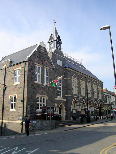
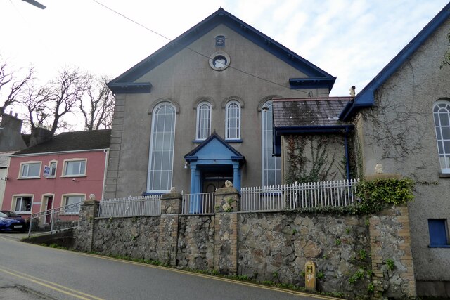
Cardigan Guildhall
Cardigan Guildhall (Welsh: Neuadd y Dref Aberteifi), is a municipal building in Pendre, Cardigan, Ceredigion, Wales. The structure, which is now used as...

Cardigan County School
Cardigan County School is the name given to the endowed grammar school in Cardigan which was founded there in the mid seventeenth century. The Intermediate...
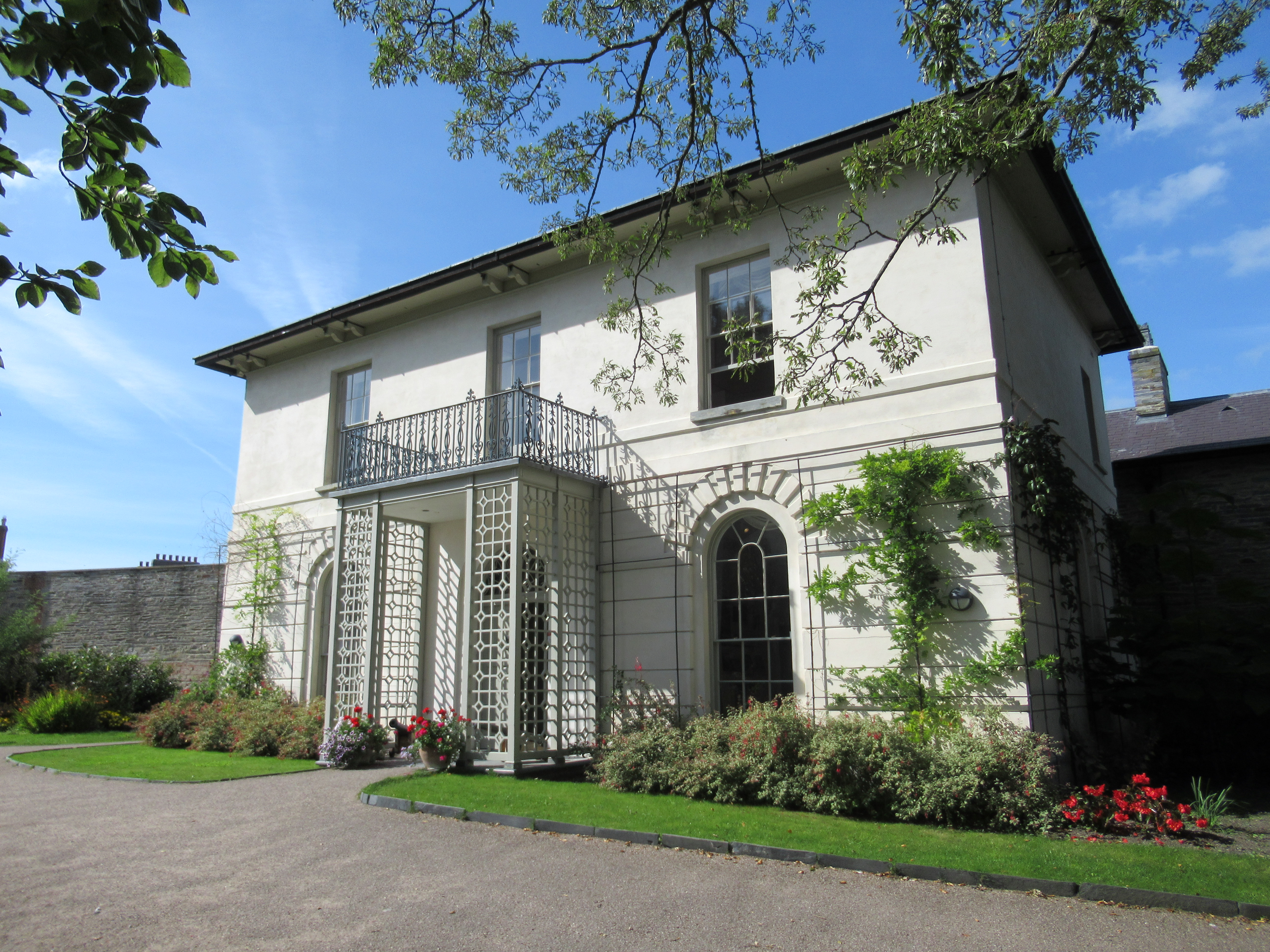
Castle Green House
Castle Green House is a Grade II* listed house located in the grounds of Cardigan Castle, Cardigan, Ceredigion, Wales. It was restored in the 2000s and...

Cardigan, Ceredigion
Cardigan (Welsh: Aberteifi, pronounced [abɛrˈtəivɪ] ) is both a town and a community in the county of Ceredigion, Wales. Positioned on the tidal reach...
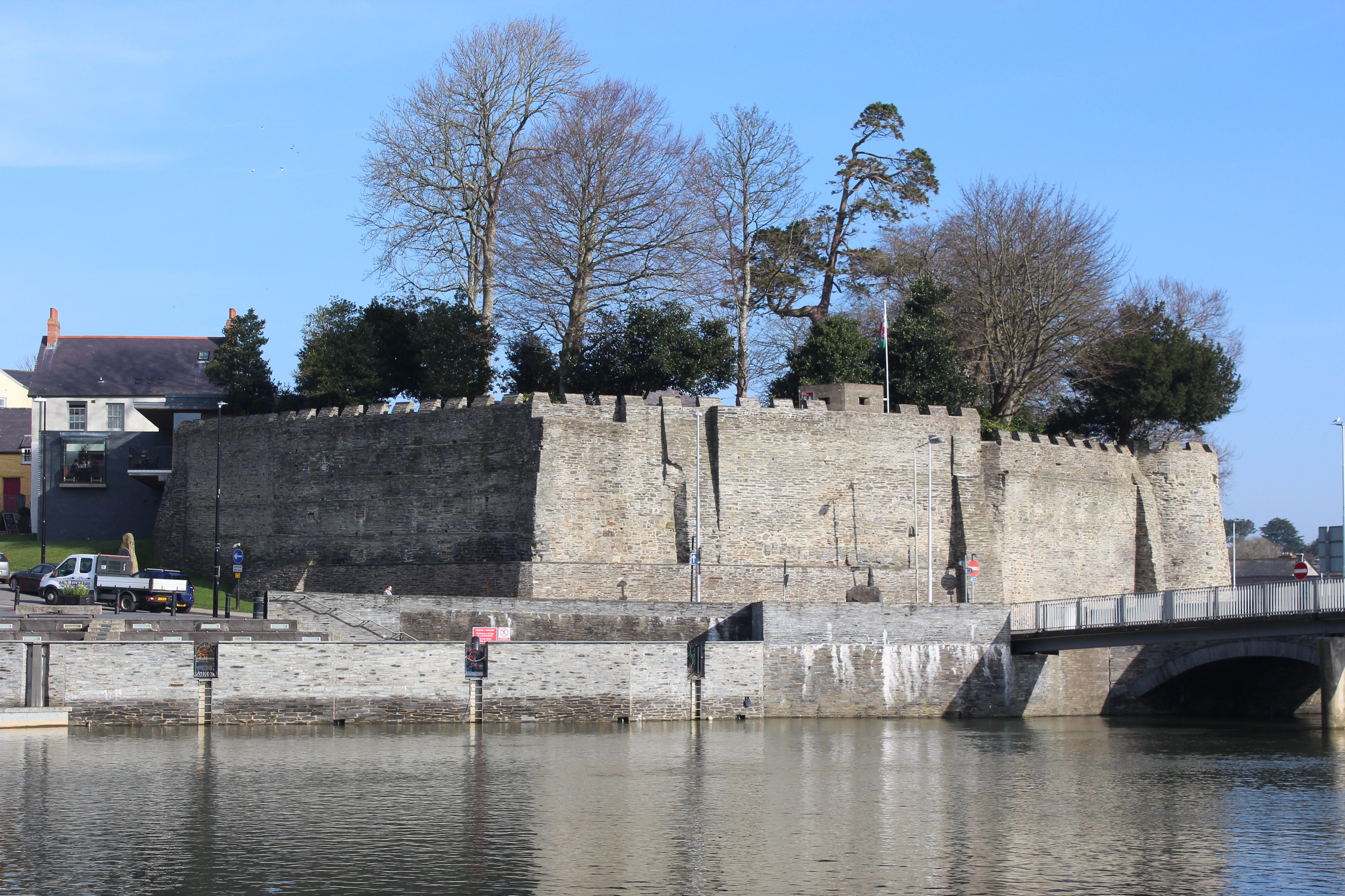
Cardigan Castle
Cardigan Castle (Welsh: Castell Aberteifi) is a castle overlooking the River Teifi in Cardigan, Ceredigion, Wales. It is a Grade I listed building. The...

St Mary's Church, Cardigan
St Mary's Church is an Anglican church located in Cardigan, Ceredigion, Wales. In 1428, with the disappearance of Holy Trinity Church, St Mary's formally...
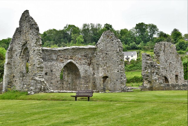
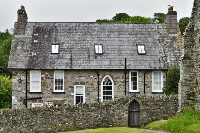
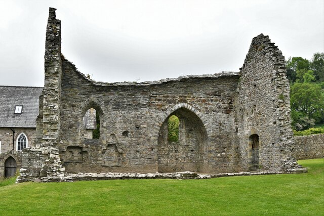
Cardigan Priory
Cardigan Priory (formally: The Priory Church of Our Lady of Cardigan; alternative: Cardigan Cell) was a Benedictine priory located in Cardigan, Ceredigion...
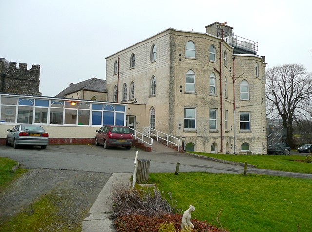
Cardigan and District Community Hospital
Cardigan and District Community Hospital (Welsh: Aberteifi a'r Cylch Ysbyty Cymunedol) was a community hospital in Cardigan, Ceredigion, Wales. It was...
Nearby Amenities
Located within 500m of 52.083553,-4.660918Have you been to Aberteifi?
Leave your review of Aberteifi below (or comments, questions and feedback).