Cnoc Smeordail

Hill, Mountain in Inverness-shire

Scotland

Cnoc Smeordail

Road junction, Eigg Left for Kildonan, right for Galmisdale
Road junction, Eigg Credit: Chris Morgan

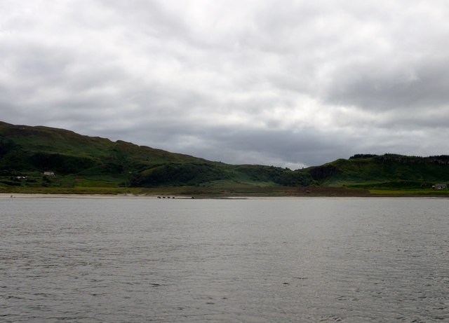
Cnoc Smeordail is a hill located in Inverness-shire, Scotland. It is part of the Scottish Highlands, known for its rugged and picturesque landscape. The hill stands at an elevation of approximately 600 meters (1,969 feet) above sea level, offering stunning views of the surrounding countryside.

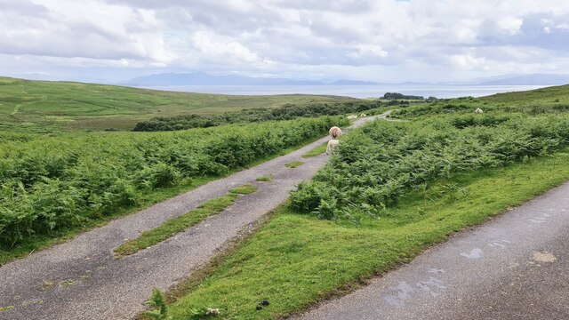
Cnoc Smeordail is a popular destination for hikers and outdoor enthusiasts, with several well-marked trails leading to the summit. The climb is considered moderate in difficulty, making it suitable for hikers of all skill levels. Along the way, visitors can expect to encounter a variety of flora and fauna, including heather, mosses, and perhaps even some red deer.

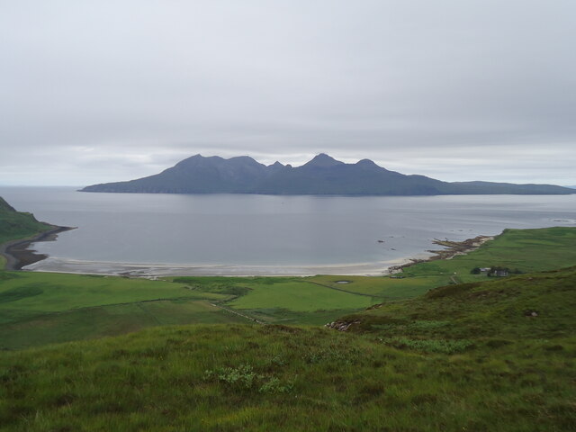
At the top of Cnoc Smeordail, hikers are rewarded with panoramic views of the surrounding mountains and valleys, making it a perfect spot for a picnic or simply to take in the beauty of the Scottish Highlands. On a clear day, it is even possible to see as far as the Moray Firth and the Isle of Skye.

Overall, Cnoc Smeordail is a must-visit destination for those looking to experience the natural beauty and tranquility of the Scottish Highlands.

If you have any feedback on the listing, please let us know in the comments section below.

Cnoc Smeordail Images

Images are sourced within 2km of 56.911562/-6.1385293 or Grid Reference NM4887. Thanks to Geograph Open Source API. All images are credited.

Road junction, Eigg Left for Kildonan, right for Galmisdale
Road junction, Eigg
Left for Kildonan, right for Galmisdale
Eigg Primary School
Eigg Primary School
Eigg Primary School
Eigg Primary School
Road to Cleadale, Eigg
Old shop display, Eigg For interior see; <a title="https://www.geograph.org.uk/photo/7231925" href="https://www.geograph.org.uk/photo/7231925">Link</a>
Old shop display, Eigg
For interior see; Link
Inside old shop, Eigg For outside see; <a title="https://www.geograph.org.uk/photo/7231921" href="https://www.geograph.org.uk/photo/7231921">Link</a>
Inside old shop, Eigg
For outside see; Link
The Bay of Laig, Isle of Eigg Looking across the Sound of Rum to a splendid profile of that island.
The Bay of Laig, Isle of Eigg
Looking across the Sound of Rum to a splendid profile of that island.
Laig, farm and bay
Laig, farm and bay
Laig from the south The scattered houses of Cleadale lie under the distant cliffs.
Laig from the south
The scattered houses of Cleadale lie under the distant cliffs.
Red Eigg From the shoreline near Mallaig
Red Eigg
From the shoreline near Mallaig
Bay of Laig on the Isle of Eigg Note where the burn has brought down debris to create a small 'promontory' where the cattle are grazing.
Bay of Laig on the Isle of Eigg
Note where the burn has brought down debris to create a small 'promontory' where the cattle are grazing.
Sunlit foliage, Eigg plantation A clearing on the path through the forestry with a glimpse of the skyline above Cleadale.
Sunlit foliage, Eigg plantation
A clearing on the path through the forestry with a glimpse of the skyline above Cleadale.
Forest plantation, Eigg Forestry in the central area of the island with the line of cliffs of volcanic rock above the green oasis of Cleadale beyond.
Forest plantation, Eigg
Forestry in the central area of the island with the line of cliffs of volcanic rock above the green oasis of Cleadale beyond.
Forest road and clearing, Eigg A sizeable clearing has been made out of shot to the left, with a widened forest road connecting to the public road to Galmisdale.
Forest road and clearing, Eigg
A sizeable clearing has been made out of shot to the left, with a widened forest road connecting to the public road to Galmisdale.
Eigg Primary School The school is near the junction of the roads from Galmisdale and from Kildonnan.
Eigg Primary School
The school is near the junction of the roads from Galmisdale and from Kildonnan.
Road to Kildonnan, Eigg The road down to Kildonnan branches off the 'main road' to Galmisdale and the pier. The mainland coast is in view on this summer evening.
Road to Kildonnan, Eigg
The road down to Kildonnan branches off the 'main road' to Galmisdale and the pier. The mainland coast is in view on this summer evening.
Cleadale from An Sgurr The cultivated and settled land at Cleadale contrasts with the fringe of cliffs on Beinn Bhuidhe in this view across the moorland from An Sgurr. The Isle of Skye is on the horizon.
Cleadale from An Sgurr
The cultivated and settled land at Cleadale contrasts with the fringe of cliffs on Beinn Bhuidhe in this view across the moorland from An Sgurr. The Isle of Skye is on the horizon.
Old shop and museum, Eigg The former shop on the road between Galmisdale and Cleadale. To the left is a café in the garden of the house.
Old shop and museum, Eigg
The former shop on the road between Galmisdale and Cleadale. To the left is a café in the garden of the house.
Show me another place!

Cnoc Smeordail is located at Grid Ref: NM4887 (Lat: 56.911562, Lng: -6.1385293)

Unitary Authority: Highland

Police Authority: Highlands and Islands

What 3 Words

///emails.simulator.dormant. Near Arisaig, Highland

Nearby Locations

Cnoc Smeordail An Cruachan

Related Wikis

Cleadale

Cleadale (Scottish Gaelic: Clèadail) is a settlement on the north west side of the island of Eigg, in the Small Isles of Scotland and is in the council...

Eigg

Eigg ( eg; Scottish Gaelic: Eige; Scots: Eigg) is one of the Small Isles in the Scottish Inner Hebrides. It lies to the south of the Isle of Skye and to...

Galmisdale

Galmisdale is the main port of the island of Eigg, one of the Small Isles of the Inner Hebrides. It is in the Scottish council area of Highland. ��2�...

An Sgùrr (Eigg)

An Sgùrr is the highest hill on the Inner Hebridean island of Eigg, Lochaber, Highland, Scotland. It was formed 58.72 ± 0.07 million years ago; the result...

Have you been to Cnoc Smeordail?

Leave your review of Cnoc Smeordail below (or comments, questions and feedback).