Am Màm
Hill, Mountain in Inverness-shire
Scotland
Am Màm

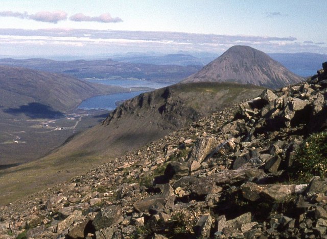
Am Màm is a prominent hill located in the region of Inverness-shire, Scotland. Standing at an impressive height of 924 meters (3,031 feet), it is classified as a mountain rather than a hill. Situated within the stunning landscape of the Scottish Highlands, Am Màm offers breathtaking panoramic views of the surrounding area.
The climb up Am Màm is a popular activity for outdoor enthusiasts and hillwalkers, with several well-established routes available to reach the summit. The most commonly used path begins at a car park near the village of Foyers, which provides easy access for visitors. The ascent can be challenging at times, with steep and rocky sections, but the rewarding vistas make it well worth the effort.
The mountain is known for its diverse flora and fauna, including heather, ferns, and various species of birds such as golden eagles and ptarmigans. The lower slopes are covered in dense forestry, adding an extra element of beauty to the surroundings.
Am Màm is also notable for its historical and cultural significance. The area is rich in ancient settlements and archaeological sites, including stone circles and burial cairns, reflecting its long-standing human presence.
For nature lovers and adventure seekers, a visit to Am Màm offers a chance to immerse oneself in the natural wonders of the Scottish Highlands. Whether it is the stunning views, the challenging climb, or the rich history, Am Màm is an attraction that captivates visitors and showcases the beauty of Inverness-shire.
If you have any feedback on the listing, please let us know in the comments section below.
Am Màm Images
Images are sourced within 2km of 57.264429/-6.2368296 or Grid Reference NG4427. Thanks to Geograph Open Source API. All images are credited.


Am Màm is located at Grid Ref: NG4427 (Lat: 57.264429, Lng: -6.2368296)
Unitary Authority: Highland
Police Authority: Highlands and Islands
What 3 Words
///archduke.shaky.still. Near Carbost, Highland
Nearby Locations
Related Wikis
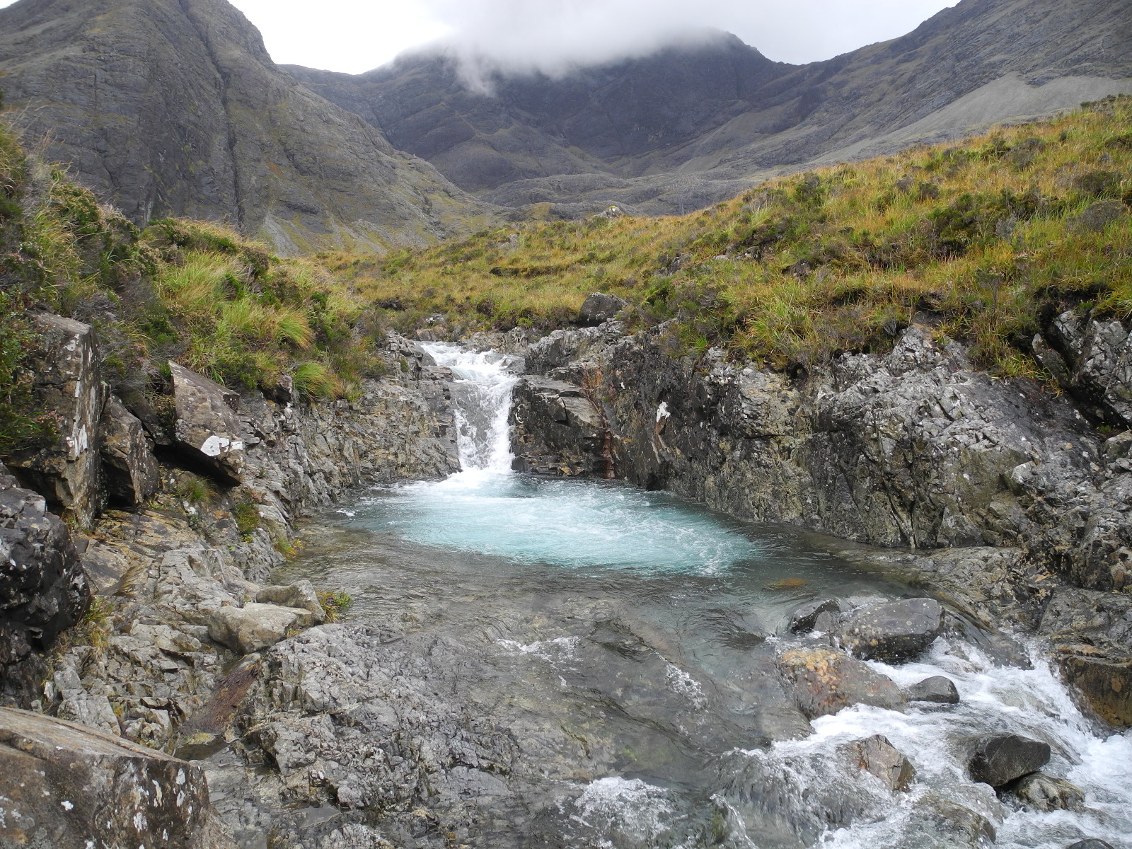
Fairy Pools
The Fairy Pools (Scottish Gaelic: Glumagan nan Sithichean) are a natural waterfall phenomenon in Glen Brittle on the Isle of Skye, on the Allt Coir' a...

Battle of Coire Na Creiche
The Battle of Coire na Creiche (Battle of Benquhillan) was a Scottish clan battle fought on the Isle of Skye in 1601. It was the culmination of a year...

Bruach na Frìthe
Bruach na Frìthe is one of the principal summits on the Black Cuillin ridge, on the Isle of Skye, Scotland. Like the rest of the range it is composed of...
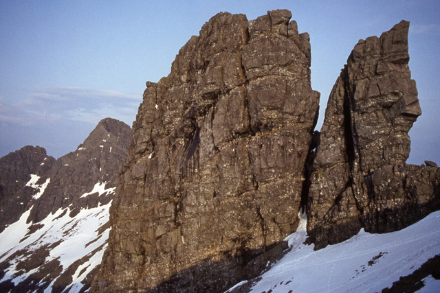
Am Basteir
Am Basteir (Scottish Gaelic: Am Bàisteir, 'the baptizer') is a mountain peak in the northern Cuillin range on the Isle of Skye in Scotland. It is 934 metres...
Nearby Amenities
Located within 500m of 57.264429,-6.2368296Have you been to Am Màm?
Leave your review of Am Màm below (or comments, questions and feedback).