Watch Croft

Hill, Mountain in Cornwall

England

Watch Croft

'Wild' ponies at Bosigran The tenant at Bosigran farm has left and taken his Belted Galloway cattle with him. The National Trust have replaced them with ponies from a pony sanctuary. They roam freely, but they don't graze as efficiently as the cattle.  The fields are reverting to long grass and bracken.
'Wild' ponies at Bosigran Credit: David Medcalf

The requested URL returned error: 429 Too Many Requests

If you have any feedback on the listing, please let us know in the comments section below.

Watch Croft Images

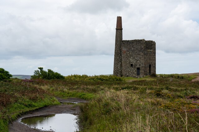
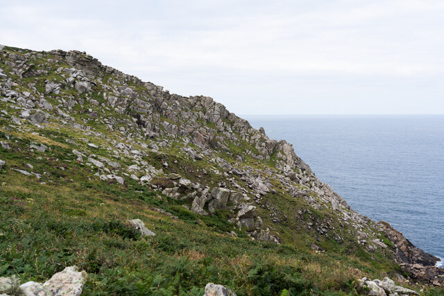
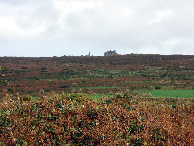
Images are sourced within 2km of 50.165225/-5.6131753 or Grid Reference SW4235. Thanks to Geograph Open Source API. All images are credited.

'Wild' ponies at Bosigran The tenant at Bosigran farm has left and taken his Belted Galloway cattle with him. The National Trust have replaced them with ponies from a pony sanctuary. They roam freely, but they don't graze as efficiently as the cattle.  The fields are reverting to long grass and bracken.
'Wild' ponies at Bosigran
The tenant at Bosigran farm has left and taken his Belted Galloway cattle with him. The National Trust have replaced them with ponies from a pony sanctuary. They roam freely, but they don't graze as efficiently as the cattle. The fields are reverting to long grass and bracken.
The buildings at Bosporthennis These are no longer completely abandoned (see: <a title="https://www.geograph.org.uk/photo/71726)," href="https://www.geograph.org.uk/photo/71726),">Link</a> but have been restored as a holiday home. So just abandoned for the majority of the year.
The buildings at Bosporthennis
These are no longer completely abandoned (see: Link but have been restored as a holiday home. So just abandoned for the majority of the year.
Chimney and shaft buildings as part of Ding Dong Mines in Penwith
Path near Bosigran, with Can Galver Engine House in the distance
Porthmoina Cove
Porthmoina Cove
Porthmeor Cove from the South West Coast Path
Stone Stile SW4236a Cattle stile with granite block balanced on two blocks and one granite step each side; next to gate, probably originally a field stile. Footpath on National Trust land from B3306 to Bosigran cliff castle and SW coast path. On open land. First stile on this footpath north of the B3306 and Carn Galver 
Within farmland from the Porthmeor Stream to Porthmoina Stream.
Photo by Dr Charlotte MacKenzie
Stone Stile SW4236a
Cattle stile with granite block balanced on two blocks and one granite step each side; next to gate, probably originally a field stile. Footpath on National Trust land from B3306 to Bosigran cliff castle and SW coast path. On open land. First stile on this footpath north of the B3306 and Carn Galver Within farmland from the Porthmeor Stream to Porthmoina Stream. Photo by Dr Charlotte MacKenzie
Stone Stile SW4236a Cattle stile with granite block balanced on two blocks and one granite step each side; next to gate, probably originally a field stile. Footpath on National Trust land from B3306 to Bosigran cliff castle and SW coast path.  On open land. First stile on this footpath north of the B3306 and Carn Galver. Within farmland from the Porthmeor Stream to Porthmoina Stream.
Stone Stile SW4236a
Cattle stile with granite block balanced on two blocks and one granite step each side; next to gate, probably originally a field stile. Footpath on National Trust land from B3306 to Bosigran cliff castle and SW coast path. On open land. First stile on this footpath north of the B3306 and Carn Galver. Within farmland from the Porthmeor Stream to Porthmoina Stream.
Stone Stile SW4236b On farm land north of B3306 and west of Bosigran farm buildings, next to farm gate on track between late prehistoric and medieval field boundaries at Bosigran. On public footpath 120/15/2 Gold. Cattle stile with granite block balanced on two blocks and one granite step each side; next to gate. Looking west.
Stone Stile SW4236b
On farm land north of B3306 and west of Bosigran farm buildings, next to farm gate on track between late prehistoric and medieval field boundaries at Bosigran. On public footpath 120/15/2 Gold. Cattle stile with granite block balanced on two blocks and one granite step each side; next to gate. Looking west.
Stone Stile SW4236b On farm land north of B3306 and west of Bosigran farm buildings, next to farm gate on track between late prehistoric and medieval field boundaries at Bosigran. On public footpath 120/15/2 Gold. Cattle stile with granite block balanced on two blocks and one granite step each side; next to gate. Looking east to Bosigran farmstead
Stone Stile SW4236b
On farm land north of B3306 and west of Bosigran farm buildings, next to farm gate on track between late prehistoric and medieval field boundaries at Bosigran. On public footpath 120/15/2 Gold. Cattle stile with granite block balanced on two blocks and one granite step each side; next to gate. Looking east to Bosigran farmstead
Stone Stile SW4237a Boundary from field into Bosigran farm buildings, on Bosigran farm land north of B3306, west of Porthmeor stream. Public footpath 120/15/1 and 120/14/3 Gold. Circa early C19. Dressed granite moorstone and granite rubble. Stepped cattle stile adjoining rubble-faced hedge. Parish: Zennor
HER Number: DCO11754  Grade II listed No. 1144347
Stone Stile SW4237a
Boundary from field into Bosigran farm buildings, on Bosigran farm land north of B3306, west of Porthmeor stream. Public footpath 120/15/1 and 120/14/3 Gold. Circa early C19. Dressed granite moorstone and granite rubble. Stepped cattle stile adjoining rubble-faced hedge. Parish: Zennor HER Number: DCO11754 Grade II listed No. 1144347
Stone Stile SW4237a Boundary from field into Bosigran farm buildings, on Bosigran farm land north of B3306, west of Porthmeor stream. Public footpath 120/15/1 and 120/14/3 Gold. Dressed granite moorstone and granite rubble. Stepped cattle stile adjoining rubble-faced hedge.
Parish: Zennor
HER Number: DCO11754  Grade II listed No. 1144347
Stone Stile SW4237a
Boundary from field into Bosigran farm buildings, on Bosigran farm land north of B3306, west of Porthmeor stream. Public footpath 120/15/1 and 120/14/3 Gold. Dressed granite moorstone and granite rubble. Stepped cattle stile adjoining rubble-faced hedge. Parish: Zennor HER Number: DCO11754 Grade II listed No. 1144347
Stone Stile SW4237b Three stone steps. At eastern end of enclosed track at Bosigran/Lower Porthmeor tin working site. The stile leads south from the enclosed lane, at right angles to a second stile which is on the main path running east. Path number 120/14 gold.
Parish: Zennor
HER Number: DCO11914  Grade II listed 1137458 ‘Aqueduct and Stiles’
Stone Stile SW4237b
Three stone steps. At eastern end of enclosed track at Bosigran/Lower Porthmeor tin working site. The stile leads south from the enclosed lane, at right angles to a second stile which is on the main path running east. Path number 120/14 gold. Parish: Zennor HER Number: DCO11914 Grade II listed 1137458 ‘Aqueduct and Stiles’
Stone Stile SW4237c Cattle stile with three large steps. Public footpath 120/14/3 gold & 120/14/2 silver from: Bosigran to: Lower Porthmeor. 
Parish: Zennor
HER Number: DCO11914  Grade II listed 1137458 ‘Aqueduct and Stiles’
Stone Stile SW4237c
Cattle stile with three large steps. Public footpath 120/14/3 gold & 120/14/2 silver from: Bosigran to: Lower Porthmeor. Parish: Zennor HER Number: DCO11914 Grade II listed 1137458 ‘Aqueduct and Stiles’
Stone Stile SW4237c Cattle stile with three large steps. Public footpath 120/14/3 gold & 120/14/2 silver from Bosigran to Lower Porthmeor. 
Parish: Zennor
HER Number: DCO11914  Grade II listed 1137458 ‘Aqueduct and Stiles’
Stone Stile SW4237c
Cattle stile with three large steps. Public footpath 120/14/3 gold & 120/14/2 silver from Bosigran to Lower Porthmeor. Parish: Zennor HER Number: DCO11914 Grade II listed 1137458 ‘Aqueduct and Stiles’
Stone Stile SW4237d Cattle stile with three large steps each side. At western end of enclosed track at Bosigran/Lower Porthmeor tin working site. Public footpath 120/14/3 gold 
Parish: Zennor
HER Number: DCO11914  Grade II listed 1137458 ‘Aqueduct and Stiles’
Stone Stile SW4237d
Cattle stile with three large steps each side. At western end of enclosed track at Bosigran/Lower Porthmeor tin working site. Public footpath 120/14/3 gold Parish: Zennor HER Number: DCO11914 Grade II listed 1137458 ‘Aqueduct and Stiles’
Cliffs down to Halldrine Cove from South West Coastal Path
Show me another place!

Watch Croft is located at Grid Ref: SW4235 (Lat: 50.165225, Lng: -5.6131753)

Unitary Authority: Cornwall

Police Authority: Devon and Cornwall

What 3 Words

///foresight.haunts.suitcase. Near St Just, Cornwall

Related Wikis

Watch Croft

Watch Croft (Cornish: Carnonbigh) is a prominent hill, 252 metres (827 ft) high overlooking the north coast of the Cornwall, UK. Its prominence of 225...

Rosemergy

Rosemergy is a hamlet near Morvah in Cornwall, England, United Kingdom on the B3306 road between St Ives and St Just. == References ==
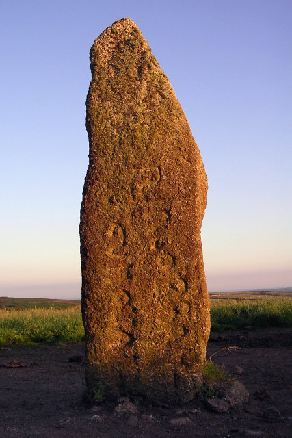
Mên Scryfa

Mên Scryfa (or Mên Scrifa, literally "stone with writing") is an inscribed standing stone in Cornwall, England, United Kingdom (grid reference SW427353...
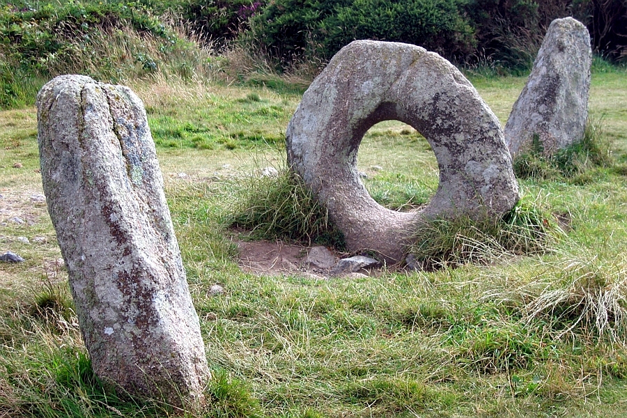
Mên-an-Tol

The Mên-an-Tol (Cornish: Men an Toll) is a small formation of standing stones in Cornwall, UK (grid reference SW426349). It is about three miles northwest...

Nearby Amenities

Located within 500m of 50.165225,-5.6131753
Watch Croft
Ele: 252
Name Kw: Carnonbigh
Natural: peak
Wikidata: Q16248640
Lat/Long: 50.1650069/-5.6134453
Watch Croft
Description: OS trig pillar
Ele: 252.097
Man Made: survey_point
Note: Accurate location import for imagery offset calibration
Ref: S1721
Source: Ordnance Survey (OGL)
Survey Point: pillar
Lat/Long: 50.1652138/-5.6132314
The data included in this document is from www.openstreetmap.org. The data is made available under ODbL.

Have you been to Watch Croft?

Leave your review of Watch Croft below (or comments, questions and feedback).