Beinn Totaig

Hill, Mountain in Inverness-shire

Scotland

Beinn Totaig

Farm road, Brae Meadale
Farm road, Brae Meadale Credit: Steven Brown

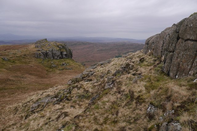
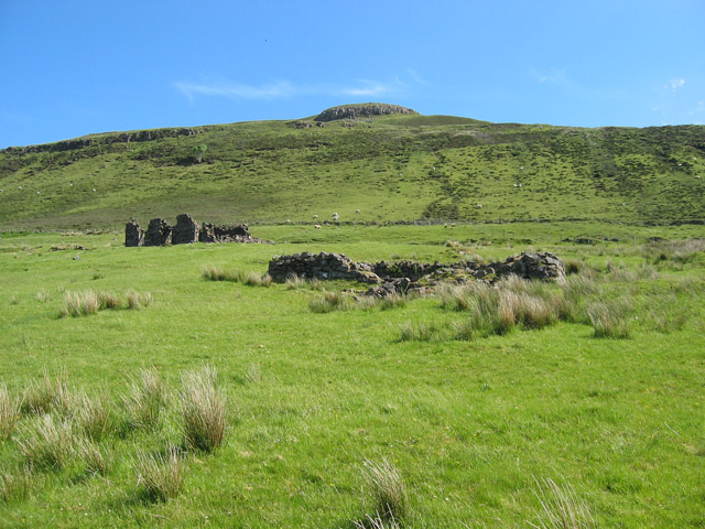
Beinn Totaig is a prominent hill located in Inverness-shire, Scotland. It stands at an elevation of approximately 610 meters (2001 feet) above sea level. The hill is situated in the remote and rugged landscape of the Scottish Highlands, offering breathtaking views and a sense of tranquility to those who venture to its summit.

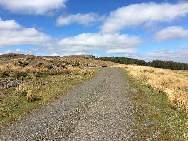
The ascent of Beinn Totaig is relatively straightforward, with a well-defined path leading to the top. Hikers can start their journey from the small village of Achnasheen, which is nestled in the picturesque glen of the same name. The climb typically takes around 2-3 hours, depending on the fitness level of the individual.

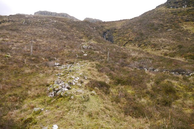
As you ascend, the terrain changes from lush green pastures to rocky outcrops, providing a diverse and challenging hiking experience. The hill is known for its steep slopes and rocky sections, which require careful navigation. However, the effort is rewarded with stunning panoramic views of the surrounding mountains, lochs, and glens.

Beinn Totaig is also notable for its rich biodiversity. The hill is home to a variety of plant and animal species, including heather, bilberry, and red deer. Birdwatchers can spot golden eagles, peregrine falcons, and other raptors soaring above the cliffs.

Due to its remote location, Beinn Totaig offers a sense of seclusion and solitude, away from the hustle and bustle of city life. It provides an excellent opportunity for outdoor enthusiasts to immerse themselves in the beauty of the Scottish Highlands and experience the true wilderness of Inverness-shire.

If you have any feedback on the listing, please let us know in the comments section below.

Beinn Totaig Images

Images are sourced within 2km of 57.348595/-6.3063935 or Grid Reference NG4136. Thanks to Geograph Open Source API. All images are credited.

Farm road, Brae Meadale
Hydroelectric works, Meadale Track serving an intake weir beneath Roineval.
Hydroelectric works, Meadale
Track serving an intake weir beneath Roineval.
Road, Meadale
Road, Meadale
Bealach Mòr The boggy col beneath Roineval.
Bealach Mòr
The boggy col beneath Roineval.
Allt Meadale The ruined dyke provides a bit of help in crossing the bogs of the Bealach Mòr.
Allt Meadale
The ruined dyke provides a bit of help in crossing the bogs of the Bealach Mòr.
Bealach Mòr Between Meadale and forested Tungadal. Like most of these places in Skye, it is very wet.
Bealach Mòr
Between Meadale and forested Tungadal. Like most of these places in Skye, it is very wet.
Crags, Roineval The mugearite cap of Roineval forms some spectacular exposures in an otherwise drab moorland setting. The summit is above this crag.
Crags, Roineval
The mugearite cap of Roineval forms some spectacular exposures in an otherwise drab moorland setting. The summit is above this crag.
Crags on Roineval Coarse grained mugearite caps the hill and provides some interesting rock scenery.
Crags on Roineval
Coarse grained mugearite caps the hill and provides some interesting rock scenery.
Summit of Roineval Rough igneous rock forms slabs and crags as well as a very fine summit. This is a very good viewpoint and well worth the modest effort required to make an ascent.
Summit of Roineval
Rough igneous rock forms slabs and crags as well as a very fine summit. This is a very good viewpoint and well worth the modest effort required to make an ascent.
Summit rocks, Roineval A view towards the forest in Tungadal.
Summit rocks, Roineval
A view towards the forest in Tungadal.
Tungadal Forest and The Storr View from the summit of Roineval.
Tungadal Forest and The Storr
View from the summit of Roineval.
Brae Meadale Looking down one of many small burns which feed the Allt Meadale. The brae is grazed by wandering sheep.
Brae Meadale
Looking down one of many small burns which feed the Allt Meadale. The brae is grazed by wandering sheep.
Across Brae Meadale to Roineval Viewed from a track to Tungadal Forest. The brae is grazed by wandering sheep.
Across Brae Meadale to Roineval
Viewed from a track to Tungadal Forest. The brae is grazed by wandering sheep.
Forest edge Looking towards Roineval past the southern tip of Tungadal Forest.
Forest edge
Looking towards Roineval past the southern tip of Tungadal Forest.
Walkers Welcome The sign inside the entrance to Tungadal Forest welcomes walkers, but the stout chain round the gate prevents unauthorised access by vehicles. Propped up behind the sign are two fire beaters - looking at the extent of the forest, I'm not convinced they would provide sufficient extinguishing effect should the forest catch fire...
Walkers Welcome
The sign inside the entrance to Tungadal Forest welcomes walkers, but the stout chain round the gate prevents unauthorised access by vehicles. Propped up behind the sign are two fire beaters - looking at the extent of the forest, I'm not convinced they would provide sufficient extinguishing effect should the forest catch fire...
Track in Tungadal Forest There are several miles of similar tracks in the forest.
Track in Tungadal Forest
There are several miles of similar tracks in the forest.
Track junction There are several miles of tracks within Tungadal Forest, though very few junctions, so providing to stay on a track, there is little chance of getting lost!
Track junction
There are several miles of tracks within Tungadal Forest, though very few junctions, so providing to stay on a track, there is little chance of getting lost!
Show me another place!

Beinn Totaig is located at Grid Ref: NG4136 (Lat: 57.348595, Lng: -6.3063935)

Unitary Authority: Highland

Police Authority: Highlands and Islands

What 3 Words

///resort.prowess.elbowing. Near Carbost, Highland

Nearby Locations

Beinn Totaig

Related Wikis

Mugeary

Mugeary (Scottish Gaelic: Mùigearraidh) is a farm or croft and former settlement on the island of Skye, Scotland. Located 4 kilometres (2+1⁄2 miles) southwest...

A863 road

The A863 road is one of the principal roads of the Isle of Skye in the Inner Hebrides off the west coast of mainland Scotland.It connects the town of Dunvegan...

Drynoch

Drynoch (Scottish Gaelic: An Droighneach) is a settlement on the south east tip of Loch Harport on the west coast of Skye in the Highlands of Scotland...

Carbost, Loch Harport

Carbost (Scottish Gaelic: Càrrabost) is a village on the south-west shore of Loch Harport on the Minginish peninsula of the Isle of Skye in Scotland....
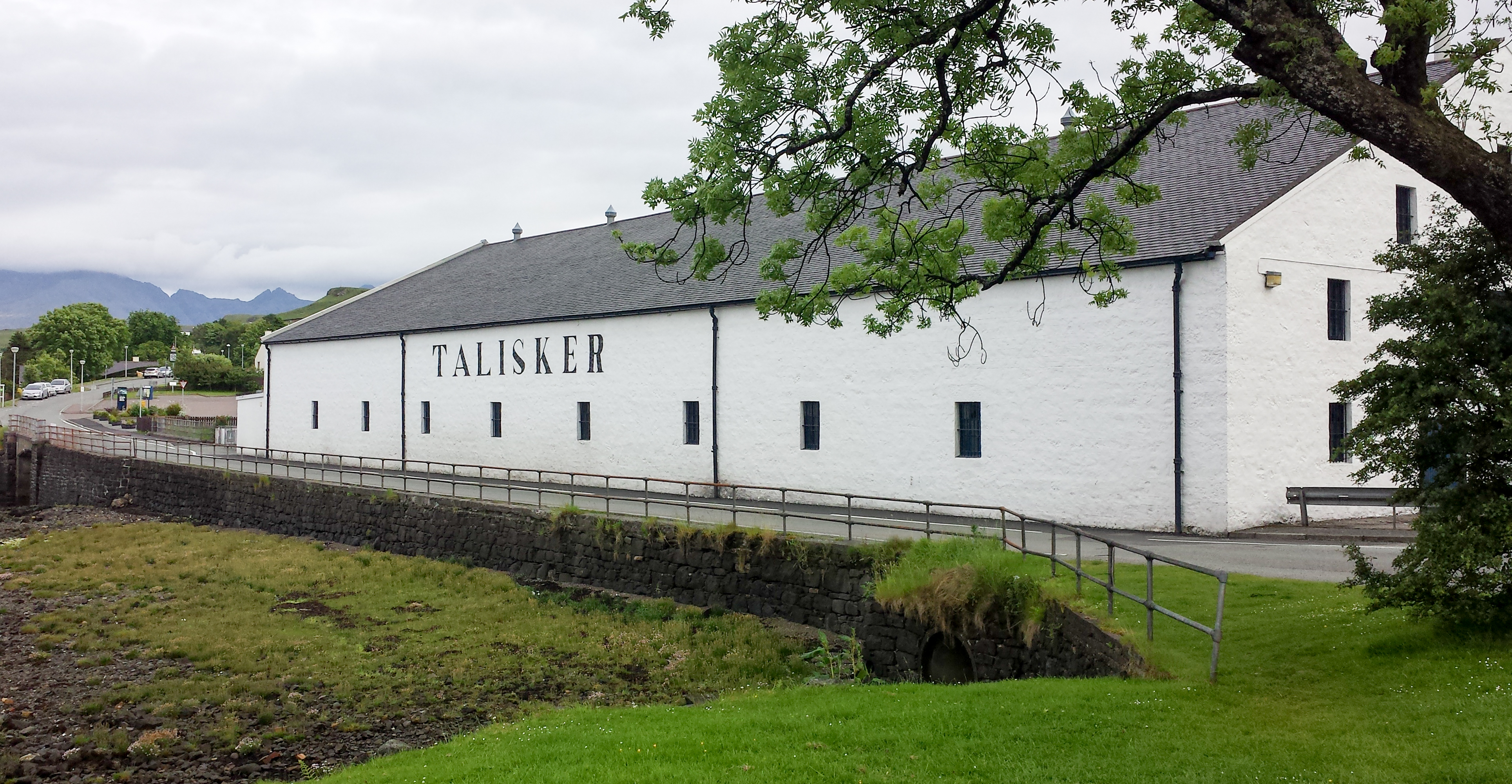
Talisker distillery

Talisker distillery is an island single malt Scotch whisky distillery based in Carbost, Scotland on the Minginish Peninsula on the Isle of Skye. The distillery...

Bracadale

Bracadale (Scottish Gaelic: Bracadal) is a settlement and parish on the Isle of Skye in Scotland. It lies on the west coast of the island, west-south-west...

Isle of Skye

The Isle of Skye, or simply Skye (; Scottish Gaelic: An t-Eilean Sgitheanach or Eilean a' Cheò), is the largest and northernmost of the major islands in...

Portnalong

Portnalong (Scottish Gaelic: Port nan Long) is a small village on north west of the Isle of Skye on the shore of Loch Harport. Portnalong is Gaelic for...

Nearby Amenities

Located within 500m of 57.348595,-6.3063935
Beinn Totaig
Natural: peak
Lat/Long: 57.3467663/-6.3076187
The data included in this document is from www.openstreetmap.org. The data is made available under ODbL.

Have you been to Beinn Totaig?

Leave your review of Beinn Totaig below (or comments, questions and feedback).