Bartinney Downs

Hill, Mountain in Cornwall

England

Bartinney Downs

St Euny's Well This little ancient well is quite tricky to find, it is on the more southerly of two parallel bridleways to the west of the (almost as esoteric) Carn Euny ancient village.
St Euny's Well Credit: Rob Farrow

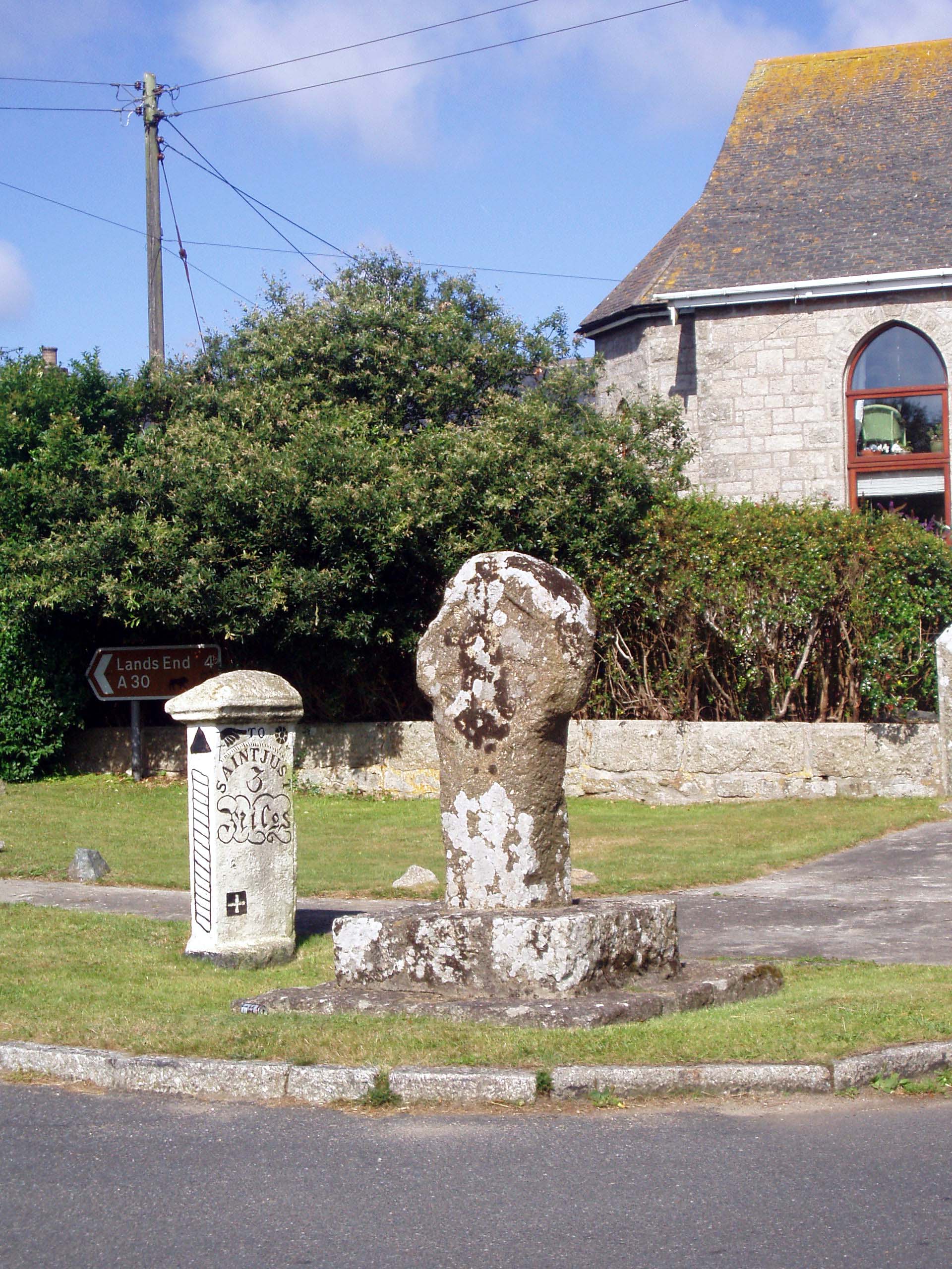
Bartinney Downs is a prominent hill in Cornwall, located in the southwestern part of England. It is situated near the town of St Just, approximately three miles northeast of Land's End.

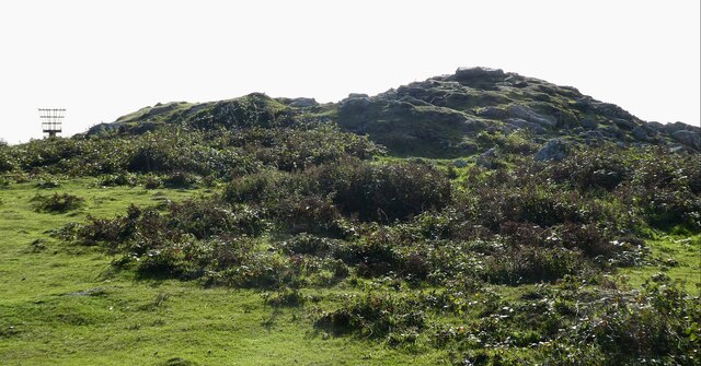
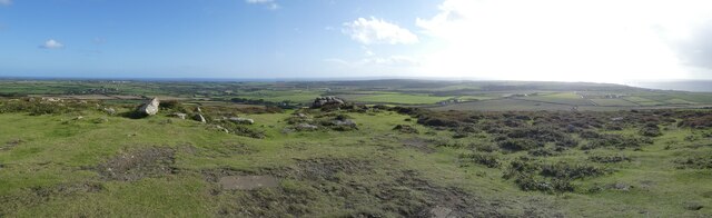
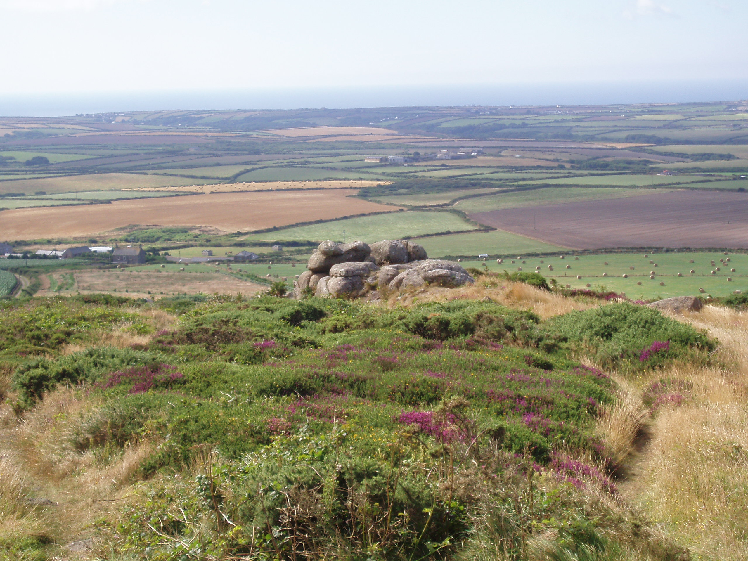
Rising to an elevation of 227 meters (745 feet), Bartinney Downs is a significant landmark in the region. The hill is composed mainly of granite, a characteristic feature of the Cornish landscape. It offers breathtaking panoramic views of the surrounding countryside, including the rugged coastline and the vast Atlantic Ocean.

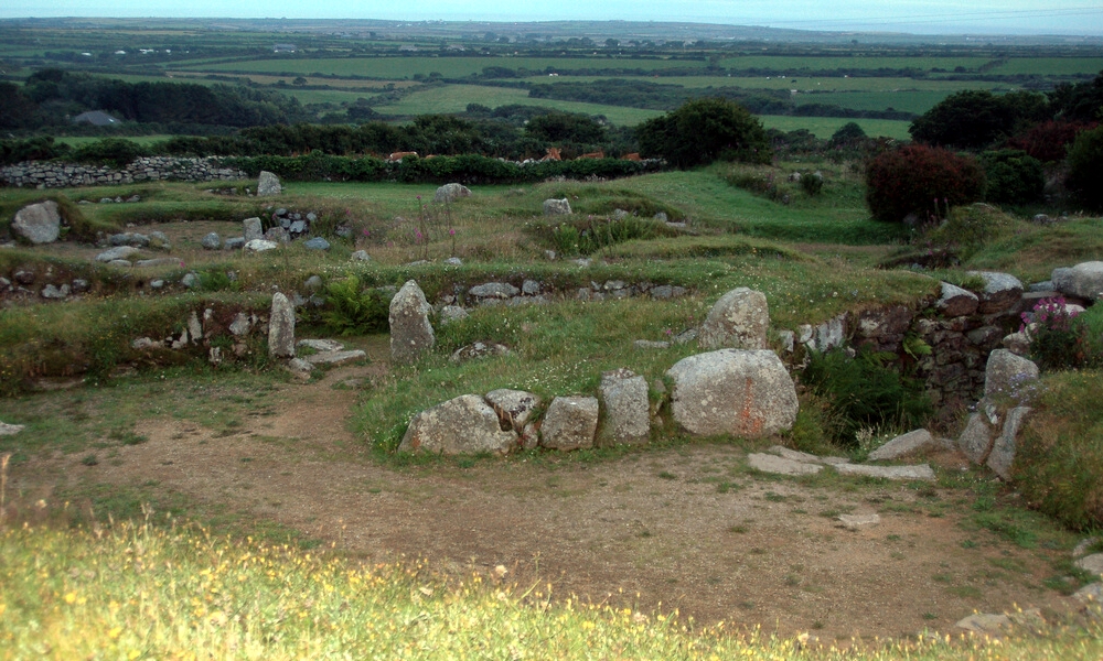
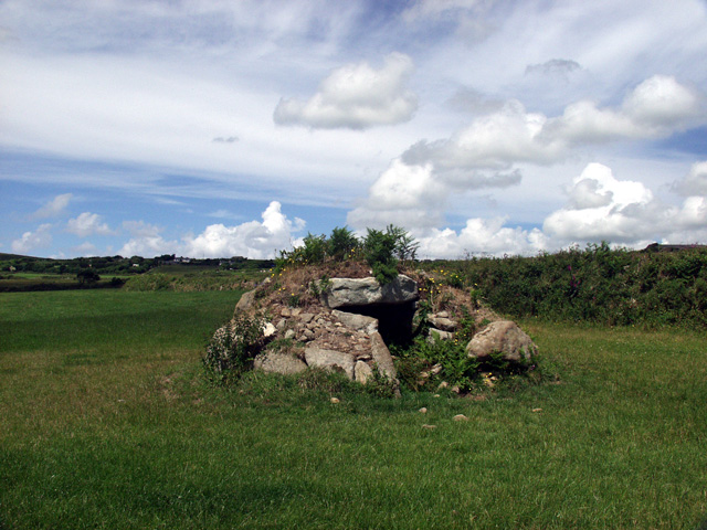
The area surrounding Bartinney Downs is known for its rich history. It is home to ancient burial mounds, known as barrows, which date back to the Bronze Age. These historical sites provide evidence of the area's occupation and significance throughout the centuries.

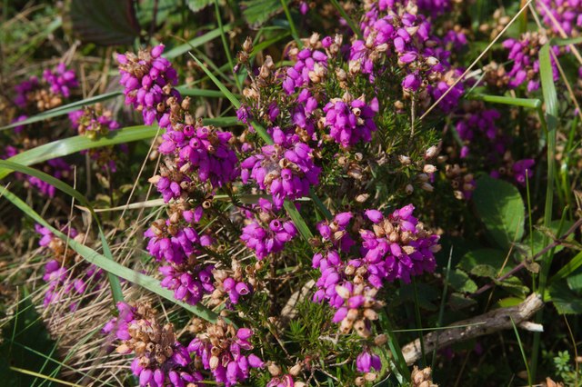
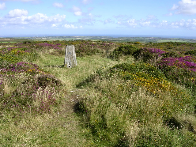
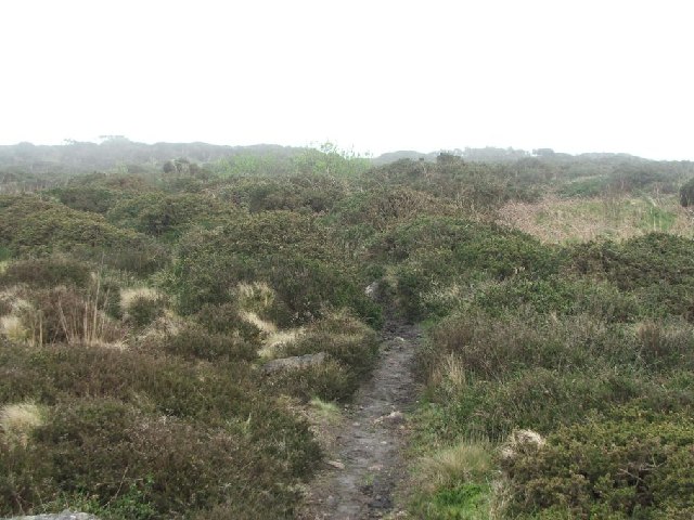
The hill is also renowned for its natural beauty and diverse wildlife. It is covered in heathland and moorland vegetation, which supports a variety of plant species, including gorse, heather, and bracken. These habitats attract a wide range of birds, insects, and small mammals, making it an ideal spot for birdwatching and wildlife enthusiasts.

Bartinney Downs is a popular destination for outdoor activities such as hiking, walking, and photography. Several footpaths and trails traverse the area, allowing visitors to explore the hill and its surroundings. The hill provides a challenging climb for those seeking adventure, offering stunning views as a reward for their efforts.

Overall, Bartinney Downs is a remarkable natural landmark in Cornwall, offering a combination of scenic beauty, historical significance, and recreational opportunities for locals and visitors alike.

If you have any feedback on the listing, please let us know in the comments section below.

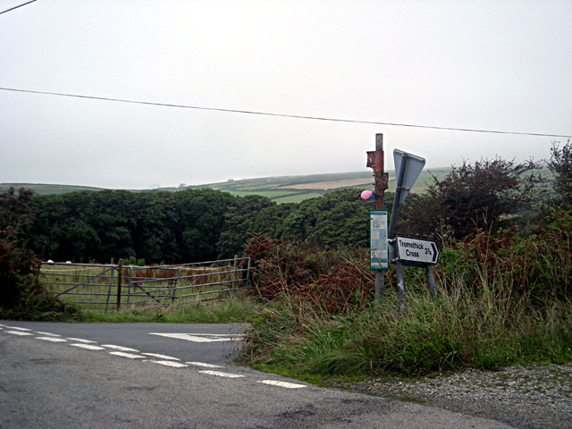
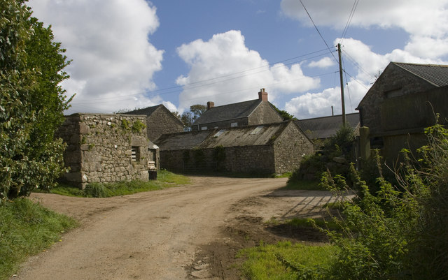
Bartinney Downs Images

Images are sourced within 2km of 50.106636/-5.6451587 or Grid Reference SW3929. Thanks to Geograph Open Source API. All images are credited.

St Euny's Well This little ancient well is quite tricky to find, it is on the more southerly of two parallel bridleways to the west of the (almost as esoteric) Carn Euny ancient village.
St Euny's Well
This little ancient well is quite tricky to find, it is on the more southerly of two parallel bridleways to the west of the (almost as esoteric) Carn Euny ancient village.
Chapel Carn Brea - Beacon & Toposcope The Beacon & Toposcope on top of Chapel Carn Brea looking in a roughly westerly direction. The Longships lighthouse can just be seen out to sea.
See shared description below:
Chapel Carn Brea - Beacon & Toposcope
The Beacon & Toposcope on top of Chapel Carn Brea looking in a roughly westerly direction. The Longships lighthouse can just be seen out to sea. See shared description below:
Chapel Carn Brea - Summit cairn The cairn atop Chapel Carn Brea with the beacon peeping out on the left.
See <a href="https://www.geograph.org.uk/photo/7013214">SW3828 : Chapel Carn Brea - entrance to Bronze Age chambered cairn</a> for the Bronze Age chambered cairn entrance hidden among these rocks.
See shared description below:
Chapel Carn Brea - Summit cairn
The cairn atop Chapel Carn Brea with the beacon peeping out on the left. See SW3828 : Chapel Carn Brea - entrance to Bronze Age chambered cairn for the Bronze Age chambered cairn entrance hidden among these rocks. See shared description below:
Chapel Carn Brea - entrance to Bronze Age chambered cairn This is the entrance to a Bronze Age chambered cairn atop Chapel Carn Brea. See shared description below.
Chapel Carn Brea - entrance to Bronze Age chambered cairn
This is the entrance to a Bronze Age chambered cairn atop Chapel Carn Brea. See shared description below.
Chapel Carn Brea - Panorama southwards There are excellent views from the top of Chapel Carn Brea - this is a panoramic view southwards.
See shared description below:
Chapel Carn Brea - Panorama southwards
There are excellent views from the top of Chapel Carn Brea - this is a panoramic view southwards. See shared description below:
The clootie tree The 'clooties' seem to be different to a couple of years ago: <a title="https://www.geograph.org.uk/photo/5986223" href="https://www.geograph.org.uk/photo/5986223">Link</a>
Clooties are pieces of cloth, usually, dipped in the water of the well and tied to a tree as an offering or an invocation - a custom that goes back for a very long time.
The clootie tree
The 'clooties' seem to be different to a couple of years ago: Link Clooties are pieces of cloth, usually, dipped in the water of the well and tied to a tree as an offering or an invocation - a custom that goes back for a very long time.
Crows-an-Wra : A30 The road heads through a small settlement.
Crows-an-Wra : A30
The road heads through a small settlement.
Crowlas : Road Looking along a road off the A30.
Crowlas : Road
Looking along a road off the A30.
View across Tredinney Common Looking across gorse and heather. The white scar is the disused china clay works and beyond it, Bartinney Downs. See also <a href="https://www.geograph.org.uk/photo/7589002">SW3928 : Disused china clay works</a>, <a href="https://www.geograph.org.uk/photo/7589010">SW3928 : Ling growing through gorse</a>, <a href="https://www.geograph.org.uk/photo/7589012">SW3928 : Bell heather on Tredinney Common</a> and <a href="https://www.geograph.org.uk/photo/7589014">SW3928 : Heather on Tredinney Common</a>.
View across Tredinney Common
Looking across gorse and heather. The white scar is the disused china clay works and beyond it, Bartinney Downs. See also SW3928 : Disused china clay works, SW3928 : Ling growing through gorse, SW3928 : Bell heather on Tredinney Common and SW3928 : Heather on Tredinney Common.
Disused china clay works View across the disused china clay works on Tredinney Common. The tiny church tower on the horizon is St Buryan church. See also <a href="https://www.geograph.org.uk/photo/7588998">SW3928 : View across Tredinney Common</a>.
Disused china clay works
View across the disused china clay works on Tredinney Common. The tiny church tower on the horizon is St Buryan church. See also SW3928 : View across Tredinney Common.
Ling growing through gorse Heather or ling (calluna vulgaris) growing through gorse on Tredinney Common, see also <a href="https://www.geograph.org.uk/photo/7589014">SW3928 : Heather on Tredinney Common</a> and <a href="https://www.geograph.org.uk/photo/7589012">SW3928 : Bell heather on Tredinney Common</a>.
Ling growing through gorse
Heather or ling (calluna vulgaris) growing through gorse on Tredinney Common, see also SW3928 : Heather on Tredinney Common and SW3928 : Bell heather on Tredinney Common.
Bell heather on Tredinney Common Bell heather (Erica cinerea) in flower on Tredinney Common, see also <a href="https://www.geograph.org.uk/photo/7589014">SW3928 : Heather on Tredinney Common</a> and <a href="https://www.geograph.org.uk/photo/7589010">SW3928 : Ling growing through gorse</a>.
Bell heather on Tredinney Common
Bell heather (Erica cinerea) in flower on Tredinney Common, see also SW3928 : Heather on Tredinney Common and SW3928 : Ling growing through gorse.
Heather on Tredinney Common Heather or ling (Calluna vulgaris) flowering on Tredinney Common, see also <a href="https://www.geograph.org.uk/photo/7589012">SW3928 : Bell heather on Tredinney Common</a> and <a href="https://www.geograph.org.uk/photo/7589010">SW3928 : Ling growing through gorse</a>.
Heather on Tredinney Common
Heather or ling (Calluna vulgaris) flowering on Tredinney Common, see also SW3928 : Bell heather on Tredinney Common and SW3928 : Ling growing through gorse.
Carn Euny - Fogou This is the Fogou at the heart of the ancient village of Carn Euny. This stone-walled underground passage is an Iron Age monument of a type found only in the far west of Cornwall. There is also one at Chysauster though that example is sealed with a grille, making this Carn Euny example perhaps the best known one.
The name Fogou comes from the Cornish for 'cave'.
<>More information to follow.
Carn Euny - Fogou
This is the Fogou at the heart of the ancient village of Carn Euny. This stone-walled underground passage is an Iron Age monument of a type found only in the far west of Cornwall. There is also one at Chysauster though that example is sealed with a grille, making this Carn Euny example perhaps the best known one. The name Fogou comes from the Cornish for 'cave'. <>More information to follow.
Caer Bran fort has been cleared The ditch outside the embankment and the central area have been cleared of the thick vegetation that covers most of the area. A temporary situation, no doubt, but it made it easier to see the fort.
Caer Bran fort has been cleared
The ditch outside the embankment and the central area have been cleared of the thick vegetation that covers most of the area. A temporary situation, no doubt, but it made it easier to see the fort.
The ditch outside Caer Bran embankment The ditch outside the embankment and the central area have been cleared of the thick vegetation that covers most of the area. A temporary situation, no doubt, but it made it easier to see the fort.
The ditch outside Caer Bran embankment
The ditch outside the embankment and the central area have been cleared of the thick vegetation that covers most of the area. A temporary situation, no doubt, but it made it easier to see the fort.
Crows-an-Wra : A30 Looking along the A30.
Crows-an-Wra : A30
Looking along the A30.
Carn Euny, information sign
Show me another place!

Bartinney Downs is located at Grid Ref: SW3929 (Lat: 50.106636, Lng: -5.6451587)

Unitary Authority: Cornwall

Police Authority: Devon and Cornwall

What 3 Words

///suggested.vocals.ruling. Near St Just, Cornwall

Related Wikis

Bartinney Castle

Bartinney Castle is an Iron Age enclosure located in the Penwith Peninsula of Southwest Cornwall, England, it is surrounded by a circular earthwork standing...

Grumbla

Grumbla (Cornish: An Gromlegh, meaning the cromlech) is a hamlet in the parish of Sancreed, Cornwall, England, UK. == Toponymy == Recorded as Gromleigh...

Carn Euny

Carn Euny (from Cornish: Karn Uni) is an archaeological site near Sancreed, on the Penwith peninsula in Cornwall, United Kingdom with considerable evidence...

Brane, Cornwall

Brane is a hamlet southwest of Sancreed in west Cornwall, England, UK. It is in the civil parish of Sancreed. It is noted for the Carn Euny Iron Age site...

Brane Barrow

Brane Barrow, or Chapel Euny Barrow, is a Neolithic entrance grave located near the hamlet of Brane, Cornwall, England, UK. It is considered to be one...

Caer Bran

Caer Bran Hill Fort is an archaeological site near Sancreed and Carn Euny Iron Age village, on the Penwith peninsula in Cornwall. == Site == It is a popular...

Chapel Carn Brea

Chapel Carn Brea is an elevated Hercynian granite outcrop, owned by the National Trust at the southern edge of the civil parish of St Just, Cornwall,...

Crows-an-Wra

Crows-an-Wra (Cornish: Krows an Wragh, meaning the witch's cross) is a hamlet in West Cornwall, England, United Kingdom. It is situated in the civil parish...

Nearby Amenities

Located within 500m of 50.106636,-5.6451587
Bartine Castle
Archaeological Site: settlement
Historic: archaeological_site
Lat/Long: 50.106748/-5.6453789
Bartinney
Description: OS trig pillar
Ele: 224.602
Man Made: survey_point
Note: Accurate location import for imagery offset calibration
Ref: S1706
Source: Ordnance Survey (OGL)
Survey Point: pillar
Lat/Long: 50.1067417/-5.6453923
The data included in this document is from www.openstreetmap.org. The data is made available under ODbL.

Have you been to Bartinney Downs?

Leave your review of Bartinney Downs below (or comments, questions and feedback).