Aird nan Uan

Hill, Mountain in Ross-shire

Scotland

Aird nan Uan

The view across the Minch from south of Grabhair The B8060 cuts across southeastern Lewis. This section south of Grabhair (Gravir) on the way to Leumrabhagh (Lemreway) has superb views over The Minch to Skye incorporating many of the islands that lie between.
The nearest island, just off the coast, so not obviously an island is Eilean Liubhaird which translates as Edward's Island after Charles Edward Stuart as he took refuge there after the Battle of Culloden.
Further away can be seen the following islands (from left to right):
Eilean Mhuire and Garbh Eilean (The Shiants) and Galtachan (seven little islets see <a href="https://www.geograph.org.uk/photo/2621947">NG3998 : Eastern Galtachan from southeastern Lewis</a>)
Many thanks to JJM <a title="https://www.geograph.org.uk/profile/19712" href="https://www.geograph.org.uk/profile/19712">Link</a> for help and information.
The view across the Minch from south of Grabhair Credit: Rob Farrow

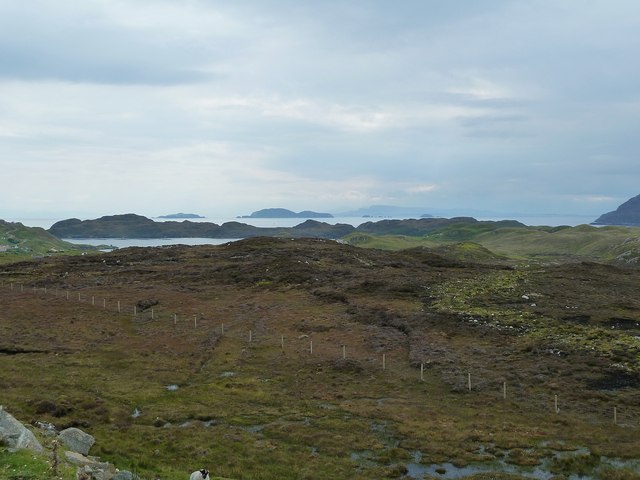
Aird nan Uan is a prominent hill located in Ross-shire, Scotland. Situated in the Northwest Highlands, it stands at an elevation of approximately 689 meters (2,260 feet) above sea level. The hill is part of the larger mountain range known as the Fannichs, which is renowned for its rugged beauty and stunning landscapes.

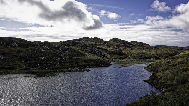
Aird nan Uan is characterized by its distinct shape and steep slopes, making it a challenging but rewarding climb for experienced hikers and mountaineers. The hill offers breathtaking panoramic views of the surrounding area, including the picturesque Loch Fannich and the surrounding peaks of the Fannichs. On a clear day, one can even catch a glimpse of the distant Isle of Skye.

The terrain of Aird nan Uan is predominantly rocky, with scattered patches of grass and heather. The hill is home to a diverse range of flora and fauna, including rare alpine plants and various bird species. It is not uncommon to spot golden eagles soaring overhead or ptarmigans camouflaging themselves amongst the rocks.

Due to its remote location and challenging ascent, Aird nan Uan is a popular destination for outdoor enthusiasts seeking solitude and adventure. It provides an opportunity to immerse oneself in the untamed beauty of the Scottish Highlands and offers a sense of accomplishment upon reaching its summit. Whether it be for hiking, photography, or simply appreciating nature's wonders, Aird nan Uan is a must-visit destination for those seeking an authentic Highland experience.

If you have any feedback on the listing, please let us know in the comments section below.
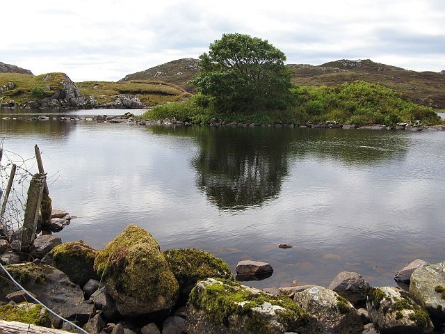
Aird nan Uan Images

Images are sourced within 2km of 58.054089/-6.4324684 or Grid Reference NB3815. Thanks to Geograph Open Source API. All images are credited.

The view across the Minch from south of Grabhair The B8060 cuts across southeastern Lewis. This section south of Grabhair (Gravir) on the way to Leumrabhagh (Lemreway) has superb views over The Minch to Skye incorporating many of the islands that lie between.
The nearest island, just off the coast, so not obviously an island is Eilean Liubhaird which translates as Edward's Island after Charles Edward Stuart as he took refuge there after the Battle of Culloden.
Further away can be seen the following islands (from left to right):
Eilean Mhuire and Garbh Eilean (The Shiants) and Galtachan (seven little islets see <a href="https://www.geograph.org.uk/photo/2621947">NG3998 : Eastern Galtachan from southeastern Lewis</a>)
Many thanks to JJM <a title="https://www.geograph.org.uk/profile/19712" href="https://www.geograph.org.uk/profile/19712">Link</a> for help and information.
The view across the Minch from south of Grabhair
The B8060 cuts across southeastern Lewis. This section south of Grabhair (Gravir) on the way to Leumrabhagh (Lemreway) has superb views over The Minch to Skye incorporating many of the islands that lie between. The nearest island, just off the coast, so not obviously an island is Eilean Liubhaird which translates as Edward's Island after Charles Edward Stuart as he took refuge there after the Battle of Culloden. Further away can be seen the following islands (from left to right): Eilean Mhuire and Garbh Eilean (The Shiants) and Galtachan (seven little islets see NG3998 : Eastern Galtachan from southeastern Lewis) Many thanks to JJM Link for help and information.
Ruin at Grabhair
Ruin at Grabhair
Loch nam Faoileag
Loch nam Faoileag
Branch of Loch nam Faoileag
Mobile bank at junction
Tom an Fhuadain and Loch Odhairn
Ruined house, Glenside/Taobh a' Ghlinne, Isle of Lewis Looking at old OS maps suggests that the house was built in the 1950s.
Ruined house, Glenside/Taobh a' Ghlinne, Isle of Lewis
Looking at old OS maps suggests that the house was built in the 1950s.
Abandoned vehicle on moorland to the south of Gravir/Grabhair, Isle of Lewis The vehicle has been dumped by a track which leads from the B8060 onto the moor.

The mast is an Emergency Services Network (ESN) telecoms mast which was installed as part of a scheme to improve coverage in remote areas of the Outer Hebrides.  Planning permission for the mast was given in January 2017 so it had not been there long when this photo was taken.
Abandoned vehicle on moorland to the south of Gravir/Grabhair, Isle of Lewis
The vehicle has been dumped by a track which leads from the B8060 onto the moor. The mast is an Emergency Services Network (ESN) telecoms mast which was installed as part of a scheme to improve coverage in remote areas of the Outer Hebrides. Planning permission for the mast was given in January 2017 so it had not been there long when this photo was taken.
Loch nam Faoileag The tree in the centre of the photo is growing on a small island in this freshwater loch east of Grabhair.
Loch nam Faoileag
The tree in the centre of the photo is growing on a small island in this freshwater loch east of Grabhair.
Loch nam Faoileag
Loch nam Faoileag
Loch Beag Eisheal A small loch beside the junction of the B8060 and the unclassified road to Cromor.
Loch Beag Eisheal
A small loch beside the junction of the B8060 and the unclassified road to Cromor.
Loch Caol a Ghairidh Mhor A small loch on the South Lochs moor. 'Caol' means thin in Gaelic.
Loch Caol a Ghairidh Mhor
A small loch on the South Lochs moor. 'Caol' means thin in Gaelic.
Grabhair Free Church A large church on a hill overlooking Glen Grabhair.
Grabhair Free Church
A large church on a hill overlooking Glen Grabhair.
Houses in Glenside Looking East down Glen Grabhair along the single track village road.
Houses in Glenside
Looking East down Glen Grabhair along the single track village road.
Loch nam Faoileag Looking East across this fairly large loch you can see the small island in the middle and, further out, the rocky outcrops of the moor.
Loch nam Faoileag
Looking East across this fairly large loch you can see the small island in the middle and, further out, the rocky outcrops of the moor.
Grabhair Village Looking East Across Loch Odhairn towards houses in Grabhair Village. In the foreground you can see a house with a peatstack and several coalbags recycled to store peats in handy amounts to take down the driveway.
Grabhair Village
Looking East Across Loch Odhairn towards houses in Grabhair Village. In the foreground you can see a house with a peatstack and several coalbags recycled to store peats in handy amounts to take down the driveway.
Lochan with water lilies A small lochan just to the south of Grabhair.
Lochan with water lilies
A small lochan just to the south of Grabhair.
Roads old and new The minor road between Leumrabhagh and Baile Ailein has seen various improvements in its time.  Here, the old road (on the right of the picture) wends an erratic way over the moors, while the newer one (left) marches straight on, sometimes as a single track, sometimes double.
Roads old and new
The minor road between Leumrabhagh and Baile Ailein has seen various improvements in its time. Here, the old road (on the right of the picture) wends an erratic way over the moors, while the newer one (left) marches straight on, sometimes as a single track, sometimes double.
Show me another place!

Aird nan Uan is located at Grid Ref: NB3815 (Lat: 58.054089, Lng: -6.4324684)

Unitary Authority: Na h-Eileanan an Iar

Police Authority: Highlands and Islands

What 3 Words

///edicts.incisions.vintages. Near Leurbost, Na h-Eileanan Siar

Related Wikis

Gravir

Gravir (Scottish Gaelic: Grabhair), is a village on the shore of Loch Odhairn (a sea loch) in the Park district of the Isle of Lewis. Gravir is within...

Calbost

Calbost (Scottish Gaelic: Calabost) is a village on the Isle of Lewis in the Outer Hebrides, Scotland. Calbost is within the parish of Lochs, and within...

Cabharstadh

Cabharstadh or Caversta (Scottish Gaelic: Cabharstaigh) is a village on the Isle of Lewis in the Outer Hebrides, Scotland. Caversta is situated in the...

Orinsay

Orinsay (Scottish Gaelic: Orasaigh) is a crofting village on the Isle of Lewis in the district of Pairc, in the Outer Hebrides, Scotland. The settlement...

Nearby Amenities

Located within 500m of 58.054089,-6.4324684
Power: pole
Lat/Long: 58.0534235/-6.4371743
Power: pole
Lat/Long: 58.0518424/-6.4395802
Power: pole
Lat/Long: 58.0526174/-6.4383732
Power: pole
Lat/Long: 58.0540458/-6.4368517
Power: pole
Lat/Long: 58.0537949/-6.4365996
Ford: yes
Lat/Long: 58.0543444/-6.4285066
The data included in this document is from www.openstreetmap.org. The data is made available under ODbL.

Have you been to Aird nan Uan?

Leave your review of Aird nan Uan below (or comments, questions and feedback).