An Cruachan

Hill, Mountain in Inverness-shire

Scotland

An Cruachan

Link loop signpost This recently erected signpost is marked 'link loop', which is not especially useful information if you don't know to what it is linking. It points down a very steep footpath which ends at another forest track. 
Other end of the path: <a href="https://www.geograph.org.uk/photo/3965738">NG4022 : Forest track and signpost</a>.
Link loop signpost Credit: Richard Dorrell

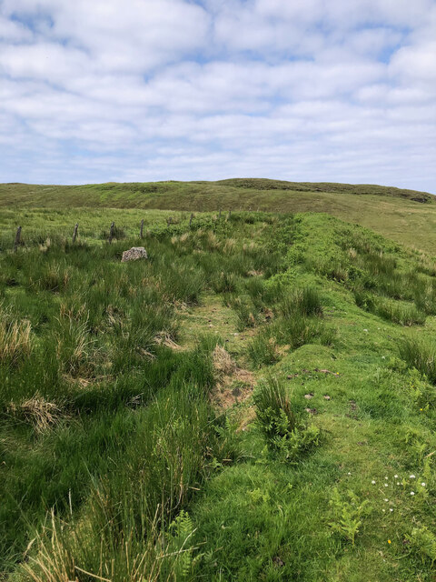
An Cruachan is a prominent hill located in the Inverness-shire region of Scotland. It is part of the Grampian Mountains range and is situated near the town of Newtonmore. The hill rises to an elevation of 875 meters (2,871 feet) above sea level, making it a popular destination for hikers and outdoor enthusiasts looking to enjoy stunning views of the surrounding landscape.

An Cruachan is known for its rugged terrain, with steep slopes and rocky outcrops that provide a challenging yet rewarding climb for experienced hikers. The hill is home to a diverse range of flora and fauna, including heather, grasses, and various bird species.

At the summit of An Cruachan, hikers are rewarded with panoramic views of the surrounding countryside, including the Cairngorms National Park and the Monadhliath Mountains. On a clear day, it is possible to see as far as Ben Nevis, the highest mountain in the British Isles.

Overall, An Cruachan offers a unique and unforgettable hiking experience for those looking to explore the natural beauty of the Scottish Highlands.

If you have any feedback on the listing, please let us know in the comments section below.

An Cruachan Images

Images are sourced within 2km of 57.218281/-6.3387185 or Grid Reference NG3822. Thanks to Geograph Open Source API. All images are credited.
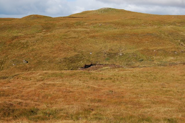
Link loop signpost This recently erected signpost is marked 'link loop', which is not especially useful information if you don't know to what it is linking. It points down a very steep footpath which ends at another forest track. 
Other end of the path: <a href="https://www.geograph.org.uk/photo/3965738">NG4022 : Forest track and signpost</a>.
Link loop signpost
This recently erected signpost is marked 'link loop', which is not especially useful information if you don't know to what it is linking. It points down a very steep footpath which ends at another forest track. Other end of the path: NG4022 : Forest track and signpost.
Footpath signpost There are not many signposts on the tracks within Glen Brittle forest. This recently erected signpost, labelled 'link loop' points down a very steep footpath which connects to another forestry track. See also: <a href="https://www.geograph.org.uk/photo/3972635">NG4022 : Link loop signpost</a>.
Footpath signpost
There are not many signposts on the tracks within Glen Brittle forest. This recently erected signpost, labelled 'link loop' points down a very steep footpath which connects to another forestry track. See also: NG4022 : Link loop signpost.
Nature's Resilience — An Ancient Dyke Reclaimed by Greenery
Ruins of Kraiknish Farmstead 19th Century according to ‘Skye, Kraiknish | Canmore’. 2023. Canmore.org.uk <<span class="nowrap"><a title="https://canmore.org.uk/site/352747/skye-kraiknish>" rel="nofollow ugc noopener" href="https://canmore.org.uk/site/352747/skye-kraiknish>">Link</a><img style="margin-left:2px;" alt="External link" title="External link - shift click to open in new window" src="https://s1.geograph.org.uk/img/external.png" width="10" height="10"/></span> [accessed 7 June 2023]
Ruins of Kraiknish Farmstead
19th Century according to ‘Skye, Kraiknish | Canmore’. 2023. Canmore.org.uk <LinkExternal link [accessed 7 June 2023]
Drought-Stricken Allt Dabhoch and its Rock Step Waterfalls
A wooden picnic table with a view to die for
An Cruachan Summit View north from trig point (just visible left frame) looking NW over Loch Eynort
An Cruachan Summit
View north from trig point (just visible left frame) looking NW over Loch Eynort
Above Glen Brittle Volcanic dyke in the slopes above the Glen Brittle to Eynort track - looking south with the Black Cuillin as background.
Above Glen Brittle
Volcanic dyke in the slopes above the Glen Brittle to Eynort track - looking south with the Black Cuillin as background.
Track on Bealach Brittle Looking north along the track that leads from the bealach to Beinn Staic.
Track on Bealach Brittle
Looking north along the track that leads from the bealach to Beinn Staic.
Waterfall in Glen Brittle Forest By a log pile in Coire Mor.
Waterfall in Glen Brittle Forest
By a log pile in Coire Mor.
Log Pile in Glen Brittle Forest An impressive pile above Loch Eynort where a big area of forest is being harvested.
Log Pile in Glen Brittle Forest
An impressive pile above Loch Eynort where a big area of forest is being harvested.
Braigh Brunal Looking east up the slope.
Braigh Brunal
Looking east up the slope.
Forest track above Loch Eynort
Forestry quarry at Eynort A larger than normal quarry in the forest. I assume it was used to provide material for the construction of the forestry roads.
Forestry quarry at Eynort
A larger than normal quarry in the forest. I assume it was used to provide material for the construction of the forestry roads.
Bealach Brittle Looking down the southern side of the bealach. The forestry road can be seen beyond the largest tree.
The peaks on the skyline are (L to R) Sgurr a Ghreadaidh, Sgurr Thormaid, Sgurr na Bannachdich, Sgurr Dearg - with the Inaccessible Pinnacle, Sgurr Alasdair and Sgurr Sgumain.
Bealach Brittle
Looking down the southern side of the bealach. The forestry road can be seen beyond the largest tree. The peaks on the skyline are (L to R) Sgurr a Ghreadaidh, Sgurr Thormaid, Sgurr na Bannachdich, Sgurr Dearg - with the Inaccessible Pinnacle, Sgurr Alasdair and Sgurr Sgumain.
Bealach Brittle Looking towards the summit of the bealach, in the direction of Loch Eynort.
Bealach Brittle
Looking towards the summit of the bealach, in the direction of Loch Eynort.
Beinn Staic Seen from Bealach Brittle, in the square to the south.
Beinn Staic
Seen from Bealach Brittle, in the square to the south.
Valley of the Allt Mor Not many humans venture here. It is 4km from the nearest road, track, path or habitation - and the going is heavy.
Valley of the Allt Mor
Not many humans venture here. It is 4km from the nearest road, track, path or habitation - and the going is heavy.
Show me another place!

An Cruachan is located at Grid Ref: NG3822 (Lat: 57.218281, Lng: -6.3387185)

Unitary Authority: Highland

Police Authority: Highlands and Islands

What 3 Words

///polygraph.noticing.slogged. Near Carbost, Highland

Nearby Locations

An Cruachan

Related Wikis

Glen Brittle

Glen Brittle (Gleann Breadail in Scottish Gaelic) is a large glen in the south of the Isle of Skye, in Scotland. It runs roughly south to north, along...

Eas Mòr, Glen Brittle

Eas Mòr is a waterfall in Glen Brittle on the island of Skye in Scotland. It lies on the Allt Coire na Bannachdich in a small gorge east of Glenbrittle...

Bualintur

Bualintur (Scottish Gaelic: Buaile an Todhair) is a remote township, which lies at the head of Loch Brittle on the island of Skye in the Highlands of...

Loch Brittle

Loch Brittle is a sea loch on the southwest coast of Skye in Scotland. A sandy beach separates Glen Brittle from Loch Brittle. The land to the sides of...

Nearby Amenities

Located within 500m of 57.218281,-6.3387185
An Cruachan
Corbett: no
Ele: 435
Graham: no
Marilyn: yes
Munro: no
Natural: peak
Prominence: 221
Lat/Long: 57.2183115/-6.3386894
The data included in this document is from www.openstreetmap.org. The data is made available under ODbL.

Have you been to An Cruachan?

Leave your review of An Cruachan below (or comments, questions and feedback).