Ainshval
Hill, Mountain in Argyllshire
Scotland
Ainshval
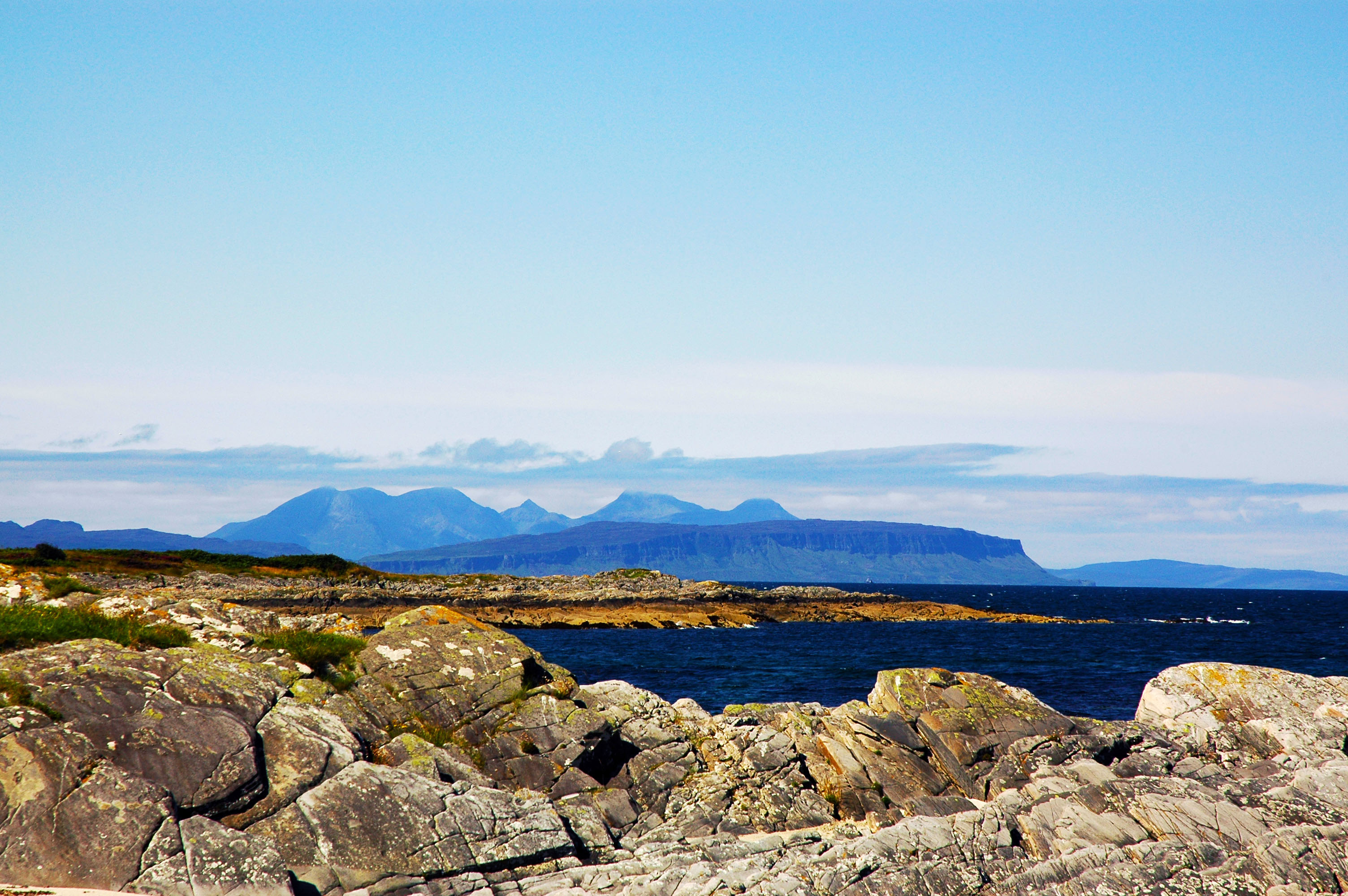
![Cloud over Askival A very long distance view of the Rum Cuillin from the summit of Meall Gorm on the Applecross Mountains. The distance is just under 60km, whilst also in the picture is the small flat island of Pabay [left], beyond which some buildings in Broadford are visible, with the twin peaks of Beinn na Caillich and Beinn Dearg to the right.](https://s1.geograph.org.uk/geophotos/07/50/00/7500001_53c86caa.jpg)
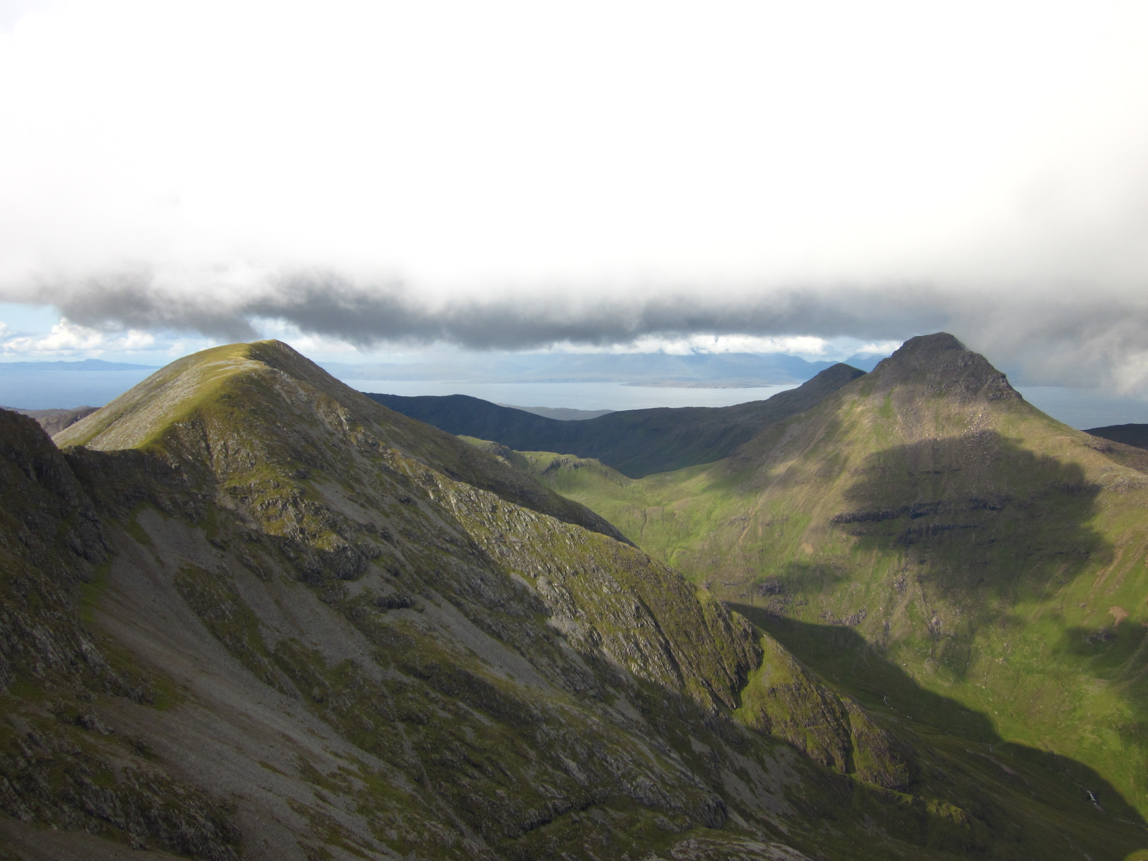
Ainshval is a prominent hill located in Argyllshire, Scotland. Standing at an elevation of 781 meters (2,562 feet), it is one of the most notable peaks in the region. Ainshval is part of the Black Cuillin range, which is renowned for its rugged and dramatic landscape.
The hill is characterized by its steep and rocky slopes, making it a challenging climb for experienced hikers and mountaineers. It offers breathtaking panoramic views of the surrounding area, including the nearby Loch Scavaig and the Isle of Skye.
Ainshval is covered with a diverse range of vegetation, including heather, grasses, and mosses. The lower slopes are dominated by birch and hazel woodlands, while higher up, the landscape transitions into a more barren and rocky terrain. This diverse ecosystem provides a home for a variety of wildlife, including red deer, golden eagles, and ptarmigans.
For those interested in outdoor activities, Ainshval offers excellent opportunities for hiking and mountain climbing. However, it is important to note that this should only be attempted by experienced and properly equipped individuals, as the terrain can be challenging and unpredictable.
Overall, Ainshval is a captivating hill in Argyllshire, attracting nature enthusiasts and adventure seekers alike with its stunning beauty and adventurous spirit.
If you have any feedback on the listing, please let us know in the comments section below.
Ainshval Images
Images are sourced within 2km of 56.965208/-6.3151169 or Grid Reference NM3794. Thanks to Geograph Open Source API. All images are credited.


Ainshval is located at Grid Ref: NM3794 (Lat: 56.965208, Lng: -6.3151169)
Unitary Authority: Highland
Police Authority: Highlands and Islands
What 3 Words
///names.blurred.headrest. Near Elgol, Highland
Nearby Locations
Related Wikis
Ainshval
Ainshval is the second highest mountain on the island of Rùm, in the Inner Hebrides of Scotland, after Askival. It is part of the Rùm Cuillin, a range...

Trollabhal
Trollabhal (also known as Trallval) (702 m) is a mountain in the island of Rùm in Lochaber, Scotland. Although the lowest of the 'Rum Cuillin' in the south...

Askival
Askival is the highest mountain on the island of Rùm, in the Inner Hebrides of Scotland. It is located 5 kilometres (3.1 mi) south of Kinloch, the main...
Small Isles
The Small Isles (Scottish Gaelic: Na h-Eileanan Tarsainn) are a small archipelago of islands in the Inner Hebrides, off the west coast of Scotland. They...

Rùm
Rùm (Scottish Gaelic pronunciation: [rˠuːm]), a Scottish Gaelic name often anglicised to Rum ( rum), is one of the Small Isles of the Inner Hebrides,...

Kinloch, Rùm
Kinloch (Scottish Gaelic: Ceann Locha) is a hamlet that is the main (now only) settlement of the island of Rùm, in the civil parish of the Small Isles...

Kinloch Castle
Kinloch Castle (Scottish Gaelic: Caisteal Cheann Locha) is an Edwardian mansion located on Kinloch, on the island of Rùm, one of the Small Isles off the...
Nearby Amenities
Located within 500m of 56.965208,-6.3151169Have you been to Ainshval?
Leave your review of Ainshval below (or comments, questions and feedback).