Knock Garsin

Hill, Mountain in Inverness-shire

Scotland

Knock Garsin

A863 near Coillore
A863 near Coillore Credit: Steven Brown

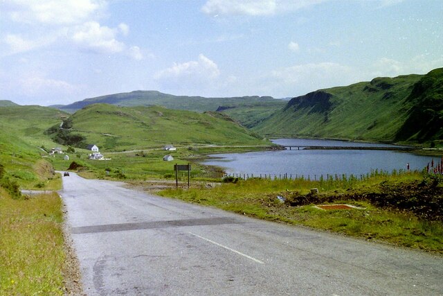
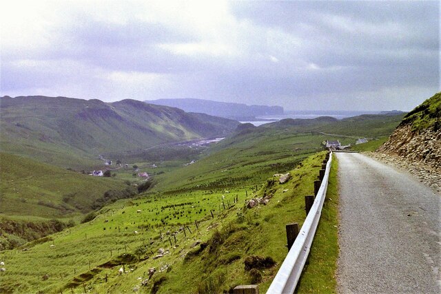
Knock Garsin is a prominent hill located in Inverness-shire, Scotland. It is part of the Scottish Highlands and offers stunning views of the surrounding landscape. Standing at an elevation of 542 meters (1,778 feet), Knock Garsin is a popular destination for hikers and outdoor enthusiasts looking to explore the rugged terrain and enjoy the natural beauty of the area.

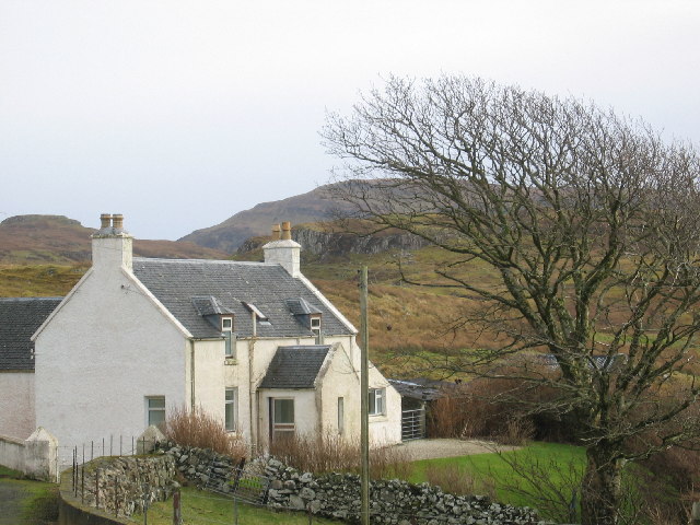
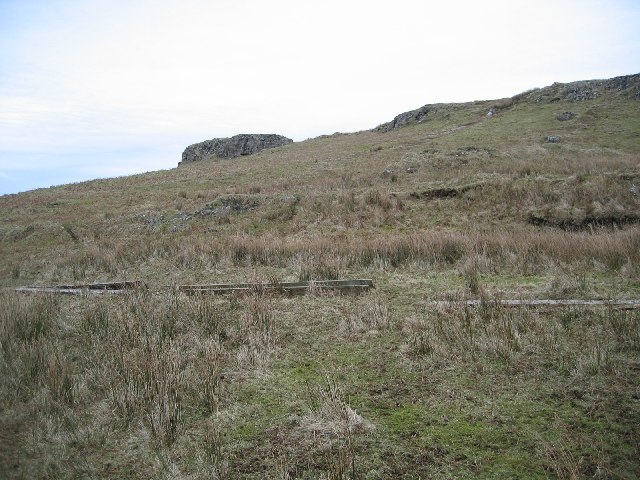
The hill is characterized by its rocky slopes, heather-covered moorland, and scattered patches of woodland. The summit of Knock Garsin provides panoramic views of the surrounding mountains, lochs, and valleys, making it a popular spot for photographers and nature lovers.

The area around Knock Garsin is rich in wildlife, with red deer, mountain hares, and a variety of bird species calling the hill home. Visitors may also catch a glimpse of rare plant species that thrive in the upland environment.

Overall, Knock Garsin offers a peaceful and remote setting for those looking to escape the hustle and bustle of city life and immerse themselves in the natural beauty of the Scottish Highlands.

If you have any feedback on the listing, please let us know in the comments section below.

Knock Garsin Images

Images are sourced within 2km of 57.364166/-6.3938367 or Grid Reference NG3538. Thanks to Geograph Open Source API. All images are credited.

A863 near Coillore
A863 near Coillore
Road junction near Bracadale
Coillore Farm Road
Coillore Farm Road
Bracadale, Skye, 1988
Dun Beag Broch
Dun Beag Broch
Mud exposures at Loch Beag Loch Beag is a minor sea loch which is effectively an arm north of the complex island and sea area at the meeting of Lochs Harport and Bracadale. The view is from a bridge carrying the A863 at the loch's north end.
Mud exposures at Loch Beag
Loch Beag is a minor sea loch which is effectively an arm north of the complex island and sea area at the meeting of Lochs Harport and Bracadale. The view is from a bridge carrying the A863 at the loch's north end.
View towards the coast near Bracadale from the B885, 1989
Struan Jetty, Skye Small fishing jetty, viewed from the eastern shore of Loch Beag.
Struan Jetty, Skye
Small fishing jetty, viewed from the eastern shore of Loch Beag.
Graves of Collie and MacKenzie at Struan churchyard Should be visited by all lovers of the Cuillin.
Graves of Collie and MacKenzie at Struan churchyard
Should be visited by all lovers of the Cuillin.
Allt Mor Gorge The steep sided gorge carved by the Allt Mor as it drops toward Loch Beag.
Allt Mor Gorge
The steep sided gorge carved by the Allt Mor as it drops toward Loch Beag.
Totardor Croft House One of only a very few houses in the Totardor township.
Totardor Croft House
One of only a very few houses in the Totardor township.
Former manse - Balgown The former manse of Balgown Parish Church <a href="https://www.geograph.org.uk/photo/1191836">NG3538 : Bracadale church</a>. The manse dates from c1790.
Former manse - Balgown
The former manse of Balgown Parish Church NG3538 : Bracadale church. The manse dates from c1790.
Dun Garsin A basalt knoll forming a good defensive site for a fort above Glen Bracadale.
Dun Garsin
A basalt knoll forming a good defensive site for a fort above Glen Bracadale.
Struan Petrol Station Petrol station is also the Post Office, newsagent, shop and garage.
Struan Petrol Station
Petrol station is also the Post Office, newsagent, shop and garage.
Cocaire Sheep troughs and old walls near Cocaire in Bracadale.
Cocaire
Sheep troughs and old walls near Cocaire in Bracadale.
Crumbling Road Bridge A bridge on a now bypassed section of the Dunvegan-Sligachan road in a bad way. The road is still open to traffic.
Crumbling Road Bridge
A bridge on a now bypassed section of the Dunvegan-Sligachan road in a bad way. The road is still open to traffic.
Amar Township Looking NW to crofts at Amar.
Amar Township
Looking NW to crofts at Amar.
Loch Beag Looking from the east of the loch to Struan Jetty.
Loch Beag
Looking from the east of the loch to Struan Jetty.
Show me another place!

Knock Garsin is located at Grid Ref: NG3538 (Lat: 57.364166, Lng: -6.3938367)

Unitary Authority: Highland

Police Authority: Highlands and Islands

What 3 Words

///howler.parkland.bouncing. Near Carbost, Highland

Related Wikis

Bracadale

Bracadale (Scottish Gaelic: Bracadal) is a settlement and parish on the Isle of Skye in Scotland. It lies on the west coast of the island, west-south-west...

Dun Beag

Dun Beag is an iron-age broch located about 1 kilometre northwest of the village of Struan on the west coast of the island of Skye, in Scotland. ��2�...

A863 road

The A863 road is one of the principal roads of the Isle of Skye in the Inner Hebrides off the west coast of mainland Scotland.It connects the town of Dunvegan...

Struan, Skye

Struan (Scottish Gaelic: An Sruthan) is a small village on the west coast of the island of Skye, on the shores of Loch Beag, itself an inlet of Loch Bracadale...

Nearby Amenities

Located within 500m of 57.364166,-6.3938367
Source: PGS
Lat/Long: 57.3601808/-6.3959288
Source: PGS
Lat/Long: 57.3603549/-6.3960151
Source: PGS
Lat/Long: 57.36046/-6.3960981
Source: PGS
Lat/Long: 57.3604953/-6.3954307
Source: PGS
Lat/Long: 57.3605586/-6.3945933
Source: PGS
Lat/Long: 57.3607768/-6.3937267
Source: PGS
Lat/Long: 57.3611331/-6.3926525
Source: PGS
Lat/Long: 57.3613417/-6.3918765
Source: PGS
Lat/Long: 57.3616913/-6.3905048
Source: PGS
Lat/Long: 57.3618576/-6.389786
Source: PGS
Lat/Long: 57.3622016/-6.3888952
Source: PGS
Lat/Long: 57.3624866/-6.3880894
Created By: dmgroom_coastlines
Source: PGS
Lat/Long: 57.36251/-6.38696
Created By: dmgroom_coastlines
Source: PGS
Lat/Long: 57.36224/-6.38674
Source: PGS
Lat/Long: 57.3617145/-6.3872183
Source: PGS
Lat/Long: 57.361488/-6.3876665
Source: PGS
Lat/Long: 57.3613368/-6.388001
Source: PGS
Lat/Long: 57.3612815/-6.38824
Source: PGS
Lat/Long: 57.3611547/-6.3884792
Source: PGS
Lat/Long: 57.3608934/-6.3889929
Source: PGS
Lat/Long: 57.360689/-6.3895038
Source: PGS
Lat/Long: 57.360475/-6.3899936
Source: PGS
Lat/Long: 57.3601199/-6.3908704
Source: PGS
Lat/Long: 57.3601216/-6.3910418
Source: PGS
Lat/Long: 57.3600818/-6.3912156
Source: PGS
Lat/Long: 57.3599881/-6.3914578
Source: PGS
Lat/Long: 57.359849/-6.3916694
Source: PGS
Lat/Long: 57.3607382/-6.3988668
Source: PGS
Lat/Long: 57.3607159/-6.3985162
Source: PGS
Lat/Long: 57.3606568/-6.398057
Source: PGS
Lat/Long: 57.3604084/-6.3971925
Source: PGS
Lat/Long: 57.3602637/-6.3963796
Source: PGS
Lat/Long: 57.359943/-6.3961908
Barrier: cattle_grid
Source: survey
Lat/Long: 57.3610185/-6.3965686
Barrier: cattle_grid
Lat/Long: 57.3654586/-6.3931757
Parking
Source: survey
Lat/Long: 57.3607316/-6.3969053
Power: pole
Lat/Long: 57.3675243/-6.3883433
Power: pole
Lat/Long: 57.3670065/-6.3896115
Power: pole
Lat/Long: 57.3665419/-6.3911695
Power: pole
Lat/Long: 57.3661099/-6.3926511
Power: pole
Lat/Long: 57.3657006/-6.3939997
Power: pole
Lat/Long: 57.364982/-6.3953806
Power: pole
Lat/Long: 57.3646596/-6.3968159
Power: pole
Lat/Long: 57.3643686/-6.3980076
Power: pole
Lat/Long: 57.3640809/-6.3992274
Power: pole
Lat/Long: 57.3636793/-6.4001896
Power: pole
Lat/Long: 57.3631158/-6.4015001
Power: pole
Lat/Long: 57.3635284/-6.4015222
Power: pole
Lat/Long: 57.3639322/-6.4015544
Power: pole
Lat/Long: 57.3643599/-6.4015967
Power: pole
Lat/Long: 57.3648615/-6.4016249
Power: pole
Lat/Long: 57.3621768/-6.4011881
Power: pole
Lat/Long: 57.3612192/-6.3966951
Power: pole
Lat/Long: 57.3614624/-6.39777
Power: pole
Lat/Long: 57.3617588/-6.3989255
Power: pole
Lat/Long: 57.3619683/-6.4001494
Power: pole
Lat/Long: 57.3662673/-6.393271
Power: pole
Lat/Long: 57.3664583/-6.394044
Power: pole
Lat/Long: 57.3666559/-6.3948754
Power: pole
Lat/Long: 57.3652458/-6.3925544
Power: pole
Lat/Long: 57.3655313/-6.3920069
Power: pole
Lat/Long: 57.3657885/-6.3915016
Power: pole
Lat/Long: 57.3660881/-6.3902113
Power: pole
Lat/Long: 57.3662445/-6.3895571
Power: pole
Lat/Long: 57.3659329/-6.3920673
The data included in this document is from www.openstreetmap.org. The data is made available under ODbL.

Have you been to Knock Garsin?

Leave your review of Knock Garsin below (or comments, questions and feedback).