Cnoc na Gaibhre Ruaidhe

Hill, Mountain in Ross-shire

Scotland

Cnoc na Gaibhre Ruaidhe

Lily Loch Geocaching is a type of global treasure hunt of people looking for caches, or hidden stashes of objects. Geocaching may also be described as a series of hide-and-seek games, where hiders provide online clues for seekers. Seekers use global positioning system (GPS) devices to find hidden caches
Lily Loch Credit: Ralph Greig

The requested URL returned error: 429 Too Many Requests

If you have any feedback on the listing, please let us know in the comments section below.

Cnoc na Gaibhre Ruaidhe Images

Images are sourced within 2km of 58.137431/-6.4889745 or Grid Reference NB3525. Thanks to Geograph Open Source API. All images are credited.

Lily Loch Geocaching is a type of global treasure hunt of people looking for caches, or hidden stashes of objects. Geocaching may also be described as a series of hide-and-seek games, where hiders provide online clues for seekers. Seekers use global positioning system (GPS) devices to find hidden caches
Lily Loch
Geocaching is a type of global treasure hunt of people looking for caches, or hidden stashes of objects. Geocaching may also be described as a series of hide-and-seek games, where hiders provide online clues for seekers. Seekers use global positioning system (GPS) devices to find hidden caches
Beside Loch Shòbhail
Loch na h-Inghin
Loch na h-Inghin
Loch Shobhail, beside the A859
Boarded up croft house at Liurbost
Dilapidated building By the side of road at Liurbost.
Dilapidated building
By the side of road at Liurbost.
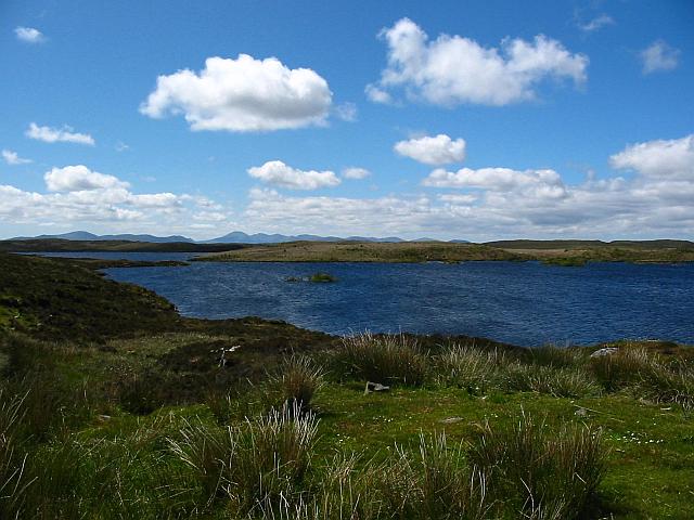
Loch Shobhail Freshwater loch above the head of Loch Liurboist.
Loch Shobhail
Freshwater loch above the head of Loch Liurboist.
Lay-by by Loch Shobhail Pull-over on the main road south of Stornoway with a view of low voltage transmission lines, loch and hills.
Lay-by by Loch Shobhail
Pull-over on the main road south of Stornoway with a view of low voltage transmission lines, loch and hills.
Creag Mhor The Big Rock seen across a glassy Loch Liurbost on a mid summer morning. Old croftland is in the foreground, running down from the house to the loch.
Creag Mhor
The Big Rock seen across a glassy Loch Liurbost on a mid summer morning. Old croftland is in the foreground, running down from the house to the loch.
Head of Loch Liurbost Slopes clad with grass and heather tumble down to the muddy head of the sea loch.
Head of Loch Liurbost
Slopes clad with grass and heather tumble down to the muddy head of the sea loch.
Eilean Orasaigh The western tip of the elongated island is visible. It is close to the northern shore (the populated side) of Loch Liurboist.
Eilean Orasaigh
The western tip of the elongated island is visible. It is close to the northern shore (the populated side) of Loch Liurboist.
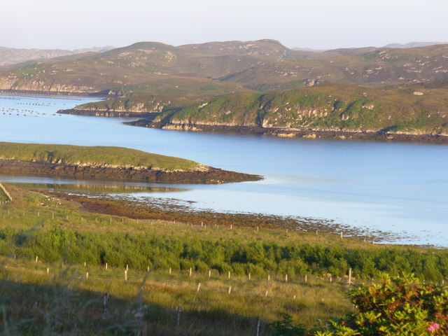
Loch Liurboist Sea loch south of Stornoway. Crofting townships line its northern shore while the southern shore is unpopulated. Fish farming is carried out on the loch.
Loch Liurboist
Sea loch south of Stornoway. Crofting townships line its northern shore while the southern shore is unpopulated. Fish farming is carried out on the loch.
Loch Liurboist Head Unpopulated area where moorland tumbles down from the hills to the tidal mud and rocks at the head of the sea loch.
Loch Liurboist Head
Unpopulated area where moorland tumbles down from the hills to the tidal mud and rocks at the head of the sea loch.
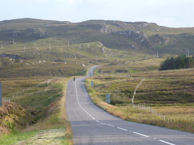
Leurbost: the A859 heads south Leaving the village on the A859 as it heads towards Balallan and Harris. Across the road, we can see the backs of the 3-2-1 countdown markers to the 30mph speed limit in the village.
Leurbost: the A859 heads south
Leaving the village on the A859 as it heads towards Balallan and Harris. Across the road, we can see the backs of the 3-2-1 countdown markers to the 30mph speed limit in the village.
Transmission lines near Liurbost Lines like this can be seen crossing the moorland of Lewis and Harris almost anywhere.
Transmission lines near Liurbost
Lines like this can be seen crossing the moorland of Lewis and Harris almost anywhere.
Loch Shòbhail From the layby on the A859 from Stornoway to Tarbert.
Loch Shòbhail
From the layby on the A859 from Stornoway to Tarbert.
Loch Shòbhail Looking south, with the A859 and electricity transmission lines running alongside.
Loch Shòbhail
Looking south, with the A859 and electricity transmission lines running alongside.
Road to Harris, seen from A858 The A859 towards Tarbert in Harris can be glimpsed here, seen from the A858 road to west Lewis from Cameron Terrace.
Road to Harris, seen from A858
The A859 towards Tarbert in Harris can be glimpsed here, seen from the A858 road to west Lewis from Cameron Terrace.
Show me another place!

Cnoc na Gaibhre Ruaidhe is located at Grid Ref: NB3525 (Lat: 58.137431, Lng: -6.4889745)

Unitary Authority: Na h-Eileanan an Iar

Police Authority: Highlands and Islands

What 3 Words

///unlimited.reclusive.dampen. Near Leurbost, Na h-Eileanan Siar

Related Wikis

Leurbost

Leurbost (Scottish Gaelic: Liùrbost) is a village on the east coast of the Isle of Lewis in the Outer Hebrides of Scotland. It is approximately 6 miles...

North Lochs

North Lochs, (Scottish Gaelic: Ceann a Tuath nan Loch), an area in eastern Lewis, Outer Hebrides, Scotland, is named for the many lochans (small lochs...

Crossbost

Crossbost is a village on the Isle of Lewis in the parish of North Lochs, in the Outer Hebrides, Scotland. It is located approximately ten miles away...

Rainish Eilean Mòr

Rainish Eilean Mòr is an uninhabited island in Loch Orasaigh, north of the village of Leurbost in the area of South Lochs on the Isle of Lewis, Lewis and...

Nearby Amenities

Located within 500m of 58.137431,-6.4889745
Created By: dmgroom_coastlines
Lat/Long: 58.14101/-6.48438
The data included in this document is from www.openstreetmap.org. The data is made available under ODbL.

Have you been to Cnoc na Gaibhre Ruaidhe?

Leave your review of Cnoc na Gaibhre Ruaidhe below (or comments, questions and feedback).