Ruinsival

Hill, Mountain in Argyllshire

Scotland

Ruinsival

The western side of Ruinsival, Rum The lower slopes culminating in Rubha Sgorr an t-Snidhe.
The western side of Ruinsival, Rum Credit: M J Richardson

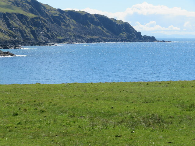
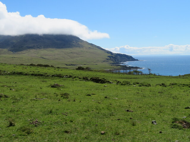
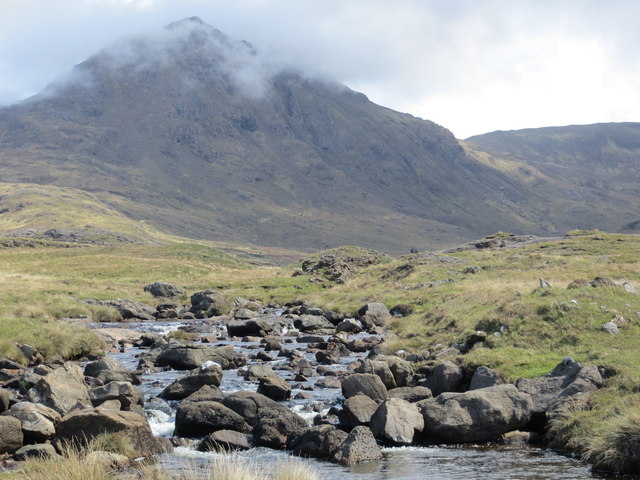
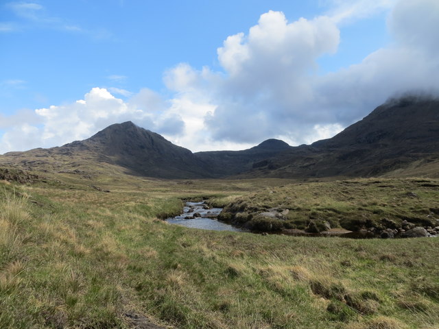
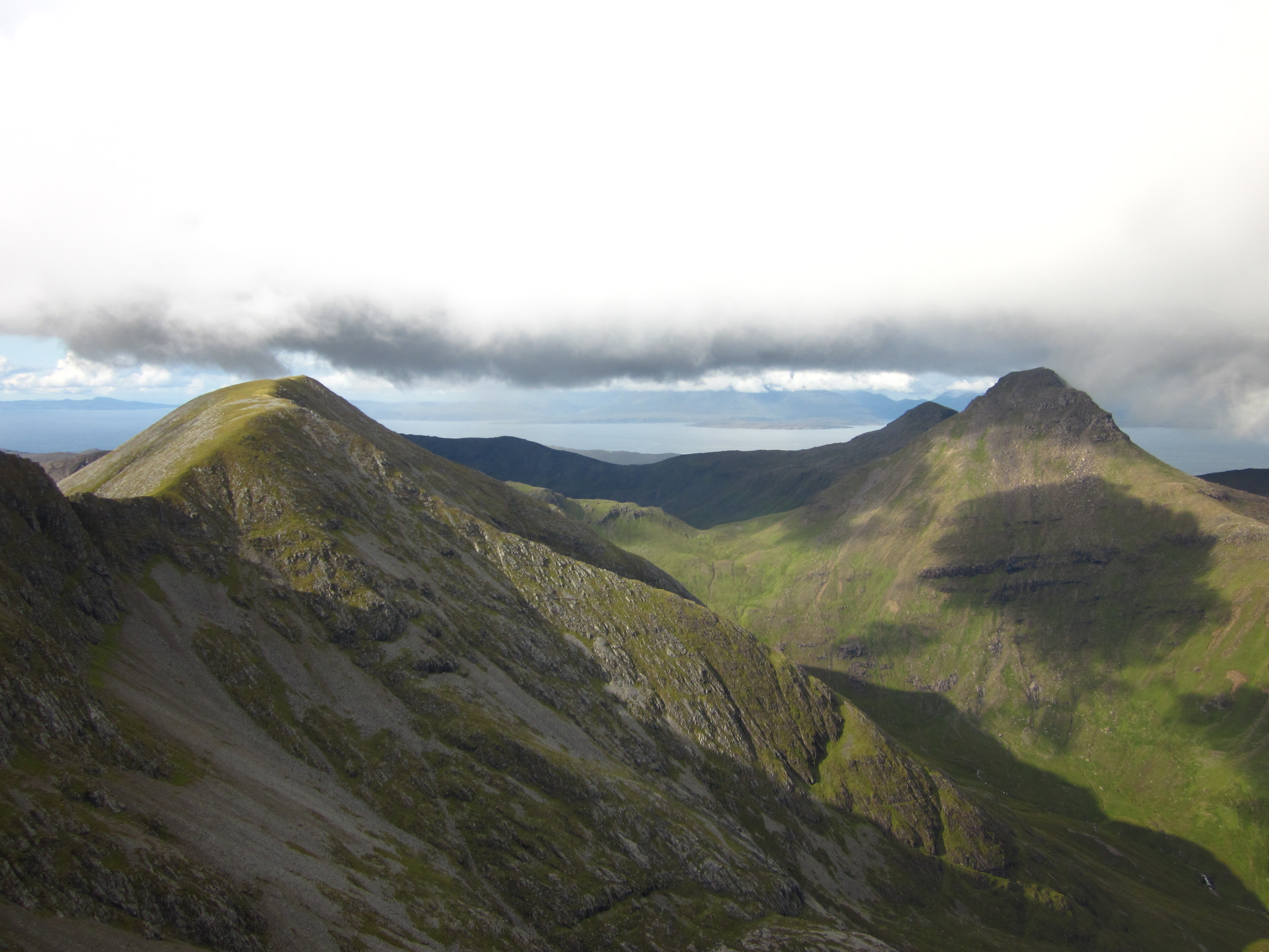
Ruinsival, located in Argyllshire, Scotland, is a breathtaking hill/mountain that offers stunning natural beauty and a rich historical significance. Standing at an impressive height of approximately 2,683 feet (818 meters), it dominates the surrounding landscape and provides panoramic views of the picturesque Argyll countryside.

The name "Ruinsival" is derived from the Gaelic phrase "Rudha an Fhithich," which translates to "the point of the raven." This name is fitting, as the mountain is often associated with the presence of ravens, adding an air of mystique to its already enchanting allure.

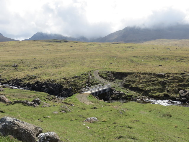
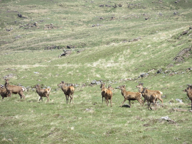
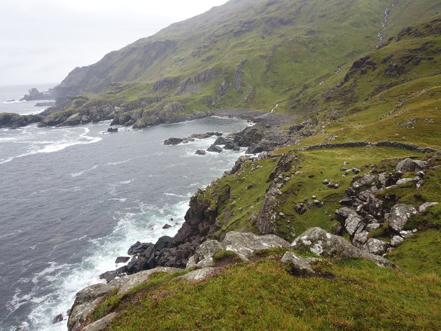
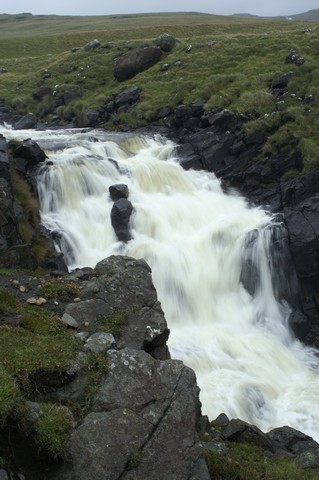
The hill/mountain is composed mainly of ancient schist and quartzite, giving it a distinctive rocky appearance. As visitors ascend its slopes, they are treated to a diverse range of habitats, including heather-clad moorlands, verdant woodlands, and cascading waterfalls. These habitats provide a sanctuary for a variety of wildlife, such as red deer, golden eagles, and peregrine falcons, making it a popular destination for nature enthusiasts and birdwatchers.

Ruinsival also holds historical significance, with traces of human activity dating back centuries. The hill/mountain features the remains of ancient settlements, including stone walls and cairns, hinting at the area's past inhabitants and their way of life. Exploring these remnants offers a glimpse into the region's rich heritage and adds an extra layer of intrigue to the experience.

Whether embarking on a challenging hike to its summit or simply admiring its beauty from afar, Ruinsival in Argyllshire is a must-visit destination for those seeking a blend of natural splendor and historical intrigue.

If you have any feedback on the listing, please let us know in the comments section below.
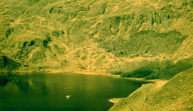
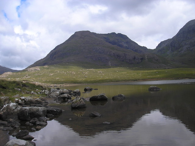
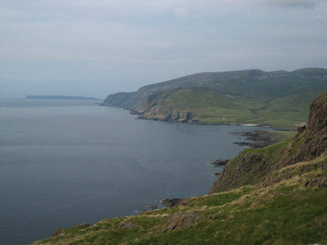
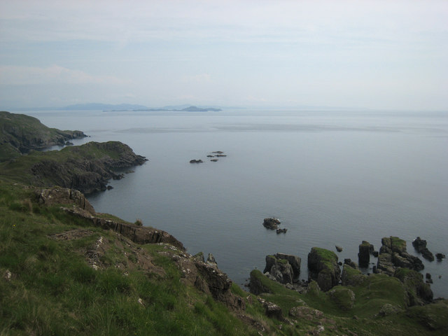
Ruinsival Images

Images are sourced within 2km of 56.962068/-6.350907 or Grid Reference NM3594. Thanks to Geograph Open Source API. All images are credited.

The western side of Ruinsival, Rum The lower slopes culminating in Rubha Sgorr an t-Snidhe.
The western side of Ruinsival, Rum
The lower slopes culminating in Rubha Sgorr an t-Snidhe.
The southwest coast of Rum As viewed from the track to Harris.
The southwest coast of Rum
As viewed from the track to Harris.
Bridge over the Abhainn Rangail
Red deer hinds on the moor in Glen Harris
Abhainn Rangail in Glen Harris Barkeval in the background
Abhainn Rangail in Glen Harris
Barkeval in the background
Abhainn Rangail in Glen Harris
Inbhir Ghil Walking from Papadil Pinnacle to Inhbir Ghil we were following the fresh tracks laid by a herd of wild goats. We could see them shortly ahead of us: mocking our slow progress.
Inbhir Ghil
Walking from Papadil Pinnacle to Inhbir Ghil we were following the fresh tracks laid by a herd of wild goats. We could see them shortly ahead of us: mocking our slow progress.
Waterfall of Abhainn Rangail at Harris The river was swallen after a bad weather
Waterfall of Abhainn Rangail at Harris
The river was swallen after a bad weather
Loch Papadil and Papadil Lodge Persistent snow cover during the 1962-63 winter in Rum gave the vegetation an uncharacteristic bleached look in March. Papadil Lodge had a roof in 1963.  The group in the rowing boat were  mountaineers having a rest-day.  They found the boat and oars on the shore of the loch, but there were no rowlocks.   So they borrowed the rowing boat and propelled it canoe-style with the oars as paddles!
Loch Papadil and Papadil Lodge
Persistent snow cover during the 1962-63 winter in Rum gave the vegetation an uncharacteristic bleached look in March. Papadil Lodge had a roof in 1963. The group in the rowing boat were mountaineers having a rest-day. They found the boat and oars on the shore of the loch, but there were no rowlocks. So they borrowed the rowing boat and propelled it canoe-style with the oars as paddles!
Loch Fiachanis This is the lochside of Loch Fiachannis, a very shallow sandy loch.  To one side there is a large sandy beach, to the other sides it is rocky and boulder strewn.  Excellent fishing and great views.
Loch Fiachanis
This is the lochside of Loch Fiachannis, a very shallow sandy loch. To one side there is a large sandy beach, to the other sides it is rocky and boulder strewn. Excellent fishing and great views.
River mouth This is the river mouth of Abhainn Fiachanis, where it meets the sea, there is much rubbish washed ashore here.
River mouth
This is the river mouth of Abhainn Fiachanis, where it meets the sea, there is much rubbish washed ashore here.
Harris Bay from southwest slopes of Ruinsival View from the cliffs above the headland Rubha Sgorr an t-Snidhe towards Harris Bay, Sgòrr Reidh and Canna.
Harris Bay from southwest slopes of Ruinsival
View from the cliffs above the headland Rubha Sgorr an t-Snidhe towards Harris Bay, Sgòrr Reidh and Canna.
Skerries off Inbhir Ghil Rocks just offshore near Inbhir Ghil in southern Rùm.  Muck and Ardnamurchan in the background.
Skerries off Inbhir Ghil
Rocks just offshore near Inbhir Ghil in southern Rùm. Muck and Ardnamurchan in the background.
Cairn on the Papadil to Harris path Canna on the left horizon and Orval on the right.
The Bullough mausoleum at Harris is just visible to the left of the white house across the bay.
Cairn on the Papadil to Harris path
Canna on the left horizon and Orval on the right. The Bullough mausoleum at Harris is just visible to the left of the white house across the bay.
Looking west from Bealach an Fhuarain Loch Fiachanais under Ruinsival on the left.
Looking west from Bealach an Fhuarain
Loch Fiachanais under Ruinsival on the left.
Descending south from Ruinsival Loch Papadil in the centre. 
Looking across the Sound of Rum with Eigg on the left 
and Muck below the horizon on the right.
Descending south from Ruinsival
Loch Papadil in the centre. Looking across the Sound of Rum with Eigg on the left and Muck below the horizon on the right.
On Leac a' Chaisteil Looking over the screes towards Loch Fiachanais and Harris.
Canna is the next island with the hills of South Uist on the horizon.
On Leac a' Chaisteil
Looking over the screes towards Loch Fiachanais and Harris. Canna is the next island with the hills of South Uist on the horizon.
Show me another place!

Ruinsival is located at Grid Ref: NM3594 (Lat: 56.962068, Lng: -6.350907)

Unitary Authority: Highland

Police Authority: Highlands and Islands

What 3 Words

///crest.rejected.goodbyes. Near Elgol, Highland

Nearby Locations

Loch Fiachanais Ruinsival

Related Wikis

Ainshval

Ainshval is the second highest mountain on the island of Rùm, in the Inner Hebrides of Scotland, after Askival. It is part of the Rùm Cuillin, a range...

Trollabhal

Trollabhal (also known as Trallval) (702 m) is a mountain in the island of Rùm in Lochaber, Scotland. Although the lowest of the 'Rum Cuillin' in the south...

Askival

Askival is the highest mountain on the island of Rùm, in the Inner Hebrides of Scotland. It is located 5 kilometres (3.1 mi) south of Kinloch, the main...

Rùm

Rùm (Scottish Gaelic pronunciation: [rˠuːm]), a Scottish Gaelic name often anglicised to Rum ( rum), is one of the Small Isles of the Inner Hebrides,...

Nearby Amenities

Located within 500m of 56.962068,-6.350907
Ruinsival
Corbett: no
Ele: 528
Graham: no
Munro: no
Natural: peak
Wikidata: Q24662553
Lat/Long: 56.9600966/-6.3503548
The data included in this document is from www.openstreetmap.org. The data is made available under ODbL.

Have you been to Ruinsival?

Leave your review of Ruinsival below (or comments, questions and feedback).