A' Mharagach

Hill, Mountain in Argyllshire

Scotland

A' Mharagach

Red Deer at Kilmory, Rum Rocky coast at the north of the island.
Red Deer at Kilmory, Rum Credit: M J Richardson

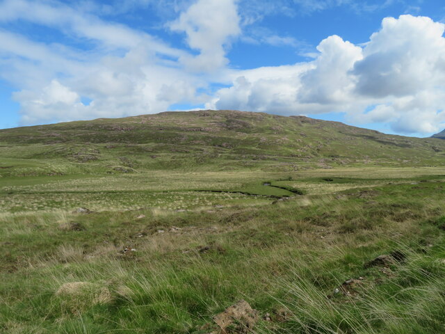
A' Mharagach is a prominent hill located in the Argyllshire region of Scotland. It is situated in the remote and rugged landscape of the Scottish Highlands, offering breathtaking views and a challenging terrain for hikers and mountaineers. Standing at an elevation of approximately 3,146 feet (959 meters), A' Mharagach is a popular destination for outdoor enthusiasts seeking an adventurous experience.

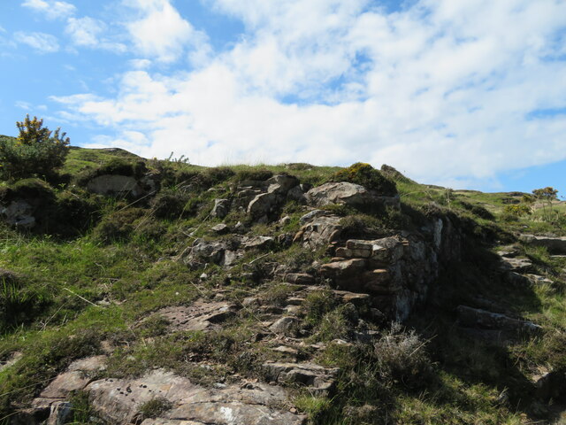
The hill is characterized by its steep slopes, rocky outcrops, and grassy ridges, making it an ideal destination for those looking for a challenging climb. The ascent to the summit is demanding but rewarding, as it offers panoramic vistas of the surrounding glens, lochs, and mountain ranges. On a clear day, visitors can enjoy breathtaking views of the nearby Beinn Dearg, Beinn Eighe, and Liathach mountains.

A' Mharagach is a part of a larger mountain range known as the Fannichs, which comprises several other prominent peaks. This range is renowned for its remote and wild nature, attracting experienced hikers and climbers who seek solitude and wilderness.

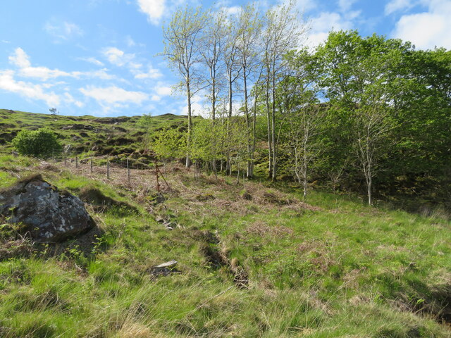
The hill is home to a diverse range of flora and fauna, with heather-covered slopes and scattered patches of woodland. Birdwatchers may spot golden eagles, ptarmigans, and peregrine falcons soaring above, while red deer and mountain hares roam the lower slopes.

Due to its remote location, it is recommended to come well-prepared with appropriate hiking gear, maps, and provisions. It is advisable to check weather conditions and plan accordingly, as the Scottish Highlands are known for their unpredictable climate.

If you have any feedback on the listing, please let us know in the comments section below.

A' Mharagach Images

Images are sourced within 2km of 57.045591/-6.3808499 or Grid Reference NG3403. Thanks to Geograph Open Source API. All images are credited.

Red Deer at Kilmory, Rum Rocky coast at the north of the island.
Red Deer at Kilmory, Rum
Rocky coast at the north of the island.
Small lodge at Kilmory, Rum Used for many years by researchers studying the Red Deer population on the island. The Cuillin of Skye is about 20km to the northeast.
Small lodge at Kilmory, Rum
Used for many years by researchers studying the Red Deer population on the island. The Cuillin of Skye is about 20km to the northeast.
Proterozoic sandstone at Kilmory Fairly old fine-grained sandstone rocks, from 2500 - 500 million years ago, forming the major part of north Rum.
Proterozoic sandstone at Kilmory
Fairly old fine-grained sandstone rocks, from 2500 - 500 million years ago, forming the major part of north Rum.
Small lodge and store at Kilmory Used by  researchers for the long term study of the Red Deer population on the island.
Small lodge and store at Kilmory
Used by researchers for the long term study of the Red Deer population on the island.
Kilmory Bay, Rum Looking northeast to Skye. It is possible also to make out the island of Soay, as a low island visible for about a third of the RH side of the Skye shore.
Kilmory Bay, Rum
Looking northeast to Skye. It is possible also to make out the island of Soay, as a low island visible for about a third of the RH side of the Skye shore.
Kilmory Glen With Kilmory River and the slopes of Mullach Mòr.
Kilmory Glen
With Kilmory River and the slopes of Mullach Mòr.
Red Deer at Kilmory A few of the several hundred deer on Rum, which have been the subject of research and population studies for many years.
Red Deer at Kilmory
A few of the several hundred deer on Rum, which have been the subject of research and population studies for many years.
Woodland in Kilmory Glen Mixed woodland on a rocky hillside.
Woodland in Kilmory Glen
Mixed woodland on a rocky hillside.
Kilmory Glen Trackside rocks and gorse.
Kilmory Glen
Trackside rocks and gorse.
A view of Skye from Rum [2] Looking north over Kilmory Bay.
A view of Skye from Rum [2]
Looking north over Kilmory Bay.
A view of Skye from Rum [3] Looking northeast from Kilmory.
A view of Skye from Rum [3]
Looking northeast from Kilmory.
Kilmory old Burial Ground - Rhum
Stack, North coast of Rùm West of Kilmory.
Stack, North coast of Rùm
West of Kilmory.
Allt Loch Sgaorishal Rocky terrain on the north coast of Rùm.
Allt Loch Sgaorishal
Rocky terrain on the north coast of Rùm.
Wreck of the Jack Abry II It's now 8 years since this trawler ran ground. See the MAIB Accident Report - <span class="nowrap"><a title="https://assets.publishing.service.gov.uk/media/547c6fa040f0b60241000045/JackAbryIIReport.pdf" rel="nofollow ugc noopener" href="https://assets.publishing.service.gov.uk/media/547c6fa040f0b60241000045/JackAbryIIReport.pdf">Link</a><img style="margin-left:2px;" alt="External link" title="External link - shift click to open in new window" src="https://s1.geograph.org.uk/img/external.png" width="10" height="10"/></span>
Wreck of the Jack Abry II
It's now 8 years since this trawler ran ground. See the MAIB Accident Report - LinkExternal link
NW coast of Rum A wider angle view including the distinctive cliff shown in <a href="https://www.geograph.org.uk/photo/520442">NG3202 : Cliff in north Rum</a>.
The peak at the extreme left is Blaven on Skye.
NW coast of Rum
A wider angle view including the distinctive cliff shown in NG3202 : Cliff in north Rum. The peak at the extreme left is Blaven on Skye.
Show me another place!

A' Mharagach is located at Grid Ref: NG3403 (Lat: 57.045591, Lng: -6.3808499)

Unitary Authority: Highland

Police Authority: Highlands and Islands

What 3 Words

///auctioned.awakes.buildings. Near Elgol, Highland

Nearby Locations

Monadh Dubh A' Mharagach

Related Wikis

Rùm

Rùm (Scottish Gaelic pronunciation: [rˠuːm]), a Scottish Gaelic name often anglicised to Rum ( rum), is one of the Small Isles of the Inner Hebrides,...

Sanday, Inner Hebrides

Sanday (Scottish Gaelic: Sandaigh; Scots: Sandee) is one of the Small Isles, in the Scottish Inner Hebrides. It is a tidal island linked to its larger...

Kinloch Castle

Kinloch Castle (Scottish Gaelic: Caisteal Cheann Locha) is an Edwardian mansion located on Kinloch, on the island of Rùm, one of the Small Isles off the...

St Edward's Church, Sanday

St Edward's Church, Sanday, is a deconsecrated, and now disused church on the small isle of Sanday, Inner Hebrides, Scotland. The church was a gift to...

Nearby Amenities

Located within 500m of 57.045591,-6.3808499
Jack Abry II
Historic: wreck
Seamark Type: wreck
Seamark Wreck Category: hull_showing
Seamark Wreck Water Level: part-submerged
Source: survey
Website: https://www.gov.uk/maib-reports/grounding-of-stern-trawler-jack-abry-ii-on-the-isle-of-rum-scotland
Lat/Long: 57.0484698/-6.3818474
Waterway: waterfall
Lat/Long: 57.0483577/-6.3792298
The data included in this document is from www.openstreetmap.org. The data is made available under ODbL.

Have you been to A' Mharagach?

Leave your review of A' Mharagach below (or comments, questions and feedback).