Aird Molach

Hill, Mountain in Ross-shire

Scotland

Aird Molach

Looking towards Loch Mor Stiomrabhaigh
Looking towards Loch Mor Stiomrabhaigh Credit: Mike Dunn

Aird Molach is a prominent hill located in Ross-shire, Scotland. It is situated in the northwest Highlands, near the village of Achnasheen. Standing at an elevation of 1,789 feet (545 meters), Aird Molach offers breathtaking panoramic views of the surrounding area.

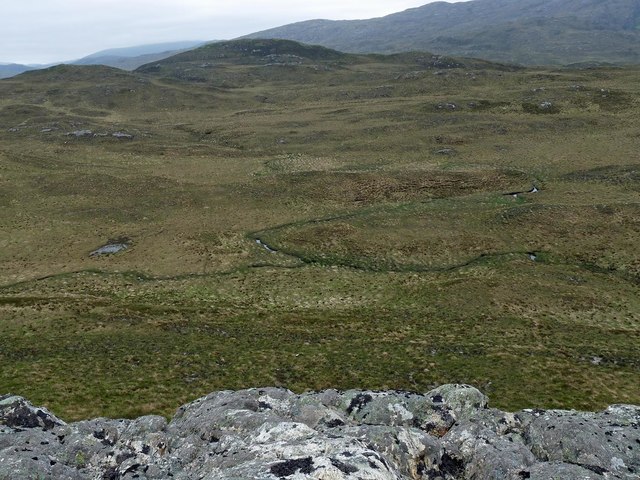
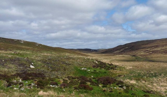
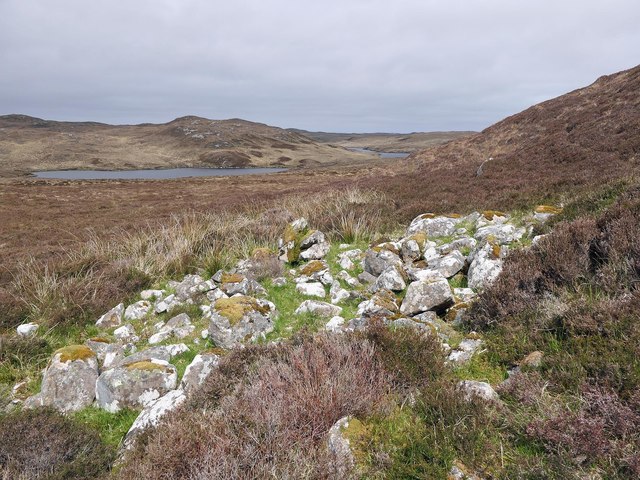
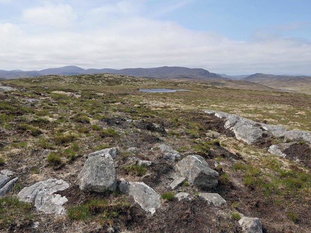
The hill is characterized by its distinct shape, with a long ridge that stretches from the north to the south. This ridge is covered in heather and grass, providing a vibrant display of colors during the summer months. Aird Molach is also known for its rocky terrain, with scattered boulders and outcrops adding to its rugged appeal.

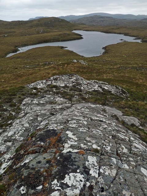
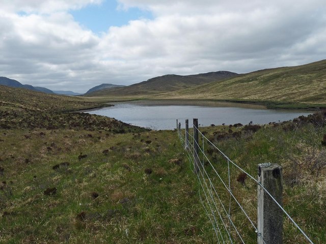
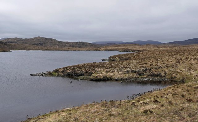
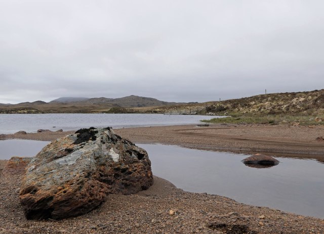
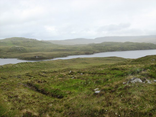
The ascent to the summit of Aird Molach is a popular choice for hikers and outdoor enthusiasts. The climb can be challenging at times, with steep sections and uneven ground, but the reward is well worth it. On a clear day, the view from the top allows visitors to admire the stunning landscapes of the Scottish Highlands, with rolling hills, lochs, and distant mountains stretching as far as the eye can see.

The area surrounding Aird Molach is rich in wildlife, making it a haven for nature lovers. Red deer, mountain hares, and golden eagles are often spotted in the vicinity, adding to the allure of the hill.

Overall, Aird Molach is a remarkable hill in Ross-shire, offering a blend of natural beauty, adventure, and wildlife. It is a must-visit destination for those seeking to experience the rugged charm of the Scottish Highlands.

If you have any feedback on the listing, please let us know in the comments section below.

Aird Molach Images

Images are sourced within 2km of 58.038919/-6.5045426 or Grid Reference NB3414. Thanks to Geograph Open Source API. All images are credited.

Looking towards Loch Mor Stiomrabhaigh
Confluence of the Allt Eitneach with a tributary, Isle of Lewis Taken from Cnoc an Uillt Eitnich.
Confluence of the Allt Eitneach with a tributary, Isle of Lewis
Taken from Cnoc an Uillt Eitnich.
Rock slab on the southern slopes of Sidhean Tom Mhic Reacail, Isle of Lewis Looking towards Loch na Ciste, all of which lies within the grid square.
Rock slab on the southern slopes of Sidhean Tom Mhic Reacail, Isle of Lewis
Looking towards Loch na Ciste, all of which lies within the grid square.
Loch nan Lùb, Isle of Lewis An inlet on the northern arm of this U-shaped loch.
Loch nan Lùb, Isle of Lewis
An inlet on the northern arm of this U-shaped loch.
Fence above Loch na h-Àirigh Meadhonach, Isle of Lewis The loch straddles this grid square and the one to the north.
Fence above Loch na h-Àirigh Meadhonach, Isle of Lewis
The loch straddles this grid square and the one to the north.
Remains of possible farmstead, Glen Uirn, Isle of Lewis From <span class="nowrap"><a title="https://canmore.org.uk/site/134037" rel="nofollow ugc noopener" href="https://canmore.org.uk/site/134037">Link</a><img style="margin-left:2px;" alt="External link" title="External link - shift click to open in new window" src="https://s1.geograph.org.uk/img/external.png" width="10" height="10"/></span> : "What may be a farmstead comprising three unroofed buildings, which are annotated as Ruins, and a head-dyke are depicted on the 1st edition of the OS 6-inch map (Ross-shire, Island of Lewis 1854, sheet 37)."
Remains of possible farmstead, Glen Uirn, Isle of Lewis
From LinkExternal link : "What may be a farmstead comprising three unroofed buildings, which are annotated as Ruins, and a head-dyke are depicted on the 1st edition of the OS 6-inch map (Ross-shire, Island of Lewis 1854, sheet 37)."
Loch Shanndabhat, Isle of Lewis The OS Name Book of 1848-1852 describes Loch Shanndabhat as, "a large fresh water loch into which flows Allt Feithe Luachraich.  It is deep and very narrow about its centre".
Loch Shanndabhat, Isle of Lewis
The OS Name Book of 1848-1852 describes Loch Shanndabhat as, "a large fresh water loch into which flows Allt Feithe Luachraich. It is deep and very narrow about its centre".
Inflow to Loch Shanndabhat, Isle of Lewis This unnamed burn rises below Sidhean Shanndabhat and flows for approximately 500m before discharging into the loch.
Inflow to Loch Shanndabhat, Isle of Lewis
This unnamed burn rises below Sidhean Shanndabhat and flows for approximately 500m before discharging into the loch.
Shieling hut below Sidhean Shanndabhat, Isle of Lewis This is one in a row of about ten huts.
Shieling hut below Sidhean Shanndabhat, Isle of Lewis
This is one in a row of about ten huts.
Possible remains of cairn, Sidhean Dubha, Isle of Lewis OS maps with a scale of 1:25,000 and larger show a cairn to the north-east of the highest point of Sidhean Dubha.  There didn't appear to be one on the ground.  The only thing I could find was this rough ring of stones which may previously have been the base of a cairn.
Possible remains of cairn, Sidhean Dubha, Isle of Lewis
OS maps with a scale of 1:25,000 and larger show a cairn to the north-east of the highest point of Sidhean Dubha. There didn't appear to be one on the ground. The only thing I could find was this rough ring of stones which may previously have been the base of a cairn.
Gates at Eisgein, Isle of Lewis Gates to Eisgein about 2km north of Eisgen Lodge. Photo taken looking north.
Gates at Eisgein, Isle of Lewis
Gates to Eisgein about 2km north of Eisgen Lodge. Photo taken looking north.
Moorland east of the Eisgein road Lochan nan Uidhean Beaga in the background.
Moorland east of the Eisgein road
Lochan nan Uidhean Beaga in the background.
Track to small quarry Stones from the quarry were probably used to build the road.
Track to small quarry
Stones from the quarry were probably used to build the road.
Loch Beag Stiomrabhaigh One of the many small lochs in this part of Lewis.
Loch Beag Stiomrabhaigh
One of the many small lochs in this part of Lewis.
Loch Mor Stiomrabhaigh Taken from the eastern flank of Cleite Breac looking towards the narrows of Loch Mor Stiomrabhaigh and beyond.  The ditching  running down the hillside in the foreground was undertaken for forestry plantation, but this did not proceed.
Loch Mor Stiomrabhaigh
Taken from the eastern flank of Cleite Breac looking towards the narrows of Loch Mor Stiomrabhaigh and beyond. The ditching running down the hillside in the foreground was undertaken for forestry plantation, but this did not proceed.
Loch Mor Stiomrabhaigh Looking south towards Loch Mor Stiomrabhaigh in the mid distance and the higher hills of Harris beyond.  In some parts of these island the peat can be several metres deep, but here there is almost none and the mineral soil is exposed under thin vegetation.
Loch Mor Stiomrabhaigh
Looking south towards Loch Mor Stiomrabhaigh in the mid distance and the higher hills of Harris beyond. In some parts of these island the peat can be several metres deep, but here there is almost none and the mineral soil is exposed under thin vegetation.
Moorland Burn Looking downstream at a survey point on a small unnamed burn that flows north.
Moorland Burn
Looking downstream at a survey point on a small unnamed burn that flows north.
A tranquil road through moorland Looking down onto the road leading Eisgein Lodge from a craggy vantage point of Lewisian Gneiss bedrock.
A tranquil road through moorland
Looking down onto the road leading Eisgein Lodge from a craggy vantage point of Lewisian Gneiss bedrock.
Show me another place!

Aird Molach is located at Grid Ref: NB3414 (Lat: 58.038919, Lng: -6.5045426)

Unitary Authority: Na h-Eileanan an Iar

Police Authority: Highlands and Islands

What 3 Words

///removable.trickle.chats. Near Leurbost, Na h-Eileanan Siar

Related Wikis

Stiomrabhaig

Stiomrabhaig is an abandoned crofter's village on the Isle of Lewis in the Outer Hebrides. == History == The United Kingdom Census 1851 shows that the...

Gravir

Gravir (Scottish Gaelic: Grabhair), is a village on the shore of Loch Odhairn (a sea loch) in the Park district of the Isle of Lewis. Gravir is within...

Orinsay

Orinsay (Scottish Gaelic: Orasaigh) is a crofting village on the Isle of Lewis in the district of Pairc, in the Outer Hebrides, Scotland. The settlement...

Park, Lewis

Park (Scottish Gaelic: A' Phàirc), also known as South Lochs, is a huge area of land connected to the rest of Lewis only by a narrow neck between Loch...

Have you been to Aird Molach?

Leave your review of Aird Molach below (or comments, questions and feedback).