Ben Toirlean

Hill, Mountain in Inverness-shire

Scotland

Ben Toirlean

Dun Beag Broch
Dun Beag Broch Credit: David Brown

Ben Toirlean, located in Inverness-shire, Scotland, is a prominent hill/mountain that stands at an elevation of approximately 917 meters (3,009 feet). It is situated in the western part of the county, within the Lochaber region, and forms part of the Grampian Mountains. The mountain is known for its breathtaking beauty and challenging hiking trails, attracting outdoor enthusiasts from far and wide.

Ben Toirlean offers stunning panoramic views of the surrounding landscape, including the nearby Loch Treig and the Grey Corries range. Its rugged terrain consists of steep slopes and rocky ridges, making it a popular destination for experienced hikers and mountaineers seeking a thrilling adventure. The ascent to the summit is demanding, but the rewarding vistas make the effort worthwhile.

The mountain is also home to a diverse range of flora and fauna, with heather-covered slopes and scattered patches of woodland providing habitats for various species. Wildlife enthusiasts may spot red deer, mountain hares, and a variety of bird species, including golden eagles and ptarmigans.

Due to its remote location and challenging terrain, it is advisable for visitors to be well-prepared with appropriate outdoor gear and navigation tools. It is also recommended to check weather conditions beforehand, as the mountain can experience rapidly changing weather patterns.

Overall, Ben Toirlean in Inverness-shire offers a thrilling and picturesque mountain experience, attracting nature lovers and adventure seekers alike.

If you have any feedback on the listing, please let us know in the comments section below.

Ben Toirlean Images

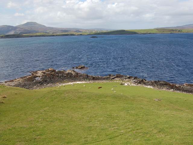
Images are sourced within 2km of 57.366588/-6.4560817 or Grid Reference NG3239. Thanks to Geograph Open Source API. All images are credited.

Dun Beag Broch
Dun Beag Broch
Dun Beag broch Looking across Loch Bracadale from the remains of the Dun Beag broch
Dun Beag broch
Looking across Loch Bracadale from the remains of the Dun Beag broch
Ullinish , Skye Looking north toward Ullinish Lodge Hotel
Ullinish , Skye
Looking north toward Ullinish Lodge Hotel
Ullinish Lodge Hotel, Isle of Skye
Dunbeg (or Dun Beag) Broch, Isle of Skye
Dun Struan Beag
Dun Struan Beag
Old Road Looking north west along the old straight road that has been replaced by a new road with a big bend to avoid the boggy land.
Old Road
Looking north west along the old straight road that has been replaced by a new road with a big bend to avoid the boggy land.
Sheep Loading Ramp Near Ullinish. A steep drop onto the lorry!
Sheep Loading Ramp
Near Ullinish. A steep drop onto the lorry!
House at Eabost Looking SW across Loch Bracadale. In the distance is the island of Wiay.
House at Eabost
Looking SW across Loch Bracadale. In the distance is the island of Wiay.
Mobile Bank Looks to be ready to end its days on this fairly remote farm. I wonder if the Clydesdale know it's here?
Mobile Bank
Looks to be ready to end its days on this fairly remote farm. I wonder if the Clydesdale know it's here?
Ullinish Looking north at the houses of Ullinish on the shore of Loch Bracadale.
Ullinish
Looking north at the houses of Ullinish on the shore of Loch Bracadale.
Sheep on the Old Road South of Gearymore.
Sheep on the Old Road
South of Gearymore.
Colbost Point Looking across the rough grazings above Colbost Point, near Eabost. The islands visible in Loch Bracadale are Tarner and Harlosh.
Colbost Point
Looking across the rough grazings above Colbost Point, near Eabost. The islands visible in Loch Bracadale are Tarner and Harlosh.
Grazings at Eabost West Croft land with sheep grazing. The view is across Loch Bracadale to the mouth of Loch Caroy.
Grazings at Eabost West
Croft land with sheep grazing. The view is across Loch Bracadale to the mouth of Loch Caroy.
Recycling bins near Struan Increasingly evident in the Scottish Highlands are collecting bins like these. No problem in a supermarket car park, or a built up area, but questionably brightly coloured for an entirely rural setting such as this one.
Recycling bins near Struan
Increasingly evident in the Scottish Highlands are collecting bins like these. No problem in a supermarket car park, or a built up area, but questionably brightly coloured for an entirely rural setting such as this one.
Ben Toirlean The trig point on the low summit of Ben Toirlean, looking towards a hazy Black Cuillin.
Ben Toirlean
The trig point on the low summit of Ben Toirlean, looking towards a hazy Black Cuillin.
Dun Mor Just north of the well known Dun Beag (small fort) in <a href="https://www.geograph.org.uk/gridref/NG3338">NG3338</a> is Dun Mor (big fort). It is certainly bigger in footprint, but little remains of it other than this tumbled wall. Great views from here.
Dun Mor
Just north of the well known Dun Beag (small fort) in NG3338 is Dun Mor (big fort). It is certainly bigger in footprint, but little remains of it other than this tumbled wall. Great views from here.
Site of Dun Mor The east side of the cnoc on which Dun Mor was built. View is to Loch Bracadale, with Oronsay <a href="https://www.geograph.org.uk/gridref/NG3135">NG3135</a> in the centre.
Site of Dun Mor
The east side of the cnoc on which Dun Mor was built. View is to Loch Bracadale, with Oronsay NG3135 in the centre.
Show me another place!

Ben Toirlean is located at Grid Ref: NG3239 (Lat: 57.366588, Lng: -6.4560817)

Unitary Authority: Highland

Police Authority: Highlands and Islands

What 3 Words

///closed.closed.reset. Near Carbost, Highland

Nearby Locations

Ben Toirlean

Related Wikis

Struan, Skye

Struan (Scottish Gaelic: An Sruthan) is a small village on the west coast of the island of Skye, on the shores of Loch Beag, itself an inlet of Loch Bracadale...

Ullinish

Ullinish (Gaelic: Uilfhinis) is a crofting township on Loch Bracadale, on the southwest coast of Skye, Scotland. The only promontory fort on Skye is located...

Ose, Skye

Ose (Scottish Gaelic: Òs) is a small coastal settlement of Loch Bracadale, in the Scottish Highland area. It lies on the west coast of the Isle of Skye...

Dun Beag

Dun Beag is an iron-age broch located about 1 kilometre northwest of the village of Struan on the west coast of the island of Skye, in Scotland. ��2�...

Nearby Amenities

Located within 500m of 57.366588,-6.4560817
Power: pole
Lat/Long: 57.3686244/-6.4629803
Power: pole
Lat/Long: 57.3678863/-6.4626985
Power: pole
Lat/Long: 57.3671503/-6.462465
Power: pole
Lat/Long: 57.3666054/-6.4622757
Power: pole
Lat/Long: 57.3661147/-6.4618329
Power: pole
Lat/Long: 57.3656501/-6.4614545
Power: pole
Lat/Long: 57.3653831/-6.4601601
Power: pole
Lat/Long: 57.3650997/-6.4588497
Power: pole
Lat/Long: 57.3648208/-6.4575372
Power: pole
Lat/Long: 57.3645678/-6.4563194
Power: pole
Lat/Long: 57.3643236/-6.4551981
Power: pole
Lat/Long: 57.3640782/-6.4540668
Power: pole
Lat/Long: 57.3638785/-6.4531288
Power: pole
Lat/Long: 57.363657/-6.4520559
Power: pole
Lat/Long: 57.3634573/-6.451142
Power: pole
Lat/Long: 57.3633085/-6.4511601
The data included in this document is from www.openstreetmap.org. The data is made available under ODbL.

Have you been to Ben Toirlean?

Leave your review of Ben Toirlean below (or comments, questions and feedback).