Cleitichean Beag

Hill, Mountain in Ross-shire

Scotland

Cleitichean Beag

Pentland Road
Pentland Road Credit: Peter Moore

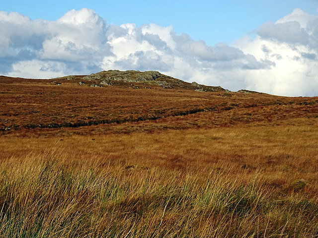
Cleitichean Beag is a prominent hill located in Ross-shire, a county in the Scottish Highlands. Situated in the Northwest Highlands Geopark, it is part of the larger Torridon mountain range. Cleitichean Beag stands at an elevation of approximately 721 meters (2,365 feet), offering breathtaking panoramic views of the surrounding landscape.

The hill is characterized by its rugged and rocky terrain, typical of the Torridon mountains. It is renowned for its challenging trails, making it a popular destination for hikers and mountaineers seeking a thrilling outdoor experience. The slopes of Cleitichean Beag are often covered in heather, providing a vibrant splash of color against the backdrop of the Scottish Highlands.

The surrounding area is rich in wildlife, with various species of birds, including golden eagles and ptarmigans, frequently spotted. Red deer can also be found roaming the hillsides, adding to the natural allure of the region.

Accessible from the nearby village of Torridon, Cleitichean Beag is a haven for outdoor enthusiasts. The hill offers a range of hiking routes, catering to different levels of experience. One popular trail leads to the summit, rewarding climbers with stunning views of Loch Torridon and the surrounding mountain peaks.

Cleitichean Beag is not only a natural wonder but also holds historical significance. The area is dotted with remnants of ancient settlements, including stone circles and burial cairns, providing a glimpse into the region's past.

Overall, Cleitichean Beag is a captivating and challenging hill in Ross-shire, offering both natural beauty and historical intrigue to those who venture to explore its slopes.

If you have any feedback on the listing, please let us know in the comments section below.

Cleitichean Beag Images

Images are sourced within 2km of 58.234006/-6.650335 or Grid Reference NB2736. Thanks to Geograph Open Source API. All images are credited.

Pentland Road
Pentland Road
Branch of the Pentland Road to Breascleit
Druim na Bràiste Looking towards Loch na Bràiste.
Druim na Bràiste
Looking towards Loch na Bràiste.
Peat cutting by the Pentland Road
Road junction on the Pentland Road A junction on the minor road from Stornoway to Breascleat or to Carloway.
Road junction on the Pentland Road
A junction on the minor road from Stornoway to Breascleat or to Carloway.
Cleitichean Beag viewed from the Pentland Road
The Pentland Road Looking in the direction of Stornoway. The ruin visible on the far left is marked on the map but not named. Probably an old Sheiling.
The Pentland Road
Looking in the direction of Stornoway. The ruin visible on the far left is marked on the map but not named. Probably an old Sheiling.
Looking west on the Pentland Road
Ruin beside the Pentland Road Looks like it is an old Sheiling.
Ruin beside the Pentland Road
Looks like it is an old Sheiling.
Loch Cleitichean A small and rocky loch above the Pentland Road.
Loch Cleitichean
A small and rocky loch above the Pentland Road.
Pentland Road Junction Meeting of three single track roads (from Steornabhagh, Breascleit and Carlabhagh - or Stornoway, Breasclete and Carloway) in the middle of nowhere on a bleak Lewisian moorland. The Pentland Road / Rathad Phentland was originally envisaged as a railway - but, somehow, nobody wanted to build it.
Note the peat cuttings in the middle distance.
Pentland Road Junction
Meeting of three single track roads (from Steornabhagh, Breascleit and Carlabhagh - or Stornoway, Breasclete and Carloway) in the middle of nowhere on a bleak Lewisian moorland. The Pentland Road / Rathad Phentland was originally envisaged as a railway - but, somehow, nobody wanted to build it. Note the peat cuttings in the middle distance.
Peat Stacks Small stacks drying beside the Pentland Road on Lewis.
Peat Stacks
Small stacks drying beside the Pentland Road on Lewis.
Peat Stacks by the Pentland Road Small stacks of peat cut from the turf-covered moorland in deepest Lewis.
Peat Stacks by the Pentland Road
Small stacks of peat cut from the turf-covered moorland in deepest Lewis.
Lewisian bog Extremely wet and boggy land, which covers large areas of Lewis. This was north of the minor Rathad a' Phentland between Charlabhaigh and Stornoway.
Lewisian bog
Extremely wet and boggy land, which covers large areas of Lewis. This was north of the minor Rathad a' Phentland between Charlabhaigh and Stornoway.
The valley of Allt Loch nam Breac Extremely wet and boggy land, which covers large areas of Lewis. This area was north of the minor Rathad a' Phentland between Charlabhaigh and Stornoway, and drains Loch nam Breac.
The valley of Allt Loch nam Breac
Extremely wet and boggy land, which covers large areas of Lewis. This area was north of the minor Rathad a' Phentland between Charlabhaigh and Stornoway, and drains Loch nam Breac.
Loch an Tuim Loch an Tuim viewed from the Pentland Road.
Loch an Tuim
Loch an Tuim viewed from the Pentland Road.
Drainage ditch Beside the Pentland Road near Loch an Tairbeart nan Cleitichean.
Drainage ditch
Beside the Pentland Road near Loch an Tairbeart nan Cleitichean.
Rocky outcrops Alongside the Pentland Road.
Rocky outcrops
Alongside the Pentland Road.
Show me another place!

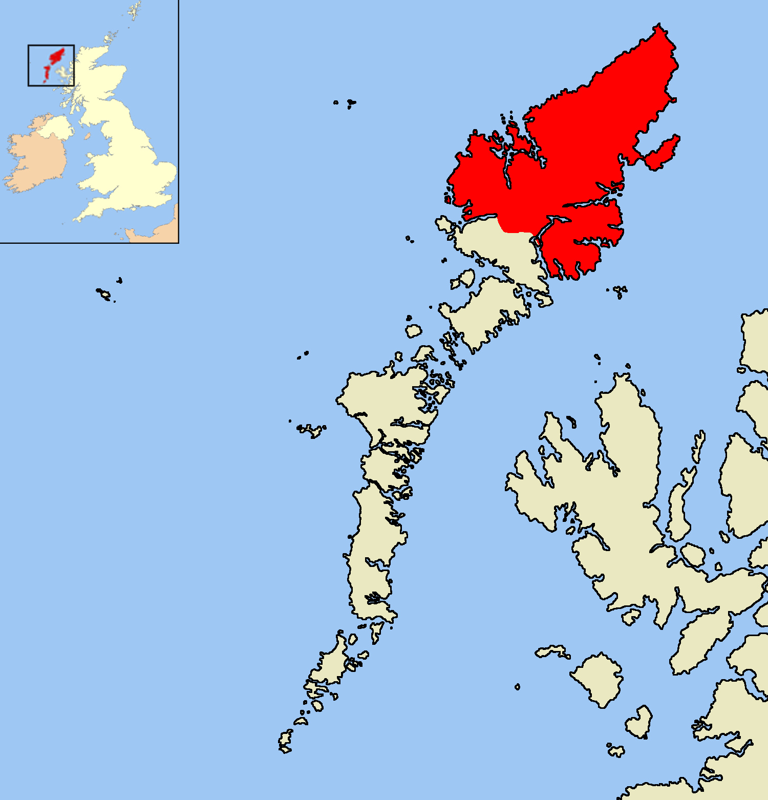
Cleitichean Beag is located at Grid Ref: NB2736 (Lat: 58.234006, Lng: -6.650335)

Unitary Authority: Na h-Eileanan an Iar

Police Authority: Highlands and Islands

What 3 Words

///graced.radar.innovator. Near Carloway, Na h-Eileanan Siar

Nearby Locations

Cleitichean Beag

Related Wikis

Lewis and Harris

Lewis and Harris (Scottish Gaelic: Leòdhas agus Na Hearadh, Scots: Lewis an Harris), or Lewis with Harris, is a single Scottish island in the Outer Hebrides...

Lewis Peatlands

Lewis Peatlands (Scottish Gaelic: mòinteach Leòdhais) is a large area of blanket bog covering more than one third of the Isle of Lewis, off the west coast...

Isle of Lewis

The Isle of Lewis (Scottish Gaelic: Eilean Leòdhais) or simply Lewis (Scottish Gaelic: Leòdhas, pronounced [ˈʎɔːəs̪] ) is the northern part of Lewis and...

Callanish X

The Callanish X stone circle (or "Na Dromannan", "Druim Nan Eun") is one of many megalithic structures around the more well-known and larger Calanais I...

Have you been to Cleitichean Beag?

Leave your review of Cleitichean Beag below (or comments, questions and feedback).