An Cruachan

Hill, Mountain in Inverness-shire

Scotland

An Cruachan

North-eastern flank of Beinn na h-Uamha
North-eastern flank of Beinn na h-Uamha Credit: Mick Garratt

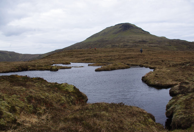
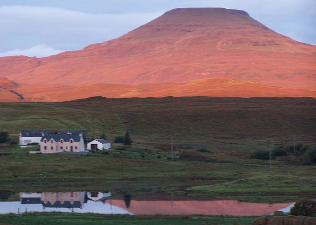
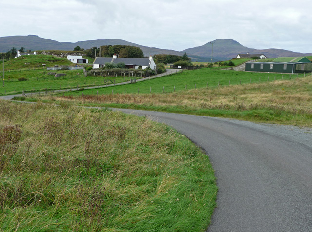
An Cruachan, located in Inverness-shire, Scotland, is a prominent hill/mountain standing at an elevation of approximately 1,116 meters (3,661 feet). It is part of the Grampian Mountains, which stretch across the Scottish Highlands. An Cruachan is situated in a remote and rugged area, offering breathtaking panoramic views of the surrounding landscape.

This mountain is a popular destination for outdoor enthusiasts, hikers, and mountaineers due to its challenging terrain and stunning scenery. It is often climbed as part of a longer hiking route known as the An Cruachan Horseshoe, which includes several other peaks in the region.

The ascent of An Cruachan can be demanding, with steep and rocky sections, making it suitable for experienced hikers or those accompanied by a guide. The summit rewards climbers with an awe-inspiring vista, encompassing the vastness of Loch Ness, the Great Glen, and the nearby Munros (mountains over 3,000 feet).

The area surrounding An Cruachan is rich in wildlife and natural beauty. It is home to a variety of plant species, including heather, moss, and wildflowers, adding color and vibrancy to the landscape. Birdwatchers may spot golden eagles, peregrine falcons, and other raptors soaring above the mountain.

An Cruachan offers a challenging and rewarding experience for outdoor enthusiasts, providing an opportunity to immerse oneself in the untamed beauty of the Scottish Highlands and witness breathtaking views of the surrounding countryside.

If you have any feedback on the listing, please let us know in the comments section below.

An Cruachan Images

Images are sourced within 2km of 57.390012/-6.5983338 or Grid Reference NG2342. Thanks to Geograph Open Source API. All images are credited.

North-eastern flank of Beinn na h-Uamha
Ascending the vertiginous eastern ridge of Healabhal Bheag
A partially dried-up lochan north of Healabhal Bheag
Misnamed majesty—Osdale River and Healabhal Bheag
Whispers of Cottongrass—A serene blanket bog landscape
Contouring Beinn Bhuidhe—Healabhal Bheag beckons
Crossing Abhainn Easa Dhuibh—An inviting pool
Renovation at Orbost House The 18th-century wing (at right) and its early 19th-century extension are enveloped in scaffolding and a major renovation is in place.

Orbost House is listed Category B <span class="nowrap"><a title="https://www.britishlistedbuildings.co.uk/200330767-orbost-house-duirinish" rel="nofollow ugc noopener" href="https://www.britishlistedbuildings.co.uk/200330767-orbost-house-duirinish">Link</a><img style="margin-left:2px;" alt="External link" title="External link - shift click to open in new window" src="https://s1.geograph.org.uk/img/external.png" width="10" height="10"/></span>
Renovation at Orbost House
The 18th-century wing (at right) and its early 19th-century extension are enveloped in scaffolding and a major renovation is in place. Orbost House is listed Category B LinkExternal link
Orbost House The 18th-century east gable of the mansion, scaffolded for major restoration, is glimpsed through bare winter trees with a carpet of snowdrops in the foreground.

Orbost House is listed Category B <span class="nowrap"><a title="https://www.britishlistedbuildings.co.uk/200330767-orbost-house-duirinish" rel="nofollow ugc noopener" href="https://www.britishlistedbuildings.co.uk/200330767-orbost-house-duirinish">Link</a><img style="margin-left:2px;" alt="External link" title="External link - shift click to open in new window" src="https://s1.geograph.org.uk/img/external.png" width="10" height="10"/></span>
Orbost House
The 18th-century east gable of the mansion, scaffolded for major restoration, is glimpsed through bare winter trees with a carpet of snowdrops in the foreground. Orbost House is listed Category B LinkExternal link
Walled garden at Orbost The walled garden would originally have been used to grow ornamental plants, fruit and vegetables.  It was restored from the 1990s in memory of members of the local Swire family- see <a href="https://www.geograph.org.uk/photo/5106590">NG2543 : Inscription at Orbost</a> - but is now laid mainly to lawn.
Walled garden at Orbost
The walled garden would originally have been used to grow ornamental plants, fruit and vegetables. It was restored from the 1990s in memory of members of the local Swire family- see NG2543 : Inscription at Orbost - but is now laid mainly to lawn.
Inscription at Orbost "This walled garden was restored in memory of Flora MacDonald Swire and of her grandparents Otta and Roger Swire of Orbost".

Flora MacDonald Margaret Swire, aged 23, a descendant of Flora MacDonald the Highland heroine of 1746, was one of the victims of Pan Am Flight 103 which crashed over Lockerbie in December 1988.  Her grandmother Otta Flora MacDonald Loïs, née Tarn (1898-1973) was an enthusiast for the folklore and traditions of Skye and other islands and wrote three books on the subject.

For the location see <a href="https://www.geograph.org.uk/photo/5106565">NG2543 : Walled garden at Orbost</a>.
Inscription at Orbost
"This walled garden was restored in memory of Flora MacDonald Swire and of her grandparents Otta and Roger Swire of Orbost". Flora MacDonald Margaret Swire, aged 23, a descendant of Flora MacDonald the Highland heroine of 1746, was one of the victims of Pan Am Flight 103 which crashed over Lockerbie in December 1988. Her grandmother Otta Flora MacDonald Loïs, née Tarn (1898-1973) was an enthusiast for the folklore and traditions of Skye and other islands and wrote three books on the subject. For the location see NG2543 : Walled garden at Orbost.
Orbost peacock One of the resident birds struts his stuff.
Orbost peacock
One of the resident birds struts his stuff.
East front of Orbost House Emerging after more than two years of extensive restoration by MacKenzie Building & Civil Engineering Contractors of Dunvegan, this is the Regency (early 19th-century) building added to the east of the earlier (1764-5) house, originally the home of the MacLeod tacksmen of Orbost.  The stonework has been repointed and newly limewashed to simulate its original appearance, the chimneystacks reconstructed and new attic windows installed in place of the former Velux rooflights.   

The house is listed Category B <span class="nowrap"><a title="https://www.britishlistedbuildings.co.uk/200330767-orbost-house-duirinish" rel="nofollow ugc noopener" href="https://www.britishlistedbuildings.co.uk/200330767-orbost-house-duirinish">Link</a><img style="margin-left:2px;" alt="External link" title="External link - shift click to open in new window" src="https://s1.geograph.org.uk/img/external.png" width="10" height="10"/></span> 

"Main (east) facade of tooled Soay stone [from the small island just south of Skye] with polished ashlar dressings, harled flanks; earlier house of rubble. Principal facade; slightly advanced pedimented centre bay with 3 terminal urns; giant angle pilasters [antae] to outer bays; cornice and blocking course. Engaged Roman Doric columned doorpiece; decorative fanlight, sidelights and panelled door approached by flight steps. Ground floor windows taller than 1st; 12-pane glazing; 1 ground, 2 upper south gable windows; broad corniced end stacks with margins; slate roofs."
East front of Orbost House
Emerging after more than two years of extensive restoration by MacKenzie Building & Civil Engineering Contractors of Dunvegan, this is the Regency (early 19th-century) building added to the east of the earlier (1764-5) house, originally the home of the MacLeod tacksmen of Orbost. The stonework has been repointed and newly limewashed to simulate its original appearance, the chimneystacks reconstructed and new attic windows installed in place of the former Velux rooflights. The house is listed Category B LinkExternal link "Main (east) facade of tooled Soay stone [from the small island just south of Skye] with polished ashlar dressings, harled flanks; earlier house of rubble. Principal facade; slightly advanced pedimented centre bay with 3 terminal urns; giant angle pilasters [antae] to outer bays; cornice and blocking course. Engaged Roman Doric columned doorpiece; decorative fanlight, sidelights and panelled door approached by flight steps. Ground floor windows taller than 1st; 12-pane glazing; 1 ground, 2 upper south gable windows; broad corniced end stacks with margins; slate roofs."
Beach on Loch Bharcasaig The dark sand beach at the head of the sea loch, a branch of Loch Bracadale.
Beach on Loch Bharcasaig
The dark sand beach at the head of the sea loch, a branch of Loch Bracadale.
Small lochan on An Cruachan Looking over Loch Bracadale with the Cuillin in cloud in the far distance.
Small lochan on An Cruachan
Looking over Loch Bracadale with the Cuillin in cloud in the far distance.
Loch Bharcasaig Meall Greepa is the prominent headland at centre-left. The Harlosh peninsula is beyond, with Harlosh Island to the right. Tarner Island is just visible beyond that (centre-right).
Loch Bharcasaig
Meall Greepa is the prominent headland at centre-left. The Harlosh peninsula is beyond, with Harlosh Island to the right. Tarner Island is just visible beyond that (centre-right).
Small lochan on An Cruachan Looking towards Healabhal Bheag.
Small lochan on An Cruachan
Looking towards Healabhal Bheag.
Trig point on Healabhal Bheag Suffering from weathering. Also known as Macleod's Table South. 
Looking over Loch Bracadale with the Cuillin in cloud in the far distance.
Trig point on Healabhal Bheag
Suffering from weathering. Also known as Macleod's Table South. Looking over Loch Bracadale with the Cuillin in cloud in the far distance.
Show me another place!

An Cruachan is located at Grid Ref: NG2342 (Lat: 57.390012, Lng: -6.5983338)

Unitary Authority: Highland

Police Authority: Highlands and Islands

What 3 Words

///suspend.prune.ranged. Near Dunvegan, Highland

Nearby Locations

An Cruachan

Related Wikis

Healabhal Bheag

Healabhal Bheag is a hill located on the Duirinish peninsula of the Isle of Skye in the Inner Hebrides, Scotland. It is also known as MacLeod's Table South...
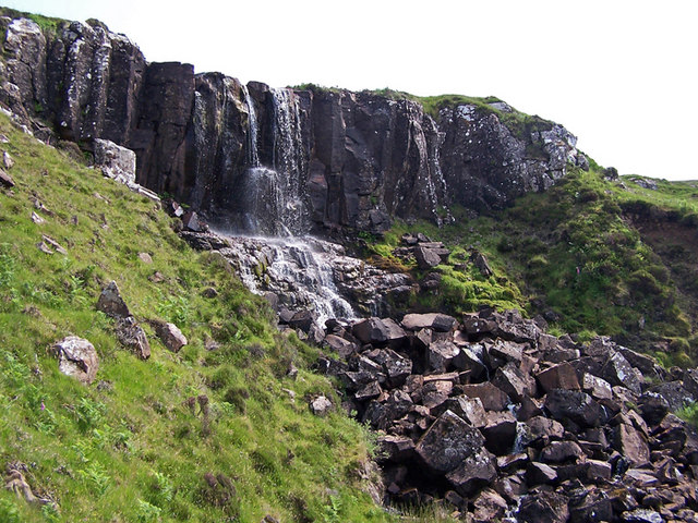
Eas Mòr, Durinish

Eas Mòr is a waterfall on the Duirinish peninsula of the island of Skye in Scotland. It lies on the Allt Mhicheil, a tributary of the Dibidal River below...

Roag, Skye

Roag (Scottish Gaelic: Ròdhag), meaning noisy place or 'deer bay' in Norse, is a small remote scattered hamlet on the north west shore of Pool Roag in...

Vatten, Skye

Vatten is a hamlet 3 miles (4.8 km) south east of Dunvegan, on the eastern shore of Loch Vatten, on the Isle of Skye, in the council area of Highland,...

Harlosh

Harlosh (Scottish Gaelic: Heàrrlois) is a settlement on the island of Skye off the west coast of Scotland. The settlement is on a peninsula of the same...

Harlosh Island

Harlosh Island is one of four islands to be found in Skye's Loch Bracadale. Harlosh Island is one mile (1.5 kilometres) from the coast of the Duirinish...
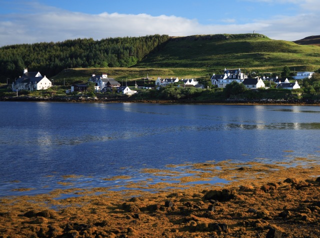
Dunvegan

Dunvegan (Scottish Gaelic: Dùn Bheagain) is a village on the Isle of Skye in Scotland. It is famous for Dunvegan Castle, seat of the chiefs of Clan MacLeod...

Eilean Mòr, Loch Dunvegan

Eilean Mòr is an uninhabited island in Loch Dunvegan in north west Skye, Scotland. At low water the island is connected to Eilean Dubh. == Footnotes ==

Nearby Amenities

Located within 500m of 57.390012,-6.5983338
An Cruachan
Ele: 288
Natural: peak
Lat/Long: 57.3899381/-6.5981043
Ele: 270
Lat/Long: 57.39077/-6.5976942
The data included in this document is from www.openstreetmap.org. The data is made available under ODbL.

Have you been to An Cruachan?

Leave your review of An Cruachan below (or comments, questions and feedback).