Cnoc Leinish

Hill, Mountain in Inverness-shire

Scotland

Cnoc Leinish

Water utility in Glendale Operated by Scottish Water, this installation is beside the B884 road and just below the summit of the pass between Colbost and the village of Glendale, over the shoulder of Beinn Tobhtaig (Ben Totaig).  Water to supply the local communities is normally in sufficient supply from the local hills, but in dry spells it has to be supplemented by road tankers which discharge to an intake at the summit.
Water utility in Glendale Credit: Tiger

Cnoc Leinish is a prominent hill located in the county of Inverness-shire, Scotland. It lies in close proximity to the village of Uig, on the Isle of Skye, and offers breathtaking views of the surrounding picturesque landscapes.

Standing at an elevation of approximately 318 meters (1,043 feet), Cnoc Leinish is not classified as a mountain but is rather considered a hill. Despite this, it remains a popular destination for hikers and outdoor enthusiasts due to its accessibility and stunning vistas.

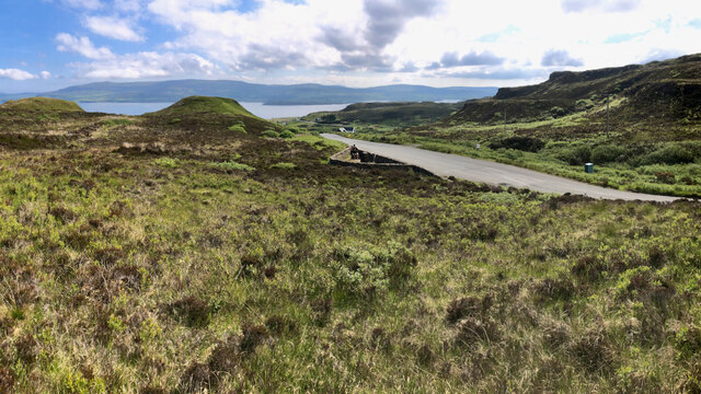
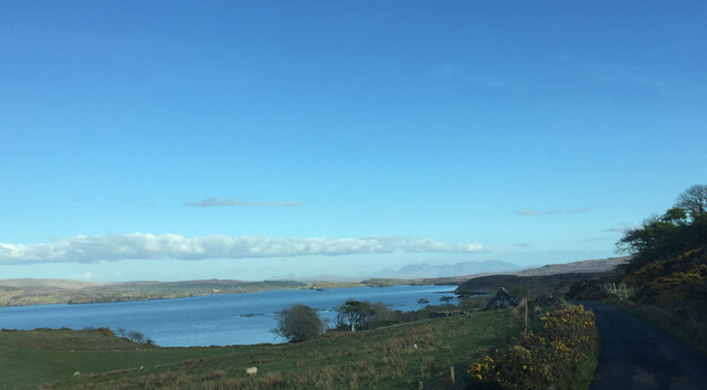
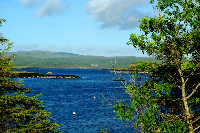
The hill features a relatively gentle slope, making it suitable for hikers of all levels. Its well-defined paths and trails provide ease of navigation, allowing visitors to explore its natural beauty at their own pace. The ascent to the summit is relatively straightforward, and the effort is rewarded with panoramic views of the Isle of Skye, including Loch Snizort and the surrounding hills.

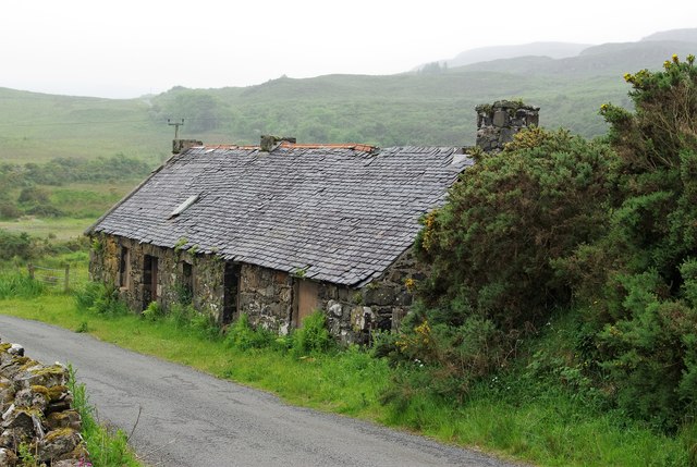
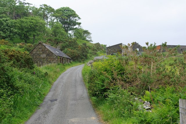
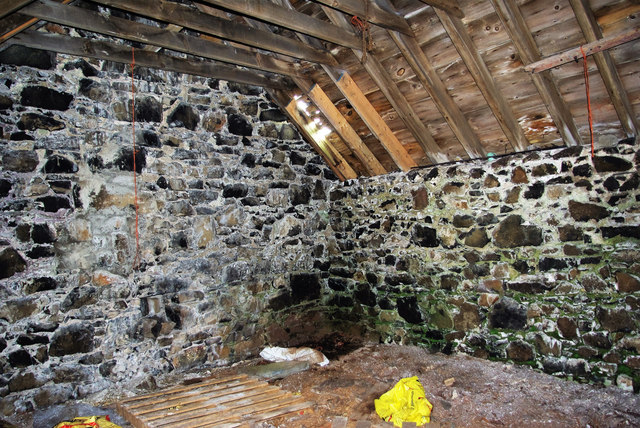
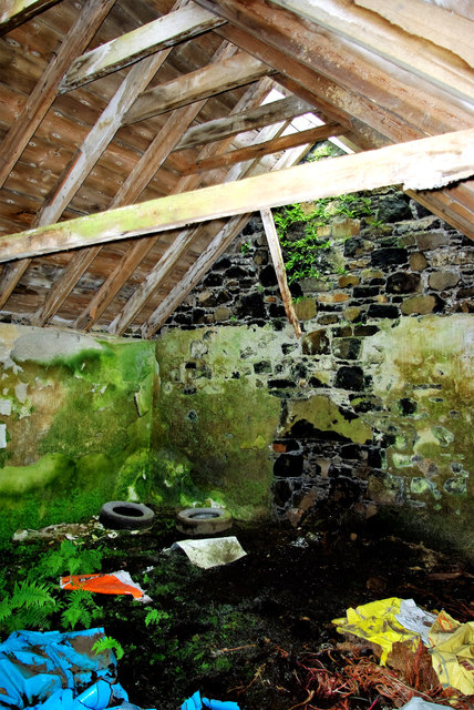
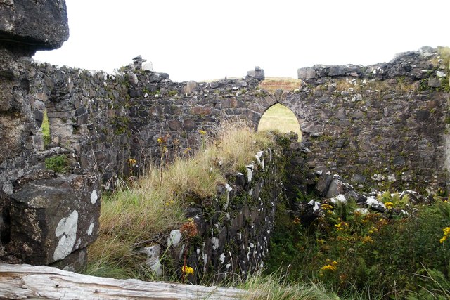
The hill is also known for its rich historical and cultural significance. It is home to the ruins of Cnoc Leinish House, a former hunting lodge built in the 19th century. The house was once a prominent residence on the island and has a fascinating history.

In addition to its natural and historical attractions, Cnoc Leinish boasts diverse flora and fauna. During the spring and summer months, the hill is adorned with colorful wildflowers, adding a touch of vibrancy to the landscape. Birdwatchers may also be delighted to spot various species of birds, including golden eagles and peregrine falcons.

Cnoc Leinish offers a delightful outdoor experience for those seeking tranquility, natural beauty, and a touch of history in the stunning region of Inverness-shire.

If you have any feedback on the listing, please let us know in the comments section below.
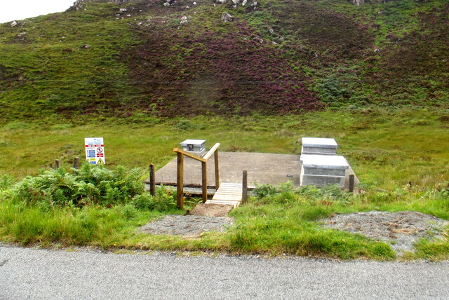
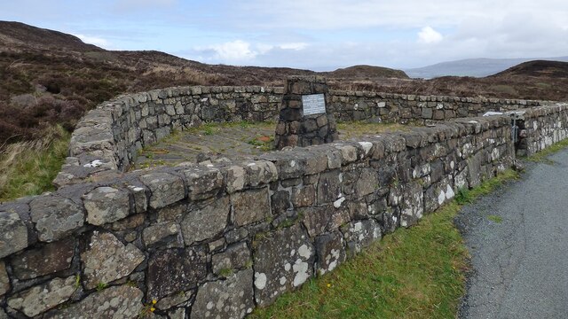
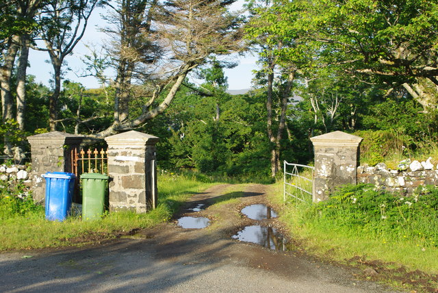
Cnoc Leinish Images

Images are sourced within 2km of 57.458439/-6.6557226 or Grid Reference NG2050. Thanks to Geograph Open Source API. All images are credited.

Water utility in Glendale Operated by Scottish Water, this installation is beside the B884 road and just below the summit of the pass between Colbost and the village of Glendale, over the shoulder of Beinn Tobhtaig (Ben Totaig).  Water to supply the local communities is normally in sufficient supply from the local hills, but in dry spells it has to be supplemented by road tankers which discharge to an intake at the summit.
Water utility in Glendale
Operated by Scottish Water, this installation is beside the B884 road and just below the summit of the pass between Colbost and the village of Glendale, over the shoulder of Beinn Tobhtaig (Ben Totaig). Water to supply the local communities is normally in sufficient supply from the local hills, but in dry spells it has to be supplemented by road tankers which discharge to an intake at the summit.
Glendale Land League Memorial <span class="nowrap"><a title="https://canmore.org.uk/site/318783/skye-cnoc-an-t-sithean-glendale-land-league-memorial" rel="nofollow ugc noopener" href="https://canmore.org.uk/site/318783/skye-cnoc-an-t-sithean-glendale-land-league-memorial">Link</a><img style="margin-left:2px;" alt="External link" title="External link - shift click to open in new window" src="https://s1.geograph.org.uk/img/external.png" width="10" height="10"/></span>
Glendale Land League Memorial
The pass above Cealabost—Cnoc an t-Sìthean and the Monument to the Glendale Land Leaguers
Postbox IV55 52 The roadside box at Totaig, like many in the district. has a flap to protect letters from the elements.  For its surroundings see <a href="https://www.geograph.org.uk/photo/951870">NG1950 : Postbox and hay stooks</a>.
Postbox IV55 52
The roadside box at Totaig, like many in the district. has a flap to protect letters from the elements. For its surroundings see NG1950 : Postbox and hay stooks.
Entrance to Husabost House A summer view of the beginning of the avenue leading to the enigmatic home of the Martins. "Husabost House" as listed in the local directory is a tautology since the Norse name Husabost means "settlement where there is a house".
Entrance to Husabost House
A summer view of the beginning of the avenue leading to the enigmatic home of the Martins. "Husabost House" as listed in the local directory is a tautology since the Norse name Husabost means "settlement where there is a house".
Husabost cottage The masonry and roof timbers of Richard Dorrell's <a href="https://www.geograph.org.uk/photo/1086135">NG1951 : Derelict cottage at Husabost</a> are still relatively sound but the slipped and missing slates have let in water so that the earth floor at the nearer end, beneath the rising ground of the hillside, is now flooded.  For interior views see <a href="https://www.geograph.org.uk/photo/5000774">NG1951 : Rural dereliction at Husabost</a> and <a href="https://www.geograph.org.uk/photo/5000765">NG1951 : Inside Husabost cottage</a>.
Husabost cottage
The masonry and roof timbers of Richard Dorrell's NG1951 : Derelict cottage at Husabost are still relatively sound but the slipped and missing slates have let in water so that the earth floor at the nearer end, beneath the rising ground of the hillside, is now flooded. For interior views see NG1951 : Rural dereliction at Husabost and NG1951 : Inside Husabost cottage.
Cnoc na Cille Or "Church Hill"; there is a row of derelict cottages on the left and higher up, on the right, the <a href="https://www.geograph.org.uk/photo/1086140">NG1951 : Barns at Husabost</a> and <a href="https://www.geograph.org.uk/photo/1086166">NG1951 : The former church of Cnoc na Cille</a>.
Cnoc na Cille
Or "Church Hill"; there is a row of derelict cottages on the left and higher up, on the right, the NG1951 : Barns at Husabost and NG1951 : The former church of Cnoc na Cille.
Inside Husabost cottage The masonry and roof timbers of the abandoned building remain in reasonable state but the missing slates are letting in some rain.  At the southern end of the building the earth floor is above the level of the surrounding ground and has stays fairly dry but it is a different story at the other end <a href="https://www.geograph.org.uk/photo/5000774">NG1951 : Rural dereliction at Husabost</a>.
Inside Husabost cottage
The masonry and roof timbers of the abandoned building remain in reasonable state but the missing slates are letting in some rain. At the southern end of the building the earth floor is above the level of the surrounding ground and has stays fairly dry but it is a different story at the other end NG1951 : Rural dereliction at Husabost.
Rural dereliction at Husabost The cottage is built into the rising hillside and at the north end the earth floor is below ground and has become a quagmire as the crumbling roof lets in the rain; ferns have sprouted and a variety of refuse has been dumped.  For the exterior see <a href="https://www.geograph.org.uk/photo/5000739">NG1951 : Husabost cottage</a>.
Rural dereliction at Husabost
The cottage is built into the rising hillside and at the north end the earth floor is below ground and has become a quagmire as the crumbling roof lets in the rain; ferns have sprouted and a variety of refuse has been dumped. For the exterior see NG1951 : Husabost cottage.
Inside the ruined chapel at Cnoc na Cille Ragwort and other weeds flourish in the roofless building.  The wall dividing the nave longitudinally must date from the time after the church was abandoned for worship, when it was used as a mill and storehouse.
Inside the ruined chapel at Cnoc na Cille
Ragwort and other weeds flourish in the roofless building. The wall dividing the nave longitudinally must date from the time after the church was abandoned for worship, when it was used as a mill and storehouse.
Isle of Skye flag / Bratach an Eilein The new island flag flies at the entrance to a croft in Totaig. Unveiled in August 2020, the winning design by 9-year-old Calum Alasdair Munro was chosen by public vote from 369 entries.

A Nordic cross (with the vertical component shifted towards the hoist as in the flags of all the Scandinavian countries) is intertwined with a circle to represent the island's historic blend of Norse and Celtic cultures. The five oars of the birlinn (or galley) in the canton stand for the five wings or peninsulas which make up An t-Eilean Sgiathanach, the "winged isle". The colours recall the yellow of the MacLeods, whose clan lands lie in the west of the island, and the blue of the MacDonalds and Mackinnons in the north, south and east.
Isle of Skye flag / Bratach an Eilein
The new island flag flies at the entrance to a croft in Totaig. Unveiled in August 2020, the winning design by 9-year-old Calum Alasdair Munro was chosen by public vote from 369 entries. A Nordic cross (with the vertical component shifted towards the hoist as in the flags of all the Scandinavian countries) is intertwined with a circle to represent the island's historic blend of Norse and Celtic cultures. The five oars of the birlinn (or galley) in the canton stand for the five wings or peninsulas which make up An t-Eilean Sgiathanach, the "winged isle". The colours recall the yellow of the MacLeods, whose clan lands lie in the west of the island, and the blue of the MacDonalds and Mackinnons in the north, south and east.
View towards Husabost
Useless road sign at Husabost At the <a href="https://www.geograph.org.uk/photo/4630652">NG1951 : Entrance to Husabost House</a> this home-made notice is now almost completely obscured by gorse. Behind the branches it reads "Slow - farm vehicles".
Useless road sign at Husabost
At the NG1951 : Entrance to Husabost House this home-made notice is now almost completely obscured by gorse. Behind the branches it reads "Slow - farm vehicles".
Quiet please! Notice affixed to a roadside tree near the entrance to the Husabost estate. There is no obvious source of noise nearby beyond the usual activities of the district.
Quiet please!
Notice affixed to a roadside tree near the entrance to the Husabost estate. There is no obvious source of noise nearby beyond the usual activities of the district.
New postbox at Colbost <a href="https://www.geograph.org.uk/photo/4698963">NG2049 : Colbost postbox IV55 42</a> has recently been replaced by a new pressed steel model which can accept larger letters and small packets. The daily collection is still made at 8.15am.
New postbox at Colbost
NG2049 : Colbost postbox IV55 42 has recently been replaced by a new pressed steel model which can accept larger letters and small packets. The daily collection is still made at 8.15am.
Blackhouse Museum, Colbost The croft museum in the township of Colbost, on the west shore of Loch Dunvegan, was established in 1969 by local man Peter MacAskill as the first of several heritage projects in the area. Its centrepiece was a restored island blackhouse (Taigh Dubh), constructed of rough unmortared stone and replicating typical living conditions in 19th-century rural Skye. There were two doors, one for the crofter's family who occupied two thirds of the building and the other for the animals housed in the byre which took up the remaining space. There were no windows or chimneys; daylight entered through the doorways and smoke from the central peat fire, continuously burning in its hearth on the floor of the living room, escaped though a raised opening in the thatched roof. The interior was thus dark and smoky and the floor was of beaten earth. Kettles and cooking pots were hung on a slabhraidh (chain) suspended from the rafters over the fire, and crockery and utensils was kept in a dresser and presses (cupboards) against the walls. A replica of an illicit whisky still could be seen to the rear of the museum.

The adjoining Three Chimneys restaurant was also opened by Peter, initially to provide refreshments for visitors to the museum, and takes its name from the Kent hamlet near Sevenoaks where Peter had formerly lived.

Sadly the museum was not able to reopen following its closure just before the Covid pandemic of 2020, and by 2023 it stood derelict with the neglected roof thatch disintegrating.
Blackhouse Museum, Colbost
The croft museum in the township of Colbost, on the west shore of Loch Dunvegan, was established in 1969 by local man Peter MacAskill as the first of several heritage projects in the area. Its centrepiece was a restored island blackhouse (Taigh Dubh), constructed of rough unmortared stone and replicating typical living conditions in 19th-century rural Skye. There were two doors, one for the crofter's family who occupied two thirds of the building and the other for the animals housed in the byre which took up the remaining space. There were no windows or chimneys; daylight entered through the doorways and smoke from the central peat fire, continuously burning in its hearth on the floor of the living room, escaped though a raised opening in the thatched roof. The interior was thus dark and smoky and the floor was of beaten earth. Kettles and cooking pots were hung on a slabhraidh (chain) suspended from the rafters over the fire, and crockery and utensils was kept in a dresser and presses (cupboards) against the walls. A replica of an illicit whisky still could be seen to the rear of the museum. The adjoining Three Chimneys restaurant was also opened by Peter, initially to provide refreshments for visitors to the museum, and takes its name from the Kent hamlet near Sevenoaks where Peter had formerly lived. Sadly the museum was not able to reopen following its closure just before the Covid pandemic of 2020, and by 2023 it stood derelict with the neglected roof thatch disintegrating.
Loch Dunvegan A view across the sea loch from Colbost on a June evening. Dunvegan Castle in <a href="https://www.geograph.org.uk/gridref/NG2449">NG2449</a> is prominent on the eastern shore.
Loch Dunvegan
A view across the sea loch from Colbost on a June evening. Dunvegan Castle in NG2449 is prominent on the eastern shore.
Tobar Eòin (John's Well) Marked by the Ordnance Survey as a spring, this well gives clear fresh water though within a few metres of high water. Eòin is the old form of the name John, used in the Gaelic Bible for both John the Baptist and John the Evangelist in the New Testament, almost completely replaced in modern Scottish Gaelic by Iain, and in Ireland by Seán. One local tradition associates this spring with a John Mackay, but others take it to be a holy well dedicated to one of the biblical saints. There are several such wells in Ireland commemorating the Baptist, including this <a href="https://www.geograph.org.uk/photo/7142493">S5661 : Holy Well</a> at Johnswell (Tobar Eoin) in Co. Kilkenny which was the scene of a midsummer festival on St John's Eve, 23rd June.

The present concrete surround is modern. The well also gives its name to the nearby house <a href="https://www.geograph.org.uk/photo/2923125">NG2149 : Tobar Eòin</a>.
Tobar Eòin (John's Well)
Marked by the Ordnance Survey as a spring, this well gives clear fresh water though within a few metres of high water. Eòin is the old form of the name John, used in the Gaelic Bible for both John the Baptist and John the Evangelist in the New Testament, almost completely replaced in modern Scottish Gaelic by Iain, and in Ireland by Seán. One local tradition associates this spring with a John Mackay, but others take it to be a holy well dedicated to one of the biblical saints. There are several such wells in Ireland commemorating the Baptist, including this S5661 : Holy Well at Johnswell (Tobar Eoin) in Co. Kilkenny which was the scene of a midsummer festival on St John's Eve, 23rd June. The present concrete surround is modern. The well also gives its name to the nearby house NG2149 : Tobar Eòin.
Show me another place!

Cnoc Leinish is located at Grid Ref: NG2050 (Lat: 57.458439, Lng: -6.6557226)

Unitary Authority: Highland

Police Authority: Highlands and Islands

What 3 Words

///removal.cheeses.amicably. Near Glendale, Highland

Related Wikis

Totaig

Totaig (from Old Norse Topt-vík) is a small crofting settlement on the west coast of Loch Dunvegan on the Isle of Skye. The village of Dunvegan is 5 miles...

Colbost

Colbost (Scottish Gaelic: Cealabost) is a scattered hamlet on the B884 road, in the Glendale estate, overlooking Loch Dunvegan on the Scottish island of...

The Three Chimneys

The Three Chimneys is a restaurant in Colbost, Isle of Skye, Scotland. While in operation beforehand, the restaurant came to prominence after being taken...

Fasach

Fasach (Scottish Gaelic: Fàsach) is a crofting settlement in Glendale on the Duirinish peninsula of the Isle of Skye, Scottish Highlands and is in the...

Nearby Amenities

Located within 500m of 57.458439,-6.6557226
Leinish
Place: locality
Lat/Long: 57.4595778/-6.6610729
The data included in this document is from www.openstreetmap.org. The data is made available under ODbL.

Have you been to Cnoc Leinish?

Leave your review of Cnoc Leinish below (or comments, questions and feedback).