Beinn Leathann

Hill, Mountain in Ross-shire

Scotland

Beinn Leathann

View towards Tolsta Chaolais
View towards Tolsta Chaolais Credit: David Dixon

Beinn Leathann is a prominent hill located in the county of Ross-shire, in the Scottish Highlands. It is part of the Torridon Mountain range, which is known for its stunning landscapes and rugged terrain. Rising to a height of approximately 926 meters (3,038 feet), Beinn Leathann offers breathtaking panoramic views of the surrounding area.

The hill is characterized by its steep slopes and rocky outcrops, making it a popular destination for hikers and mountaineers seeking a challenging climb. Its distinctive shape and rugged beauty make it a standout feature within the Torridon range.

Beinn Leathann is situated near the village of Kinlochewe, making it easily accessible for those looking to explore the area. The surrounding landscape is dominated by vast moorlands, lochs, and glens, adding to the overall scenic appeal of the region.

Wildlife enthusiasts are drawn to Beinn Leathann due to its rich biodiversity. The hill is home to a variety of plant and animal species, including red deer, golden eagles, and ptarmigan. During the summer months, the slopes of Beinn Leathann are adorned with colorful wildflowers, creating a picturesque scene.

Due to its location within the Scottish Highlands, weather conditions on Beinn Leathann can be unpredictable and change rapidly. Proper equipment and clothing are essential for those planning to hike or climb the hill.

In conclusion, Beinn Leathann is a stunning hill in Ross-shire, boasting rugged beauty, breathtaking views, and a diverse range of flora and fauna. It offers an exciting challenge for outdoor enthusiasts and provides a true taste of the Scottish Highlands' natural splendor.

If you have any feedback on the listing, please let us know in the comments section below.

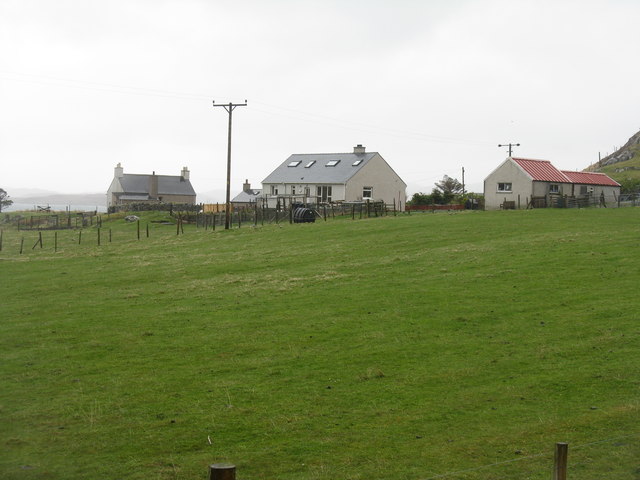
Beinn Leathann Images

Images are sourced within 2km of 58.239434/-6.7697801 or Grid Reference NB2037. Thanks to Geograph Open Source API. All images are credited.

View towards Tolsta Chaolais
West Point
West Point
The Road to Tolsta Chaolais
Fish Farm Cages, Loch na Muilne
Loch na Muilne
Loch na Muilne
Croft near Breasclete
House on a hill near Breasclete
Port a' Chaoil Stream flowing from Loch a' Bhaile enters Loch Rog an Ear, a sea loch, at Aird na Moine.
Port a' Chaoil
Stream flowing from Loch a' Bhaile enters Loch Rog an Ear, a sea loch, at Aird na Moine.
Loch a' Bhaile The narrow loch, hemmed in by steep hillsides, flows out into Loch Rog an Ear, a sea loch, via a short river.
Loch a' Bhaile
The narrow loch, hemmed in by steep hillsides, flows out into Loch Rog an Ear, a sea loch, via a short river.
Loch a' Bhaile Loch a' Bhaile & Tolastadh a' Chaolais beyond.
Loch a' Bhaile
Loch a' Bhaile & Tolastadh a' Chaolais beyond.
Tolstachaolais: the post office While many post offices have a buzzer which sounds as the door opens, the postmistress here is alerted to the arrival of customers by the loud bark of the dog tethered to the outside wall.
Tolstachaolais: the post office
While many post offices have a buzzer which sounds as the door opens, the postmistress here is alerted to the arrival of customers by the loud bark of the dog tethered to the outside wall.
Tolstachaolais: along the shore of Loch a' Bhaile Looking across the loch, which runs alongside the road through the village. However, this is the far side that we are looking along.
Tolstachaolais: along the shore of Loch a' Bhaile
Looking across the loch, which runs alongside the road through the village. However, this is the far side that we are looking along.
Tolstachaolais: postbox № HS2 62 This postbox stands more or less in the centre of the village, in front of a house that is set particularly well back from the road. The larger-scale map still marks that house as a post office, although it has actually (as reflected in the 1:50,000 and 1:25,000 map) relocated just over a kilometre to the north - see <a href="https://www.geograph.org.uk/photo/3086624">NB1939 : Tolstachaolais: the post office</a>.
Tolstachaolais: postbox № HS2 62
This postbox stands more or less in the centre of the village, in front of a house that is set particularly well back from the road. The larger-scale map still marks that house as a post office, although it has actually (as reflected in the 1:50,000 and 1:25,000 map) relocated just over a kilometre to the north - see NB1939 : Tolstachaolais: the post office.
Tolstachaolais: Loch a’ Bhaile Looking down this loch from its northern end, with the main part of the village visible far right.
Tolstachaolais: Loch a’ Bhaile
Looking down this loch from its northern end, with the main part of the village visible far right.
Tolstachaolais: hillside cows and Bernera view Looking across the sound separating the eastern side of Bernera from the Lewis mainland, beyond three cows grazing on the slopes to the south of Tolstachaolais village.
Tolstachaolais: hillside cows and Bernera view
Looking across the sound separating the eastern side of Bernera from the Lewis mainland, beyond three cows grazing on the slopes to the south of Tolstachaolais village.
Outlet from Loch a' Bhaile into Port a' Chaoil At the crofting community of Tolastadh a' Chaolais.
Outlet from Loch a' Bhaile into Port a' Chaoil
At the crofting community of Tolastadh a' Chaolais.
Loch a' Bhaile In the crofting community of Tolastadh a' Chaolais.
Loch a' Bhaile
In the crofting community of Tolastadh a' Chaolais.
Cnoc Feoal Part of the crofting community of Tolastadh a' Chaolais on the shores of Loch Ròg an Ear.
Cnoc Feoal
Part of the crofting community of Tolastadh a' Chaolais on the shores of Loch Ròg an Ear.
Show me another place!

Beinn Leathann is located at Grid Ref: NB2037 (Lat: 58.239434, Lng: -6.7697801)

Unitary Authority: Na h-Eileanan an Iar

Police Authority: Highlands and Islands

What 3 Words

///left.owned.custard. Near Carloway, Na h-Eileanan Siar

Related Wikis

Tolsta Chaolais

Tolsta Chaolais (also Tolastadh Chaolais, Tolstadh a' Chaolais) is a village on the Isle of Lewis, Scotland. It consists of about forty houses, clustered...

Ceabhaigh

Ceabhaigh is a small island in an arm of Loch Ròg on the west coast of Lewis in the Outer Hebrides of Scotland. It is about 25 hectares (62 acres) in extent...

Breasclete

Breasclete (Scottish Gaelic: Brèascleit) is a village and community on the west side of the Isle of Lewis, in the Outer Hebrides, Scotland. Breasclete...

Dun Carloway

Dun Carloway (Scottish Gaelic: Dùn Chàrlabhaigh) is a broch situated in the district of Carloway, on the west coast of the Isle of Lewis, Scotland (grid...

Breaclete

Breacleit (or Roulanish; Scottish Gaelic: Breacleit; Old Norse: Breiðiklettr) is the central village on Great Bernera in the Outer Hebrides, Scotland....

Eilean Chearstaidh

Eilean Kearstay (Scottish Gaelic: Eilean Chearstaigh) is an uninhabited island in Loch Roag in the Outer Hebrides of Scotland. It lies south east of Great...

Callanish

Callanish (Scottish Gaelic: Calanais) is a village (township) on the west side of the Isle of Lewis, in the Outer Hebrides (Western Isles), Scotland. Callanish...

Great Bernera

Great Bernera (; Scottish Gaelic: Beàrnaraigh Mòr), often known just as Bernera (Scottish Gaelic: Beàrnaraigh), is an island and community in the Outer...

Related Videos

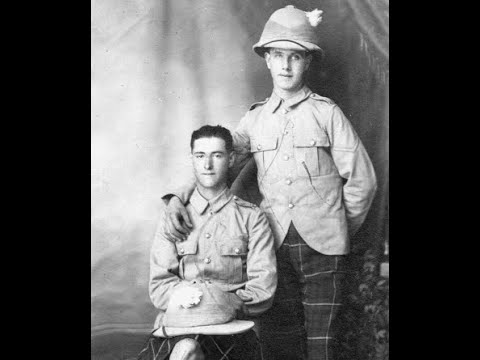
East Loch Roag Remembrance

A video celebrating those from Breasclete, Callanish, and Garynahine who served. Gus Am Bris An Latha/We Will Remember ...

Nearby Amenities

Located within 500m of 58.239434,-6.7697801
Passing Place
Lat/Long: 58.2375512/-6.7652257
Passing Place
Lat/Long: 58.2371642/-6.7707768
Passing Place
Lat/Long: 58.2385126/-6.7754012
Passing Place
Lat/Long: 58.2382636/-6.776396
Barrier: cattle_grid
Lat/Long: 58.2376886/-6.7775489
Power: pole
Lat/Long: 58.2366113/-6.7634064
Power: pole
Lat/Long: 58.2369216/-6.7639665
Power: pole
Lat/Long: 58.2370225/-6.7641102
Power: pole
Lat/Long: 58.2370952/-6.7653656
Power: pole
Lat/Long: 58.2371551/-6.7662376
Power: pole
Lat/Long: 58.2372508/-6.7671694
Power: pole
Lat/Long: 58.2373471/-6.7679634
Power: pole
Lat/Long: 58.2375246/-6.7692248
Power: pole
Lat/Long: 58.2375492/-6.7705507
Power: pole
Lat/Long: 58.2375764/-6.7717706
Power: pole
Lat/Long: 58.2376128/-6.7731679
Power: pole
Lat/Long: 58.2376283/-6.7738554
Power: pole
Lat/Long: 58.238011/-6.774474
Power: pole
Lat/Long: 58.2382852/-6.7749375
Power: pole
Lat/Long: 58.2383435/-6.7753722
Power: pole
Lat/Long: 58.2385611/-6.7770099
Power: pole
Lat/Long: 58.2386617/-6.7779732
Passing Place
Lat/Long: 58.2373544/-6.7685048
Passing Place
Lat/Long: 58.2369216/-6.7638048
Passing Place
Lat/Long: 58.2372449/-6.7699926
Power: pole
Lat/Long: 58.2391614/-6.7735581
Power: pole
Lat/Long: 58.2392427/-6.7726602
Power: pole
Lat/Long: 58.2387447/-6.7748743
Power: pole
Lat/Long: 58.2390394/-6.7723141
Power: pole
Lat/Long: 58.2388843/-6.7737495
Rubha nan Lìon
Place: locality
Lat/Long: 58.2371955/-6.7739073
Beinn Leathann
Ele: 60
Natural: peak
Lat/Long: 58.2391947/-6.769487
Beannan Mòr
Ele: 76
Natural: peak
Lat/Long: 58.2423571/-6.7747656
Cnocan Loisg
Place: locality
Lat/Long: 58.2432719/-6.7727486
Cùl Beannan
Place: locality
Lat/Long: 58.2436785/-6.7704311
Cnoc a' Bhoineid
Place: locality
Lat/Long: 58.2433623/-6.7691008
Port a' Chaoil
Natural: cape
Lat/Long: 58.236258/-6.7744223
The data included in this document is from www.openstreetmap.org. The data is made available under ODbL.

Have you been to Beinn Leathann?

Leave your review of Beinn Leathann below (or comments, questions and feedback).