Beinn an Loch

Hill, Mountain in Inverness-shire

Scotland

Beinn an Loch

North end of An Dubh Loch Looking a lot more 'gorm' than 'dubh' on a perfect January morning.
North end of An Dubh Loch Credit: John Allan

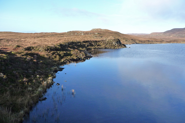
Beinn an Loch, also known as Beinn an Lochain, is a prominent hill located in Inverness-shire, Scotland. Standing at an impressive height of 901 meters (2,959 feet), it is considered a Munro, which is a Scottish mountain with a summit above 3,000 feet (914 meters).

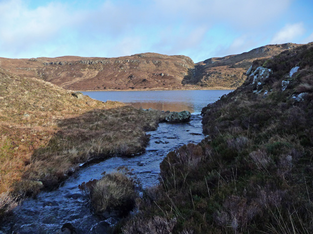
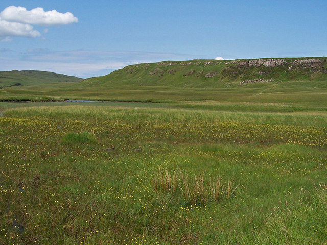
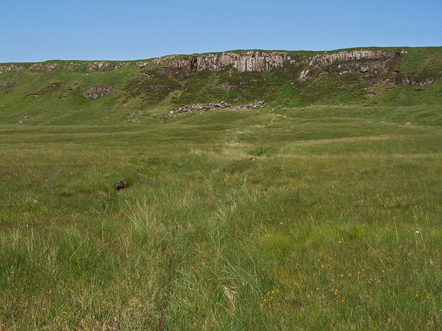
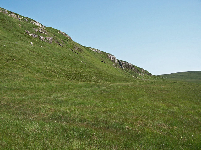
Situated in the northwest part of Inverness-shire, Beinn an Loch forms part of the Fannichs mountain range. It is known for its distinctive conical shape, making it a distinctive landmark in the surrounding landscape. The hill is composed of ancient Lewisian Gneiss, which adds to its rugged appearance.

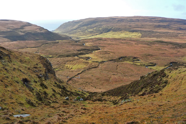
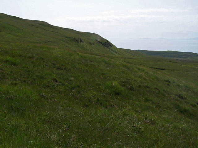
The ascent of Beinn an Loch begins from a starting point near Braemore Junction, where a track leads to the south of the hill. The path initially traverses through a forested area before opening up to reveal the hill's steep slopes. As climbers ascend, they are met with breathtaking panoramic views of the surrounding countryside, including nearby lochs and other mountain peaks.

The hill provides a challenging but rewarding climb for experienced hikers and mountaineers. The terrain is mainly rocky and steep, requiring careful navigation and suitable equipment. The summit offers a stunning vantage point, allowing visitors to admire the vast expanse of the Scottish Highlands.

Beinn an Loch is a popular destination for outdoor enthusiasts, offering a chance to experience the beauty and grandeur of the Scottish mountains. It provides a unique opportunity to immerse oneself in the natural splendor of Inverness-shire while enjoying a physically demanding adventure.

If you have any feedback on the listing, please let us know in the comments section below.

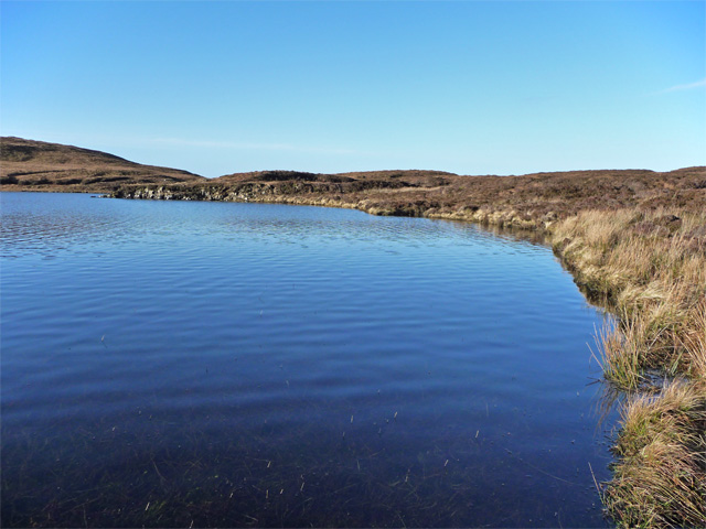
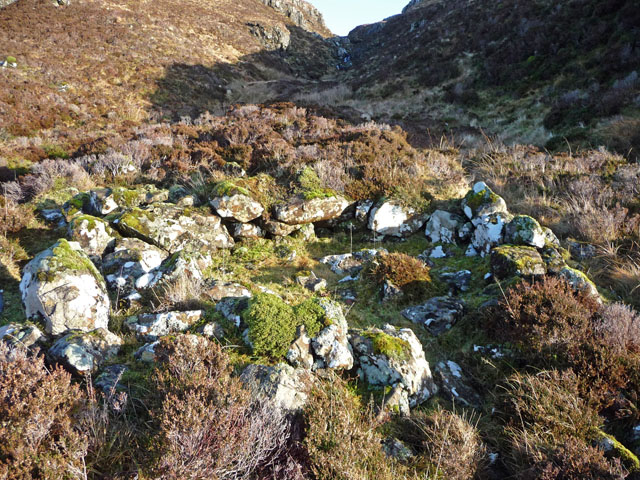
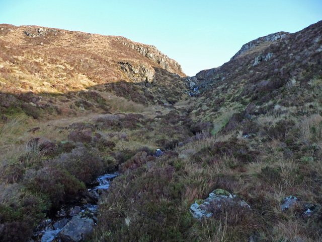
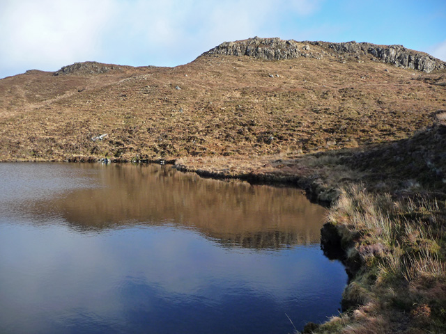
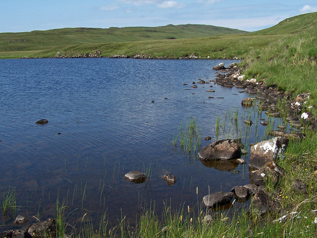
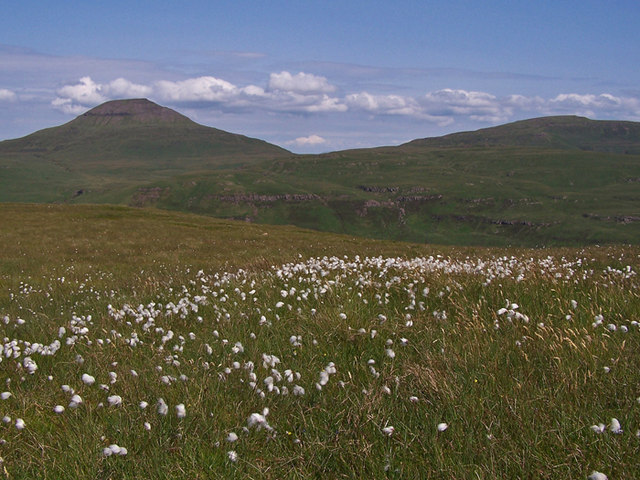
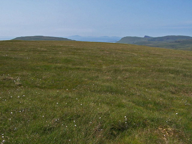
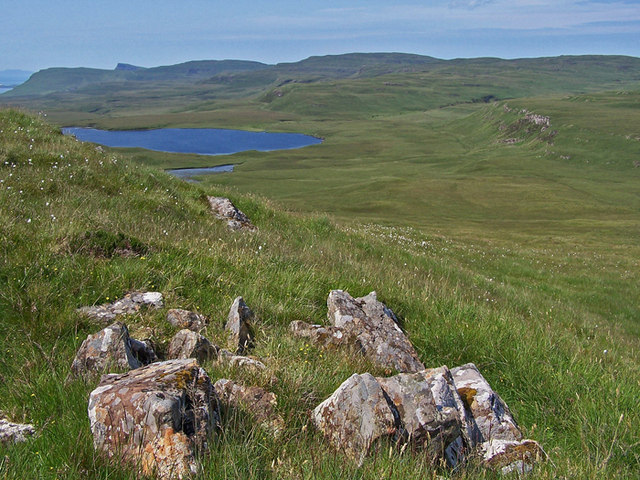
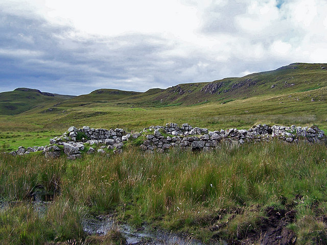
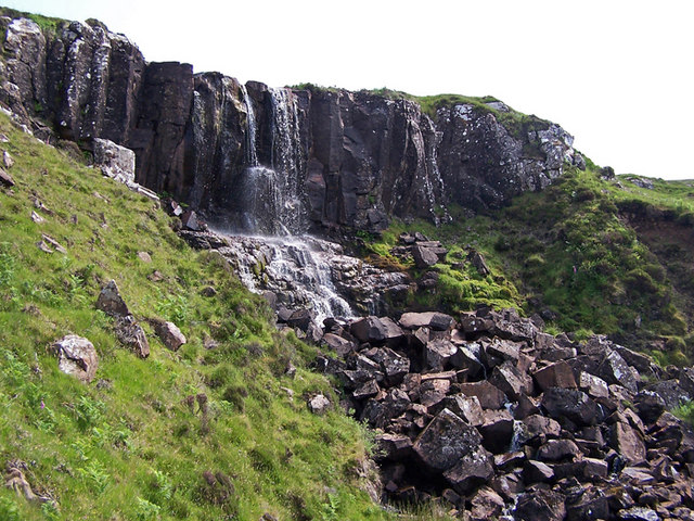
Beinn an Loch Images

Images are sourced within 2km of 57.378652/-6.6584087 or Grid Reference NG2041. Thanks to Geograph Open Source API. All images are credited.

North end of An Dubh Loch Looking a lot more 'gorm' than 'dubh' on a perfect January morning.
North end of An Dubh Loch
Looking a lot more 'gorm' than 'dubh' on a perfect January morning.
Hut circle near An Dubh Loch The remains of a round structure, bigger than a typical shieling and not in the right sort of place to be one. Probably the remnants of a much older, permanent dwelling.
Hut circle near An Dubh Loch
The remains of a round structure, bigger than a typical shieling and not in the right sort of place to be one. Probably the remnants of a much older, permanent dwelling.
Gorge on Beinn an Uisge The burn in this gorge on the south-west of the hill flows into An Dubh Loch. <a href="https://www.geograph.org.uk/photo/1135807">NG1843 : North end of An Dubh Loch</a>
Gorge on Beinn an Uisge
The burn in this gorge on the south-west of the hill flows into An Dubh Loch. NG1843 : North end of An Dubh Loch
South end of An Dubh Loch
An Dubh Loch The black loch looking blue on a clear January day. The outflow from here reaches the sea in the Lorgill River.
An Dubh Loch
The black loch looking blue on a clear January day. The outflow from here reaches the sea in the Lorgill River.
The outflow from An Dubh Loch The Allt an Dubh Loch leaves from here to reach the sea in Lorgill Bay as part of the Lorgill River.
The outflow from An Dubh Loch
The Allt an Dubh Loch leaves from here to reach the sea in Lorgill Bay as part of the Lorgill River.
Moorland above Lorgill The large area in the centre of the picture would have been the summer grazings for the community at Lorgill. Old turf walls, shielings and lazy beds are still visible amongst the bogs and heather. The big green patch in the distance marks the position of the permanent (at least until the clearances) settlement of Lorgill. <a href="https://www.geograph.org.uk/photo/1136016">NG1742 : Lorgill</a>
Moorland above Lorgill
The large area in the centre of the picture would have been the summer grazings for the community at Lorgill. Old turf walls, shielings and lazy beds are still visible amongst the bogs and heather. The big green patch in the distance marks the position of the permanent (at least until the clearances) settlement of Lorgill. NG1742 : Lorgill
South East from Ben Connan No summit cairn, but lots of cotton grass. 
This view is towards the cliffs at the foot of Glen Ollisdal.
South East from Ben Connan
No summit cairn, but lots of cotton grass. This view is towards the cliffs at the foot of Glen Ollisdal.
Shore of Loch Glen Ionadal
North east from Ben Connan Ben Connan has a grassy flattish summit, and a healthy growth of cotton grass.
The mountain on the left is Healabhal Bheag.
North east from Ben Connan
Ben Connan has a grassy flattish summit, and a healthy growth of cotton grass. The mountain on the left is Healabhal Bheag.
Summit of Ben Connan Looking north west, with mountains on the Isle of Harris visible on the horizon.
Summit of Ben Connan
Looking north west, with mountains on the Isle of Harris visible on the horizon.
Northern slope of Ben Connan Looking towards Loch Glen Ionadal.
Northern slope of Ben Connan
Looking towards Loch Glen Ionadal.
Northern slope of Ben Connan Looking west.
Northern slope of Ben Connan
Looking west.
Buttercups in the marsh This marshy area close to Loch Glen Ionadal (in square <a href="https://www.geograph.org.uk/gridref/NG1941">NG1941</a> ) is full of flowering buttercups.
Buttercups in the marsh
This marshy area close to Loch Glen Ionadal (in square NG1941 ) is full of flowering buttercups.
Loch Glen Ionadal To the south of the loch is this shallow marshy area, which is probably full of water in wetter weather.
Loch Glen Ionadal
To the south of the loch is this shallow marshy area, which is probably full of water in wetter weather.
Craggy inland cliffs This cliff is at the southern end of Glen Ionadal, to the east of the loch.
Craggy inland cliffs
This cliff is at the southern end of Glen Ionadal, to the east of the loch.
Southern end of Glen Ionadal Steep craggy cliffs edge the glen at the foot of Beinn an Loch.
Southern end of Glen Ionadal
Steep craggy cliffs edge the glen at the foot of Beinn an Loch.
Ruin in Scaladal The Highland Council Historic Environment Record shows this as a ruined longhouse which has been converted into a sheep fank. <span class="nowrap"><a title="http://her.highland.gov.uk/SingleResult.aspx?uid=MHG4989" rel="nofollow ugc noopener" href="http://her.highland.gov.uk/SingleResult.aspx?uid=MHG4989">Link</a><img style="margin-left:2px;" alt="External link" title="External link - shift click to open in new window" src="https://s1.geograph.org.uk/img/external.png" width="10" height="10"/></span> . The walls are too broken down for it to be any use for containing animals now.
Ruin in Scaladal
The Highland Council Historic Environment Record shows this as a ruined longhouse which has been converted into a sheep fank. LinkExternal link . The walls are too broken down for it to be any use for containing animals now.
Show me another place!

Beinn an Loch is located at Grid Ref: NG2041 (Lat: 57.378652, Lng: -6.6584087)

Unitary Authority: Highland

Police Authority: Highlands and Islands

What 3 Words

///bulge.aimlessly.teaspoons. Near Glendale, Highland

Nearby Locations

Beinn an Loch

Related Wikis

Eas Mòr, Durinish

Eas Mòr is a waterfall on the Duirinish peninsula of the island of Skye in Scotland. It lies on the Allt Mhicheil, a tributary of the Dibidal River below...

Healabhal Bheag

Healabhal Bheag is a hill located on the Duirinish peninsula of the Isle of Skye in the Inner Hebrides, Scotland. It is also known as MacLeod's Table South...

Ramasaig

Ramasaig is a small township on the western shore of the Duirinish peninsula, on Dunvegan, Isle of Skye and is in the Scottish Highlands and is in the...

Duirinish, Skye

Duirinish (Scottish Gaelic: Diùirinis) is a peninsula and civil parish on the island of Skye in Scotland. It is situated in the north west between Loch...

Related Videos

Macleod's Tables, Isle of Skye 30/10/23

Healabhal Bheag and Healabhal Mhor, near Dunvegan, on the Isle of Skye. Route Description ...

Nearby Amenities

Located within 500m of 57.378652,-6.6584087
Beinn an Loch
Ele: 233
Natural: peak
Lat/Long: 57.3777365/-6.660886
The data included in this document is from www.openstreetmap.org. The data is made available under ODbL.

Have you been to Beinn an Loch?

Leave your review of Beinn an Loch below (or comments, questions and feedback).