Ascleit
Hill, Mountain in Ross-shire
Scotland
Ascleit
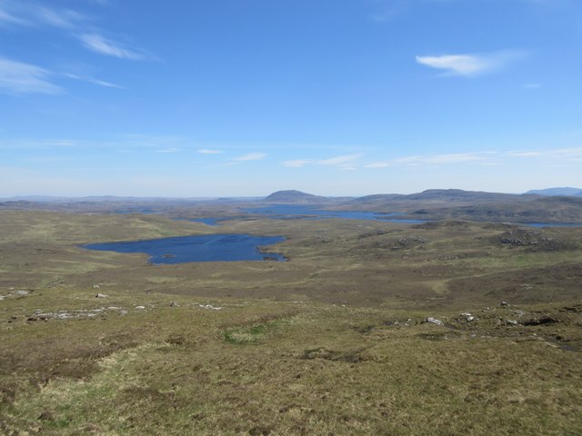
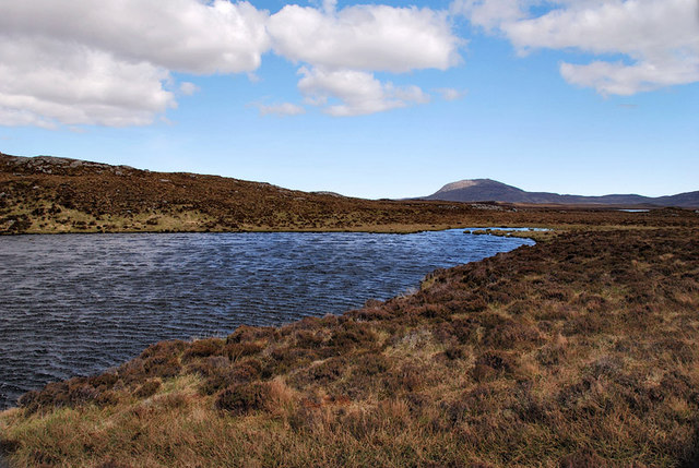
![View Towards Loch Ruadh Meadhanach A view towards Loch Ruadh Meadhanach from the lower slopes of Caultrashal Mor [Coltraiseal Mòr].](https://s3.geograph.org.uk/geophotos/03/69/37/3693795_acc940a3.jpg)
Ascleit is a hill located in the county of Ross-shire, Scotland. Standing at an elevation of approximately 318 meters (1,043 feet), it is a prominent feature in the local landscape. Ascleit is situated in a rural area, surrounded by rolling hills and picturesque countryside.
The hill offers breathtaking views from its summit, allowing visitors to appreciate the beauty of the surrounding countryside. On a clear day, one can see for miles, with panoramic vistas stretching out towards the distant horizon. The summit is accessible via a well-marked hiking trail, making it a popular destination for outdoor enthusiasts and nature lovers.
The vegetation on Ascleit consists mainly of heather, grasses, and low-lying shrubs, which provide habitat for a variety of wildlife. Birdwatchers may be rewarded with sightings of species such as buzzards, kestrels, and ravens soaring above the hill. On the lower slopes, one might encounter rabbits, hares, and the occasional deer.
Due to its relatively modest height, Ascleit is a suitable destination for hikers of varying skill levels. Its gentle gradient and well-maintained paths make it accessible to families and beginners, while more experienced walkers can explore the surrounding area and extend their hike to neighboring hills.
Overall, Ascleit offers a peaceful and rewarding outdoor experience, combining stunning views, diverse wildlife, and a sense of tranquility in the heart of the Scottish countryside.
If you have any feedback on the listing, please let us know in the comments section below.
Ascleit Images
Images are sourced within 2km of 58.08463/-6.8108977 or Grid Reference NB1620. Thanks to Geograph Open Source API. All images are credited.
Ascleit is located at Grid Ref: NB1620 (Lat: 58.08463, Lng: -6.8108977)
Unitary Authority: Na h-Eileanan an Iar
Police Authority: Highlands and Islands
What 3 Words
///oddly.ecologist.swinging. Near Leurbost, Na h-Eileanan Siar
Nearby Locations
Related Wikis

Eilean Mòr, Loch Langavat
Eilean Mòr is an island in Loch Langavat on the Isle of Lewis in the Outer Hebrides of Scotland. == Footnotes ==

Gisla Hydro-Electric Scheme
Gisla Hydro-Electric Scheme was a small scheme promoted by the North of Scotland Hydro-Electric Board on the Isle of Lewis, Outer Hebrides, Scotland. It...

Airidh a' Bhruaich
Airidh a' Bhruaich (Arivruaich - anglicised) is a scattered crofting township in the South Lochs district of the Isle of Lewis in the Outer Hebrides of...
Nearby Amenities
Located within 500m of 58.08463,-6.8108977Have you been to Ascleit?
Leave your review of Ascleit below (or comments, questions and feedback).