Cnoc na Crìch

Hill, Mountain in Ross-shire

Scotland

Cnoc na Crìch

Camas Sanndaig Looking across the bay. In the distance is the low island of Pabaigh Mor with the headland of Bhaltos beyond.

A bundle of fencing wire is abandoned in the rocky gully above the sea.
Camas Sanndaig Credit: Rob Burke

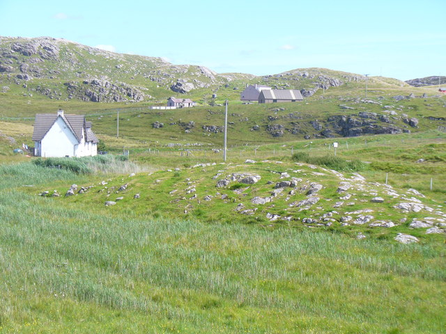
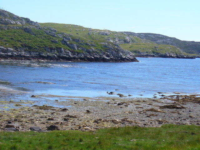
Cnoc na Crìch is a prominent hill located in Ross-shire, Scotland. Situated amidst the picturesque Highlands, it offers breathtaking panoramic views of the surrounding landscape. With an elevation of approximately 1,200 feet (366 meters), it stands as a notable landmark in the region.

The hill is characterized by its rugged terrain and rocky slopes, making it a popular destination for hikers and outdoor enthusiasts. Its summit presents an ideal vantage point, providing stunning vistas of the nearby lochs, glens, and rolling hills. On clear days, it is even possible to catch a glimpse of the distant peaks of the Cairngorms National Park.

Cnoc na Crìch is home to a diverse range of flora and fauna. The lower slopes are covered in heather, while the higher reaches are adorned with patches of grasses and mosses. Birdwatchers often frequent the area, as it serves as a habitat for various species, including buzzards, kestrels, and peregrine falcons.

Access to Cnoc na Crìch is relatively straightforward, with several walking paths leading to the summit. The most popular route starts from the nearby village of Garve and follows a well-marked trail up the hill. The ascent can be challenging at times, but the rewarding views at the top make it well worth the effort.

Overall, Cnoc na Crìch offers a captivating natural experience, providing visitors with a chance to immerse themselves in the beauty of the Scottish Highlands.

If you have any feedback on the listing, please let us know in the comments section below.

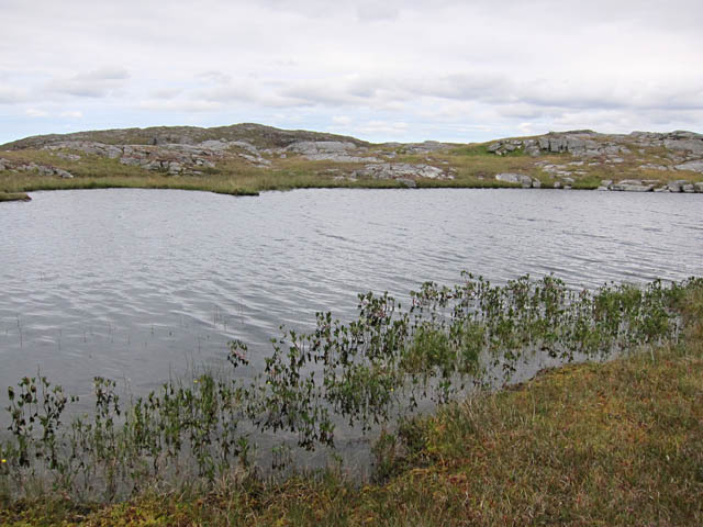
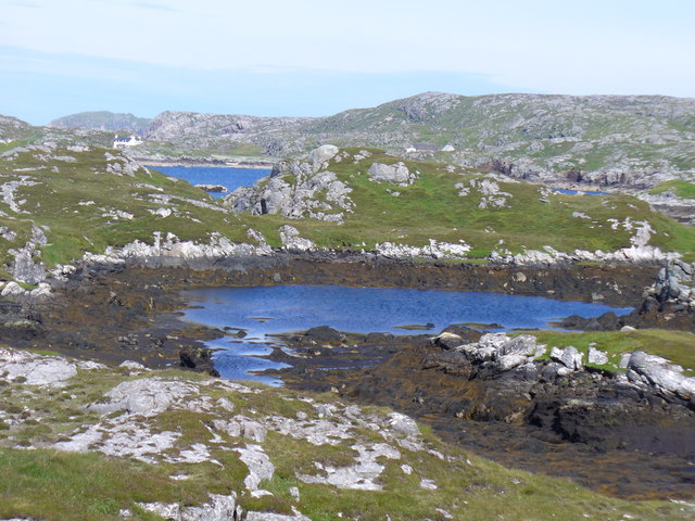
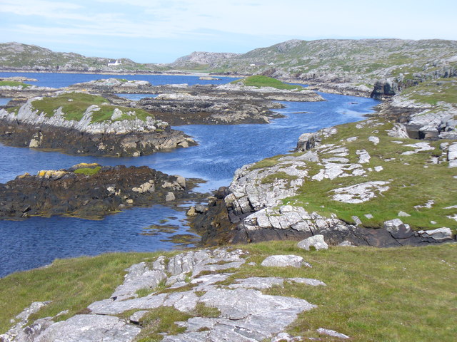
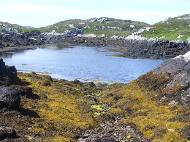
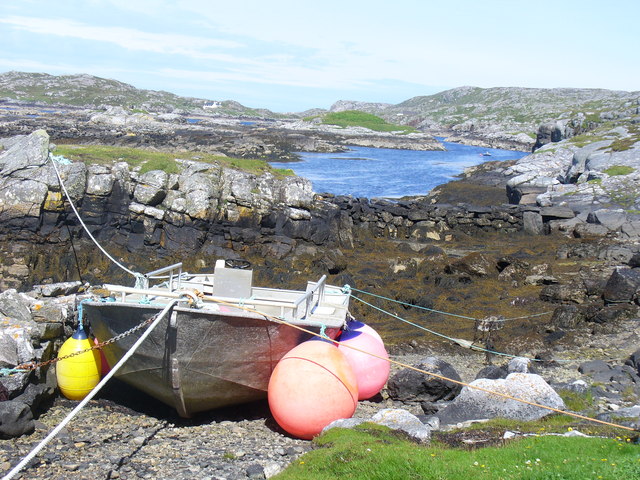
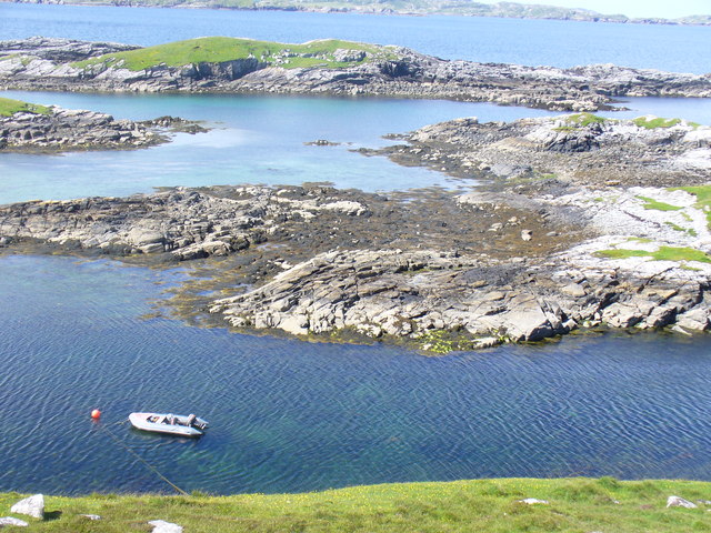
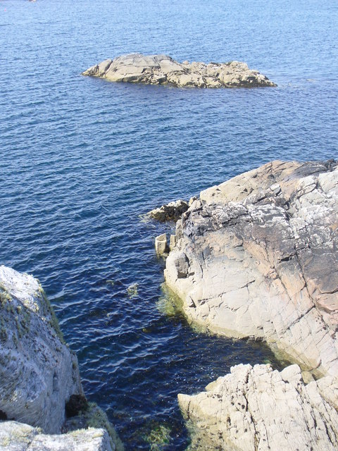
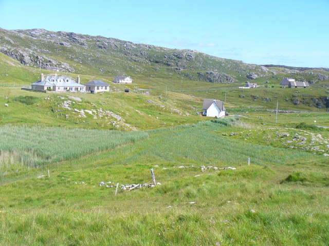
Cnoc na Crìch Images

Images are sourced within 2km of 58.242461/-6.849753 or Grid Reference NB1538. Thanks to Geograph Open Source API. All images are credited.

Camas Sanndaig Looking across the bay. In the distance is the low island of Pabaigh Mor with the headland of Bhaltos beyond.

A bundle of fencing wire is abandoned in the rocky gully above the sea.
Camas Sanndaig
Looking across the bay. In the distance is the low island of Pabaigh Mor with the headland of Bhaltos beyond. A bundle of fencing wire is abandoned in the rocky gully above the sea.
Beach north of Bhalasaigh
Sea loch west of Loch Veiravat Although it isn't obvious from here, this is the start of a long channel that leads out to the sea.
Sea loch west of Loch Veiravat
Although it isn't obvious from here, this is the start of a long channel that leads out to the sea.
Small loch on Great Bernera The waymarked path to Bosta passes right by this loch.
Small loch on Great Bernera
The waymarked path to Bosta passes right by this loch.
West coast of Great Bernera A complicated coastline with many interesting features.
West coast of Great Bernera
A complicated coastline with many interesting features.
War Memorial, Breacleit The memorial stands on a mound at the crossroads in the centre of Breacleit / Breaclete, the capital of Great Bernera / Bearnaraigh. On the skyline is the Bernera Community Centre.
<span class="nowrap"><a title="http://www.uigandbernera.com/" rel="nofollow ugc noopener" href="http://www.uigandbernera.com/">Link</a><img style="margin-left:2px;" alt="External link" title="External link - shift click to open in new window" src="https://s1.geograph.org.uk/img/external.png" width="10" height="10"/></span>
War Memorial, Breacleit
The memorial stands on a mound at the crossroads in the centre of Breacleit / Breaclete, the capital of Great Bernera / Bearnaraigh. On the skyline is the Bernera Community Centre. LinkExternal link
Breacleit, Bernera Summer flowers, church and school in the village centre.
<span class="nowrap"><a title="http://www.uigandbernera.com/" rel="nofollow ugc noopener" href="http://www.uigandbernera.com/">Link</a><img style="margin-left:2px;" alt="External link" title="External link - shift click to open in new window" src="https://s1.geograph.org.uk/img/external.png" width="10" height="10"/></span>
Breacleit, Bernera
Summer flowers, church and school in the village centre. LinkExternal link
Tidal Lagoon, Valasay Tob Bhalasaigh, on the island of Great Bernera / Bearnaraigh.
<span class="nowrap"><a title="http://www.uigandbernera.com/" rel="nofollow ugc noopener" href="http://www.uigandbernera.com/">Link</a><img style="margin-left:2px;" alt="External link" title="External link - shift click to open in new window" src="https://s1.geograph.org.uk/img/external.png" width="10" height="10"/></span>
Tidal Lagoon, Valasay
Tob Bhalasaigh, on the island of Great Bernera / Bearnaraigh. LinkExternal link
Tob Bhalasaigh from the Footbridge View northwards, along the narrow tidal lagoon, to Tobson 2 kilometres away in the distance.
Tob Bhalasaigh from the Footbridge
View northwards, along the narrow tidal lagoon, to Tobson 2 kilometres away in the distance.
Tob Lathach Small tidal lagoon on the west coast of Great Bernera / Bearnaraigh.
<span class="nowrap"><a title="http://www.uigandbernera.com/" rel="nofollow ugc noopener" href="http://www.uigandbernera.com/">Link</a><img style="margin-left:2px;" alt="External link" title="External link - shift click to open in new window" src="https://s1.geograph.org.uk/img/external.png" width="10" height="10"/></span>
Tob Lathach
Small tidal lagoon on the west coast of Great Bernera / Bearnaraigh. LinkExternal link
Coast North of Poll Ula West coast of Great Bernera / Bearnaraigh - with many small skerries close to shore.
<span class="nowrap"><a title="http://www.uigandbernera.com/" rel="nofollow ugc noopener" href="http://www.uigandbernera.com/">Link</a><img style="margin-left:2px;" alt="External link" title="External link - shift click to open in new window" src="https://s1.geograph.org.uk/img/external.png" width="10" height="10"/></span>
Coast North of Poll Ula
West coast of Great Bernera / Bearnaraigh - with many small skerries close to shore. LinkExternal link
Tob Lathach, Bearnaraigh Small tidal lagoon on the west coast of Great Bernera.
<span class="nowrap"><a title="http://www.uigandbernera.com/" rel="nofollow ugc noopener" href="http://www.uigandbernera.com/">Link</a><img style="margin-left:2px;" alt="External link" title="External link - shift click to open in new window" src="https://s1.geograph.org.uk/img/external.png" width="10" height="10"/></span>
Tob Lathach, Bearnaraigh
Small tidal lagoon on the west coast of Great Bernera. LinkExternal link
Tob Liongaim Well-tethered boat, with floats, at the head of a tidal lagoon on Bearnaraigh's western coast.
<span class="nowrap"><a title="http://www.uigandbernera.com/" rel="nofollow ugc noopener" href="http://www.uigandbernera.com/">Link</a><img style="margin-left:2px;" alt="External link" title="External link - shift click to open in new window" src="https://s1.geograph.org.uk/img/external.png" width="10" height="10"/></span>
Tob Liongaim
Well-tethered boat, with floats, at the head of a tidal lagoon on Bearnaraigh's western coast. LinkExternal link
Tob Liongaim, Bearnaraigh Tidal lagoon, skerries and RIB on the west coast of Great Bernera, south of Tobson.
Tob Liongaim, Bearnaraigh
Tidal lagoon, skerries and RIB on the west coast of Great Bernera, south of Tobson.
Skerry in Camas Sanndaig Rocky shore and small islet on the west coast of Great Bernera / Bearnaraigh, south of Tobson.
<span class="nowrap"><a title="http://www.uigandbernera.com/" rel="nofollow ugc noopener" href="http://www.uigandbernera.com/">Link</a><img style="margin-left:2px;" alt="External link" title="External link - shift click to open in new window" src="https://s1.geograph.org.uk/img/external.png" width="10" height="10"/></span>
Skerry in Camas Sanndaig
Rocky shore and small islet on the west coast of Great Bernera / Bearnaraigh, south of Tobson. LinkExternal link
Tobson The oldest inhabited settlement on the island of Great Bernera / Bearnaraigh.
<span class="nowrap"><a title="http://www.uigandbernera.com/" rel="nofollow ugc noopener" href="http://www.uigandbernera.com/">Link</a><img style="margin-left:2px;" alt="External link" title="External link - shift click to open in new window" src="https://s1.geograph.org.uk/img/external.png" width="10" height="10"/></span>
Tobson
The oldest inhabited settlement on the island of Great Bernera / Bearnaraigh. LinkExternal link
Concentric Rock Formation, Tobson Unusual rock pattern showing through the grass at Tobson, the oldest inhabited settlement on Great Bernera / Bearnaraigh.
<span class="nowrap"><a title="http://www.uigandbernera.com/" rel="nofollow ugc noopener" href="http://www.uigandbernera.com/">Link</a><img style="margin-left:2px;" alt="External link" title="External link - shift click to open in new window" src="https://s1.geograph.org.uk/img/external.png" width="10" height="10"/></span>
Concentric Rock Formation, Tobson
Unusual rock pattern showing through the grass at Tobson, the oldest inhabited settlement on Great Bernera / Bearnaraigh. LinkExternal link
Ceann a' Stiogha Head of the tidal lagoon, Tob Bhalasaigh at Tobson on Great Bernera, Bearnaraigh.
<span class="nowrap"><a title="http://www.uigandbernera.com/" rel="nofollow ugc noopener" href="http://www.uigandbernera.com/">Link</a><img style="margin-left:2px;" alt="External link" title="External link - shift click to open in new window" src="https://s1.geograph.org.uk/img/external.png" width="10" height="10"/></span>
Ceann a' Stiogha
Head of the tidal lagoon, Tob Bhalasaigh at Tobson on Great Bernera, Bearnaraigh. LinkExternal link
Show me another place!

Cnoc na Crìch is located at Grid Ref: NB1538 (Lat: 58.242461, Lng: -6.849753)

Unitary Authority: Na h-Eileanan an Iar

Police Authority: Highlands and Islands

What 3 Words

///insiders.blurs.staging. Near Carloway, Na h-Eileanan Siar

Related Wikis

Great Bernera

Great Bernera (; Scottish Gaelic: Beàrnaraigh Mòr), often known just as Bernera (Scottish Gaelic: Beàrnaraigh), is an island and community in the Outer...

Bernera Riot

The Bernera Riot occurred in 1874, on the island of Great Bernera, in Scotland in response to the Highland Clearances. The use of the term 'Bernera Riot...

Breaclete

Breacleit (or Roulanish; Scottish Gaelic: Breacleit; Old Norse: Breiðiklettr) is the central village on Great Bernera in the Outer Hebrides, Scotland....

Dun Bharabhat, Great Bernera

Dun Bharabhat (or Dun Baravat) is an Iron Age galleried dun or "semi-broch" situated on the island of Great Bernera near Lewis in Scotland (grid reference...

Nearby Amenities

Located within 500m of 58.242461,-6.849753
Barrier: cattle_grid
Source: Bing
Lat/Long: 58.2433863/-6.8540232
Passing Place
Lat/Long: 58.2382669/-6.852851
Bus Stop
Croir, Road End
Naptan AtcoCode: 60101256
Naptan NaptanCode: 94727958
Lat/Long: 58.245124/-6.855168
Passing Place
Lat/Long: 58.2417082/-6.8538002
Passing Place
Lat/Long: 58.2448009/-6.8549747
Passing Place
Lat/Long: 58.2459473/-6.8542098
Power: pole
Lat/Long: 58.2453838/-6.8543709
Power: pole
Lat/Long: 58.2456308/-6.8542582
Power: pole
Lat/Long: 58.243296/-6.8530861
Power: pole
Lat/Long: 58.2437759/-6.8526999
Power: pole
Lat/Long: 58.2443971/-6.8533356
Power: pole
Lat/Long: 58.2450139/-6.8539712
Power: pole
Lat/Long: 58.24248/-6.853762
Power: pole
Lat/Long: 58.241585/-6.8540195
Power: pole
Lat/Long: 58.2408749/-6.8538264
Power: pole
Lat/Long: 58.2402593/-6.8536547
Power: pole
Lat/Long: 58.2396889/-6.8537352
Power: pole
Lat/Long: 58.2388136/-6.8538613
The data included in this document is from www.openstreetmap.org. The data is made available under ODbL.

Have you been to Cnoc na Crìch?

Leave your review of Cnoc na Crìch below (or comments, questions and feedback).