Ulabhal

Hill, Mountain in Inverness-shire

Scotland

Ulabhal

Summit cairn on Oireabhal with view towards Ulabhal
Summit cairn on Oireabhal with view towards Ulabhal Credit: Colin Park

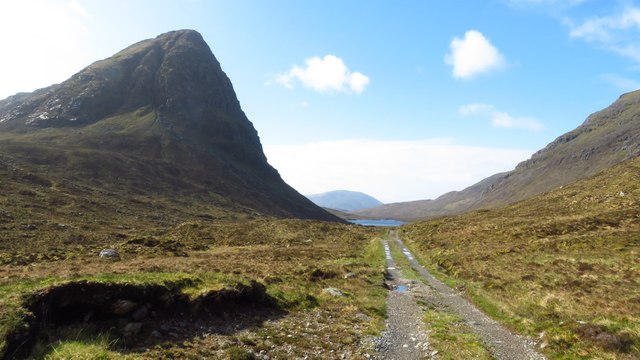
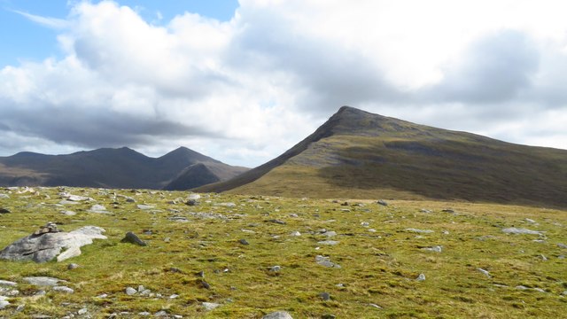
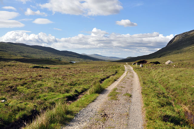
Ulabhal is a prominent hill located in Inverness-shire, Scotland. Situated in the northwest Highlands, it forms part of the rugged landscape that characterizes this region. With an elevation of approximately 720 meters (2,362 feet), Ulabhal stands tall and commands breathtaking views of the surrounding area.

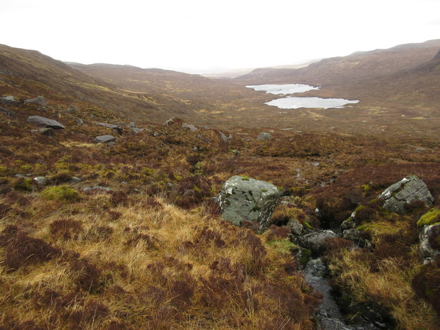
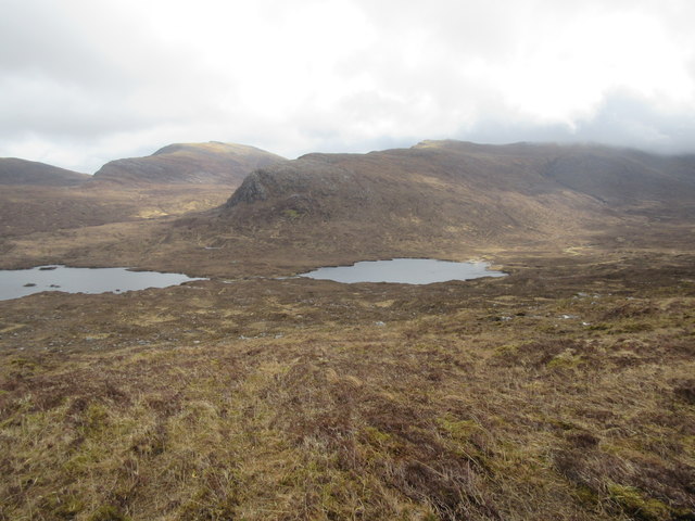
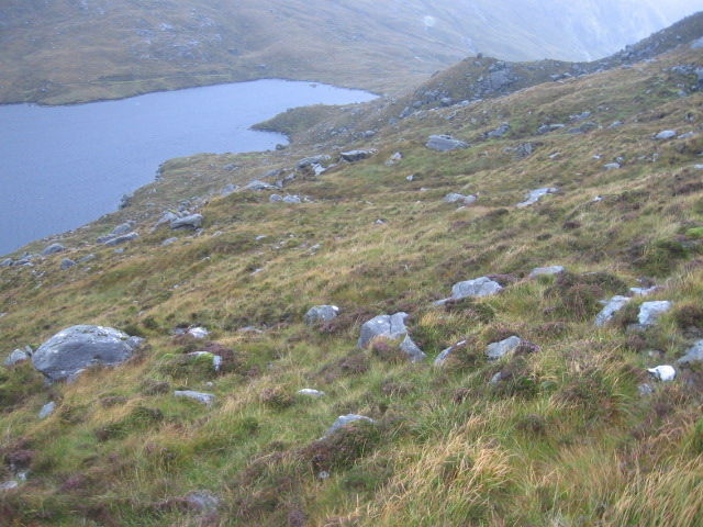
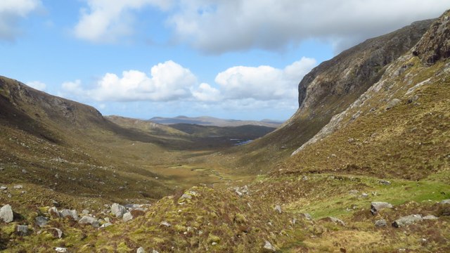
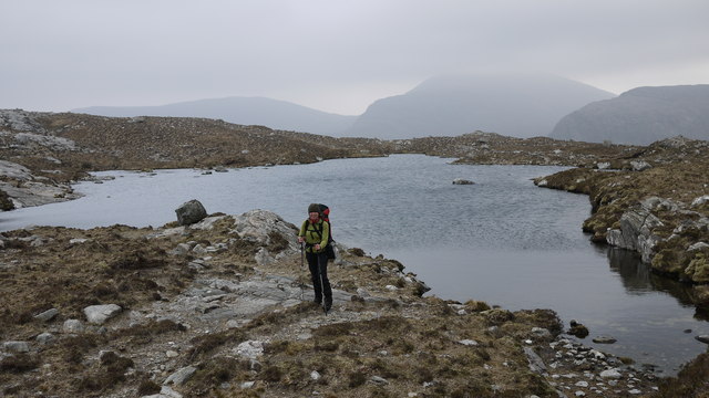
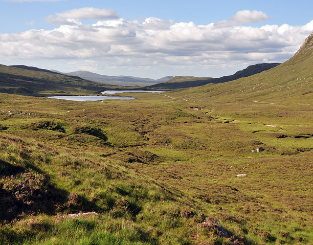
This striking hill is known for its distinctive shape, with a long, broad ridge that stretches from its summit. The ascent to the top is challenging but rewarding, offering hikers a chance to immerse themselves in the beauty of the Scottish Highlands. From the summit, visitors can enjoy panoramic vistas of the surrounding mountains, glens, and lochs.

Ulabhal is a popular destination for outdoor enthusiasts, attracting hikers, climbers, and nature lovers from near and far. Its proximity to other notable landmarks, such as Loch Ness and the Great Glen, further enhances its appeal as a must-visit location.

The hill is rich in flora and fauna, with heather-covered slopes and an abundance of wildlife. Rare species of birds, including golden eagles and peregrine falcons, can often be spotted soaring above the hill. The surrounding area is also home to red deer, wild goats, and other native wildlife.

Ulabhal offers a unique opportunity to experience the untamed beauty of the Scottish Highlands. Its rugged terrain, stunning views, and diverse wildlife make it a haven for nature enthusiasts seeking an adventure in the heart of Inverness-shire.

If you have any feedback on the listing, please let us know in the comments section below.

Ulabhal Images

Images are sourced within 2km of 57.995982/-6.9338025 or Grid Reference NB0811. Thanks to Geograph Open Source API. All images are credited.

Summit cairn on Oireabhal with view towards Ulabhal
View south along track towards Sron Scourst
Eastern side of Ulabhal The lower slopes of Ulabhal are rough and tussocky on this side. the twin lochs are Lochan an Fheoir and Loch Bhoisimid.
Eastern side of Ulabhal
The lower slopes of Ulabhal are rough and tussocky on this side. the twin lochs are Lochan an Fheoir and Loch Bhoisimid.
Upper Gleann Mhiabhaig Across the glen, the steep crags on Sron Ard rise above the lochs, Loch Bhoisimid and Lochan an Fheoir.
Upper Gleann Mhiabhaig
Across the glen, the steep crags on Sron Ard rise above the lochs, Loch Bhoisimid and Lochan an Fheoir.
Above Creag Chliostair
Hillside towards Loch Aiseabhat
Footbridge near Loch Chliostair The path leads to Gleann Uladail.
Footbridge near Loch Chliostair
The path leads to Gleann Uladail.
On the ridge north of Oireabhal with view towards Ulabhal
Rocky outcrop on ridge leading north towards Ulabhal
Cleft in rock and view down through Cathadail towards Sron Scourst
Summit cairn on Ulabhal
View north from Ulabhal towards Muladal The northern slope from Ulabhal is initially a boulder field.
View north from Ulabhal towards Muladal
The northern slope from Ulabhal is initially a boulder field.
The plateau summit of Muladal with view towards Ulabhal
Path down through Gleann Uladail A good engineered path leads down into the valley.
Path down through Gleann Uladail
A good engineered path leads down into the valley.
Looking west from lochan east of Sron Uladal
Watershed of Glen Meavaig Looking across the boggy ground at the high point of Glen Meavaig to Loch Voshimid, where the track ends.
Watershed of Glen Meavaig
Looking across the boggy ground at the high point of Glen Meavaig to Loch Voshimid, where the track ends.
Track in Glen Meavaig The estate track just after crossing the watershed, leading to the fishing lochs.
Track in Glen Meavaig
The estate track just after crossing the watershed, leading to the fishing lochs.
Concreted ford in Glen Meavaig This concreted ford with tubes serves as a low bridge over the burn draining the corrie above. The 500m peak of Sron Scourst looms spectacularly in the background.
Concreted ford in Glen Meavaig
This concreted ford with tubes serves as a low bridge over the burn draining the corrie above. The 500m peak of Sron Scourst looms spectacularly in the background.
Show me another place!

Ulabhal is located at Grid Ref: NB0811 (Lat: 57.995982, Lng: -6.9338025)

Unitary Authority: Na h-Eileanan an Iar

Police Authority: Highlands and Islands

What 3 Words

///bronze.evaded.contemplate. Near Tarbert, Na h-Eileanan Siar

Nearby Locations

Ulabhal

Related Wikis

Oireabhal

Oireabhal (662 m) is a mountain in Harris, in the Outer Hebrides of Scotland. The peak is the highest point on a complex ridge that runs from north to...

Uladail

Uladail is a location near Amhuinnsuidhe, on Harris in the Outer Hebrides, Scotland. Sron Ulladail is a sheer cliff which at 370 metres (1,210 ft) is one...

Tiorga Mor

Tiorga Mor (679 m) is a mountain in Harris, in the Outer Hebrides of Scotland. The most westerly peak of the high mountains of Harris, it is a very rugged...

Chliostair Hydro-Electric Scheme

Chliostair Hydro-Electric Scheme is a small scheme promoted by the North of Scotland Hydro-Electric Board on Harris, Outer Hebrides. It consists of a single...

Nearby Amenities

Located within 500m of 57.995982,-6.9338025
Ulabhal
Ele: 659
Name En: Ullaval
Name Gd: Ulabhal
Natural: peak
Source: OS7
Lat/Long: 57.9961781/-6.9337465
The data included in this document is from www.openstreetmap.org. The data is made available under ODbL.

Have you been to Ulabhal?

Leave your review of Ulabhal below (or comments, questions and feedback).