Aineabhal

Hill, Mountain in Ross-shire

Scotland

Aineabhal

Footbridge over the Abhainn Ghascleit This footbridge over the Abhainn Ghascleit is a welcome sight to a weary hiker. The stream is often difficult to ford, and the bridge can be the only safe way across.
Footbridge over the Abhainn Ghascleit Credit: Marc Calhoun

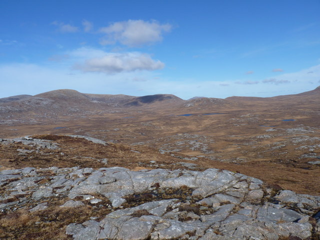
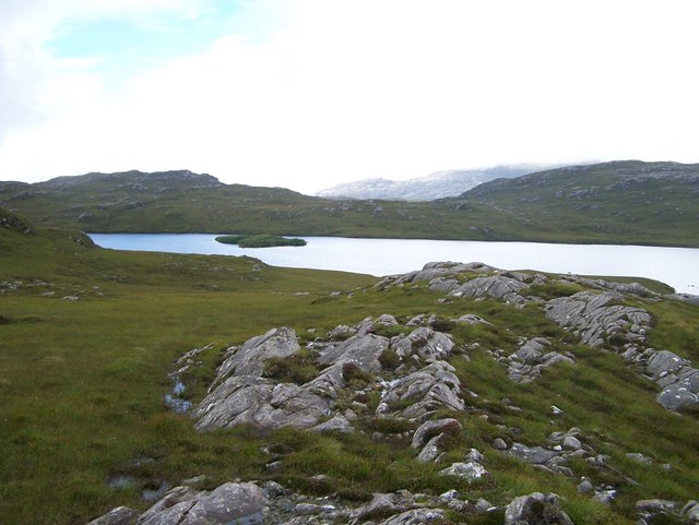
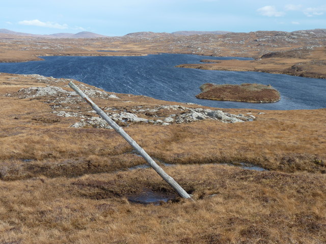
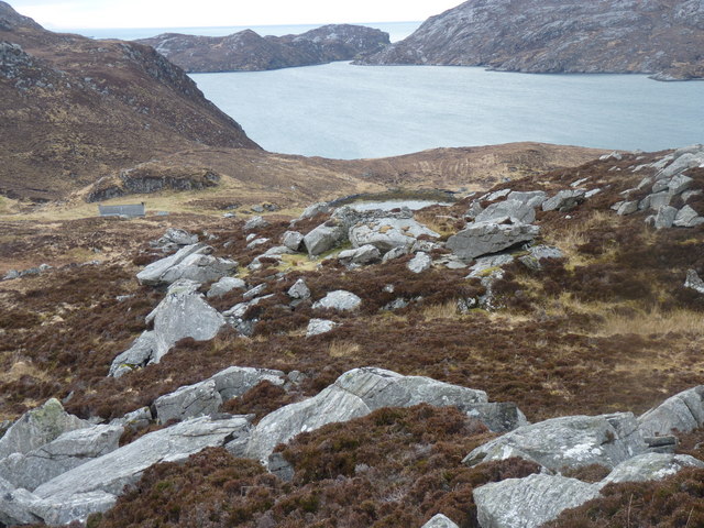
Aineabhal is a prominent hill located in Ross-shire, in the Scottish Highlands. It is part of the North West Highlands Geopark and stands at an impressive height of 528 meters (1,732 feet). Aineabhal is situated near the village of Achiltibuie, offering breathtaking views of the surrounding area.

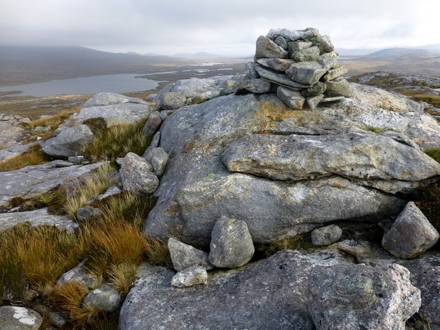
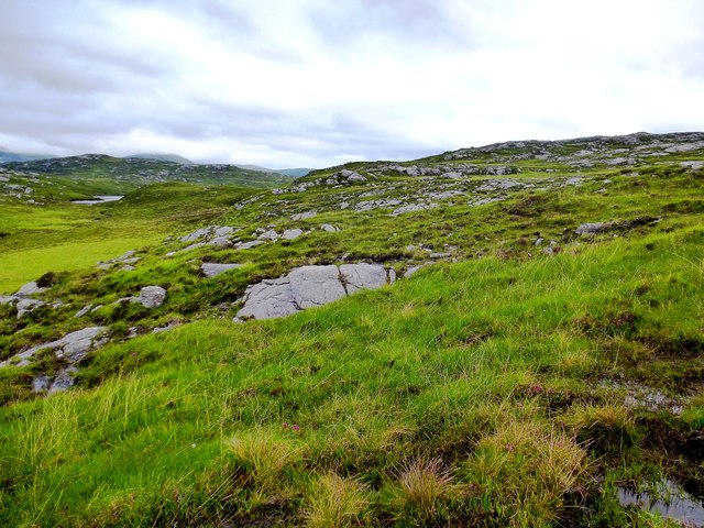
The hill is composed mainly of Torridonian sandstone, which adds to its unique geological significance. Its distinctive shape, with steep slopes and a pointed summit, makes it easily recognizable from a distance. The hill is covered in heather and scattered with rocks, creating a picturesque landscape.

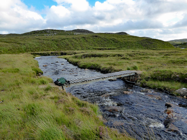
Aineabhal is a popular destination for outdoor enthusiasts, offering a range of activities such as hiking and hillwalking. There are various routes to reach the summit, catering to different levels of difficulty and experience. The ascent can be challenging at times, but the rewarding panoramic views from the top make it all worthwhile.

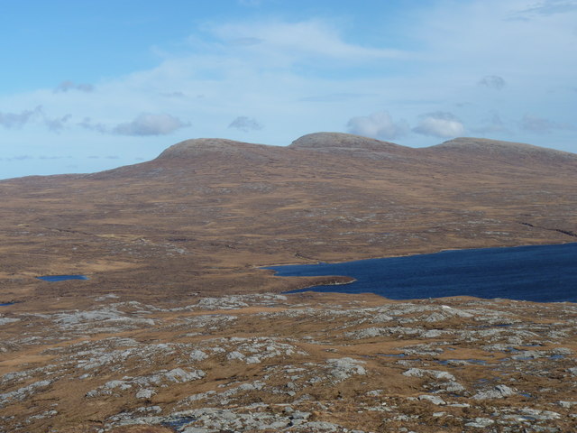
From the summit of Aineabhal, visitors can enjoy stunning vistas of the surrounding mountains, lochs, and coastline. On clear days, it is possible to see as far as the Isle of Skye and the Outer Hebrides. The hill also provides an excellent vantage point for birdwatching, with golden eagles and peregrine falcons often spotted in the area.

Overall, Aineabhal offers a captivating blend of natural beauty, geological significance, and outdoor activities, making it a must-visit destination for those exploring the Ross-shire region.

If you have any feedback on the listing, please let us know in the comments section below.

Aineabhal Images

Images are sourced within 2km of 58.068353/-6.9984056 or Grid Reference NB0519. Thanks to Geograph Open Source API. All images are credited.

Footbridge over the Abhainn Ghascleit This footbridge over the Abhainn Ghascleit is a welcome sight to a weary hiker. The stream is often difficult to ford, and the bridge can be the only safe way across.
Footbridge over the Abhainn Ghascleit
This footbridge over the Abhainn Ghascleit is a welcome sight to a weary hiker. The stream is often difficult to ford, and the bridge can be the only safe way across.
Cleitean nam Bothan Ruadha Looking northeast to Beinn a' Tuath from Cleitean nam Bothan Ruadha.
Cleitean nam Bothan Ruadha
Looking northeast to Beinn a' Tuath from Cleitean nam Bothan Ruadha.
East end of Loch Bodabhat Looking southwest over the east end of Loch Bodabhat. The hill Ceartabhal above loch a' Ghlinne in the far distance.
East end of Loch Bodabhat
Looking southwest over the east end of Loch Bodabhat. The hill Ceartabhal above loch a' Ghlinne in the far distance.
Aineabhal Summit Cairn Bagged with Jim Bloomer, Colin Crawford and George Morl. on a lovely day for September. Only 4 out of 9 of Alan Holmes RIB trip bagged this P98 today.
Name: Aineabhal
Hill number: 7098
Height: 166m / 545ft
Area: 24A: Lewis and Nearby Islands
Class: 1,sHu
Grid ref: NB053197 (est)
Drop: 98m
Col: 68m  NB063198
Aineabhal Summit Cairn
Bagged with Jim Bloomer, Colin Crawford and George Morl. on a lovely day for September. Only 4 out of 9 of Alan Holmes RIB trip bagged this P98 today. Name: Aineabhal Hill number: 7098 Height: 166m / 545ft Area: 24A: Lewis and Nearby Islands Class: 1,sHu Grid ref: NB053197 (est) Drop: 98m Col: 68m NB063198
View Across Loch Gruineabhat View across Loch Gruineabhat and beyond to the subHuMP Aineabhal which is the next hill on our bagging list today.
View Across Loch Gruineabhat
View across Loch Gruineabhat and beyond to the subHuMP Aineabhal which is the next hill on our bagging list today.
Southwest slopes of Corcasmol Rocky outcrops and wet peat on the slopes of Corcasmol. (The photograph also shows some of the adjacent square <a href="https://www.geograph.org.uk/gridref/NB0518">NB0518</a> - the loch in the western corner is the southern corner of Loch Bodabhat where the Abhainn Sgianuillt flows out)
Southwest slopes of Corcasmol
Rocky outcrops and wet peat on the slopes of Corcasmol. (The photograph also shows some of the adjacent square NB0518 - the loch in the western corner is the southern corner of Loch Bodabhat where the Abhainn Sgianuillt flows out)
House and Outbuildings at Tamnabhaigh
Bridge over Abhainn Tamnabhaig
Loch na Craobhaig Beinn a deas, Beinn Mheadhanach and Beinn a Truath are on the horizon.
Loch na Craobhaig
Beinn a deas, Beinn Mheadhanach and Beinn a Truath are on the horizon.
The large expanse of moorland north of Aireabhal
Loch Bodabhat
Loch Bodabhat
Mill at Loch Gruineabhat The ruin of the mill that lies in the middle of the stream that flows out of Loch Gruineabhat. After passing through the mill the stream cascades down to the Tamanavay River, which can be seen at the top centre of the photo.
Mill at Loch Gruineabhat
The ruin of the mill that lies in the middle of the stream that flows out of Loch Gruineabhat. After passing through the mill the stream cascades down to the Tamanavay River, which can be seen at the top centre of the photo.
The cairn on Aineabhal
Rocky moorland on Aineabhal
Old telegraph pole One of a line of poles from Tamnabhaigh to Ceann Loch Reasort
Old telegraph pole
One of a line of poles from Tamnabhaigh to Ceann Loch Reasort
Sand at the East end of Loch Sneathabhal
The hillside above Aird Sleitnis In the centre of the picture is a manmade structure incorporating existing large boulders.
The hillside above Aird Sleitnis
In the centre of the picture is a manmade structure incorporating existing large boulders.
Moorland above Aird Sleitinis The green area shows signs of human activity. The 7 mile long landrover track back to civilization can be seen in the background.
Moorland above Aird Sleitinis
The green area shows signs of human activity. The 7 mile long landrover track back to civilization can be seen in the background.
Show me another place!

Aineabhal is located at Grid Ref: NB0519 (Lat: 58.068353, Lng: -6.9984056)

Unitary Authority: Na h-Eileanan an Iar

Police Authority: Highlands and Islands

What 3 Words

///tracking.crackled.lost. Near Tarbert, Na h-Eileanan Siar

Nearby Locations

Aineabhal

Related Wikis

Uladail

Uladail is a location near Amhuinnsuidhe, on Harris in the Outer Hebrides, Scotland. Sron Ulladail is a sheer cliff which at 370 metres (1,210 ft) is one...

Mealista

Mealista (Scottish Gaelic: Mealasta) was a township in the west of the Isle of Lewis. It is currently largely uninhabited due to the Highland Clearances...

Game pieces of the Lewis chessmen hoard

Game pieces of the Lewis chessmen hoard include the ninety-three game pieces of the Lewis chessmen hoard found on the Isle of Lewis in the Outer Hebrides...

Eilean Mhealasta

Eilean Mhealasta (Mealista Island) is an uninhabited island off the west coast of Lewis in the Outer Hebrides of Scotland. It takes its name from Mealista...

Tiorga Mor

Tiorga Mor (679 m) is a mountain in Harris, in the Outer Hebrides of Scotland. The most westerly peak of the high mountains of Harris, it is a very rugged...

Scarp, Scotland

Scarp (Scottish Gaelic: An Sgarp) is an uninhabited island in the Outer Hebrides of Scotland, west of Hushinish on Harris. Once inhabited, the island was...

Brenish

Brenish (Scottish Gaelic: Brèinis) is a small village situated on the west coast of the Isle of Lewis, which is part of the Outer Hebrides of Scotland...

Gasker

Gasker is a small uninhabited islet in the Outer Hebrides of Scotland, 8 kilometres (4+1⁄2 nautical miles) southwest of Scarp, off the west coast of Harris...

Have you been to Aineabhal?

Leave your review of Aineabhal below (or comments, questions and feedback).