Airigh na Gaoithe
Hill, Mountain in Inverness-shire
Scotland
Airigh na Gaoithe

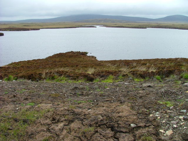
Airigh na Gaoithe is a hill located in Inverness-shire, Scotland. It is part of the rugged landscape of the Scottish Highlands, offering stunning panoramic views of the surrounding countryside. The hill stands at an elevation of approximately 1,600 feet, making it a popular destination for hikers and outdoor enthusiasts looking to challenge themselves with a steep ascent.
The name Airigh na Gaoithe translates to "hill of the wind" in Gaelic, reflecting the often blustery conditions that can be experienced at the summit. Despite the challenging climb, the views from the top are well worth the effort, with sweeping vistas of the rolling hills and valleys below.
The hill is home to a variety of wildlife, including deer, birds of prey, and other native species. It is also dotted with ancient ruins and archaeological sites, adding to its historical and cultural significance.
Visitors to Airigh na Gaoithe can enjoy a sense of tranquility and solitude in the remote and unspoiled landscape, as well as the opportunity to connect with nature and experience the beauty of the Scottish Highlands firsthand.
If you have any feedback on the listing, please let us know in the comments section below.
Airigh na Gaoithe Images
Images are sourced within 2km of 57.587376/-7.3117123 or Grid Reference NF8267. Thanks to Geograph Open Source API. All images are credited.


Airigh na Gaoithe is located at Grid Ref: NF8267 (Lat: 57.587376, Lng: -7.3117123)
Unitary Authority: Na h-Eileanan an Iar
Police Authority: Highlands and Islands
What 3 Words
///income.anchorman.decency. Near Lochmaddy, Na h-Eileanan Siar
Nearby Locations
Related Wikis

North Uist
North Uist (Scottish Gaelic: Uibhist a Tuath; Scots: North Uise) is an island and community in the Outer Hebrides of Scotland. == Etymology == In Donald...

Loch Sgadabhagh
Loch Sgadabhagh or Loch Scadavay is a body of water on the island of North Uist, Scotland. The name may be of Old Norse derivation meaning "lake of tax...

Ardheisker
Ardheisker (Scottish Gaelic: Àird Heillsgeir) is a settlement on North Uist, in the Outer Hebrides, Scotland. Ardheisker is within the parish of North...

Baleshare
Baleshare (Scottish Gaelic: Baile Sear) is a flat tidal island in the Outer Hebrides of Scotland. Baleshare lies to the south-west of North Uist. Its economics...
Related Videos

𝕭𝖊𝖓 𝕷𝖆𝖓𝖌𝖆𝖘𝖘, 𝕮𝖆𝖎𝖗𝖓, 𝕾𝖙𝖆𝖓𝖉𝖎𝖓𝖌 𝕾𝖙𝖔𝖓𝖊𝖘, 𝖂𝖔𝖔𝖉, 𝕹𝖔𝖗𝖙𝖍 𝖀𝖎𝖘𝖙, 𝕰𝖝𝖕𝖑𝖔𝖗𝖎𝖓𝖌 𝕾𝖈𝖔𝖙𝖑𝖆𝖓𝖉'𝖘 𝕳𝖎𝖘𝖙𝖔𝖗𝖞
Ben Langass, Cairn, Standing Stones, Wood, North Uist, Exploring Scotland's History A circular walk to learn of two very different ...
Nearby Amenities
Located within 500m of 57.587376,-7.3117123Have you been to Airigh na Gaoithe?
Leave your review of Airigh na Gaoithe below (or comments, questions and feedback).