Druim Langara

Hill, Mountain in Inverness-shire

Scotland

Druim Langara

Loch Tormasad island A small island near the outflow of Loch Tormasad
Loch Tormasad island Credit: G Kilpatrick

The requested URL returned error: 429 Too Many Requests

If you have any feedback on the listing, please let us know in the comments section below.

Druim Langara Images

Images are sourced within 2km of 57.566723/-7.3321913 or Grid Reference NF8165. Thanks to Geograph Open Source API. All images are credited.

Loch Tormasad island A small island near the outflow of Loch Tormasad
Loch Tormasad island
A small island near the outflow of Loch Tormasad
Lochan on the moorland Small Loch situated between Loch Huna and the western end of Loch A Bharpa.
Lochan on the moorland
Small Loch situated between Loch Huna and the western end of Loch A Bharpa.
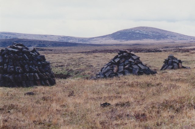
Peat stacks beside the A867 Looking towards Marrogh (168m) in the distance.
Peat stacks beside the A867
Looking towards Marrogh (168m) in the distance.
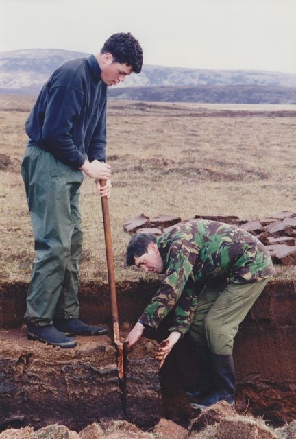
Cutting peats beside the A867 Traditional cutting of peats to dry for fuel in North Uist.
Cutting peats beside the A867
Traditional cutting of peats to dry for fuel in North Uist.
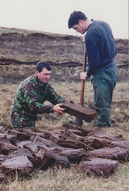
Cutting peats beside the A867 Traditional cutting of peats to dry for fuel in North Uist.
Cutting peats beside the A867
Traditional cutting of peats to dry for fuel in North Uist.
Clachan Stores What was a decent general store at the Clachan Junction until a couple of years ago is trading no more. The caravan that was parked in the driveway in 2007 <a href="https://www.geograph.org.uk/photo/445214">NF8164 : Clachan Stores</a> is still in place though...
Clachan Stores
What was a decent general store at the Clachan Junction until a couple of years ago is trading no more. The caravan that was parked in the driveway in 2007 NF8164 : Clachan Stores is still in place though...
North Uist War Memorial Memorial to the men of North Uist who laid down their lives during the first and second world wars.
North Uist War Memorial
Memorial to the men of North Uist who laid down their lives during the first and second world wars.
Hebridean Smokehouse, Clachan Local industry on North Uist, specialising in salmon and scallops.
<span class="nowrap"><a title="http://www.hebrideansmokehouse.com/" rel="nofollow ugc noopener" href="http://www.hebrideansmokehouse.com/">Link</a><img style="margin-left:2px;" alt="External link" title="External link - shift click to open in new window" src="https://s1.geograph.org.uk/img/external.png" width="10" height="10"/></span>
Hebridean Smokehouse, Clachan
Local industry on North Uist, specialising in salmon and scallops. LinkExternal link
Loch na Maoile Duibhe and Loch na Bà Ceire Moorland lochs from Druim Langara
Loch na Maoile Duibhe and Loch na Bà Ceire
Moorland lochs from Druim Langara
Moorland south of Uineabhal
Loch Huna A hidden Loch in North Uist with an ancient Dun in a group of tiny islets
Loch Huna
A hidden Loch in North Uist with an ancient Dun in a group of tiny islets
Looking towards Loch nan Strùban Improved grassland with the peat moor behind
Looking towards Loch nan Strùban
Improved grassland with the peat moor behind
Interior of North Uist The scene from Druim Langara
Interior of North Uist
The scene from Druim Langara
Road across Criongrabhal Access to the hill and moor ground
Road across Criongrabhal
Access to the hill and moor ground
Remains of 19th Century house at Clachan, North Uist As with many houses of this vintage on the island, the outer walls were constructed with large stones with a cavity of approximately 9 inches. The cavity was filled with small rocks so providing some insulation.
Remains of 19th Century house at Clachan, North Uist
As with many houses of this vintage on the island, the outer walls were constructed with large stones with a cavity of approximately 9 inches. The cavity was filled with small rocks so providing some insulation.
Clachan: postbox № HS6 7 A small postbox diagonally opposite the post office.
Clachan: postbox № HS6 7
A small postbox diagonally opposite the post office.
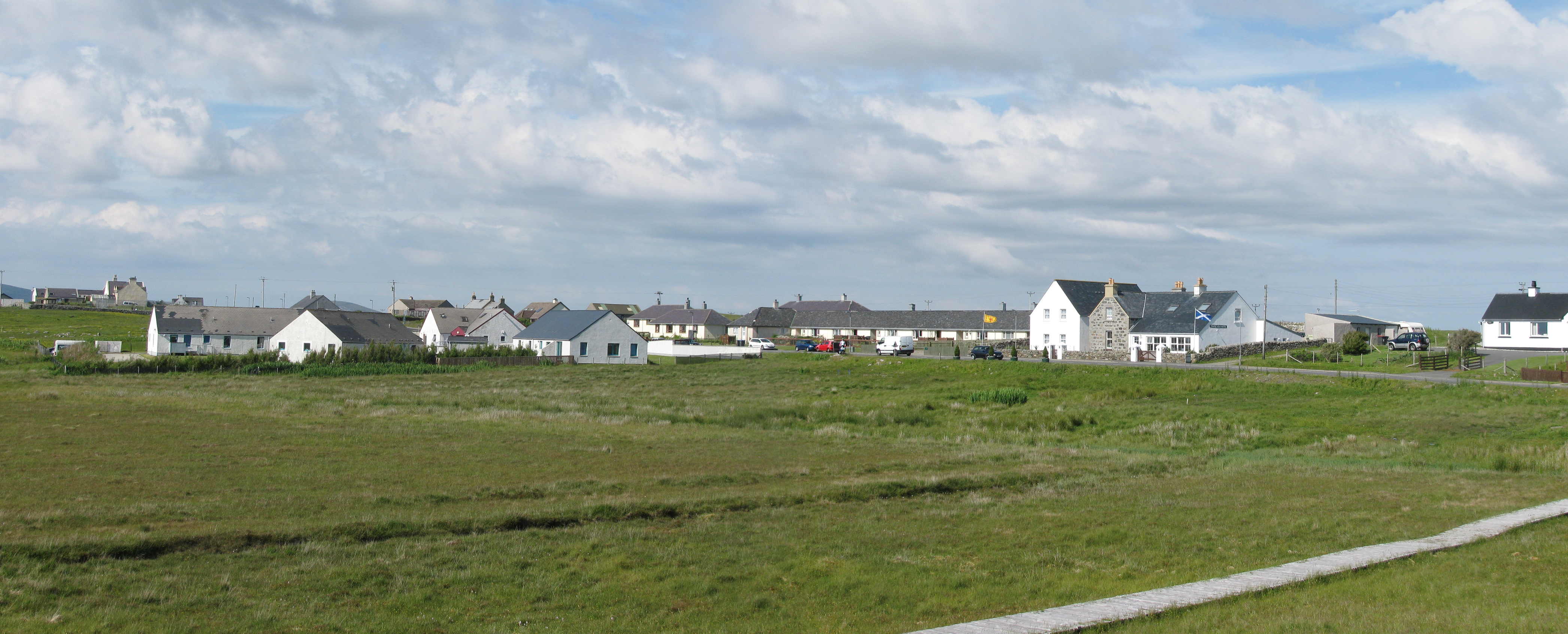
A867, Clachan Clachan is where the roads from the west and east side of North Uist meet before continuing southwards towards Benbecula.
A867, Clachan
Clachan is where the roads from the west and east side of North Uist meet before continuing southwards towards Benbecula.
Sticking up a turbine A small wind turbine under construction at Clachan.
Sticking up a turbine
A small wind turbine under construction at Clachan.
Show me another place!

Druim Langara is located at Grid Ref: NF8165 (Lat: 57.566723, Lng: -7.3321913)

Unitary Authority: Na h-Eileanan an Iar

Police Authority: Highlands and Islands

What 3 Words

///note.hindering.pining. Near Balivanich, Na h-Eileanan Siar

Nearby Locations

Druim Langara

Related Wikis

North Uist

North Uist (Scottish Gaelic: Uibhist a Tuath; Scots: North Uise) is an island and community in the Outer Hebrides of Scotland. == Etymology == In Donald...

Baleshare

Baleshare (Scottish Gaelic: Baile Sear) is a flat tidal island in the Outer Hebrides of Scotland. Baleshare lies to the south-west of North Uist. Its economics...

Battle of Carinish

The Battle of Carinish was a Scottish clan battle fought in North Uist in 1601. It was part of a year of feuding between Clan MacLeod of Dunvegan and the...

Carinish

Carinish (Scottish Gaelic: Càirinis), is a hamlet on North Uist, in the Outer Hebrides, Scotland. It is in the south of the island, about two miles (three...

Nearby Amenities

Located within 500m of 57.566723,-7.3321913
Generator Method: wind_turbine
Generator Output Electricity: 900 kW
Generator Source: wind
Generator Type: horizontal_axis
Operator: North Uist Development Company (Trading) Ltd
Power: generator
Start Date: 2019-08
Website: https://www.uistwind.com
Lat/Long: 57.5637407/-7.330032
Turning Circle
Lat/Long: 57.563845/-7.3297957
The data included in this document is from www.openstreetmap.org. The data is made available under ODbL.

Have you been to Druim Langara?

Leave your review of Druim Langara below (or comments, questions and feedback).