Airneabhal

Hill, Mountain in Inverness-shire

Scotland

Airneabhal

Old shieling
Old shieling Credit: Jac Volbeda

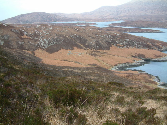
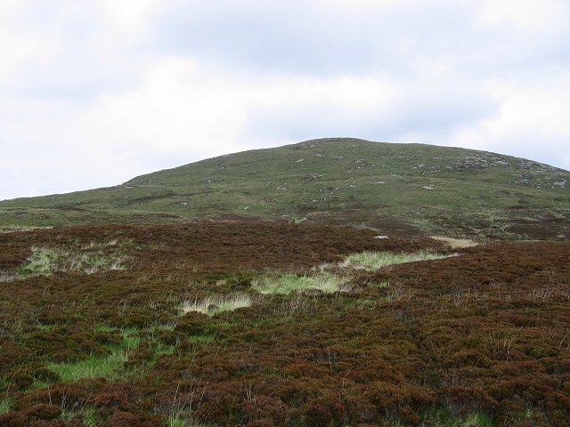
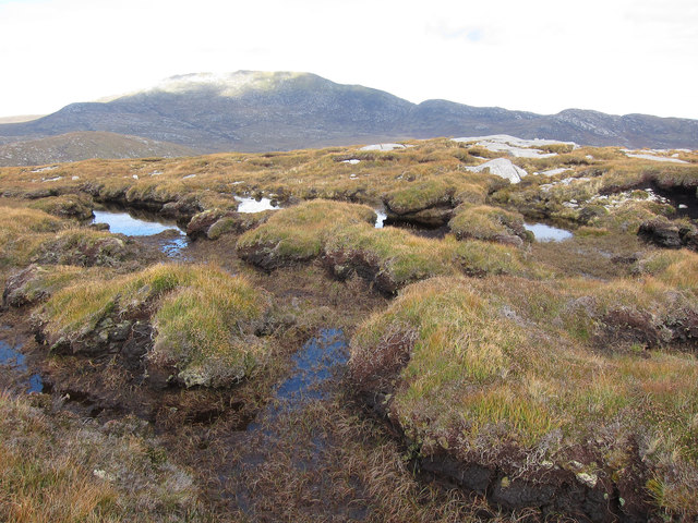
Airneabhal is a prominent hill located in Inverness-shire, Scotland. It is part of the Uig Hills range and stands at an elevation of 564 meters (1,850 feet) above sea level. The hill is characterized by its rounded shape and rocky terrain, making it a popular destination for hikers and outdoor enthusiasts.

The summit of Airneabhal offers stunning panoramic views of the surrounding countryside, including the Isle of Lewis and the Atlantic Ocean. On a clear day, visitors can see as far as the Outer Hebrides and the mountains of the Scottish Highlands.

The hill is home to a variety of flora and fauna, with heather, grasses, and wildflowers covering its slopes. Birdwatchers may be able to spot species such as golden eagles, buzzards, and peregrine falcons soaring overhead.

Access to Airneabhal is typically via a network of well-maintained hiking trails, with the most popular starting point being the village of Timsgarry. Visitors are advised to wear appropriate footwear and clothing, as weather conditions on the hill can change rapidly.

If you have any feedback on the listing, please let us know in the comments section below.

Airneabhal Images

Images are sourced within 2km of 57.207963/-7.3267621 or Grid Reference NF7825. Thanks to Geograph Open Source API. All images are credited.

Old shieling
Old shieling
Loch Snigiscleit
Loch Snigiscleit
Below Stulabhal Looking across the bog and deep grass to Loch Drollabhat (in next square). At the foot of the west ridge of Stulabhal.
Below Stulabhal
Looking across the bog and deep grass to Loch Drollabhat (in next square). At the foot of the west ridge of Stulabhal.
On Airneabhal A peaty lochan in one of the many folds in the gneiss plateau at the top of this hill.  Gneiss is incredibly old, Some of the rocks on the Western Isles have been dated at about 2.8 billion years before the present day.
On Airneabhal
A peaty lochan in one of the many folds in the gneiss plateau at the top of this hill. Gneiss is incredibly old, Some of the rocks on the Western Isles have been dated at about 2.8 billion years before the present day.
Airneabhal Taken from the west, where the drier slopes, drier as the water can flow down hill out of the soil, makes way for the gentler slopes of the great bogland.
Airneabhal
Taken from the west, where the drier slopes, drier as the water can flow down hill out of the soil, makes way for the gentler slopes of the great bogland.
Summit of Beinn Hurabhat A small heathery summit reached by squelching through a lot of bog.
Summit of Beinn Hurabhat
A small heathery summit reached by squelching through a lot of bog.
Southwest ridge of Beinn Hurabhat Looking down towards Loch Snigiscleit.
Southwest ridge of Beinn Hurabhat
Looking down towards Loch Snigiscleit.
Abhainn Hornaraidh glen Looking toward the gap between Airneabhal and Stulabhal towards Loch Drollabhat. Loch Hurabhat just in photo at the right.
Abhainn Hornaraidh glen
Looking toward the gap between Airneabhal and Stulabhal towards Loch Drollabhat. Loch Hurabhat just in photo at the right.
Loch Hurabhat Seen from Beinn Hurabhat.
Loch Hurabhat
Seen from Beinn Hurabhat.
Loch Drollabhat
Loch Drollabhat
Loch Snigiscleit from the North shore
Loch Snigiscleit
Loch Snigiscleit
Loch Drollabhar
Loch Drollabhar
Top of Trinneabhal Looking down to the lowland peat and machair lochs of South Uist.
Top of Trinneabhal
Looking down to the lowland peat and machair lochs of South Uist.
Lochans on Trinneabhal Small pools along the broad ridge.
Lochans on Trinneabhal
Small pools along the broad ridge.
Peat hags on Trinneabhal Surprisingly easy to get across. The ground was often damp, but never boot-swallingly so.
Peat hags on Trinneabhal
Surprisingly easy to get across. The ground was often damp, but never boot-swallingly so.
Trinneabhal, South Uist Looking towards the mouth of Loch Ainenort.
Trinneabhal, South Uist
Looking towards the mouth of Loch Ainenort.
South Uist moorland Not high but a good walk and great views.
South Uist moorland
Not high but a good walk and great views.
Show me another place!

Airneabhal is located at Grid Ref: NF7825 (Lat: 57.207963, Lng: -7.3267621)

Unitary Authority: Na h-Eileanan an Iar

Police Authority: Highlands and Islands

What 3 Words

///ketchup.viewing.schematic. Near Lochboisdale, Na h-Eileanan Siar

Nearby Locations

Airneabhal

Related Wikis

Askernish

Askernish (Scottish Gaelic: Àisgearnais, Aisgernis) is a crofting community on South Uist, in the Outer Hebrides, Scotland. Askernish is in the parish...

Milton (South Uist)

Milton (Scottish Gaelic: Geàrraidh Bhailteas) is the name of a tack or tenant farm on the island of South Uist in the Outer Hebrides, Scotland. It was...

Stuley

Stuley is an island lying to the east of South Uist in the Outer Hebrides, Scotland. It lies off the section of coastline between Loch Eynort and Loch...

Auratote

Auratote (Scottish Gaelic: Oratobht) is a location on South Uist in the Outer Hebrides, Scotland. Auratote is within the parish of South Uist. == References... ==

Nearby Amenities

Located within 500m of 57.207963,-7.3267621
Àirneabhal
Corbett: no
Ele: 257
Graham: no
Marilyn: yes
Munro: no
Name En: Arnaval
Name Gd: Àirneabhal
Natural: peak
Prominence: 176
Lat/Long: 57.2079397/-7.3269319
The data included in this document is from www.openstreetmap.org. The data is made available under ODbL.

Have you been to Airneabhal?

Leave your review of Airneabhal below (or comments, questions and feedback).