Aird nan Gobhar

Hill, Mountain in Inverness-shire

Scotland

Aird nan Gobhar

South Uist War Memorial
South Uist War Memorial Credit: Sandy Gerrard

Aird nan Gobhar is a hill located in Inverness-shire, Scotland. It is part of the Monadhliath Mountains range and stands at an elevation of 621 meters (2,037 feet). The name "Aird nan Gobhar" translates to "height of the goats" in Gaelic, reflecting the rugged and rocky terrain of the hill.

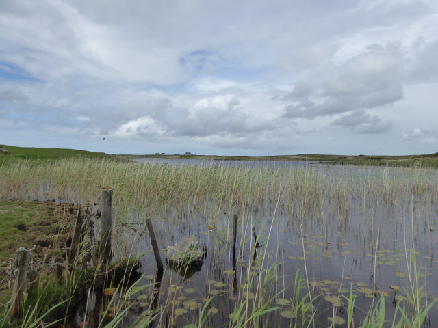
Aird nan Gobhar offers stunning panoramic views of the surrounding landscape, including the nearby Loch Ness and the Great Glen. The hill is a popular destination for hikers and outdoor enthusiasts looking to explore the Scottish Highlands.

The ascent to the summit of Aird nan Gobhar can be challenging, with steep and rocky sections along the way. However, the effort is rewarded with breathtaking views and a sense of accomplishment upon reaching the top.

The hill is home to a variety of wildlife, including deer, birds, and other mountain fauna. Visitors may also come across remnants of old settlements or ruins scattered throughout the area, adding to the historical charm of Aird nan Gobhar.

Overall, Aird nan Gobhar is a picturesque and rugged hill in the Scottish Highlands, offering a rewarding outdoor experience for those willing to explore its slopes.

If you have any feedback on the listing, please let us know in the comments section below.

Aird nan Gobhar Images

Images are sourced within 2km of 57.226902/-7.4081463 or Grid Reference NF7328. Thanks to Geograph Open Source API. All images are credited.

South Uist War Memorial
War memorial near Cill Donnain
Two Kingspan/Proven turbines Beside the South Uist Museum.
Two Kingspan/Proven turbines
Beside the South Uist Museum.
The beach at Kildonan, South Uist There was a lot of sea-weed on the shore - recent storms, perhaps?
The beach at Kildonan, South Uist
There was a lot of sea-weed on the shore - recent storms, perhaps?
The beach at Kildonan, South Uist Yet another perfect Hebridean beach.
The beach at Kildonan, South Uist
Yet another perfect Hebridean beach.
Road approaching a  causeway across Loch Chill Donnain
Road approaching a causeway across Loch Chill Donnain
Wind turbine near Bornais Not a 6-bladed turbine but just a feature of my camera's multiple exposure.
Wind turbine near Bornais
Not a 6-bladed turbine but just a feature of my camera's multiple exposure.
Houses at Bornais Notice the prolific bog iris in amongst the grass.
Houses at Bornais
Notice the prolific bog iris in amongst the grass.
Lochan at Bornais
Lochan at Bornais
Cairn and Enclosures at Sligeanach Deas The crofter has also left some storage bags around.
Cairn and Enclosures at Sligeanach Deas
The crofter has also left some storage bags around.
Loch Upper Kildonan Looking north towards Bornish Church on the horizon.
Loch Upper Kildonan
Looking north towards Bornish Church on the horizon.
Loch Upper Kildonan Looking out across the island studded north end of the loch from the ruins on the west shore.
Loch Upper Kildonan
Looking out across the island studded north end of the loch from the ruins on the west shore.
Angling Boat, Upper Kildonan
Eaglais Naoimh Moire (St. Mary's R C Church)
Machair at Bornish
Machair at Bornish
Reeds, Loch Chill Donnain
Old walls above Loch Àird an Sgairbh
Dun, Loch na Muilne The OS map identifies this small island in Loch na Muilne as the site of a dun.   It appears that the island can be reached by a causeway or series of stepping stones.
Dun, Loch na Muilne
The OS map identifies this small island in Loch na Muilne as the site of a dun. It appears that the island can be reached by a causeway or series of stepping stones.
Show me another place!

Aird nan Gobhar is located at Grid Ref: NF7328 (Lat: 57.226902, Lng: -7.4081463)

Unitary Authority: Na h-Eileanan an Iar

Police Authority: Highlands and Islands

What 3 Words

///headrest.outs.pheasants. Near Lochboisdale, Na h-Eileanan Siar

Related Wikis

Milton (South Uist)

Milton (Scottish Gaelic: Geàrraidh Bhailteas) is the name of a tack or tenant farm on the island of South Uist in the Outer Hebrides, Scotland. It was...

Bornish

Bornish (Scottish Gaelic: Bòrnais) is a village and community council area on South Uist in the Outer Hebrides, Scotland. Bornish is also within the civil...

Dun Vulan

Dun Vulan Broch (Scottish Gaelic: 'Dùn Mhùlan' or 'Dùn Mhaoilinn') is an Iron Age broch in South Uist, Scotland. == Location == Dun Vulan is located in...

Ormacleit Castle

Ormacleit Castle (Scottish Gaelic: Caisteal Ormacleit) is a ruined mansion house of the early 18th century. It is located on South Uist in the Western...

Nearby Amenities

Located within 500m of 57.226902,-7.4081463
Passing Place
Lat/Long: 57.2229943/-7.4099141
Cill Donnain
Name En: Kildonan
Name Gd: Cill Donnain
Place: village
Lat/Long: 57.2237211/-7.4033528
Passing Place
Lat/Long: 57.2239378/-7.4047691
Power: pole
Lat/Long: 57.2237057/-7.4058308
Power: pole
Lat/Long: 57.2235169/-7.4065576
Power: pole
Lat/Long: 57.2235881/-7.4045353
Power: pole
Lat/Long: 57.2234879/-7.4034248
Power: pole
Lat/Long: 57.2228635/-7.4113963
Power: pole
Lat/Long: 57.2228664/-7.4100928
Power: pole
Lat/Long: 57.2228737/-7.4090253
Power: pole
Lat/Long: 57.2232504/-7.4075802
Passing Place
Lat/Long: 57.2232174/-7.4073808
Power: pole
Lat/Long: 57.2242226/-7.4017377
Power: pole
Lat/Long: 57.224455/-7.4022768
Power: pole
Lat/Long: 57.2246786/-7.402765
The data included in this document is from www.openstreetmap.org. The data is made available under ODbL.

Have you been to Aird nan Gobhar?

Leave your review of Aird nan Gobhar below (or comments, questions and feedback).