Àird Rubha Mòr

Hill, Mountain in Inverness-shire

Scotland

Àird Rubha Mòr

The A888 towards Earsairidh
The A888 towards Earsairidh Credit: John Allan

Àird Rubha Mòr is a hill located in the Inverness-shire region of Scotland. It is part of the Scottish Highlands, known for its rugged terrain and stunning natural beauty. The hill stands at an elevation of approximately 540 meters (1772 feet) above sea level.

Àird Rubha Mòr is a popular destination for hikers and outdoor enthusiasts, offering panoramic views of the surrounding countryside and coastline. The hill is covered in heather and grasses, with rocky outcrops scattered throughout the landscape. Wildlife such as deer and birds can often be spotted in the area.

The hill is accessible by foot, with several walking trails leading to the summit. The hike is considered moderate in difficulty, with some steep sections and uneven terrain. On a clear day, hikers can enjoy breathtaking views of the nearby Loch Ness and the surrounding mountains.

Overall, Àird Rubha Mòr is a picturesque and tranquil location, perfect for those looking to explore the natural beauty of the Scottish Highlands.

If you have any feedback on the listing, please let us know in the comments section below.

Àird Rubha Mòr Images

Images are sourced within 2km of 56.954025/-7.4431297 or Grid Reference NL6997. Thanks to Geograph Open Source API. All images are credited.

The A888 towards Earsairidh
Coastal rocks A view at low tide of the coastal rock platform by Earsairidh.
Coastal rocks
A view at low tide of the coastal rock platform by Earsairidh.
Sandy beach on Orasaigh There are four Orasaighs around Barra, it being the Gaelic for small tidal island. The fishing waste on the beach is unfortunately common, though it will do less harm on the beach than on the seabed.
Sandy beach on Orasaigh
There are four Orasaighs around Barra, it being the Gaelic for small tidal island. The fishing waste on the beach is unfortunately common, though it will do less harm on the beach than on the seabed.
Earsairidh, Barraigh
Orasaigh, near Earsairidh
Remains of fence on Orosay Looking NE to Mainland Barra.  Taken whilst waiting for the tide to turn to give clearance to kayak through the shallow channel.
Remains of fence on Orosay
Looking NE to Mainland Barra. Taken whilst waiting for the tide to turn to give clearance to kayak through the shallow channel.
Leinis Small grassy peninsula on the east coast of Barra.
Leinis
Small grassy peninsula on the east coast of Barra.
Orasaigh Small island off the east coast of Barra.
Orasaigh
Small island off the east coast of Barra.
Cottage at Earsairidh This apparently isolated cottage on a rocky shore makes an almost classic Hebridean view.
Cottage at Earsairidh
This apparently isolated cottage on a rocky shore makes an almost classic Hebridean view.
Orasaigh This little island is one of a surprisingly large number with the same name, or variants of it.
Orasaigh
This little island is one of a surprisingly large number with the same name, or variants of it.
Leinis Looking south across the rocky shore of the Leinis peninsula.
Leinis
Looking south across the rocky shore of the Leinis peninsula.
Cross-cutting Dykes The dark dyke is an undeformed 'younger basic' dyke cutting across a pegmatitic granite vein which itself cuts through a microdiorite dyke. The pegamtite is not easy to see in this image; it is the pale rock on either side of the narrowest part of the dark mafic dyke.
Cross-cutting Dykes
The dark dyke is an undeformed 'younger basic' dyke cutting across a pegmatitic granite vein which itself cuts through a microdiorite dyke. The pegamtite is not easy to see in this image; it is the pale rock on either side of the narrowest part of the dark mafic dyke.
Leinis Point Rocky foreshore running south from Leinis Point.
Leinis Point
Rocky foreshore running south from Leinis Point.
Leinis Point The gap in the rocks is a Tertiary dyke which has been eroded by the sea, leaving the more resistant older gneiss on either side.
Leinis Point
The gap in the rocks is a Tertiary dyke which has been eroded by the sea, leaving the more resistant older gneiss on either side.
Earsairidh Scattered croft houses near the shore road through Ersary.
Earsairidh
Scattered croft houses near the shore road through Ersary.
Orasaigh The foreground rocks are on the Leinis peninsula.
Orasaigh
The foreground rocks are on the Leinis peninsula.
Earsairidh and Orasaigh The island is almost tidal, separated from the mainland of Barra only by a narrow strip of white sand, easily seen under the translucent water of the rising tide.
Earsairidh and Orasaigh
The island is almost tidal, separated from the mainland of Barra only by a narrow strip of white sand, easily seen under the translucent water of the rising tide.
Orasaigh Pale sand and dark rock are revealed by the clear sea water on the coast of Barra.
Orasaigh
Pale sand and dark rock are revealed by the clear sea water on the coast of Barra.
Show me another place!

Àird Rubha Mòr is located at Grid Ref: NL6997 (Lat: 56.954025, Lng: -7.4431297)

Unitary Authority: Na h-Eileanan an Iar

Police Authority: Highlands and Islands

What 3 Words

///commenced.reshape.unfilled. Near CastleBay, Na h-Eileanan Siar

Related Wikis

Brevig, Barra

Brevig (Scottish Gaelic: Brèibhig) is a village on the island of Barra, in the Outer Hebrides, Scotland. The settlement is situated on the A888, which...

Heaval

Heaval is the highest hill on the Outer Hebridean island of Barra, Scotland. The highest point is 383 metres high above sea level and it is located 1.5...
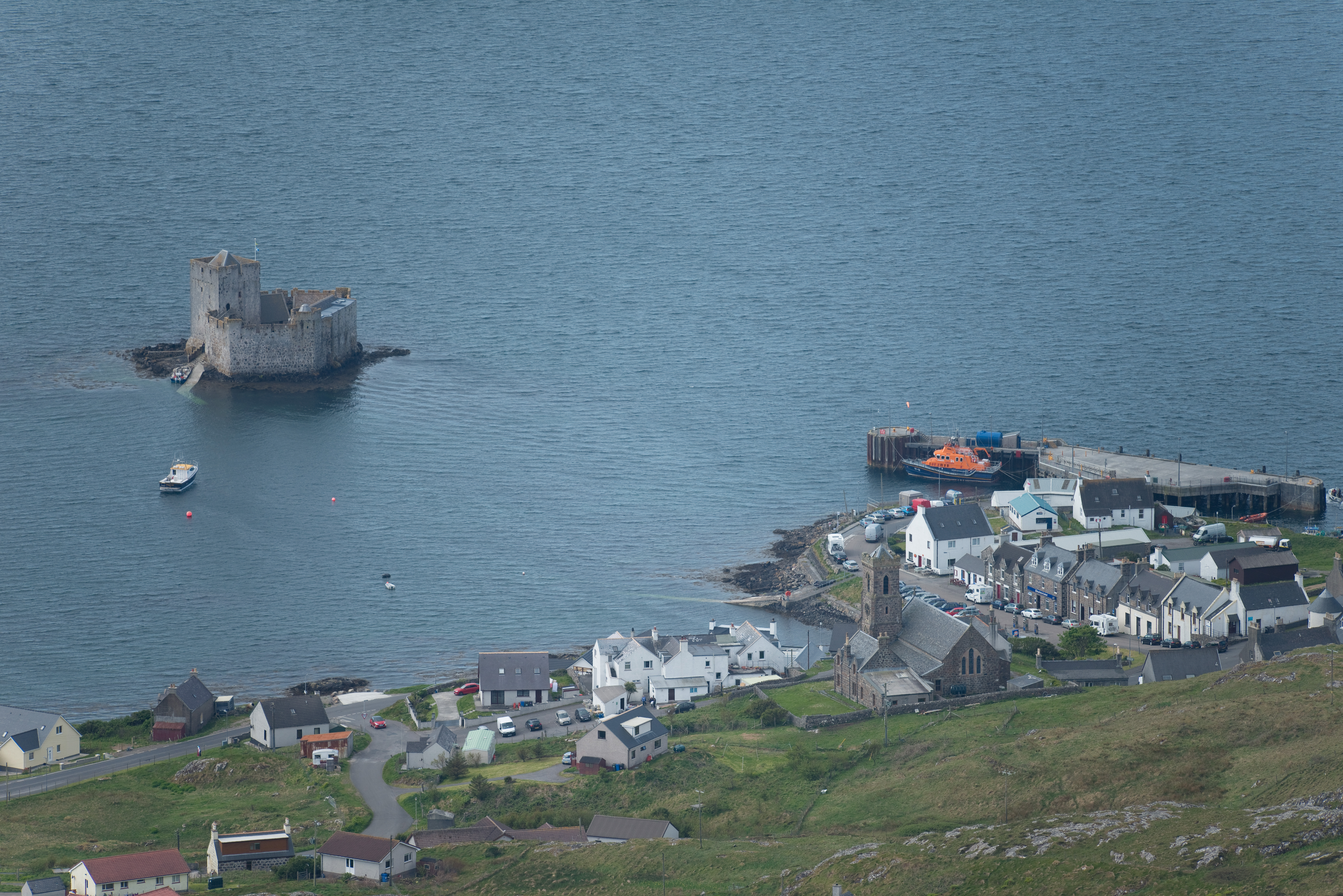
Castlebay

Castlebay (Scottish Gaelic: Bàgh a' Chaisteil [baːɣ ə ˈxaʃtʲɪl]) is the main village and a community council area on the island of Barra in the Outer Hebrides...

Kisimul Castle

Kisimul Castle (Scottish Gaelic: Caisteal Chiosmuil) and also known as Kiessimul Castle, is a medieval castle located on a small island off Castlebay,...

Nearby Amenities

Located within 500m of 56.954025,-7.4431297
Àird Rubha Mòr
Ele: 110
Natural: peak
Lat/Long: 56.9535167/-7.4416027
The data included in this document is from www.openstreetmap.org. The data is made available under ODbL.

Have you been to Àird Rubha Mòr?

Leave your review of Àird Rubha Mòr below (or comments, questions and feedback).