Broom Covert
Downs, Moorland in Suffolk East Suffolk
England
Broom Covert

Broom Covert is a stunning area located in Suffolk, England, known for its diverse landscape consisting of downs, moorland, and woodlands. Covering approximately 500 acres, this beautiful site offers a unique combination of natural features.
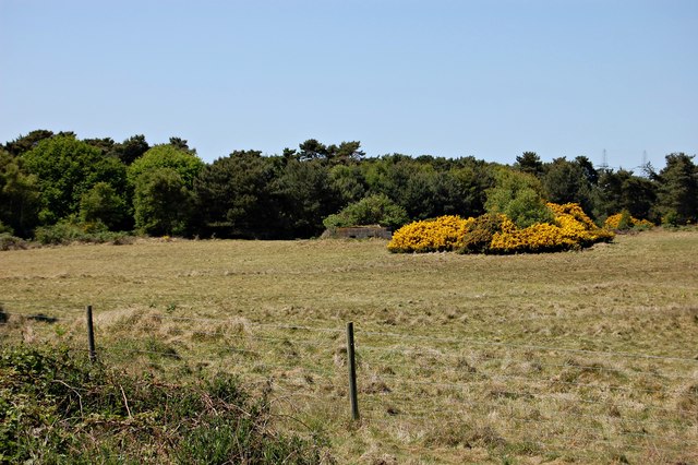
The downs in Broom Covert are characterized by their rolling hills and expansive grasslands. They provide a picturesque backdrop for visitors to enjoy breathtaking views of the surrounding countryside. These open spaces are home to a variety of plant species, including wildflowers and grasses, which create a vibrant and colorful display during the warmer months.
In contrast, the moorland areas of Broom Covert offer a more rugged and wild environment. Here, visitors can explore the heathland and peat bogs, which are home to a range of unique flora and fauna. Moorland birds such as curlews, skylarks, and stonechats can be spotted, adding to the area's natural charm.
The woodlands within Broom Covert are a haven for wildlife, with ancient trees providing shelter for a wide array of species. Visitors can wander along the woodland trails, listening to the soothing sounds of birdsong and the rustling of leaves underfoot. These woodlands are also home to various mammals, including deer and foxes, which can occasionally be seen by lucky observers.
Overall, Broom Covert is a captivating destination for nature enthusiasts and those seeking a tranquil escape. Its diverse range of downs, moorland, and woodlands provides a rich and varied ecosystem, showcasing the natural beauty of Suffolk. Whether it's exploring the rolling hills, traversing the moorlands, or immersing oneself in the peaceful woodlands, Broom Covert offers an unforgettable experience for all who visit.
If you have any feedback on the listing, please let us know in the comments section below.
Broom Covert Images
Images are sourced within 2km of 52.21024/1.6059527 or Grid Reference TM4663. Thanks to Geograph Open Source API. All images are credited.


Broom Covert is located at Grid Ref: TM4663 (Lat: 52.21024, Lng: 1.6059527)
Administrative County: Suffolk
District: East Suffolk
Police Authority: Suffolk
What 3 Words
///stages.trickle.flotation. Near Leiston, Suffolk
Nearby Locations
Related Wikis
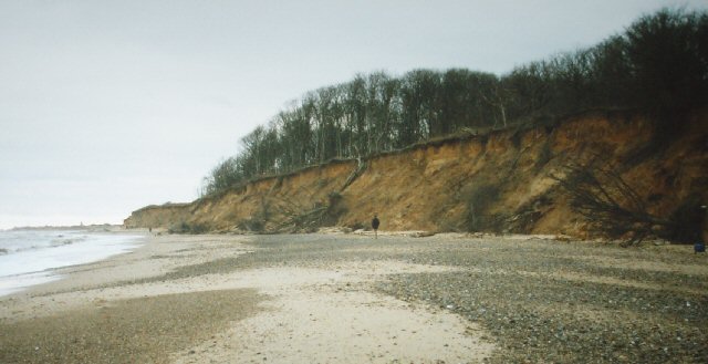
Sizewell
Sizewell is an English fishing hamlet in the East Suffolk district of Suffolk, England. It belongs to the civil parish of Leiston and lies on the North...

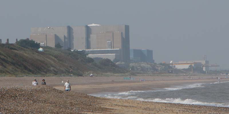
Sizewell C nuclear power station
Sizewell C nuclear power station is a project to construct a 3,200 MWe nuclear power station with two EPR reactors in Suffolk, England. The project was...

Sizewell Belts
Sizewell Marshes form a 260-acre (105.4 ha) biological Site of Special Scientific Interest adjacent to Sizewell in Suffolk. It is in the Suffolk Coast...
Suffolk Coast and Heaths
The Suffolk Coast and Heaths AONB is an Area of Outstanding Natural Beauty in Suffolk and Essex, England. The AONB covers ancient woodland, commercial...
Nearby Amenities
Located within 500m of 52.21024,1.6059527Have you been to Broom Covert?
Leave your review of Broom Covert below (or comments, questions and feedback).