St Alban's Downs

Downs, Moorland in Kent Dover

England

St Alban's Downs

Nonington Church Of England Primary School, Church Street This view of <a href="https://www.geograph.org.uk/photo/6638352">TR2552 : Nonington Church of England Primary School, Church Street</a> shows the school, before any ongoing work had started to build a traditionally constructed brick-block classroom extension.
Nonington Church Of England Primary School, Church Street Credit: John Baker

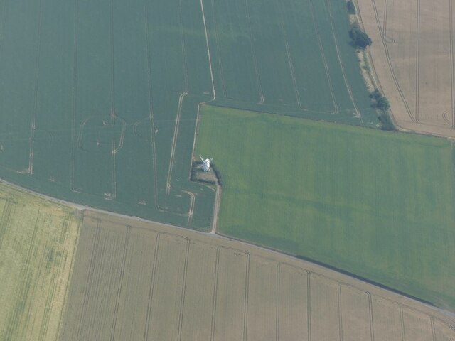
St Alban's Downs, located in Kent, England, is a picturesque area known for its stunning natural beauty and diverse wildlife. Spanning over a vast expanse of moorland, this region is a haven for nature enthusiasts and outdoor adventurers alike.

The downs are characterized by rolling hills, open grasslands, and scattered pockets of woodland, offering visitors a variety of landscapes to explore. The area is home to an array of flora and fauna, including rare orchids, wildflowers, and an abundance of bird species. It is not uncommon to spot kestrels, skylarks, and peregrine falcons soaring overhead.

The downs are also known for their rich history and archaeological significance. Numerous Iron Age hill forts, burial mounds, and ancient trackways can be found throughout the area, providing glimpses into the past civilizations that once inhabited this land.

Visitors to St Alban's Downs can enjoy a range of recreational activities, including hiking, cycling, and horseback riding. The network of well-maintained trails offers opportunities for both leisurely walks and more challenging treks, rewarding visitors with breathtaking panoramic views of the surrounding countryside.

In addition to its natural beauty, St Alban's Downs is a designated Area of Outstanding Natural Beauty (AONB), ensuring its preservation for future generations to enjoy. The downs are also part of a larger nature reserve, contributing to the conservation efforts of the region.

With its stunning landscapes, diverse wildlife, and rich history, St Alban's Downs in Kent is a must-visit destination for anyone seeking to immerse themselves in the beauty of nature and experience the tranquility of the moorland.

If you have any feedback on the listing, please let us know in the comments section below.

St Alban's Downs Images

Images are sourced within 2km of 51.226804/1.2491607 or Grid Reference TR2652. Thanks to Geograph Open Source API. All images are credited.

Nonington Church Of England Primary School, Church Street This view of <a href="https://www.geograph.org.uk/photo/6638352">TR2552 : Nonington Church of England Primary School, Church Street</a> shows the school, before any ongoing work had started to build a traditionally constructed brick-block classroom extension.
Nonington Church Of England Primary School, Church Street
This view of TR2552 : Nonington Church of England Primary School, Church Street shows the school, before any ongoing work had started to build a traditionally constructed brick-block classroom extension.
Flint wall, Church Street The <a href="https://www.geograph.org.uk/photo/6640615">TR2552 : Hole in flint wall, Church Street</a> has been repaired, if rather badly.
Flint wall, Church Street
The TR2552 : Hole in flint wall, Church Street has been repaired, if rather badly.
Chillenden Windmill: aerial 2022
Chillenden Mill A post mill windmill built in 1858 at Chillenden.  The mill is Grade II* listed, see: <span class="nowrap"><a title="https://historicengland.org.uk/listing/the-list/list-entry/1111765?section=official-list-entry" rel="nofollow ugc noopener" href="https://historicengland.org.uk/listing/the-list/list-entry/1111765?section=official-list-entry">Link</a><img style="margin-left:2px;" alt="External link" title="External link - shift click to open in new window" src="https://s1.geograph.org.uk/img/external.png" width="10" height="10"/></span>
Chillenden Mill
A post mill windmill built in 1858 at Chillenden. The mill is Grade II* listed, see: LinkExternal link
Nonington, St Mary the Virgin
Toll Cottage, Nonington A Grade II listed building, 15th century or earlier, said to have an early 13th century origin.
Toll Cottage, Nonington
A Grade II listed building, 15th century or earlier, said to have an early 13th century origin.
St, Mary's Church, Nonington Grade I listed, restored in 1867 and 1887.
St, Mary's Church, Nonington
Grade I listed, restored in 1867 and 1887.
The Nonington Horse, St. Mary's Church The purple poppies which adorn this  horse are a symbol of all the animals involved, without choice, in conflicts across the world and particularly in WWI, where so many horses died or were slaughtered.
The Nonington Horse, St. Mary's Church
The purple poppies which adorn this horse are a symbol of all the animals involved, without choice, in conflicts across the world and particularly in WWI, where so many horses died or were slaughtered.
St, Mary's Church, Nonington One of the few stained windows in the church.  A Grade I listed building, late 13th century, restored in 1867 and 1887.
St, Mary's Church, Nonington
One of the few stained windows in the church. A Grade I listed building, late 13th century, restored in 1867 and 1887.
St, Mary's Church, Nonington Looking along the nave to the east window. A Grade I listed building, late 13th century, restored in 1867 and 1887.
St, Mary's Church, Nonington
Looking along the nave to the east window. A Grade I listed building, late 13th century, restored in 1867 and 1887.
Memorial stone in the cemetery, Nonington The stone was erected by the Rev. Sholto  D. C. Douglas, vicar, to the memory of John Payn, born 1850 and died 1872. The inscription gives dire warnings of the terrible consequences of straying from the path of righteousness!
Memorial stone in the cemetery, Nonington
The stone was erected by the Rev. Sholto D. C. Douglas, vicar, to the memory of John Payn, born 1850 and died 1872. The inscription gives dire warnings of the terrible consequences of straying from the path of righteousness!
"All is safely gathered in", Nonington Harvested field off Easole Street.
"All is safely gathered in", Nonington
Harvested field off Easole Street.
Lower Lodge, Nonington A  thatched lodge, early 19th century and Grade II listed, at the northern end of the track that leads into Fredville Park.
Lower Lodge, Nonington
A thatched lodge, early 19th century and Grade II listed, at the northern end of the track that leads into Fredville Park.
Sheep in Fredville Park, Nonington The one in the foreground has horns but I don't know if it's a ewe or a ram as it's sitting down.
Sheep in Fredville Park, Nonington
The one in the foreground has horns but I don't know if it's a ewe or a ram as it's sitting down.
White thing in rape field by Palm Tree Lane Presumably fly tipped, but what is it?
White thing in rape field by Palm Tree Lane
Presumably fly tipped, but what is it?
Palm Tree Lane by corner of Goodnestone Wood Heading north.
Palm Tree Lane by corner of Goodnestone Wood
Heading north.
Track to Pinners Farm Also public footpath EE281, Nonington.
Track to Pinners Farm
Also public footpath EE281, Nonington.
Church House, Nonington The church is off to the left.
Church House, Nonington
The church is off to the left.
Show me another place!

St Alban's Downs is located at Grid Ref: TR2652 (Lat: 51.226804, Lng: 1.2491607)

Administrative County: Kent

District: Dover

Police Authority: Kent

What 3 Words

///youth.planet.sneezing. Near Aylesham, Kent

Related Wikis

Chillenden

Chillenden is a village and former civil parish, now in the parish of Goodnestone, in the Dover district, in east Kent, England. It is between Canterbury...
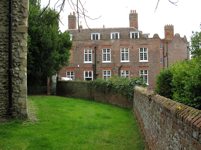
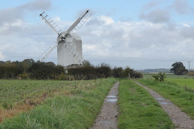
Knowlton Court

Knowlton Court is a Grade I listed manor house near Goodnestone, Kent, England that dates back to the Elizabethan period. The present front façade in the...

John Narborough

Admiral Sir John Narborough (or Narbrough, c. 1640–1688) was an English naval commander. He served with distinction in the Anglo-Dutch Wars and against...

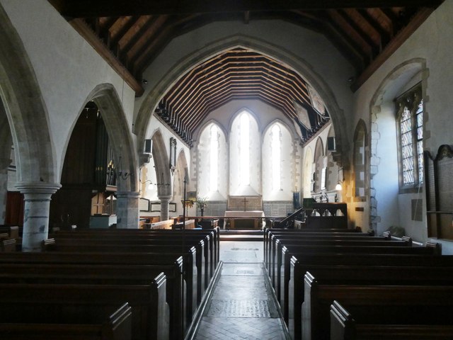
St Clement's Church, Knowlton

St Clement's Church is a redundant Anglican church in the village of Knowlton, Kent, England. It is recorded in the National Heritage List for England...

Nearby Amenities

Located within 500m of 51.226804,1.2491607
Power: pole
Lat/Long: 51.2283585/1.255538
Power: pole
Lat/Long: 51.2296107/1.2542304
Power: pole
Lat/Long: 51.2285647/1.2546761
Generator Output Electricity: yes
Generator Source: solar
Generator Type: solar_photovoltaic_panel
Location: roof
Power: generator
Lat/Long: 51.2249159/1.2532273
Beech Grove Bruderhof
Place: hamlet
Lat/Long: 51.2289712/1.2436144
The data included in this document is from www.openstreetmap.org. The data is made available under ODbL.

Have you been to St Alban's Downs?

Leave your review of St Alban's Downs below (or comments, questions and feedback).