Creteway Down

Downs, Moorland in Kent Shepway

England

Creteway Down

Forgiving Light, South Street A notice, affixed to a fence, located just beyond the man wearing the blue shirt, read:  

Let’s Play Plaza 

Welcome to the Plaza (not)!

The immediate area is the meeting point for all the ancient ways in and out of Folkestone.
 
The adjacent Triennial 2021 artwork, Forgiving Light, is part of a project to remind us of this by imagining how it could be were it to become pedestrian friendly, rather than traffic dominated.

Across the road the ‘Welcome to Folkestone’ messaging hub and the ‘Plinth on the Plaza’ also recall where several now-destroyed little streets converged.
A full exhibition giving the context of this idea is on display in the black building in the car park, Folkestone’s very own ‘Urban Room’ (aka ‘One the Plaza’) Open daily 11-5.
Forgiving Light, South Street Credit: John Baker

Creteway Down is a picturesque area located in Kent, England, renowned for its stunning natural beauty and diverse landscapes. Situated within the larger area known as the Kent Downs, Creteway Down offers visitors a unique experience of both downs and moorland scenery.

The downs in Creteway Down are characterized by rolling hills and open grasslands, providing visitors with breathtaking panoramic views of the surrounding countryside. The rich greenery and wildflowers that blanket the downs during the warmer months create a vibrant and colorful backdrop. These open spaces also offer ample opportunities for walking, hiking, and picnicking, making it a popular destination for outdoor enthusiasts.

In addition to the downs, Creteway Down features areas of moorland, which are characterized by heather, gorse, and bracken. This diverse landscape is home to a variety of wildlife, including rare bird species, butterflies, and small mammals. As a result, Creteway Down is a haven for nature lovers and birdwatchers, who flock to the area to observe and photograph the abundant wildlife.

The tranquil and peaceful ambiance of Creteway Down, combined with its natural beauty, makes it an ideal location for those seeking a break from the hustle and bustle of city life. Whether visitors are interested in exploring the downs, immersing themselves in the moorland, or simply enjoying the stunning vistas, Creteway Down offers a unique and captivating experience for all who visit.

If you have any feedback on the listing, please let us know in the comments section below.

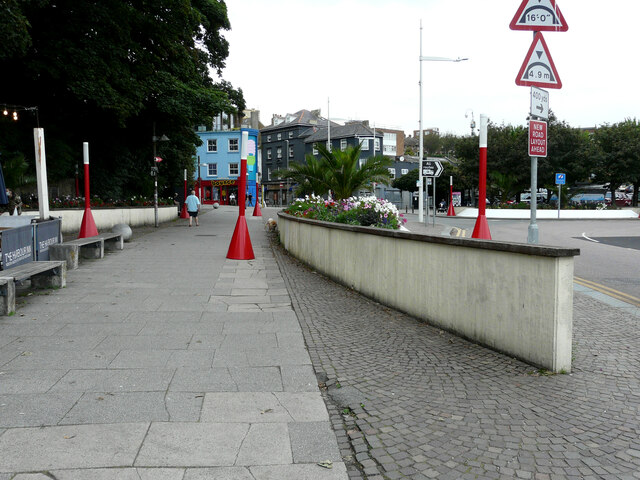
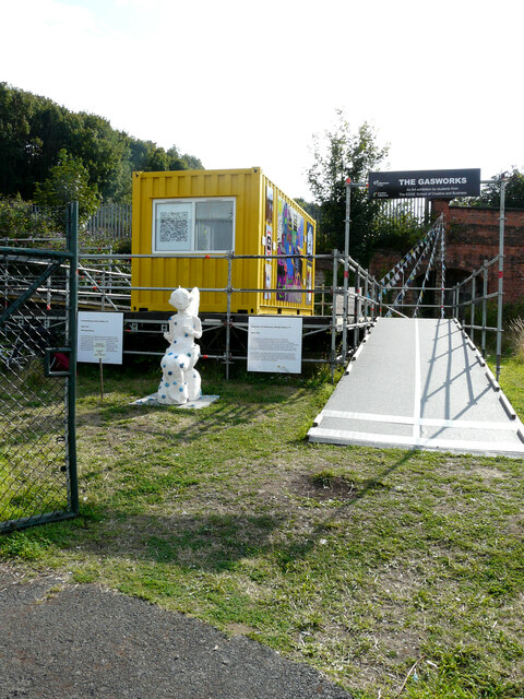
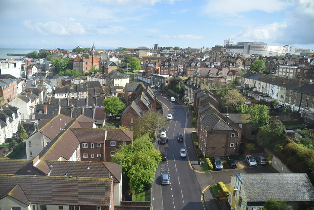
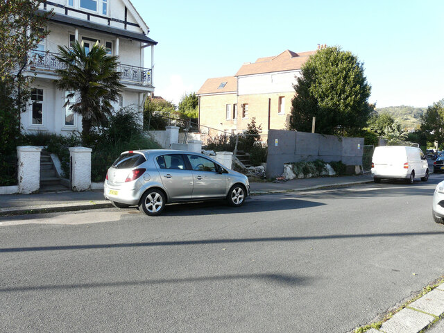
Creteway Down Images

Images are sourced within 2km of 51.09793/1.1851972 or Grid Reference TR2338. Thanks to Geograph Open Source API. All images are credited.

Forgiving Light, South Street A notice, affixed to a fence, located just beyond the man wearing the blue shirt, read:  

Let’s Play Plaza 

Welcome to the Plaza (not)!

The immediate area is the meeting point for all the ancient ways in and out of Folkestone.
 
The adjacent Triennial 2021 artwork, Forgiving Light, is part of a project to remind us of this by imagining how it could be were it to become pedestrian friendly, rather than traffic dominated.

Across the road the ‘Welcome to Folkestone’ messaging hub and the ‘Plinth on the Plaza’ also recall where several now-destroyed little streets converged.
A full exhibition giving the context of this idea is on display in the black building in the car park, Folkestone’s very own ‘Urban Room’ (aka ‘One the Plaza’) Open daily 11-5.
Forgiving Light, South Street
A notice, affixed to a fence, located just beyond the man wearing the blue shirt, read: Let’s Play Plaza Welcome to the Plaza (not)! The immediate area is the meeting point for all the ancient ways in and out of Folkestone. The adjacent Triennial 2021 artwork, Forgiving Light, is part of a project to remind us of this by imagining how it could be were it to become pedestrian friendly, rather than traffic dominated. Across the road the ‘Welcome to Folkestone’ messaging hub and the ‘Plinth on the Plaza’ also recall where several now-destroyed little streets converged. A full exhibition giving the context of this idea is on display in the black building in the car park, Folkestone’s very own ‘Urban Room’ (aka ‘One the Plaza’) Open daily 11-5.
THE GASWORKS, Foord Road North An art exhibition by the students from the EDGE School of Creative and Business, which is adjacent to <a href="https://www.geograph.org.uk/photo/4131391">TR2236 : ‘Green/Light’, Foord Road North</a>.
THE GASWORKS, Foord Road North
An art exhibition by the students from the EDGE School of Creative and Business, which is adjacent to TR2236 : ‘Green/Light’, Foord Road North.
Foord Rd
Foord Rd
Wear Bay Crescent There were <a href="https://www.geograph.org.uk/photo/6375199">TR2336 : Fire damaged houses, Wear Bay Crescent</a> in January 2020 but the fire-gutted house (number 19) has been demolished and hoarding erected.
Wear Bay Crescent
There were TR2336 : Fire damaged houses, Wear Bay Crescent in January 2020 but the fire-gutted house (number 19) has been demolished and hoarding erected.
21, Wear Bay Crescent A derelict site of <a href="https://www.geograph.org.uk/photo/6375821">TR2336 : Fire damaged houses, Wear Bay Crescent</a>.
21, Wear Bay Crescent
Wood Avenue Library The entrance to <a href="https://www.geograph.org.uk/photo/1290906">TR2237 : Wood Avenue Library</a>.

2022 opening times for the library were as follows:

Sunday: closed 
Monday: 10.00 am – 1.00pm, 2.00pm – 4.30pm
Tuesday: closed 
Wednesday: 9:30 – 1.00pm
Thursday: 10.00am – 1.00pm, 2.00 pm – 4.30 pm
Friday: 10.00am – 1.00pm, 2.00 pm – 4.30 pm
Saturday: 10.00am – 1.00pm
Wood Avenue Library
The entrance to TR2237 : Wood Avenue Library. 2022 opening times for the library were as follows: Sunday: closed Monday: 10.00 am – 1.00pm, 2.00pm – 4.30pm Tuesday: closed Wednesday: 9:30 – 1.00pm Thursday: 10.00am – 1.00pm, 2.00 pm – 4.30 pm Friday: 10.00am – 1.00pm, 2.00 pm – 4.30 pm Saturday: 10.00am – 1.00pm
Tontine Street looking north west
131, Black Bull Road These premises used to be occupied by Boomerang Printing Services.
131, Black Bull Road
These premises used to be occupied by Boomerang Printing Services.
Derelict-looking house, Black Bull Road It appears to have been the living accommodation for <a href="https://www.geograph.org.uk/photo/7112222">TR2237 : 133, Black Bull Road</a>.
Derelict-looking house, Black Bull Road
It appears to have been the living accommodation for TR2237 : 133, Black Bull Road.
133, Black Bull Road These premises, attached to <a href="https://www.geograph.org.uk/photo/7111254">TR2237 : Derelict-looking house, Black Bull Road</a>, used to be Wells pharmacy, which was permanently closed on 30 November 2020. However, there is an alternative nearby: Mistvale Chemist, whose premises are located at 127, Canterbury Road. This view of    <a href="https://www.geograph.org.uk/photo/7119440">TR2237 : Premises in Canterbury Road</a> shows the location of the chemist’s shop.
133, Black Bull Road
These premises, attached to TR2237 : Derelict-looking house, Black Bull Road, used to be Wells pharmacy, which was permanently closed on 30 November 2020. However, there is an alternative nearby: Mistvale Chemist, whose premises are located at 127, Canterbury Road. This view of TR2237 : Premises in Canterbury Road shows the location of the chemist’s shop.
Three Hills Sports Park, Cheriton Road Seen from Cornwallis Avenue, the view shows the ongoing development.   

Planning permission has been approved, with conditions, by Folkestone and Hythe District Council under application number Y18/1617/FH for the “installation of athletic running track and field events sports facility, pavilion and associated parking together with the relocation of dog walking facility”.

This is how <a href="https://www.geograph.org.uk/photo/6415564">TR2136 : Three Hills Sports Park, Cheriton Road</a> looked in March 2020.
Three Hills Sports Park, Cheriton Road
Seen from Cornwallis Avenue, the view shows the ongoing development. Planning permission has been approved, with conditions, by Folkestone and Hythe District Council under application number Y18/1617/FH for the “installation of athletic running track and field events sports facility, pavilion and associated parking together with the relocation of dog walking facility”. This is how TR2136 : Three Hills Sports Park, Cheriton Road looked in March 2020.
Three Hills Sports Park, Cheriton Road Seen from Cornwallis Avenue, the view shows the ongoing development.   

Planning permission has been approved, with conditions, by Folkestone and Hythe District Council under application number Y18/1617/FH for the “installation of athletic running track and field events sports facility, pavilion and associated parking together with the relocation of dog walking facility”.

See also <a href="https://www.geograph.org.uk/photo/7115060">TR2136 : Three Hills Sports Park, Cheriton Road</a>.
Three Hills Sports Park, Cheriton Road
Seen from Cornwallis Avenue, the view shows the ongoing development. Planning permission has been approved, with conditions, by Folkestone and Hythe District Council under application number Y18/1617/FH for the “installation of athletic running track and field events sports facility, pavilion and associated parking together with the relocation of dog walking facility”. See also TR2136 : Three Hills Sports Park, Cheriton Road.
Greenside View, Cornwallis Avenue The development is being constructed in the <a href="https://www.geograph.org.uk/photo/6415579">TR2136 : Grounds of Folkestone Sports Centre</a>.

 Planning permission has been approved, with conditions, by Folkestone and Hythe District Council under application number Y17/1595/SH for the “erection of 12, two storey dwellings off Cornwallis Avenue, together with formation of an aerial trek course and erection of a proposed snow sports and outdoor activities facility at Folkestone Sports Centre and associated parking and landscaping”.
Greenside View, Cornwallis Avenue
The development is being constructed in the TR2136 : Grounds of Folkestone Sports Centre. Planning permission has been approved, with conditions, by Folkestone and Hythe District Council under application number Y17/1595/SH for the “erection of 12, two storey dwellings off Cornwallis Avenue, together with formation of an aerial trek course and erection of a proposed snow sports and outdoor activities facility at Folkestone Sports Centre and associated parking and landscaping”.
'Electric Blue-bird' descending Folkestone Harbour Branch, 2008 After one of the 'last trains' had departed, this cavalcade of three class 73 electro-diesels appeared. 73 204, 73 205 and 73 209 were running on diesel as the third rail supply had been turned off some years previously, in fact the rail had been removed uphill from this location at Warren Road level crossing.
'Electric Blue-bird' descending Folkestone Harbour Branch, 2008
After one of the 'last trains' had departed, this cavalcade of three class 73 electro-diesels appeared. 73 204, 73 205 and 73 209 were running on diesel as the third rail supply had been turned off some years previously, in fact the rail had been removed uphill from this location at Warren Road level crossing.
Premises in Canterbury Road Mace corner shop (number 129a), Coral bookmakers (number 129) and Mistvale Chemist (number 131).
Premises in Canterbury Road
Mace corner shop (number 129a), Coral bookmakers (number 129) and Mistvale Chemist (number 131).
Greenside View, Cornwallis Avenue The development is being constructed in the <a href="https://www.geograph.org.uk/photo/6415579">TR2136 : Grounds of Folkestone Sports Centre</a>.

This was a similar view of <a href="https://www.geograph.org.uk/photo/7118190">TR2136 : Greenside View, Cornwallis Avenue</a> photographed in February 2022.
Greenside View, Cornwallis Avenue
The development is being constructed in the TR2136 : Grounds of Folkestone Sports Centre. This was a similar view of TR2136 : Greenside View, Cornwallis Avenue photographed in February 2022.
Show me another place!

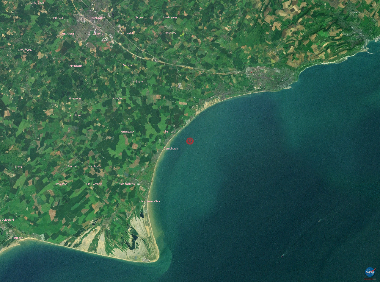
Creteway Down is located at Grid Ref: TR2338 (Lat: 51.09793, Lng: 1.1851972)

Administrative County: Kent

District: Shepway

Police Authority: Kent

What 3 Words

///originate.javelin.mystified. Near Capel le Ferne, Kent

Nearby Locations

Creteway Down

Related Wikis

2007 Kent earthquake

The 2007 Kent earthquake registered 4.3 on the Richter scale and struck south east Kent, South East England on 28 April 2007 at 07:18:12 UTC (08:18:12...

Folkestone East railway station

Folkestone East is a former railway station in Folkestone, England. Opened by the South Eastern Railway in 1843 as part of its main line from London, it...

Capel-le-Ferne

Capel-le-Ferne is a village on the White Cliffs of Dover, near Folkestone in Kent, England. Its name derives from a medieval French term meaning "chapel...

Folkestone Roman Villa

Folkestone Roman Villa, also referred to as the East Bay Site, is a villa built during the Roman Occupation of Britain, and is located in East Wear Bay...

Nearby Amenities

Located within 500m of 51.09793,1.1851972
Crossing
Crossing: traffic_signals
Crossing Ref: pelican
Source: survey
Traffic Signals Sound: yes
Lat/Long: 51.0949019/1.1819224
Traffic Calming: hump
Lat/Long: 51.0947517/1.1846462
Traffic Calming: hump
Lat/Long: 51.0945041/1.1853915
Crossing
Crossing: traffic_signals
Crossing Ref: pelican
Source: survey
Traffic Signals Sound: yes
Lat/Long: 51.0948355/1.1820705
Traffic Calming: hump
Lat/Long: 51.0940888/1.1840048
Traffic Calming: hump
Lat/Long: 51.0938638/1.1848448
Turning Circle
Lat/Long: 51.0965704/1.183062
Millennium Milepost Crete Road East
Description: 1) Folkestone 0.75 2) Dover 6.25
Image: https://www.cyclestreets.net/location/185607/cyclestreets185607.jpg
Information: guidepost
Ncn Milepost: mills
Source: survey
Sustrans Ref: MP 296
Tourism: information
Lat/Long: 51.0974292/1.1904935
Crossing
Crossing: unmarked
Kerb: lowered
Tactile Paving: yes
Lat/Long: 51.0944005/1.1812302
Communication Radio: yes
Height: 45
Man Made: tower
Tower Construction: lattice
Tower Type: communication
Lat/Long: 51.0997428/1.1825206
Bus Stop
Holywell Avenue
Bus: yes
Local Ref: opp
Naptan AtcoCode: 2400100155
Naptan Bearing: SE
Naptan BusStopType: CUS
Naptan CommonName: Holywell Avenue
Naptan Indicator: opp
Naptan Landmark: Holywell Avenue
Naptan NaptanCode: kntgwdap
Naptan PlusbusZoneRef: FLKSTNC
Naptan RevisionNumber: 1
Naptan Status: act
Naptan Street: Canterbury Road
Naptan Verified: no
Public Transport: platform
Ref: kntgwdap
Source: naptan_import
Source Date: 2018-04-10
Lat/Long: 51.0956159/1.180402
Bus Stop
Holywell Avenue
Bus: yes
Local Ref: adj
Naptan AtcoCode: 2400A029040A
Naptan Bearing: NW
Naptan BusStopType: MKD
Naptan CommonName: Holywell Avenue
Naptan Indicator: adj
Naptan Landmark: Holywell Avenue
Naptan NaptanCode: kntdgpma
Naptan PlusbusZoneRef: FLKSTNC
Naptan RevisionNumber: 3
Naptan Status: act
Naptan Street: Canterbury Road
Naptan Verified: no
Public Transport: platform
Ref: kntdgpma
Shelter: yes
Source: naptan_import
Source Date: 2018-04-10
Lat/Long: 51.0957846/1.179824
Bus Stop
Creteway Down
Bus: yes
Local Ref: adj
Naptan AtcoCode: 2400A029330A
Naptan Bearing: E
Naptan BusStopType: MKD
Naptan CommonName: Creteway Down
Naptan Indicator: adj
Naptan Landmark: Creteway Down
Naptan NaptanCode: kntdgtdg
Naptan PlusbusZoneRef: FLKSTNC
Naptan RevisionNumber: 3
Naptan Status: act
Naptan Street: Hill Road
Naptan Verified: no
Public Transport: platform
Ref: kntdgtdg
Shelter: yes
Source: naptan_import
Source Date: 2018-04-13
Lat/Long: 51.0947991/1.1855945
Bus Stop
Dover Hill
Bus: yes
Local Ref: E-bound
Naptan AtcoCode: 2400A030210A
Naptan Bearing: E
Naptan BusStopType: MKD
Naptan CommonName: Dover Hill
Naptan Indicator: E-bound
Naptan Landmark: Creteway Down
Naptan NaptanCode: kntdgwtp
Naptan PlusbusZoneRef: FLKSTNC
Naptan RevisionNumber: 3
Naptan Status: act
Naptan Street: Dover Hill
Naptan Verified: no
Public Transport: platform
Ref: kntdgwtp
Source: naptan_import
Source Date: 2009-06-03
Lat/Long: 51.094405/1.1881831
Turning Circle
Lat/Long: 51.093865/1.1825246
Post Box
Postal Code: CT19
Ref: CT19 30
Source: survey
Lat/Long: 51.0950877/1.1845695
Turning Circle
Lat/Long: 51.0939658/1.1851314
Tourism: artwork
Lat/Long: 51.0975517/1.187428
Traffic Calming: hump
Lat/Long: 51.0935088/1.1855618
Traffic Calming: hump
Lat/Long: 51.0941932/1.1860941
Traffic Calming: hump
Lat/Long: 51.0948361/1.1837908
Traffic Calming: hump
Lat/Long: 51.093787/1.1866983
Noexit: yes
Lat/Long: 51.0935682/1.1836428
Traffic Calming: hump
Lat/Long: 51.0940052/1.1832712
Traffic Calming: hump
Lat/Long: 51.0944352/1.1831008
Barrier: stile
Bicycle: no
Foot: yes
Material: wood
Stile: stepover
Lat/Long: 51.0990972/1.1848852
Barrier: kissing_gate
Bicycle: no
Foot: yes
Material: metal
Lat/Long: 51.0991513/1.1845067
Crossing
Crossing: unmarked
Lat/Long: 51.0947692/1.1865917
Crossing
Crossing: unmarked
Kerb: lowered
Tactile Paving: yes
Lat/Long: 51.095515/1.1801192
Turning Circle
Lat/Long: 51.0971152/1.1810107
Crossing
Crossing: unmarked
Crossing Island: yes
Kerb Left: lowered
Kerb Right: raised
Tactile Paving: o
Lat/Long: 51.0954508/1.1804913
Crossing
Crossing: unmarked
Kerb Left: lowered
Kerb Right: raised
Tactile Paving: no
Lat/Long: 51.0954178/1.180402
Generator Method: photovoltaic
Generator Output Electricity: yes
Generator Source: solar
Generator Type: solar_photovoltaic_panel
Location: roof
Power: generator
Lat/Long: 51.0948433/1.187304
Generator Method: photovoltaic
Generator Output Electricity: yes
Generator Source: solar
Generator Type: solar_photovoltaic_panel
Location: roof
Power: generator
Lat/Long: 51.095085/1.1851931
Generator Method: photovoltaic
Generator Output Electricity: yes
Generator Source: solar
Generator Type: solar_photovoltaic_panel
Location: roof
Power: generator
Lat/Long: 51.0954616/1.1861238
Generator Method: photovoltaic
Generator Output Electricity: yes
Generator Source: solar
Generator Type: solar_photovoltaic_panel
Location: roof
Power: generator
Lat/Long: 51.0954338/1.1839445
Generator Method: photovoltaic
Generator Output Electricity: yes
Generator Source: solar
Generator Type: solar_photovoltaic_panel
Location: roof
Power: generator
Lat/Long: 51.0951828/1.1839566
Generator Method: photovoltaic
Generator Output Electricity: yes
Generator Source: solar
Generator Type: solar_photovoltaic_panel
Location: roof
Power: generator
Lat/Long: 51.0951946/1.1836374
Generator Method: photovoltaic
Generator Output Electricity: yes
Generator Source: solar
Generator Type: solar_photovoltaic_panel
Location: roof
Power: generator
Lat/Long: 51.0951887/1.1829132
Generator Method: photovoltaic
Generator Output Electricity: yes
Generator Source: solar
Generator Type: solar_photovoltaic_panel
Location: roof
Power: generator
Lat/Long: 51.0951533/1.1819141
Generator Method: photovoltaic
Generator Output Electricity: yes
Generator Source: solar
Generator Type: solar_photovoltaic_panel
Location: roof
Power: generator
Lat/Long: 51.0951609/1.1818564
Generator Method: photovoltaic
Generator Output Electricity: yes
Generator Source: solar
Generator Type: solar_photovoltaic_panel
Location: roof
Power: generator
Lat/Long: 51.0998561/1.1815399
Generator Method: photovoltaic
Generator Output Electricity: yes
Generator Source: solar
Generator Type: solar_photovoltaic_panel
Location: roof
Power: generator
Lat/Long: 51.0952409/1.1796785
Generator Method: photovoltaic
Generator Output Electricity: yes
Generator Source: solar
Generator Type: solar_photovoltaic_panel
Location: roof
Power: generator
Lat/Long: 51.0956991/1.1792869
Grit Bin
Lat/Long: 51.0955612/1.1800159
Camera Angle: 15
Camera Direction: 330
Camera Mount: pole
Camera Type: fixed
Height: 5
Man Made: surveillance
Surveillance: public
Surveillance Type: camera
Surveillance Zone: traffic
Lat/Long: 51.0952343/1.1805242
Camera Angle: 15
Camera Direction: 110
Camera Mount: pole
Camera Type: fixed
Height: 5
Man Made: surveillance
Surveillance: public
Surveillance Type: camera
Surveillance Zone: traffic
Lat/Long: 51.0952356/1.1805391
Waste Basket
Waste: trash
Lat/Long: 51.0956854/1.1799365
Grit Bin
Lat/Long: 51.0944132/1.1814056
Barrier: stile
Bicycle: no
Foot: yes
Material: wood
Stile: stepover
Lat/Long: 51.0970623/1.1913911
Barrier: kissing_gate
Bicycle: no
Foot: yes
Material: wood
Lat/Long: 51.099011/1.1851939
Barrier: kissing_gate
Bicycle: no
Foot: yes
Material: wood
Lat/Long: 51.0994469/1.1825228
Cow Tank
Note: DE:Viehtränke
Lat/Long: 51.0975373/1.1899859
Wingate Hill
Place: locality
Lat/Long: 51.097325/1.1791993
Creteway Down
Place: locality
Lat/Long: 51.098203/1.1842701
Crossing
Crossing: unmarked
Lat/Long: 51.0956544/1.1827611
Crossing
Crossing: unmarked
Lat/Long: 51.0955095/1.1852422
Crossing
Crossing: unmarked
Lat/Long: 51.0961702/1.185288
Crossing
Crossing: unmarked
Lat/Long: 51.0956832/1.1839974
Crossing
Crossing: unmarked
Lat/Long: 51.095057/1.1850319
Crossing
Crossing: unmarked
Lat/Long: 51.0949487/1.1851609
Crossing
Crossing: unmarked
Lat/Long: 51.0951743/1.1868344
Crossing
Crossing: unmarked
Lat/Long: 51.0956187/1.1851138
Barrier: kissing_gate
Lat/Long: 51.0955404/1.19014
Marker: post
Material: plastic
Source Position: gps
Utility: power
Lat/Long: 51.0938754/1.1869396
Barrier: kissing_gate
Lat/Long: 51.0966183/1.1893833
Communication Satellite: yes
Man Made: antenna
Lat/Long: 51.0997507/1.1826974
The data included in this document is from www.openstreetmap.org. The data is made available under ODbL.

Have you been to Creteway Down?

Leave your review of Creteway Down below (or comments, questions and feedback).