Whitwell Common

Downs, Moorland in Norfolk Broadland

England

Whitwell Common

Head Shunt The station yard of the heritage Whitwell & Reepham Railway
Head Shunt Credit: Kevin Waterhouse

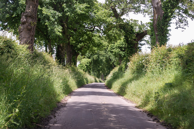
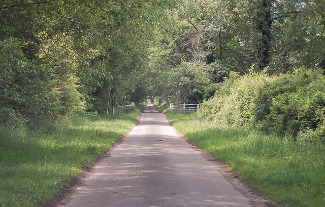
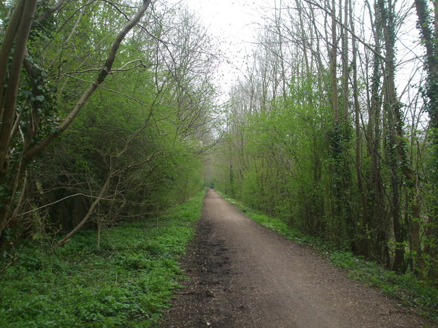
Whitwell Common is a picturesque area located in the county of Norfolk, England. Spanning over an expansive area of downs and moorland, it serves as a popular destination for nature enthusiasts and outdoor adventurers alike.

The common is characterized by its rolling hills, vast open spaces, and a diverse range of flora and fauna. Covered in heather, gorse, and grasses, the moorland offers a vibrant display of colors throughout the year, attracting visitors from far and wide. The area is also home to a variety of bird species, including skylarks, stonechats, and curlews, making it a haven for birdwatchers.

Whitwell Common is intersected by various footpaths and trails, offering visitors the opportunity to explore its natural beauty. These paths wind through the hills and valleys, providing stunning panoramic views of the surrounding countryside. Additionally, the common is crisscrossed by numerous streams and small ponds, adding to its charm and providing a habitat for amphibians and other aquatic creatures.

The common is easily accessible and has ample parking facilities, making it a convenient destination for both locals and tourists. It is a designated site of Special Scientific Interest (SSSI) due to its unique and ecologically significant features. As such, visitors are encouraged to respect and preserve the natural environment by following designated paths and refraining from littering.

With its idyllic landscapes and abundant wildlife, Whitwell Common offers a serene and tranquil escape from the hustle and bustle of everyday life, making it a must-visit destination for nature lovers and outdoor enthusiasts in Norfolk.

If you have any feedback on the listing, please let us know in the comments section below.

Whitwell Common Images

Images are sourced within 2km of 52.740213/1.0898079 or Grid Reference TG0820. Thanks to Geograph Open Source API. All images are credited.

Head Shunt The station yard of the heritage Whitwell & Reepham Railway
Head Shunt
The station yard of the heritage Whitwell & Reepham Railway
Station Entrance On the heritage Whitwell & Reepham Railway
Station Entrance
On the heritage Whitwell & Reepham Railway
Reepham: Collecting the baled straw from a harvested cereal crop
Reepham: Harvested cereal crop
Unnamed lane near Great Witchingham Heading towards Whitwell.
Unnamed lane near Great Witchingham
Heading towards Whitwell.
Blackwater Lane towards Sparham
Mill Road, Whitwell At the junction with Mill Road
Mill Road, Whitwell
At the junction with Mill Road
Mill Road & footpath Near Malthouse Farm
Mill Road & footpath
Near Malthouse Farm
St Mary, Sparham, Norfolk
St Mary, Sparham, Norfolk - East end
Clayhall Farm near Great Witchingham As agriculture becomes more and more mechanised, indeed industrialised, farms like this one are becoming more common.
Clayhall Farm near Great Witchingham
As agriculture becomes more and more mechanised, indeed industrialised, farms like this one are becoming more common.
Great Witchingham Wildlife Park is now "The Animal Ark" This park has changed its approach and you will be redirected. The focus is now on pets and farm animals.  This photo is taken from the car park.
Great Witchingham Wildlife Park is now "The Animal Ark"
This park has changed its approach and you will be redirected. The focus is now on pets and farm animals. This photo is taken from the car park.
House at Windy Ridge Although this track appeared to go through to the Sparham - Lyng road, it terminated in a scrapyard at the end of a wood, where strongly-worded Keep Out signs were displayed.
House at Windy Ridge
Although this track appeared to go through to the Sparham - Lyng road, it terminated in a scrapyard at the end of a wood, where strongly-worded Keep Out signs were displayed.
Marriott's Way near Blackwater, looking south-east This section of the Way (footpath and cycleway) is close to the point where it loops back towards Reepham at Themelthorpe <a href="https://www.geograph.org.uk/gridref/TG0623">TG0623</a>. It is close to the weak bridge in <a href="https://www.geograph.org.uk/gridref/TG0920">TG0920</a>.
Marriott's Way near Blackwater, looking south-east
This section of the Way (footpath and cycleway) is close to the point where it loops back towards Reepham at Themelthorpe TG0623. It is close to the weak bridge in TG0920.
Nowhere Lane meets A1067 at Sparhamhill Just down Nowhere Lane on the right is <a href="https://www.geograph.org.uk/photo/527929">TG0819 : Great Witchingham Wildlife Park is now "The Animal Ark"</a>.
Nowhere Lane meets A1067 at Sparhamhill
Dead-end track at Windy Ridge Just past <a href="https://www.geograph.org.uk/photo/527935">TG0818 : House at Windy Ridge</a>, this track leads into a private yard, despite hopeful indications on OS maps of a through-way.
Dead-end track at Windy Ridge
Just past TG0818 : House at Windy Ridge, this track leads into a private yard, despite hopeful indications on OS maps of a through-way.
House on the corner House at the junction of The Street and Church Lane.
House on the corner
House at the junction of The Street and Church Lane.
Show me another place!

Whitwell Common is located at Grid Ref: TG0820 (Lat: 52.740213, Lng: 1.0898079)

Administrative County: Norfolk

District: Broadland

Police Authority: Norfolk

What 3 Words

///prelude.shuffle.branching. Near Reepham, Norfolk

Nearby Locations

Blackwater Whitwell Common

Related Wikis

Whitwell Common SSSI

Whitwell Common is a 19.4-hectare (48-acre) biological Site of Special Scientific Interest north-east of Dereham in Norfolk. This common in the valley...

Whitwell & Reepham railway station

Whitwell and Reepham railway station, also known as Whitwell station, is a former station situated in Norfolk, England. The station closed in 1959 and...

A1067 road

The A1067 is an English A road entirely in the county of Norfolk. It runs from Fakenham Northern By-Pass (A148) to Norwich inner ring road (A147). �...

Sparham

Sparham is a village and civil parish in Norfolk, England. It covers an area of 7.22 km2 (2.79 sq mi) and had a population of 291 in 109 households at...

Nearby Amenities

Located within 500m of 52.740213,1.0898079
Give Way
Lat/Long: 52.7417206/1.086662
Nowhere
Place: locality
Lat/Long: 52.7395569/1.0826808
Whitwell Common Information Box
Booth: KX100
Covered: booth
Description: Information on Whitwell Common and the area
Disused Amenity: telephone
Information: nature
Man Made: telephone_box
Operator: Whitwell Common Trustees
Tourism: information
Lat/Long: 52.7414833/1.0858531
Give Way
Lat/Long: 52.7420017/1.085788
Give Way
Lat/Long: 52.7414821/1.0855377
Give Way
Lat/Long: 52.7419806/1.0858516
Barrier: kissing_gate
Foot: yes
Lat/Long: 52.7414071/1.0857817
Parking
Access: yes
Fee: no
Parking: surface
Surface: ground
Lat/Long: 52.7414586/1.0857804
Whitwell Common, Open Access Land
Leisure: nature_reserve
Place: locality
Website: http://www.lyngonline.org.uk/whitwell-common.html
Lat/Long: 52.7411814/1.0859527
Barrier: stile
Bicycle: no
Foot: yes
Lat/Long: 52.7394682/1.089111
Power: pole
Lat/Long: 52.7417529/1.09101
Barrier: stile
Bicycle: yes
Foot: yes
Material: wood
Stile: stepover
Lat/Long: 52.7402712/1.0882527
Barrier: stile
Bicycle: no
Foot: yes
Material: metal
Stile: squeezer
Lat/Long: 52.7414314/1.087783
Bench
Inscription: seeds like words broadcast
Material: wood
Seats: 3
Lat/Long: 52.7429107/1.0942427
The data included in this document is from www.openstreetmap.org. The data is made available under ODbL.

Have you been to Whitwell Common?

Leave your review of Whitwell Common below (or comments, questions and feedback).