Wye Downs

Downs, Moorland in Kent Ashford

England

Wye Downs

Listed monument Listed buildings and structures are officially designated as being of special architectural, historical or cultural significance. There are over half a million listed structures in the United Kingdom, covered by around 375,000 listings.
Listed status is more commonly associated with buildings or groups of buildings, however it can cover many other structures, including bridges, headstones, steps, ponds, monuments, walls, phone boxes, wrecks, parks, and heritage sites, and in more recent times a road crossing (Abbey Road) and graffiti art (Banksy 'Spy-booth') have been included.

In England and Wales there are three main listing designations;
Grade I (2.5%) - exceptional interest, sometimes considered to be internationally important.
Grade II* (5.5%) - particularly important buildings of more than special interest. 
Grade II (92%) - nationally important and of special interest. 

There are also locally listed structures (at the discretion of local authorities) using A, B and C designations.

In Scotland three classifications are also used but the criteria are different. There are around 47,500 Listed buildings.
Category A (8%)- generally equivalent to Grade I and II* in England and Wales
Category B (51%)- this appears generally to cover the ground of Grade II, recognising national importance.
Category C (41%)- buildings of local importance, probably with some overlap with English Grade II.

In Northern Ireland the criteria are similar to Scotland, but the classifications are:
Grade A (2.3%)
Grade B+ (4.7%)
Grade B (93%)

Read more at Wikipedia <span class="nowrap"><a title="http://en.wikipedia.org/wiki/Listed_building" rel="nofollow ugc noopener" href="http://en.wikipedia.org/wiki/Listed_building">Link</a><img style="margin-left:2px;" alt="External link" title="External link - shift click to open in new window" src="https://s1.geograph.org.uk/img/external.png" width="10" height="10"/></span>
Listed monument Credit: N Chadwick

Wye Downs, located in Kent, England, is a picturesque area of natural beauty known for its stunning woodlands, rolling hills, and wide-open moorland. Covering an area of approximately 1,100 hectares, the site is a designated Area of Outstanding Natural Beauty (AONB) and is managed by the National Trust.

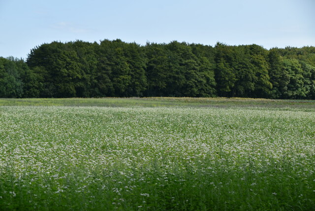
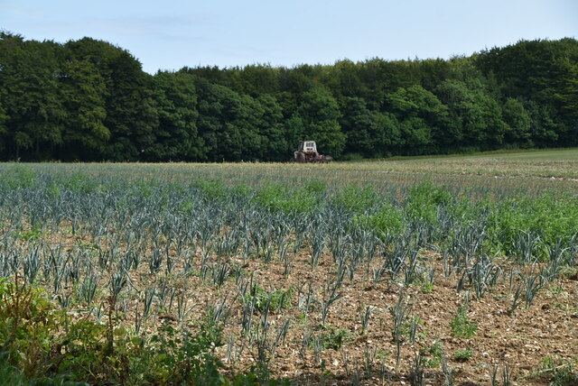
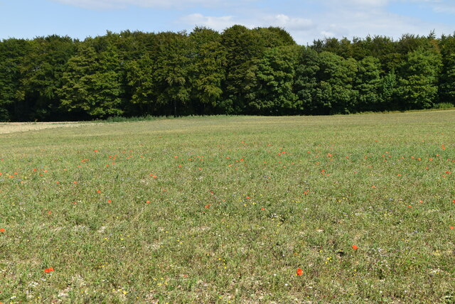
The landscape of Wye Downs is characterized by its chalk grassland, which supports a diverse range of plant species, including orchids, wildflowers, and rare grasses. This rich biodiversity makes it a haven for wildlife, with numerous species of birds, butterflies, and insects thriving in the area.

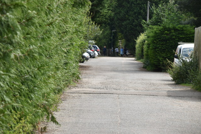
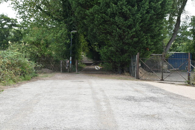
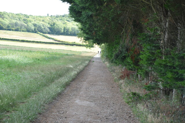
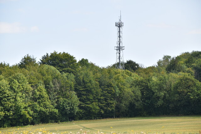
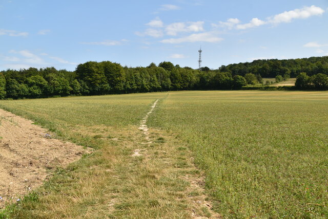
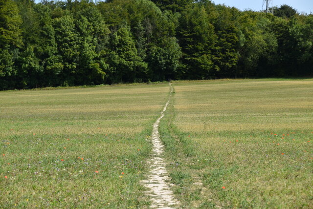
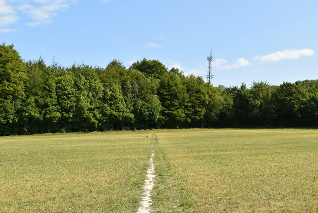
The woodlands in Wye Downs are predominantly composed of beech trees, creating a dense and enchanting canopy that provides shelter for various woodland animals, such as deer and foxes. The woodlands are also home to a network of walking trails, offering visitors the opportunity to explore the area and enjoy the tranquility of nature.

The moorland, on the other hand, offers a more open and expansive landscape, with panoramic views across the surrounding countryside. It is a popular spot for hikers, dog walkers, and nature enthusiasts, who can enjoy the sense of vastness and uninterrupted views.

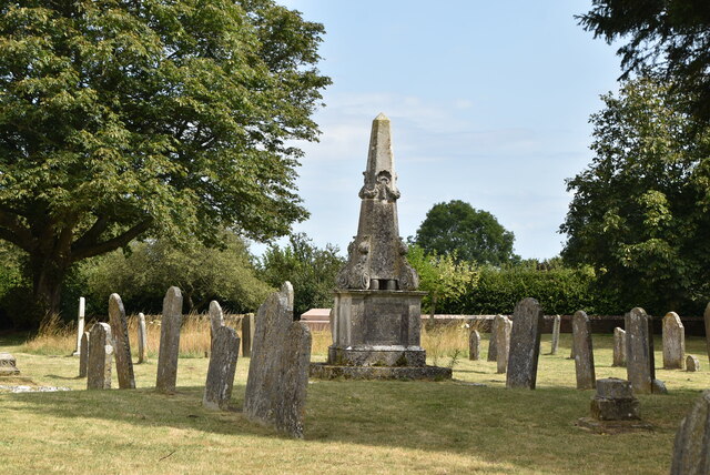
The site is also of historical and archaeological significance, with traces of ancient settlements and burial mounds dating back thousands of years. These historical features add an extra layer of intrigue to the already captivating landscape of Wye Downs.

Overall, Wye Downs in Kent offers visitors a chance to immerse themselves in the beauty of nature, with its woodlands, moorland, and rich biodiversity providing a haven of tranquility and natural wonder.

If you have any feedback on the listing, please let us know in the comments section below.

Wye Downs Images

Images are sourced within 2km of 51.178313/0.96518269 or Grid Reference TR0746. Thanks to Geograph Open Source API. All images are credited.

Listed monument Listed buildings and structures are officially designated as being of special architectural, historical or cultural significance. There are over half a million listed structures in the United Kingdom, covered by around 375,000 listings.
Listed status is more commonly associated with buildings or groups of buildings, however it can cover many other structures, including bridges, headstones, steps, ponds, monuments, walls, phone boxes, wrecks, parks, and heritage sites, and in more recent times a road crossing (Abbey Road) and graffiti art (Banksy 'Spy-booth') have been included.

In England and Wales there are three main listing designations;
Grade I (2.5%) - exceptional interest, sometimes considered to be internationally important.
Grade II* (5.5%) - particularly important buildings of more than special interest. 
Grade II (92%) - nationally important and of special interest. 

There are also locally listed structures (at the discretion of local authorities) using A, B and C designations.

In Scotland three classifications are also used but the criteria are different. There are around 47,500 Listed buildings.
Category A (8%)- generally equivalent to Grade I and II* in England and Wales
Category B (51%)- this appears generally to cover the ground of Grade II, recognising national importance.
Category C (41%)- buildings of local importance, probably with some overlap with English Grade II.

In Northern Ireland the criteria are similar to Scotland, but the classifications are:
Grade A (2.3%)
Grade B+ (4.7%)
Grade B (93%)

Read more at Wikipedia <span class="nowrap"><a title="http://en.wikipedia.org/wiki/Listed_building" rel="nofollow ugc noopener" href="http://en.wikipedia.org/wiki/Listed_building">Link</a><img style="margin-left:2px;" alt="External link" title="External link - shift click to open in new window" src="https://s1.geograph.org.uk/img/external.png" width="10" height="10"/></span>
Listed monument
Listed buildings and structures are officially designated as being of special architectural, historical or cultural significance. There are over half a million listed structures in the United Kingdom, covered by around 375,000 listings. Listed status is more commonly associated with buildings or groups of buildings, however it can cover many other structures, including bridges, headstones, steps, ponds, monuments, walls, phone boxes, wrecks, parks, and heritage sites, and in more recent times a road crossing (Abbey Road) and graffiti art (Banksy 'Spy-booth') have been included. In England and Wales there are three main listing designations; Grade I (2.5%) - exceptional interest, sometimes considered to be internationally important. Grade II* (5.5%) - particularly important buildings of more than special interest. Grade II (92%) - nationally important and of special interest. There are also locally listed structures (at the discretion of local authorities) using A, B and C designations. In Scotland three classifications are also used but the criteria are different. There are around 47,500 Listed buildings. Category A (8%)- generally equivalent to Grade I and II* in England and Wales Category B (51%)- this appears generally to cover the ground of Grade II, recognising national importance. Category C (41%)- buildings of local importance, probably with some overlap with English Grade II. In Northern Ireland the criteria are similar to Scotland, but the classifications are: Grade A (2.3%) Grade B+ (4.7%) Grade B (93%) Read more at Wikipedia LinkExternal link
Wye College The College of St. Gregory and St. Martin at Wye, more commonly known as Wye College. It was founded in 1447 by John Kempe, the Archbishop of York, as a college for the training of priests. In 1894, the school moved to new premises, and the South Eastern Agricultural College was established in the buildings. In 1898 Wye became a School of Agriculture within the University of London. Wye College was until 2005 a well-known study and research centre in the fields of Rural business and management, biological sciences, the environment and agriculture.  The College was officially closed in September 2009.
Wye College
The College of St. Gregory and St. Martin at Wye, more commonly known as Wye College. It was founded in 1447 by John Kempe, the Archbishop of York, as a college for the training of priests. In 1894, the school moved to new premises, and the South Eastern Agricultural College was established in the buildings. In 1898 Wye became a School of Agriculture within the University of London. Wye College was until 2005 a well-known study and research centre in the fields of Rural business and management, biological sciences, the environment and agriculture. The College was officially closed in September 2009.
Wye Court Cottages
Wye Court Cottages
Wye College The College of St. Gregory and St. Martin at Wye, more commonly known as Wye College. It was founded in 1447 by John Kempe, the Archbishop of York, as a college for the training of priests. In 1894, the school moved to new premises, and the South Eastern Agricultural College was established in the buildings. In 1898 Wye became a School of Agriculture within the University of London. Wye College was until 2005 a well-known study and research centre in the fields of Rural business and management, biological sciences, the environment and agriculture.  The College was officially closed in September 2009.
Wye College
The College of St. Gregory and St. Martin at Wye, more commonly known as Wye College. It was founded in 1447 by John Kempe, the Archbishop of York, as a college for the training of priests. In 1894, the school moved to new premises, and the South Eastern Agricultural College was established in the buildings. In 1898 Wye became a School of Agriculture within the University of London. Wye College was until 2005 a well-known study and research centre in the fields of Rural business and management, biological sciences, the environment and agriculture. The College was officially closed in September 2009.
Olantigh Rd
Olantigh Rd
Occupation Rd
Occupation Rd
Occupation Rd
Occupation Rd
End of Occupation Rd
Arable land
Arable land
North Downs Way A long distance path in southern England. It runs from Farnham to Dover, past Godalming, Guildford, Dorking, Merstham, Otford and Rochester, along the Surrey Hills Area of Outstanding Natural Beauty (AONB) and Kent Downs AONB. East of Boughton Lees, the path splits in two, the northern section running via Canterbury and the southern via Wye. The two sections of the path reunite at Dover. The northern route is 211 km long, and the southern route 201 km, the total length of the North Downs Way being 246 km.
The pathway is mixed in that it varies throughout its length from footpath status to bridleway, byway and road. Some 19% of the Way follows roads, though 75% of those are minor lanes. It is marked by an acorn. See <a href="https://www.geograph.org.uk/photo/1165027">TQ6561 : Crossover in Long Distance pathways</a>.
See <span class="nowrap"><a title="http://www.nationaltrail.co.uk/Northdowns/" rel="nofollow ugc noopener" href="http://www.nationaltrail.co.uk/Northdowns/">Link</a><img style="margin-left:2px;" alt="External link" title="External link - shift click to open in new window" src="https://s1.geograph.org.uk/img/external.png" width="10" height="10"/></span> for more details and an interactive map of the trail.
North Downs Way
A long distance path in southern England. It runs from Farnham to Dover, past Godalming, Guildford, Dorking, Merstham, Otford and Rochester, along the Surrey Hills Area of Outstanding Natural Beauty (AONB) and Kent Downs AONB. East of Boughton Lees, the path splits in two, the northern section running via Canterbury and the southern via Wye. The two sections of the path reunite at Dover. The northern route is 211 km long, and the southern route 201 km, the total length of the North Downs Way being 246 km. The pathway is mixed in that it varies throughout its length from footpath status to bridleway, byway and road. Some 19% of the Way follows roads, though 75% of those are minor lanes. It is marked by an acorn. See TQ6561 : Crossover in Long Distance pathways. See LinkExternal link for more details and an interactive map of the trail.
Field of leeks
Field of leeks
Mast near Wye
Mast near Wye
Stour Valley Walk The Stour Valley Walk is a 58 mile (93km) route through the Low Weald and North Downs, giving you access to some the most attractive parts of East Kent. Rolling grassland, woods, marshes, peat bog, orchards and picturesque villages make this a memorable journey which can be completed over a long weekend or in shorter sections. The symbol of the Stour Valley Walk is the heron.
See <span class="nowrap"><a title="http://www.kent.gov.uk/leisure-and-culture/explore-kent/walking/stour-valley-walk.htm" rel="nofollow ugc noopener" href="http://www.kent.gov.uk/leisure-and-culture/explore-kent/walking/stour-valley-walk.htm">Link</a><img style="margin-left:2px;" alt="External link" title="External link - shift click to open in new window" src="https://s1.geograph.org.uk/img/external.png" width="10" height="10"/></span> for more details.
Stour Valley Walk
The Stour Valley Walk is a 58 mile (93km) route through the Low Weald and North Downs, giving you access to some the most attractive parts of East Kent. Rolling grassland, woods, marshes, peat bog, orchards and picturesque villages make this a memorable journey which can be completed over a long weekend or in shorter sections. The symbol of the Stour Valley Walk is the heron. See LinkExternal link for more details.
Meadow
Meadow
Stour Valley Walk The Stour Valley Walk is a 58 mile (93km) route through the Low Weald and North Downs, giving you access to some the most attractive parts of East Kent. Rolling grassland, woods, marshes, peat bog, orchards and picturesque villages make this a memorable journey which can be completed over a long weekend or in shorter sections. The symbol of the Stour Valley Walk is the heron.
See <span class="nowrap"><a title="http://www.kent.gov.uk/leisure-and-culture/explore-kent/walking/stour-valley-walk.htm" rel="nofollow ugc noopener" href="http://www.kent.gov.uk/leisure-and-culture/explore-kent/walking/stour-valley-walk.htm">Link</a><img style="margin-left:2px;" alt="External link" title="External link - shift click to open in new window" src="https://s1.geograph.org.uk/img/external.png" width="10" height="10"/></span> for more details.
Stour Valley Walk
The Stour Valley Walk is a 58 mile (93km) route through the Low Weald and North Downs, giving you access to some the most attractive parts of East Kent. Rolling grassland, woods, marshes, peat bog, orchards and picturesque villages make this a memorable journey which can be completed over a long weekend or in shorter sections. The symbol of the Stour Valley Walk is the heron. See LinkExternal link for more details.
Show me another place!

Wye Downs is located at Grid Ref: TR0746 (Lat: 51.178313, Lng: 0.96518269)

Administrative County: Kent

District: Ashford

Police Authority: Kent

What 3 Words

///astounded.fulfilled.impulses. Near Wye, Kent

Nearby Locations

Wye Downs Collyerhill Wood

Related Wikis

Wye and Crundale Downs

Wye and Crundale Downs is a 358.3-hectare (885-acre) biological and geological Site of Special Scientific Interest in a number of separate areas east of...

Wye with Hinxhill

Wye with Hinxhill is a hillside civil parish in the borough of Ashford northeast of Ashford, Kent itself, centred 3.7 miles (6.0 km) NNE of the town centre...
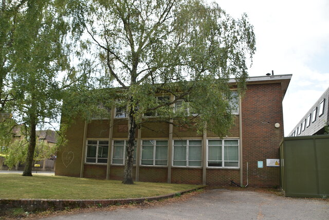
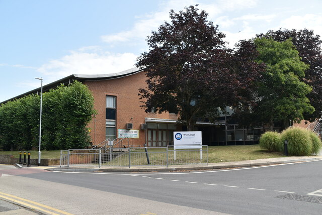
Wye School

Wye School is a British, mixed, secondary, free school in Wye, Kent. As of 2022, it is operated by United Learning. == History == Wye School opened in...

Wye College

The College of St Gregory and St Martin at Wye, commonly known as Wye College, was an education and research institution in the village of Wye, Kent. In...
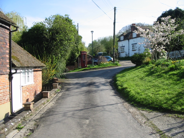
Wye, Kent

Wye is a village and former civil parish, now in the parish of Wye with Hinxhill, in the Ashford district, in Kent, England, 5 miles (8.0 km) from Ashford...
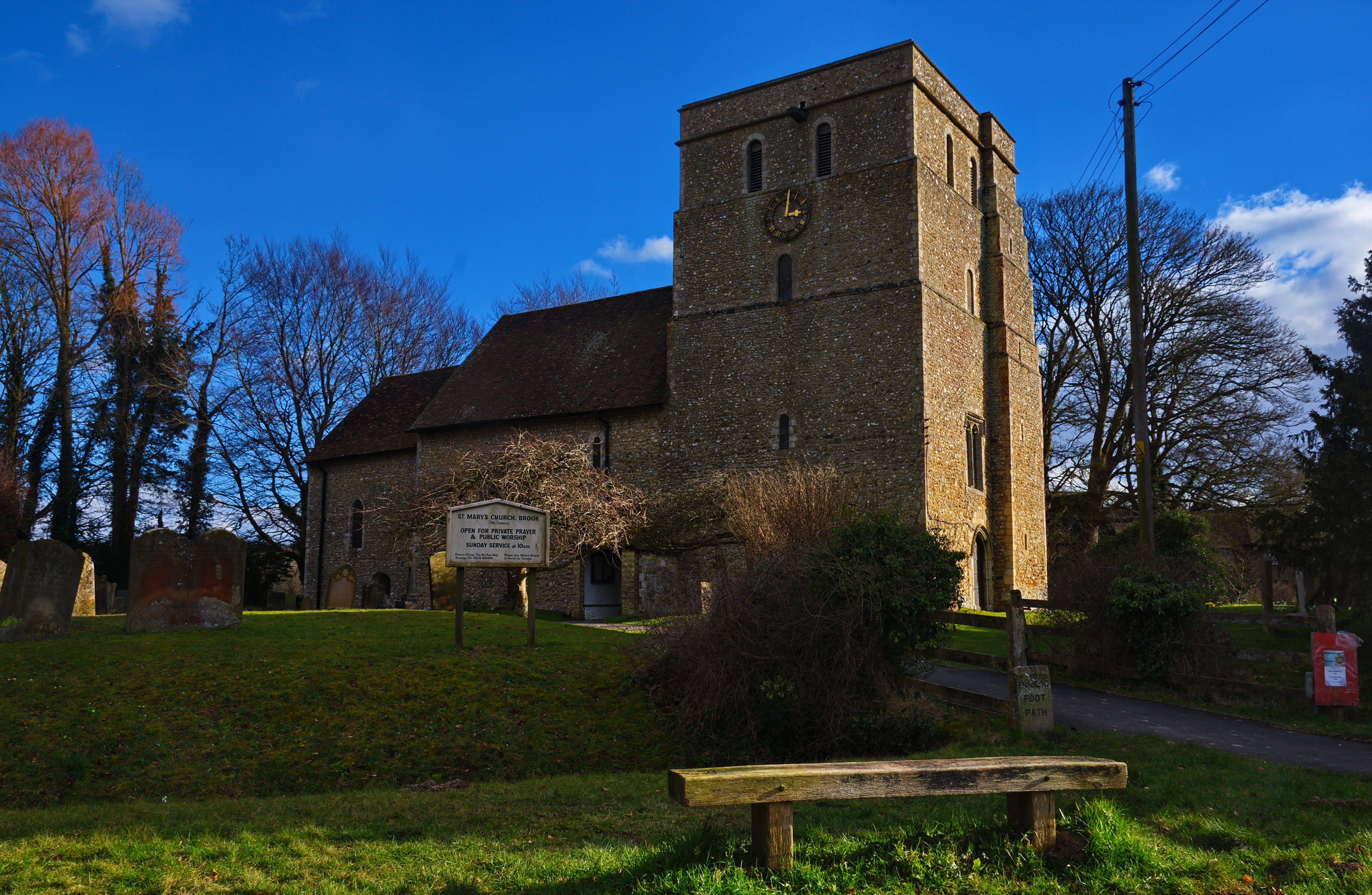
Brook, Kent

Brook is a small village and civil parish in the borough of Ashford in Kent, England, centred 4.5 miles (7.2 km) east-northeast of the town of Ashford...

Crundale, Kent

Crundale is a mostly rural village and civil parish in the Ashford District of Kent in southeast England. The village covers a section of one of the dual...
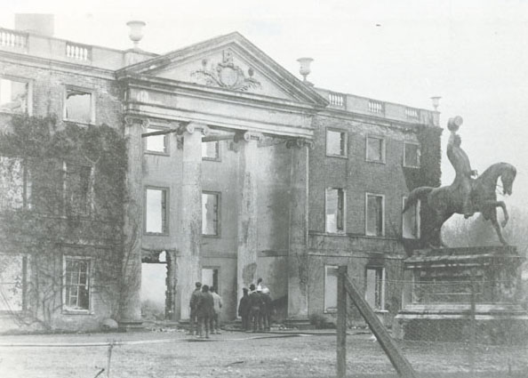
Olantigh

Olantigh is an English house 1 mile (1.6 km) north of Wye in the civil parish of Wye with Hinxhill.The garden terraces and towered stable block were Grade...

Nearby Amenities

Located within 500m of 51.178313,0.96518269
Barrier: kissing_gate
Bicycle: no
Foot: yes
Material: metal
Source: survey
Lat/Long: 51.180318/0.9648175
Barrier: stile
Lat/Long: 51.1805095/0.9603429
Bench
Lat/Long: 51.1813774/0.9629267
Wye Crown Millennium Stone
Inscription: Floreat Wye
Tourism: viewpoint
Lat/Long: 51.1813409/0.9629152
Bench
Lat/Long: 51.1815531/0.9632122
Bench
Lat/Long: 51.1813612/0.9629495
Wye Crown and Queen's Jubilee
Historic: memorial
Lat/Long: 51.1813839/0.9630569
Barrier: pull_apart_gate
Lat/Long: 51.1824915/0.9626555
Bench
Lat/Long: 51.1813392/0.9629483
Warrick Rance Memorial
Historic: memorial
Lat/Long: 51.1815483/0.9631636
The data included in this document is from www.openstreetmap.org. The data is made available under ODbL.

Have you been to Wye Downs?

Leave your review of Wye Downs below (or comments, questions and feedback).