Parney Heath

Downs, Moorland in Essex Colchester

England

Parney Heath

Field north of Birchwood Road
Field north of Birchwood Road Credit: Robin Webster

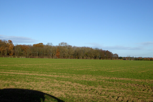
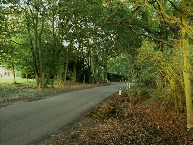
Parney Heath is a picturesque area located in Essex, England. Nestled amidst the enchanting landscape of Downs and Moorland, this region offers breathtaking natural beauty and a peaceful ambiance. Covering an expansive area, Parney Heath is a haven for nature enthusiasts and those seeking tranquility away from the hustle and bustle of city life.

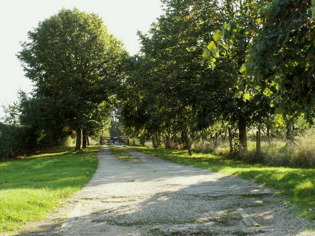
The heath is characterized by its rolling hills, vast open spaces, and lush greenery. The area is home to a diverse range of flora and fauna, making it an ideal spot for hiking, birdwatching, and nature photography. Visitors can explore the winding trails that meander through the heath, immersing themselves in the serene surroundings.

Parney Heath also boasts a rich history, with evidence of human habitation dating back to ancient times. Archaeological discoveries, such as Neolithic burial mounds, provide insights into the area's past. Additionally, remnants of Iron Age settlements and Roman forts can be found, adding to the historical significance of Parney Heath.

The heath is well-maintained, with designated picnic areas and seating spots, allowing visitors to relax and enjoy the stunning views. In spring and summer, the landscape comes alive with vibrant wildflowers, creating a colorful spectacle.

Overall, Parney Heath is a hidden gem in Essex, offering a unique blend of natural beauty, historical significance, and tranquility. Whether you are an avid nature lover, a history enthusiast, or simply seeking a peaceful escape, Parney Heath is a must-visit destination.

If you have any feedback on the listing, please let us know in the comments section below.
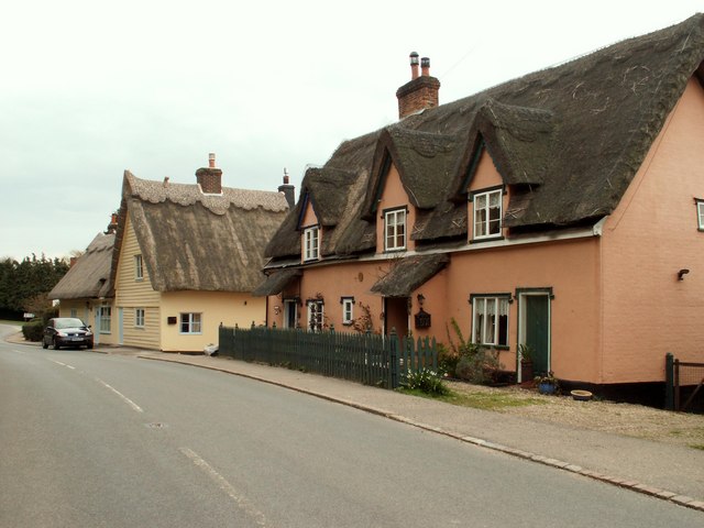
Parney Heath Images

Images are sourced within 2km of 51.947078/0.96685068 or Grid Reference TM0331. Thanks to Geograph Open Source API. All images are credited.

Field north of Birchwood Road
National Cycle Network Milestone Langham Rowe Type National Cycle Network Milepost on Route 1 in Langham, Near Colchester, Essex.

1000 Millennium cast iron mileposts were funded by the Royal Bank of Scotland to mark the creation of the National Cycle Network, and found along the cycles routes through the UK.

There are four different types of posts, "Fossil Tree" by John Mills, "The Cockerel" by Iain McColl, "Rowe Type" by Andrew Rowe, and "Tracks" by David Dudgeon. The four artists are from each country of the UK though all posts can be found in all four countries.
National Cycle Network Milestone Langham
Rowe Type National Cycle Network Milepost on Route 1 in Langham, Near Colchester, Essex. 1000 Millennium cast iron mileposts were funded by the Royal Bank of Scotland to mark the creation of the National Cycle Network, and found along the cycles routes through the UK. There are four different types of posts, "Fossil Tree" by John Mills, "The Cockerel" by Iain McColl, "Rowe Type" by Andrew Rowe, and "Tracks" by David Dudgeon. The four artists are from each country of the UK though all posts can be found in all four countries.
Thatched Cottage at Whalebone Corner
Bridleway to Glebe Farm This is Langham path #20.
Bridleway to Glebe Farm
This is Langham path #20.
Path to Langham Hall This is Langham Footpath #2 it merges with Langham #3 and comes out in Stratford St Mary.
Path to Langham Hall
This is Langham Footpath #2 it merges with Langham #3 and comes out in Stratford St Mary.
Decked out for the Coronation The <a href="https://www.geograph.org.uk/photo/40573">TM0433 : Le Talbooth</a> was clearly planning a right royal shindig. Essex is to the left, Suffolk to the right. Taken looking upstream.
Decked out for the Coronation
The TM0433 : Le Talbooth was clearly planning a right royal shindig. Essex is to the left, Suffolk to the right. Taken looking upstream.
Thatched  cottages  on  the  corner  Dedham To the left Stratford Road on the front High Street B1029
Thatched cottages on the corner Dedham
To the left Stratford Road on the front High Street B1029
Road  junction  on  the  edge  of  Dedham The B1029 going up Shoebridge's Hill. Stratford Road goes to the right
Road junction on the edge of Dedham
The B1029 going up Shoebridge's Hill. Stratford Road goes to the right
River Stour near Milsoms A stretch of the River Stour viewed from the footpath near Milsoms.
River Stour near Milsoms
A stretch of the River Stour viewed from the footpath near Milsoms.
Le Talbooth Le Talbooth originally a tollhouse for the bridge over the River Stour. Tolls were collected from road and river traffic. There has been a building here since the Sixteenth Century. The restaurant was opened in the 1930s to this day it has an enviable reputation (I can vouch for the Line Caught Sea Bass).
Le Talbooth
Le Talbooth originally a tollhouse for the bridge over the River Stour. Tolls were collected from road and river traffic. There has been a building here since the Sixteenth Century. The restaurant was opened in the 1930s to this day it has an enviable reputation (I can vouch for the Line Caught Sea Bass).
Langham village sign, Essex Langham lies just west of the A12 near the Essex/Suffolk border.
Langham village sign, Essex
Langham lies just west of the A12 near the Essex/Suffolk border.
Thatched cottages at Lamb Corner, Essex The road in this picture is the B1029 and Lamb Corner lies between Dedham and Ardleigh.
Thatched cottages at Lamb Corner, Essex
The road in this picture is the B1029 and Lamb Corner lies between Dedham and Ardleigh.
A.12 underpass near Langham, Essex This slip road joins the A.12 London bound.
A.12 underpass near Langham, Essex
This slip road joins the A.12 London bound.
Looking across towards the River Stour This late afternoon early Autumn view across the open fields towards the River Stour conjures up memories of John Constable, the great English landscape painter who lived and worked in this area around Dedham
Looking across towards the River Stour
This late afternoon early Autumn view across the open fields towards the River Stour conjures up memories of John Constable, the great English landscape painter who lived and worked in this area around Dedham
Thatched cottages at Hornestreet Hornestreet is a small area of Langham.
Thatched cottages at Hornestreet
Hornestreet is a small area of Langham.
Track leading to Monk's Farm, near Dedham, Essex
Malting Farm, close to Ardleigh, Essex
Hart's Lane, just west of Ardleigh Heath, Essex
Show me another place!

Parney Heath is located at Grid Ref: TM0331 (Lat: 51.947078, Lng: 0.96685068)

Administrative County: Essex

District: Colchester

Police Authority: Essex

What 3 Words

///pickles.choppers.limped. Near Dedham, Essex

Nearby Locations

Parney Heath

Related Wikis

Lamb Corner

Lamb Corner is a hamlet on the B1029 road, in the civil parish of Dedham in the Colchester district, in the county of Essex, England. Lamb Corner formerly...
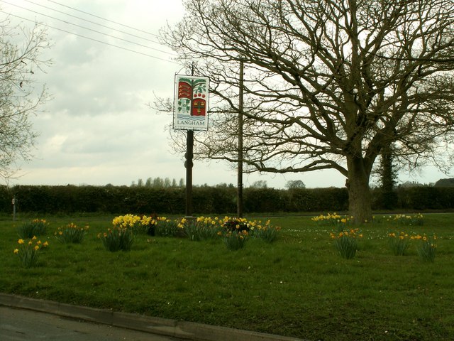
Langham, Essex

Langham is a small village in the City of Colchester district of Essex, England. == History == There is little evidence of pre-Roman occupation of what...

Ardleigh Heath

Ardleigh Heath is a hamlet on the B1029 road, in the civil parish of Ardleigh, in the Tendring District of the county of Essex, England. It is located...

Castle House, Dedham

Castle House in Dedham, Essex, England was the home of Sir Alfred Munnings from 1919 till his death in 1959. Architecturally the building contains a mixture...

Nearby Amenities

Located within 500m of 51.947078,0.96685068
Location Transition: yes
Power: pole
Lat/Long: 51.9474243/0.9607001
Power: pole
Lat/Long: 51.9469151/0.9609711
Power: pole
Lat/Long: 51.9457115/0.961478
Location Transition: yes
Power: pole
Lat/Long: 51.9474938/0.9608155
Power: pole
Lat/Long: 51.9445357/0.9619688
Turning Loop
Lat/Long: 51.9463326/0.9705794
Power: pole
Lat/Long: 51.9492231/0.9642501
Power: pole
Lat/Long: 51.9485337/0.9632134
Power: pole
Lat/Long: 51.9478666/0.9622157
Power: pole
Lat/Long: 51.9473723/0.9614351
Power: pole
Lat/Long: 51.9490263/0.9650205
Power: pole
Lat/Long: 51.9487327/0.9661366
Power: pole
Transformer: distribution
Lat/Long: 51.9484541/0.9672412
Power: pole
Lat/Long: 51.9468373/0.9606596
Power: pole
Lat/Long: 51.9459165/0.9598599
The data included in this document is from www.openstreetmap.org. The data is made available under ODbL.

Have you been to Parney Heath?

Leave your review of Parney Heath below (or comments, questions and feedback).