The Meadows
Downs, Moorland in Sussex Rother
England
The Meadows

The Meadows is a picturesque region located in Sussex, England. Known for its vast expanse of downs, moorland, and rolling hills, it offers visitors a serene and captivating natural landscape. Covering an area of approximately 500 square miles, The Meadows is a haven for nature enthusiasts and those seeking a peaceful retreat.
The region boasts an abundance of diverse flora and fauna, providing a rich habitat for numerous species. The downs, characterized by their chalk grassland, are home to a variety of rare and unique plants, including orchids and wildflowers. The moorland, with its heather-covered expanses, creates a striking contrast against the greenery of the downs. This diverse ecosystem supports a range of wildlife, such as deer, rabbits, and various bird species, making it a popular destination for birdwatchers and nature lovers.
The Meadows also offers visitors a chance to explore its charming villages and historical sites. Nestled amidst the rolling hills are quaint hamlets with traditional thatched cottages, evoking a sense of old-world charm. The region is dotted with ancient landmarks, including prehistoric burial mounds and Iron Age hill forts, providing insight into its rich history.
Outdoor activities abound in The Meadows, catering to all interests. Hiking and cycling trails crisscross the landscape, allowing visitors to immerse themselves in the natural beauty of the area. The region is also a popular destination for horse riding, with numerous equestrian centers offering guided tours and lessons.
With its breathtaking scenery, diverse wildlife, and rich history, The Meadows in Sussex is a captivating destination that offers a perfect blend of natural beauty and cultural exploration.
If you have any feedback on the listing, please let us know in the comments section below.
The Meadows Images
Images are sourced within 2km of 50.929567/0.82369305 or Grid Reference TQ9818. Thanks to Geograph Open Source API. All images are credited.


The Meadows is located at Grid Ref: TQ9818 (Lat: 50.929567, Lng: 0.82369305)
Administrative County: East Sussex
District: Rother
Police Authority: Sussex
What 3 Words
///referral.iceberg.surpassed. Near Camber, East Sussex
Nearby Locations
Related Wikis
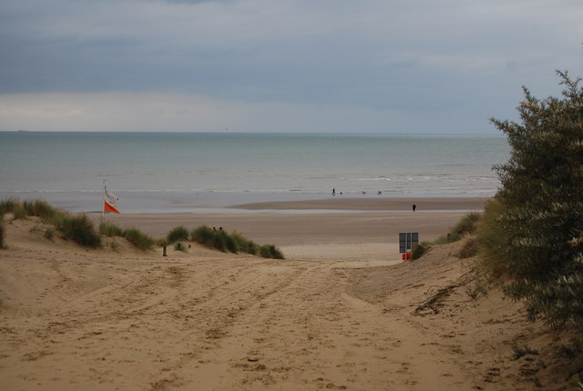
Camber Sands
Camber Sands is a beach in East Sussex, England, in the village of Camber, near Rye. It is the only sand dune system in East Sussex, and is east of the...

Camber, East Sussex
Camber is a village and civil parish in the Rother district of East Sussex, England, 3 miles (4.8 km) south-east of Rye. The village is located behind...

Bowlie Weekender
The Bowlie Weekender was a music festival curated by Belle & Sebastian at the Pontin's Holiday camp in Camber Sands, Sussex between Friday 23 and Sunday...

River Rother, East Sussex
The River Rother flows for 35 miles (56 km) through the English counties of East Sussex and Kent. Its source is near Rotherfield in East Sussex, and its...

Little Cheyne Court Wind Farm
The Little Cheyne Court Wind Farm is located 7 kilometres (4.3 miles) west of Lydd on Romney Marsh. It was built by npower renewables and cost around...
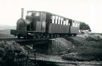
Rye and Camber Tramway
The Rye and Camber Tramway was an English railway in East Sussex. It was of 3 ft (914 mm) narrow gauge, relatively unusual amongst British narrow gauge...

Walland Marsh
Walland Marsh is a part of Romney Marsh, mostly in Kent with part in East Sussex. The name means wall-land: its north-eastern border, separating it from...

Rye Harbour
Rye Harbour is a village located on the East Sussex coast in southeast England, near the estuary of the River Rother: it is part of the civil parish of...
Nearby Amenities
Located within 500m of 50.929567,0.82369305Have you been to The Meadows?
Leave your review of The Meadows below (or comments, questions and feedback).