Bell Farm Park
Downs, Moorland in Kent Swale
England
Bell Farm Park

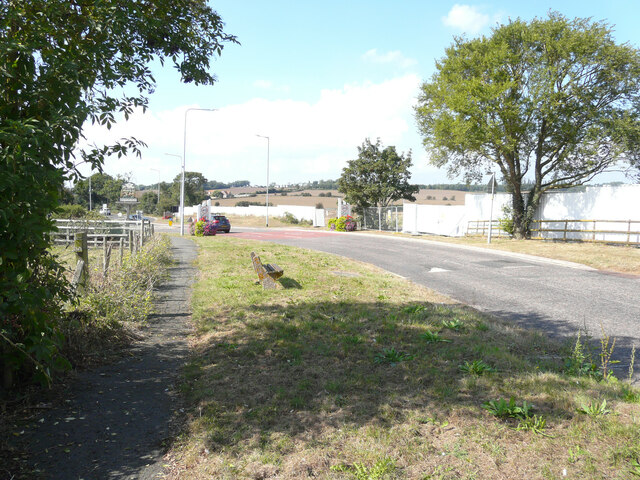
Bell Farm Park, located in Kent, is a picturesque open space that offers a serene and tranquil escape from the hustle and bustle of everyday life. Spanning across a vast area, the park is a haven for nature enthusiasts, offering a diverse range of landscapes including downs and moorland.
The downs in Bell Farm Park are characterized by rolling hills and expansive grasslands, providing visitors with breathtaking panoramic views of the surrounding countryside. This area is teeming with an array of flora and fauna, making it a popular spot for birdwatching and nature walks. The gentle slopes of the downs also make it an ideal location for recreational activities such as kite flying and picnicking.
Moorland, on the other hand, offers a unique and rugged landscape. Visitors can explore the heather-covered expanses and discover hidden trails that wind through the moors. This area is home to a variety of wildlife, including rabbits, foxes, and various bird species. The moorland provides an excellent opportunity for photography and a chance to observe the natural beauty of the region up close.
Bell Farm Park is equipped with well-maintained walking paths and picnic areas, allowing visitors to fully enjoy the park's offerings. The park also features educational signage, providing information about the local flora and fauna, as well as the history and significance of the area.
Whether you're seeking a peaceful retreat or an outdoor adventure, Bell Farm Park in Kent is a must-visit destination. Its stunning downs and moorland landscapes, combined with its accessibility and amenities, make it an ideal location for nature lovers and families alike.
If you have any feedback on the listing, please let us know in the comments section below.
Bell Farm Park Images
Images are sourced within 2km of 51.42232/0.84374599 or Grid Reference TQ9773. Thanks to Geograph Open Source API. All images are credited.


Bell Farm Park is located at Grid Ref: TQ9773 (Lat: 51.42232, Lng: 0.84374599)
Administrative County: Kent
District: Swale
Police Authority: Kent
What 3 Words
///mission.thirsty.qualifier. Near Eastchurch, Kent
Nearby Locations
Related Wikis

BRFM 95.6 FM
95.6 BRFM is a community radio station serving the Isle of Sheppey in Kent which launched on 30 October 2006. The station broadcasts 24 hours a day on...

Sheppey Cliffs and Foreshore
Sheppey Cliffs and Foreshore is a 303.6-hectare (750-acre) biological and geological Site of Special Scientific Interest which stretches between Minster...

Shurland
Shurland is a place near Eastchurch, Isle of Sheppey, Kent, England. Shurland Hall stood here and was visited by Henry VIII of England and used during...
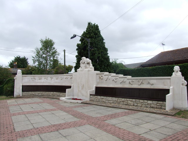
Memorial to the Home of Aviation
The Memorial to the Home of Aviation is a stone memorial sculpture at Eastchurch, on the Isle of Sheppey in the English county of Kent. The Grade II* listed...
Nearby Amenities
Located within 500m of 51.42232,0.84374599Have you been to Bell Farm Park?
Leave your review of Bell Farm Park below (or comments, questions and feedback).