Leath Heath

Downs, Moorland in Essex Maldon

England

Leath Heath

St Leonards, Southminster Over the past 800 years this parish church has suffered some of the most unsympathetic restoration I have ever seen!
St Leonards, Southminster Credit: Glyn Baker

Leath Heath is a serene and picturesque area located in the county of Essex, England. Nestled among the Downs and Moorland, this region boasts stunning natural beauty and a peaceful ambiance that attracts visitors and locals alike.

The Downs in Leath Heath offer rolling hills and lush green landscapes, creating a postcard-worthy scenery. This area is ideal for leisurely walks, hikes, and picnics, allowing visitors to immerse themselves in the tranquil surroundings. The Downs are also home to a variety of wildlife, including rabbits, foxes, and various bird species, making it a haven for nature lovers and birdwatchers.

Adjacent to the Downs lies the Moorland, characterized by its open expanses and heather-covered terrain. The Moorland provides a unique ecosystem, supporting a diverse range of plant and animal life. It is a popular spot for outdoor activities such as horseback riding, cycling, and nature photography.

Leath Heath itself is a small, close-knit community that offers a warm and welcoming atmosphere. The village is dotted with charming cottages and traditional buildings, adding to its quaint and idyllic charm. The residents take pride in their local heritage and often engage in community events and activities.

With its stunning natural landscapes, Leath Heath is a haven for those seeking respite from the hustle and bustle of city life. Its Downs and Moorland offer a peaceful escape, making it a sought-after destination for nature enthusiasts and those who appreciate the beauty of the English countryside.

If you have any feedback on the listing, please let us know in the comments section below.

Leath Heath Images

Images are sourced within 2km of 51.646932/0.840482 or Grid Reference TQ9698. Thanks to Geograph Open Source API. All images are credited.

St Leonards, Southminster Over the past 800 years this parish church has suffered some of the most unsympathetic restoration I have ever seen!
St Leonards, Southminster
Over the past 800 years this parish church has suffered some of the most unsympathetic restoration I have ever seen!
Next Stop Sellafield! It is almost certain that Southminster Station and the whole Crouch Valley line would have been Beechingized in the 1960s if it had not been for the requirement for Bradwell nuclear power station’s waste to be shipped by rail to Cumbria. You can see the power station at <a href="https://www.geograph.org.uk/photo/35708">TM0008 : Moody Magnox (Bradwell Nuclear Power Station)</a>
Next Stop Sellafield!
It is almost certain that Southminster Station and the whole Crouch Valley line would have been Beechingized in the 1960s if it had not been for the requirement for Bradwell nuclear power station’s waste to be shipped by rail to Cumbria. You can see the power station at TM0008 : Moody Magnox (Bradwell Nuclear Power Station)
The Station Arms, Southminster This is the Station Arms in Southminster. Camra’s 1997-98 Anglian pub of the year.
The Station Arms, Southminster
This is the Station Arms in Southminster. Camra’s 1997-98 Anglian pub of the year.
The King's Head, Southminster This is the King’s Head in Southminster the photo was taken from <a href="https://www.geograph.org.uk/photo/161965">TQ9599 : St Leonards, Southminster</a> churchyard
The King's Head, Southminster
This is the King’s Head in Southminster the photo was taken from TQ9599 : St Leonards, Southminster churchyard
Haystack This haystack is on the minor road that serves the farms at the south eastern end of the Dengie Peninsula
Haystack
This haystack is on the minor road that serves the farms at the south eastern end of the Dengie Peninsula
Power for the Peninsula These power lines on the Dengie Peninsula march across a field of beans heading southwest across the square towards Burnham On Crouch.
Power for the Peninsula
These power lines on the Dengie Peninsula march across a field of beans heading southwest across the square towards Burnham On Crouch.
Highless Hemp A field of THC free hemp for making rope, hessian and other useful things just outside Southminster.
Highless Hemp
A field of THC free hemp for making rope, hessian and other useful things just outside Southminster.
Muscle Bridge Why so named? Anybody know?
Muscle Bridge
Why so named? Anybody know?
Pannel's Brook Drainage ditch.
Pannel's Brook
Drainage ditch.
Dammer Wick farm
Dammer Wick farm
Crop in field south of Dammer Wick Something vaguely familiar about these plants.
Crop in field south of Dammer Wick
Something vaguely familiar about these plants.
Southminster station, Essex Great Eastern electric unit 321313 has just arrived on a service from Wickford.  The Southminster branch has an approximately hourly service, with some trains running through to and from London Liverpool Street.
Southminster station, Essex
Great Eastern electric unit 321313 has just arrived on a service from Wickford. The Southminster branch has an approximately hourly service, with some trains running through to and from London Liverpool Street.
Ratsborough Farm Lake This is a private fishing and boating lake at Ratsborough Farm near Southminster
Ratsborough Farm Lake
This is a private fishing and boating lake at Ratsborough Farm near Southminster
E.A. Depot This Environment Agency depot is on Goldsands Road in Southminster
E.A. Depot
This Environment Agency depot is on Goldsands Road in Southminster
The White Horse hotel, Southminster, Essex A very attractive Edwardian pub, just a short walk from the large St. Leonard's Church
The White Horse hotel, Southminster, Essex
A very attractive Edwardian pub, just a short walk from the large St. Leonard's Church
Newman's Farm This is Newman's Farm which stands on a poorly way-marked footpath between Southminster and Burnham-on-Crouch. I ended up on the wrong side of a ditch some distance from my intended photographer position.
Newman's Farm
This is Newman's Farm which stands on a poorly way-marked footpath between Southminster and Burnham-on-Crouch. I ended up on the wrong side of a ditch some distance from my intended photographer position.
Twizzlefoot Bridge Twizzlefoot Bridge stands on a kink in Marsh Rd that leads to a dead end at East Wick
Twizzlefoot Bridge
Twizzlefoot Bridge stands on a kink in Marsh Rd that leads to a dead end at East Wick
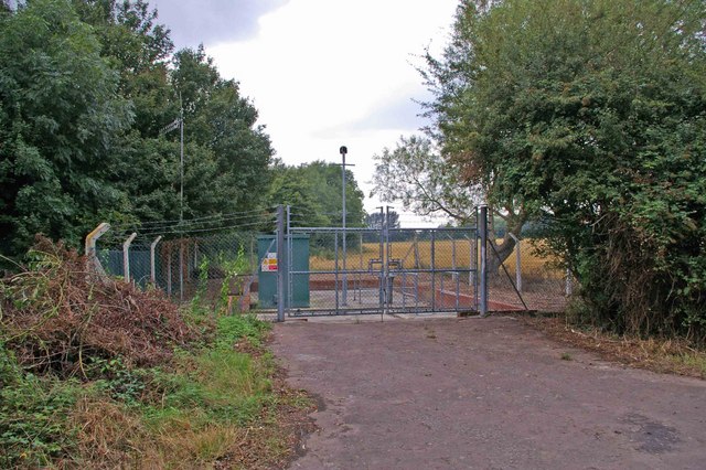
Burnham Water This Anglian Water company facility stands near Romans Farm on a footpath that runs from Marsh Rd to Mill Rd in Burnham-on-Crouch
Burnham Water
This Anglian Water company facility stands near Romans Farm on a footpath that runs from Marsh Rd to Mill Rd in Burnham-on-Crouch
Show me another place!

Leath Heath is located at Grid Ref: TQ9698 (Lat: 51.646932, Lng: 0.840482)

Administrative County: Essex

District: Maldon

Police Authority: Essex

What 3 Words

///discloses.factoring.formal. Near Southminster, Essex

Related Wikis

Goldsands Road Pit

Goldsands Road Pit is a 1.3-hectare (3.2-acre) geological Site of Special Scientific Interest in Southminster in Essex. It is a Geological Conservation...

Southminster railway station

Southminster railway station is the eastern terminus of the Crouch Valley Line in Essex, England, serving the town of Southminster and other settlements...

Southminster

Southminster is a village and civil parish on the Dengie Peninsula in the Maldon district of Essex in the East of England. It lies about 3 miles (4.8 km...

St Mary's Church, Burnham on Crouch

St Mary's Church is a Church of England church in Burnham on Crouch, Essex. It is Grade II* listed == References ==

Have you been to Leath Heath?

Leave your review of Leath Heath below (or comments, questions and feedback).