Balkholme

Settlement in Yorkshire

England

Balkholme

Mill Lane and bridleway Two horses and riders head along the bridleway. Mill Lane also forms part of NCN65.
Mill Lane and bridleway Credit: DS Pugh

Balkholme is a small village situated in the East Riding of Yorkshire, England. Nestled amidst picturesque countryside, it is located approximately 6 miles northeast of the town of Goole. The village is surrounded by fields and farmland, contributing to its serene and rural atmosphere.

With a population of around 200 residents, Balkholme offers a close-knit community feel. The village primarily consists of traditional stone-built houses, some of which date back to the 18th century, adding a touch of historical charm to the area. The village center features a few local amenities, including a small convenience store, a village hall, and a cozy pub where locals often gather.

Nature enthusiasts will appreciate the abundance of scenic walks and cycling routes in the surrounding area. The nearby River Ouse provides opportunities for fishing and boating, attracting both locals and visitors alike. The idyllic countryside also attracts birdwatchers, with the area being home to a diverse range of species.

While Balkholme itself may be relatively small, it benefits from its proximity to larger towns and cities. Goole, with its wider range of amenities including supermarkets, shops, and leisure facilities, is easily accessible from Balkholme. Additionally, the village benefits from good transport links, with nearby road networks connecting it to other parts of Yorkshire.

Overall, Balkholme offers a peaceful and scenic retreat, making it an ideal location for those seeking a tranquil village lifestyle amidst the beauty of the Yorkshire countryside.

If you have any feedback on the listing, please let us know in the comments section below.
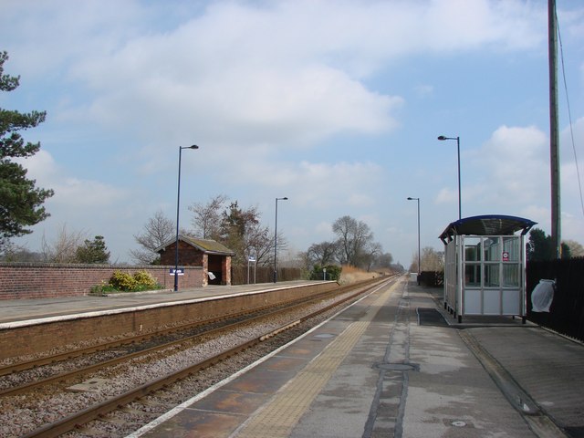
Balkholme Images

Images are sourced within 2km of 53.741618/-0.806558 or Grid Reference SE7827. Thanks to Geograph Open Source API. All images are credited.

Mill Lane and bridleway Two horses and riders head along the bridleway. Mill Lane also forms part of NCN65.
Mill Lane and bridleway
Two horses and riders head along the bridleway. Mill Lane also forms part of NCN65.
Junction with Kilpin Close Looking along the road through Kilpin which also forms part of NCN65.
Junction with Kilpin Close
Looking along the road through Kilpin which also forms part of NCN65.
Narrow Lane Looking onto Narrow Lane in Kilpin with a letterbox on the right.
Narrow Lane
Looking onto Narrow Lane in Kilpin with a letterbox on the right.
Towards the speed limit signs Looking along the road towards Howden which also forms part of NCN65.
Towards the speed limit signs
Looking along the road towards Howden which also forms part of NCN65.
Road into Kilpin Looking along the road from Howden which also forms part of NCN65.
Road into Kilpin
Looking along the road from Howden which also forms part of NCN65.
Sixpenny Wood wind farm See also <a href="https://www.geograph.org.uk/photo/6202796">SE7926 : Wheatfield and wind turbines</a>.
Sixpenny Wood wind farm
Pavement from Long Lane junction The B1230 Main Road heads to Gilberdyke.
Pavement from Long Lane junction
The B1230 Main Road heads to Gilberdyke.
Field beside Long Lane junction Looking across farmland from the junction of the B1230 Main Road hand Long Lane.
Field beside Long Lane junction
Looking across farmland from the junction of the B1230 Main Road hand Long Lane.
Long Lane meets Main Road The B1230 Main Road heads towards Gilberdyke with Long Lane to the left.
Long Lane meets Main Road
The B1230 Main Road heads towards Gilberdyke with Long Lane to the left.
Road near Home Farm Looking along Long Lane which heads west from Eastrington.
Road near Home Farm
Looking along Long Lane which heads west from Eastrington.
Road towards Eastrington Long Lane heading towards Eastrington from near Howden.
Road towards Eastrington
Long Lane heading towards Eastrington from near Howden.
Near Drain Looking along a very straight drain running across fields from Long Lane.
Near Drain
Looking along a very straight drain running across fields from Long Lane.
Long Lane Looking along the road towards Eastrington.
Long Lane
Looking along the road towards Eastrington.
National Speed Limit signs on Howden Road Looking along Howden Road towards the corner where it becomes Long Lane.
National Speed Limit signs on Howden Road
Looking along Howden Road towards the corner where it becomes Long Lane.
Road near Filbert Grove Lodge Looking along Howden Road towards Eastrington.
Road near Filbert Grove Lodge
Looking along Howden Road towards Eastrington.
Railway lines from Howden Road Looking along the Selby to Hull lines as they pass underneath Howden Road.
Railway lines from Howden Road
Looking along the Selby to Hull lines as they pass underneath Howden Road.
Lane to Eastrington Ponds Nature Reserve Towards the car park for the nature reserve from Howden Road to the west of Eastrington.
Lane to Eastrington Ponds Nature Reserve
Towards the car park for the nature reserve from Howden Road to the west of Eastrington.
Sign for Eastrington Looking along Howden Road as it approaches the village.
Sign for Eastrington
Looking along Howden Road as it approaches the village.
Show me another place!

Balkholme is located at Grid Ref: SE7827 (Lat: 53.741618, Lng: -0.806558)

Division: East Riding

Unitary Authority: East Riding of Yorkshire

Police Authority: Humberside

What 3 Words

///yacht.calculate.reveal. Near Kilpin, East Yorkshire

Nearby Locations

Balkholme

Related Wikis

Balkholme

Balkholme is a hamlet and former civil parish, now in the parish of Kilpin and the East Riding of Yorkshire, England. In 1931 the parish had a population...

Howdenshire

Howdenshire was a wapentake and a liberty of England, lying around the town of Howden in the East Riding of Yorkshire.In the Anglo-Saxon period, the district...

Kilpin

Kilpin is a village and civil parish in the East Riding of Yorkshire, England. It is situated approximately 1.5 miles (2.4 km) south-east of Howden and...

Newland, Eastrington

Newland is a hamlet in the East Riding of Yorkshire, England. It is situated approximately 3 miles (5 km) east of Howden and lies north of the B1230 road...

Belby

Belby is a hamlet in the East Riding of Yorkshire, England. It is situated approximately 4 miles (6 km) north-east of Goole town centre and 1.5 miles...

Eastrington railway station

Eastrington railway station serves the small village of Eastrington in the East Riding of Yorkshire, England. The station is 19+1⁄4 miles (31 km) west...

Saltmarshe railway station

Saltmarshe railway station is a railway station on the Hull and Doncaster Branch between Goole and Gilberdyke stations. It serves the village of Laxton...

Eastrington

Eastrington is a small village and civil parish in the East Riding of Yorkshire, England. It is situated approximately 3 miles (5 km) to the east of Howden...

Nearby Amenities

Located within 500m of 53.741618,-0.806558
Balkholme
Is In: East Riding of Yorkshire, England, UK
Is In County: East Riding of Yorkshire
Place: hamlet
Wikidata: Q4851134
Lat/Long: 53.7436609/-0.8086591
The data included in this document is from www.openstreetmap.org. The data is made available under ODbL.

Have you been to Balkholme?

Leave your review of Balkholme below (or comments, questions and feedback).