Kentwell Park

Downs, Moorland in Suffolk Babergh

England

Kentwell Park

Long Melford, Melford Hall: Northern aspect
Long Melford, Melford Hall: Northern aspect Credit: Michael Garlick

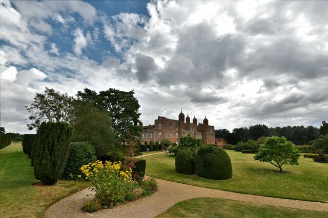
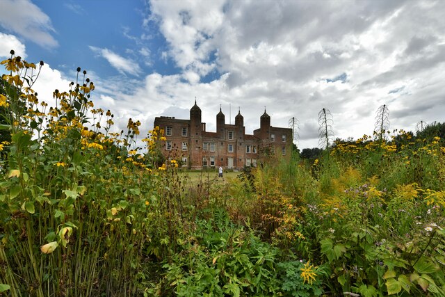
Kentwell Park is a historical estate located in Suffolk, England. Spread across an expansive area, the park encompasses diverse landscapes including downs and moorland. It is renowned for its natural beauty and rich history, attracting visitors from all over the world.

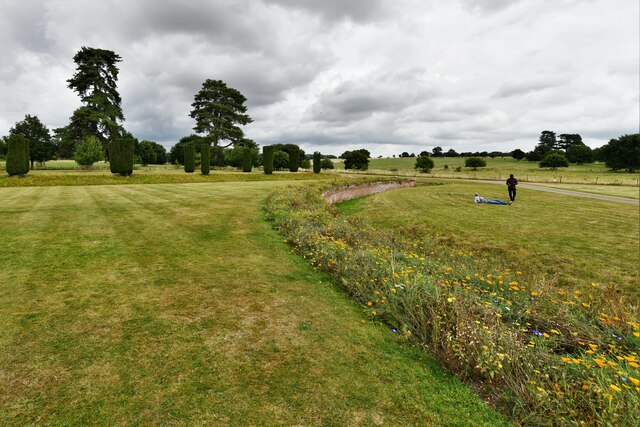
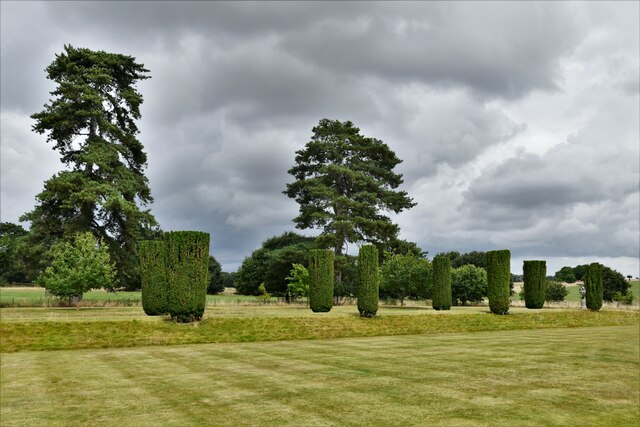
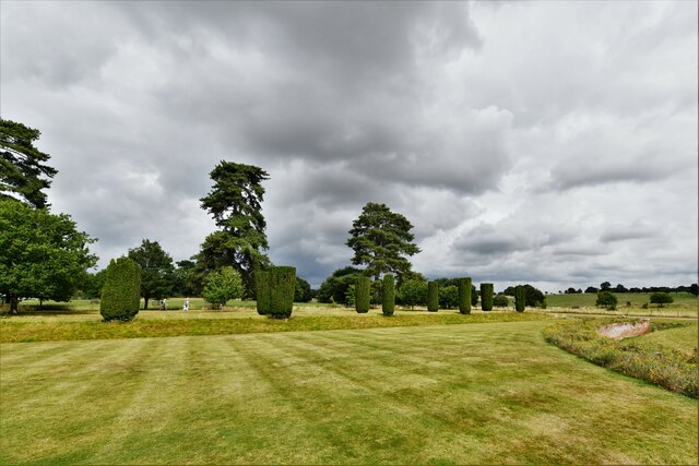
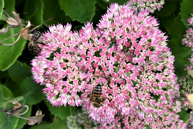
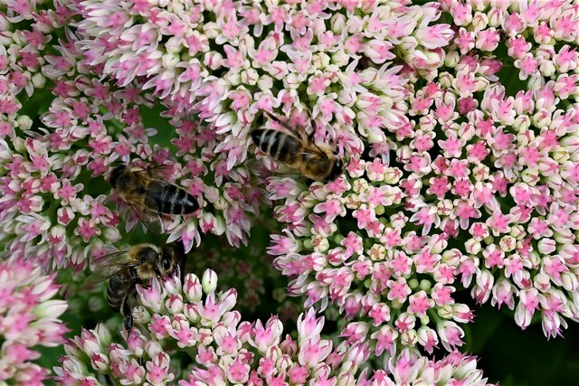
The park's downs offer picturesque views with rolling hills covered in lush green grass and scattered with colourful wildflowers. Visitors can enjoy leisurely walks and hikes, immersing themselves in the tranquil atmosphere while admiring the stunning vistas. The downs are also home to a variety of wildlife, including rabbits, foxes, and a wide range of bird species.

In contrast, the moorland within Kentwell Park presents a unique landscape characterized by open expanses of heather, gorse, and bracken. This rugged terrain offers a different outdoor experience, providing opportunities for adventurous activities such as mountain biking and horseback riding. The moorland is also home to a diverse array of plant and animal species, including rare birds like the curlew and golden plover.

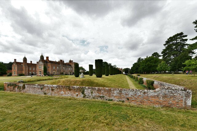
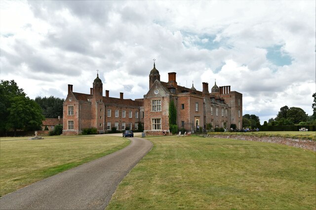
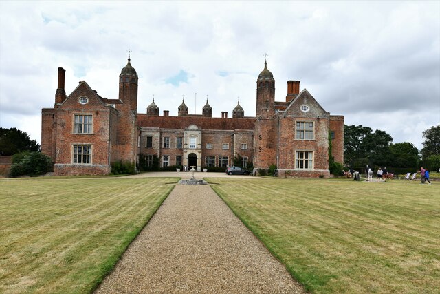
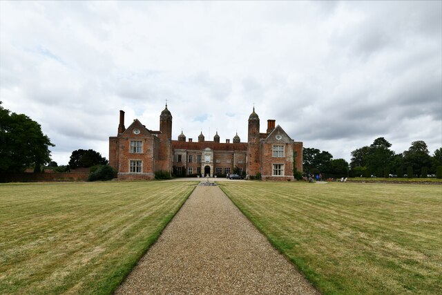
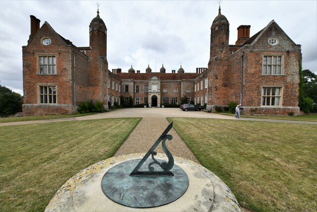
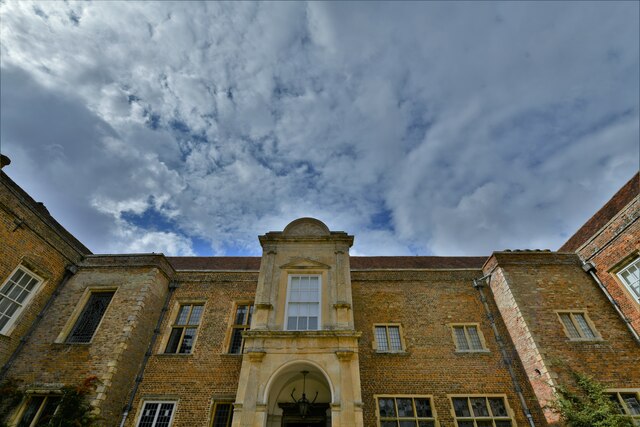
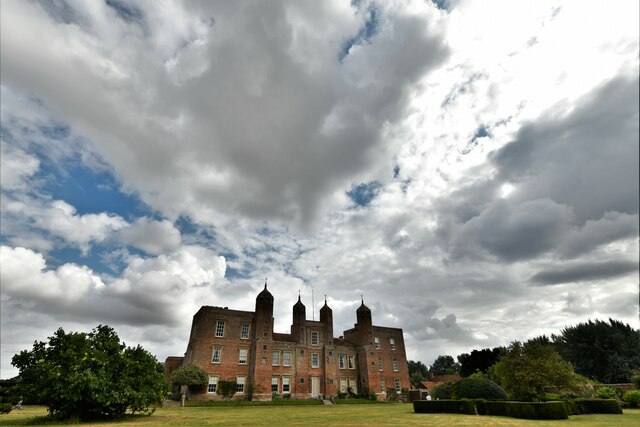
Aside from its natural attractions, Kentwell Park boasts a rich history dating back to the 16th century. The estate features a magnificent Tudor mansion, which is open to the public for guided tours. Visitors can explore the grand rooms, admire the exquisite architecture, and learn about the fascinating history of the estate and its previous inhabitants.

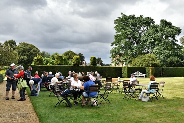
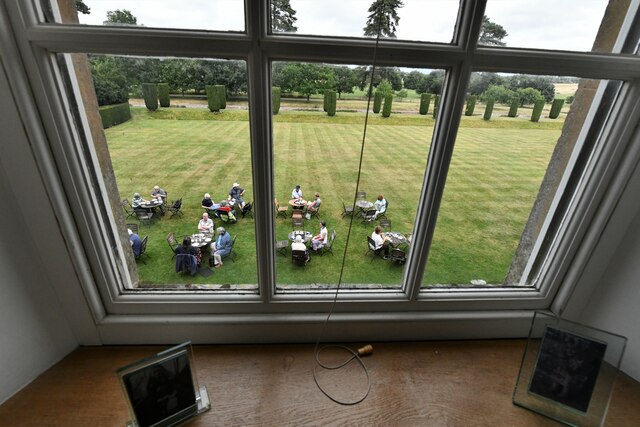
Throughout the year, Kentwell Park hosts various events and festivals, showcasing different aspects of its heritage. These include historical reenactments, traditional craft demonstrations, and seasonal celebrations. These events offer visitors a chance to step back in time and experience life as it was in centuries past.

Overall, Kentwell Park in Suffolk is a captivating destination that combines natural beauty with a rich historical heritage. Whether seeking tranquility in the downs or adventure on the moorland, visitors are sure to be captivated by the park's charm and enchantment.

If you have any feedback on the listing, please let us know in the comments section below.

Kentwell Park Images

Images are sourced within 2km of 52.095155/0.72260545 or Grid Reference TL8647. Thanks to Geograph Open Source API. All images are credited.

Long Melford, Melford Hall: Northern aspect
Long Melford, Melford Hall: Avenue of trees leading to the main entrance
Long Melford, Melford Hall: Northern eastern aspect
Long Melford, Melford Hall: Eastern aspect
Long Melford, Melford Hall: Sundial
Long Melford, Melford Hall: Flower border and grounds looking north
Long Melford, Melford Hall: Grounds looking north
Long Melford, Melford Hall: Flower border and grounds looking north
Long Melford, Melford Hall: East entrance
Long Melford, Melford Hall: Outdoor seating area for the tea room
Long Melford, Melford Hall: North western aspect
Long Melford, Melford Hall: Western aspect
Long Melford, Melford Hall: Bees on Sedum
Show me another place!

Kentwell Park is located at Grid Ref: TL8647 (Lat: 52.095155, Lng: 0.72260545)

Administrative County: Suffolk

District: Babergh

Police Authority: Suffolk

What 3 Words

///economies.alien.placidly. Near Long Melford, Suffolk

Related Wikis

Holy Trinity Church, Long Melford

The Church of the Holy Trinity is a Grade I listed parish church of the Church of England in Long Melford, Suffolk, England. It is one of 310 medieval...

Melford Hall

Melford Hall is a stately home in the village of Long Melford, Suffolk, England. Since 1786 it has been the seat of the Parker Baronets and is still lived...

Long Melford

Long Melford, colloquially and historically also referred to as Melford, is a large village and civil parish in the Babergh district, in the county of...

Long Melford F.C.

Long Melford Football Club is a football club based in Long Melford, Suffolk, England. Affiliated to the Suffolk County FA, they are currently members...

Lineage Wood & Railway Track, Long Melford

Lineage Wood & Railway Track, Long Melford is a 78.7-hectare (194-acre) biological Site of Special Scientific Interest north-east of Long Melford in Suffolk...

Stanstead, Suffolk

Stanstead is a village and civil parish in Suffolk, England. The name Stanstead comes from the Old English for "Stony place". Located off the B1066, it...

Glemsford Pits

Glemsford Pits is a 37.5-hectare (93-acre) biological Site of Special Scientific Interest south of Glemsford in Suffolk. The River Stour, which forms the...

Kentwell Woods

Kentwell Woods is a 77.6-hectare (192-acre) biological Site of Special Scientific Interest in fifteen woods in fourteen separate blocks east and north...

Nearby Amenities

Located within 500m of 52.095155,0.72260545
High Street Farm
Naptan AtcoCode: 390010789
Naptan Bearing: SW
Naptan BusStopType: CUS
Naptan CommonName: High Street Farm
Naptan Indicator: o/s
Naptan Landmark: High Street Farm
Naptan NaptanCode: sufjmwgt
Naptan Street: High Street
Naptan Verified: no
Source: naptan_import
Lat/Long: 52.0940474/0.728249
Post Box
Collection Times: Mo-Fr 09:00; Sa 07:00
Post Box Design: 2010_pattern
Post Box Mounting: pier
Post Box Type: lamp
Ref: CO10 1038D
Royal Cypher: EIIR
Royal Cypher Wikidata: Q33102113
Lat/Long: 52.091924/0.7263966
Barrier: stile
Dog Gate: yes
Lat/Long: 52.0925526/0.7220688
Power: pole
Lat/Long: 52.0939156/0.7263745
Power: pole
Lat/Long: 52.0946472/0.7268251
Barrier: stile
Lat/Long: 52.0918557/0.7218374
Toilets
Lat/Long: 52.0980874/0.7208143
Restaurant
Lat/Long: 52.0979523/0.7206534
Toilets
Lat/Long: 52.0967528/0.7194625
Camera Obscura
Lat/Long: 52.0985094/0.7185255
Waste Basket
Waste: dog_excrement
Lat/Long: 52.0928676/0.7272233
Addr City: Sudbury
Addr Housename: Lovett House
Addr Housenumber: 1A
Addr Street: High Street
Addr Village: Long Melford
Lat/Long: 52.0925874/0.7272179
Addr City: Sudbury
Addr Housenumber: 2
Addr Street: High Street
Addr Village: Long Melford
Lat/Long: 52.0924556/0.7270879
Addr City: Sudbury
Addr Housenumber: 1
Addr Street: High Street
Addr Village: Long Melford
Lat/Long: 52.0925067/0.7271321
Addr City: Sudbury
Addr Housenumber: 4
Addr Street: High Street
Addr Village: Long Melford
Lat/Long: 52.0922356/0.726935
Addr City: Sudbury
Addr Housenumber: 3
Addr Street: High Street
Addr Village: Long Melford
Lat/Long: 52.0922883/0.7269739
Addr Housenumber: 6
Lat/Long: 52.0920107/0.7267995
Addr Housenumber: 5
Lat/Long: 52.0920584/0.7268424
Addr City: Sudbury
Addr Housenumber: 7
Addr Street: High Street
Addr Village: Long Melford
Lat/Long: 52.0918714/0.7266359
Addr City: Sudbury
Addr Housenumber: 45
Addr Street: High Street
Addr Village: Long Melford
Lat/Long: 52.0919563/0.7259077
Addr City: Sudbury
Addr Housenumber: 44A
Addr Street: High Street
Addr Village: Long Melford
Lat/Long: 52.0920411/0.7260016
Barrier: stile
Dog Gate: yes
Lat/Long: 52.0925203/0.7248254
The data included in this document is from www.openstreetmap.org. The data is made available under ODbL.

Have you been to Kentwell Park?

Leave your review of Kentwell Park below (or comments, questions and feedback).