Edwards Hall Park

Downs, Moorland in Essex Rochford

England

Edwards Hall Park

Horses in field, Cherry Orchard Jubilee Country Park Cherry Orchard Jubilee Country Park is managed by Rochford District Council: <span class="nowrap"><a title="https://www.rochford.gov.uk/leisure-and-tourism/woodlands-parks-and-open-spaces/cherry-orchard-jubilee-country-park" rel="nofollow ugc noopener" href="https://www.rochford.gov.uk/leisure-and-tourism/woodlands-parks-and-open-spaces/cherry-orchard-jubilee-country-park">Link</a><img style="margin-left:2px;" alt="External link" title="External link - shift click to open in new window" src="https://s1.geograph.org.uk/img/external.png" width="10" height="10"/></span> , they say:

"Situated in the rolling countryside of the Roach Valley at the south of the District, the 200 acre beautiful wildlife park continues to mature, providing unique recreational facilities for residents and visitors to the area.  The woodland, lake, open grassland and network of connecting paths and bridleways also provide habitat for a huge range of animals and plants...

The park is taking shape out of a vision of turning an area of farmland into a public open space where everyone can enjoy all that the countryside has to offer. There are numerous public rights of way for walkers, cyclists and horse riders to enjoy. Three areas of open grassland have been established with various types of grasses including Cocksfoot, Timothy and Yorkshire Fog. These will be mown to create species-rich meadows."
Horses in field, Cherry Orchard Jubilee Country Park Credit: Roger Jones

Edwards Hall Park, located in Essex, is a beautiful recreational area encompassing Downs and Moorland. Spanning over a vast area, the park offers a variety of amenities suitable for visitors of all ages and interests.

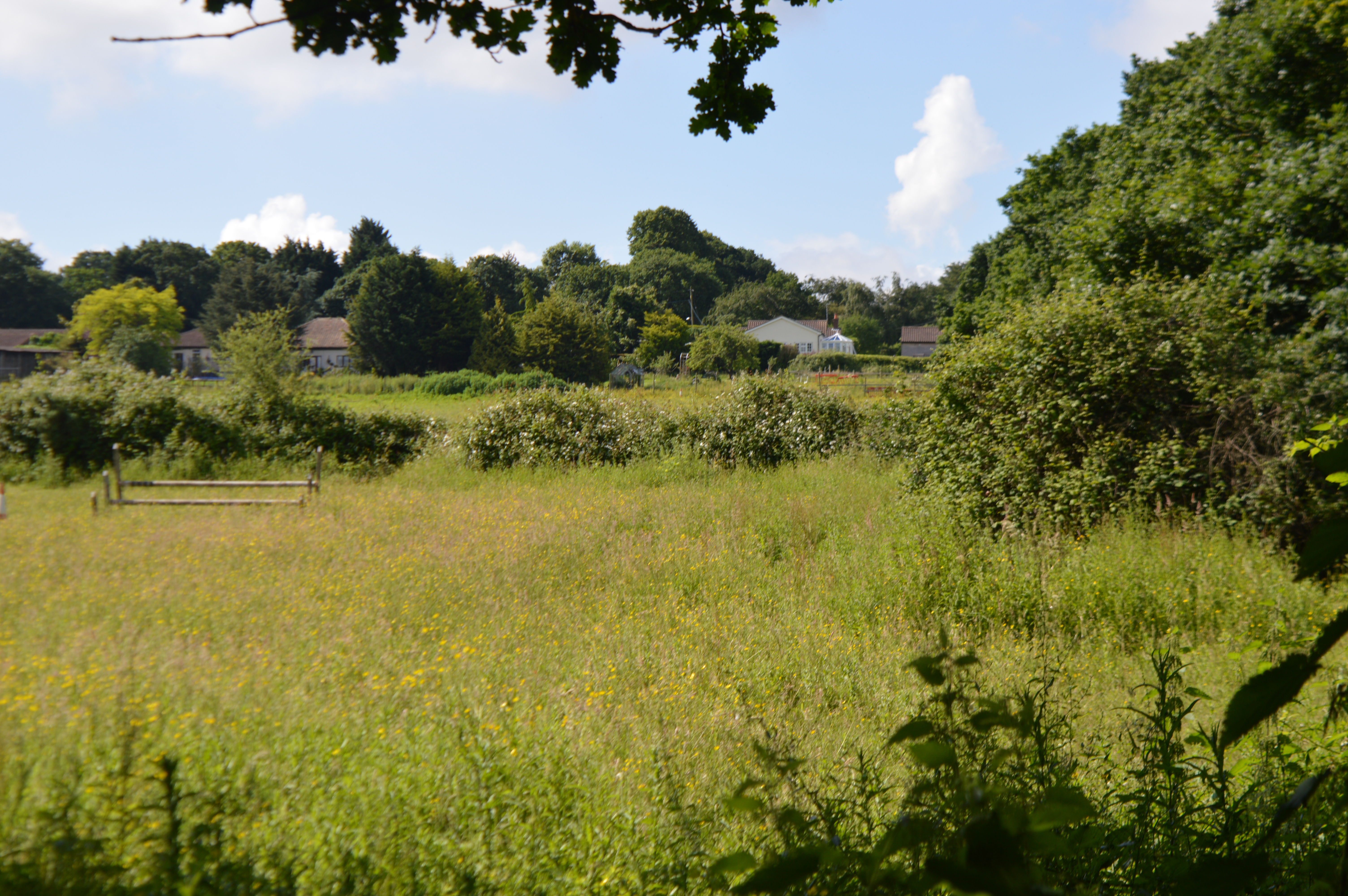
The park's Downs section is a picturesque landscape featuring rolling hills and extensive green spaces, perfect for leisurely walks or picnics with family and friends. The tranquility and natural beauty of the Downs make it a popular spot for outdoor activities such as kite flying, frisbee games, or even organized events like yoga classes.

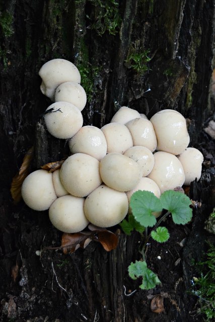
Adjacent to the Downs lies the Moorland area, characterized by its diverse flora and fauna. This section of the park provides a serene escape for nature enthusiasts, offering opportunities for bird watching and wildlife spotting. The Moorland is also home to several walking trails, allowing visitors to immerse themselves in the peaceful surroundings while exploring the park's natural wonders.

In addition to its natural attractions, Edwards Hall Park provides various facilities to accommodate visitors' needs. The park features well-maintained play areas equipped with modern playground equipment, providing endless entertainment for children. Sports enthusiasts can make use of the park's sports fields and courts, which cater to a range of activities including football, basketball, and tennis.

Furthermore, Edwards Hall Park offers ample parking spaces, ensuring accessibility for visitors arriving by car. The park also boasts clean and well-maintained restroom facilities, as well as picnic areas equipped with benches and tables for convenience.

Overall, Edwards Hall Park in Essex provides a diverse range of recreational activities amidst stunning natural surroundings, making it a popular destination for families, nature lovers, and sports enthusiasts alike.

If you have any feedback on the listing, please let us know in the comments section below.

Edwards Hall Park Images

Images are sourced within 2km of 51.576437/0.64916132 or Grid Reference TQ8389. Thanks to Geograph Open Source API. All images are credited.

Horses in field, Cherry Orchard Jubilee Country Park Cherry Orchard Jubilee Country Park is managed by Rochford District Council: <span class="nowrap"><a title="https://www.rochford.gov.uk/leisure-and-tourism/woodlands-parks-and-open-spaces/cherry-orchard-jubilee-country-park" rel="nofollow ugc noopener" href="https://www.rochford.gov.uk/leisure-and-tourism/woodlands-parks-and-open-spaces/cherry-orchard-jubilee-country-park">Link</a><img style="margin-left:2px;" alt="External link" title="External link - shift click to open in new window" src="https://s1.geograph.org.uk/img/external.png" width="10" height="10"/></span> , they say:

"Situated in the rolling countryside of the Roach Valley at the south of the District, the 200 acre beautiful wildlife park continues to mature, providing unique recreational facilities for residents and visitors to the area.  The woodland, lake, open grassland and network of connecting paths and bridleways also provide habitat for a huge range of animals and plants...

The park is taking shape out of a vision of turning an area of farmland into a public open space where everyone can enjoy all that the countryside has to offer. There are numerous public rights of way for walkers, cyclists and horse riders to enjoy. Three areas of open grassland have been established with various types of grasses including Cocksfoot, Timothy and Yorkshire Fog. These will be mown to create species-rich meadows."
Horses in field, Cherry Orchard Jubilee Country Park
Cherry Orchard Jubilee Country Park is managed by Rochford District Council: LinkExternal link , they say: "Situated in the rolling countryside of the Roach Valley at the south of the District, the 200 acre beautiful wildlife park continues to mature, providing unique recreational facilities for residents and visitors to the area. The woodland, lake, open grassland and network of connecting paths and bridleways also provide habitat for a huge range of animals and plants... The park is taking shape out of a vision of turning an area of farmland into a public open space where everyone can enjoy all that the countryside has to offer. There are numerous public rights of way for walkers, cyclists and horse riders to enjoy. Three areas of open grassland have been established with various types of grasses including Cocksfoot, Timothy and Yorkshire Fog. These will be mown to create species-rich meadows."
Footpath near Rawreth-Hall Wood, Cherry Orchard Jubilee Country Park Cherry Orchard Jubilee Country Park is managed by Rochford District Council: <span class="nowrap"><a title="https://www.rochford.gov.uk/leisure-and-tourism/woodlands-parks-and-open-spaces/cherry-orchard-jubilee-country-park" rel="nofollow ugc noopener" href="https://www.rochford.gov.uk/leisure-and-tourism/woodlands-parks-and-open-spaces/cherry-orchard-jubilee-country-park">Link</a><img style="margin-left:2px;" alt="External link" title="External link - shift click to open in new window" src="https://s1.geograph.org.uk/img/external.png" width="10" height="10"/></span> , they say:

"Situated in the rolling countryside of the Roach Valley at the south of the District, the 200 acre beautiful wildlife park continues to mature, providing unique recreational facilities for residents and visitors to the area.  The woodland, lake, open grassland and network of connecting paths and bridleways also provide habitat for a huge range of animals and plants...

The park is taking shape out of a vision of turning an area of farmland into a public open space where everyone can enjoy all that the countryside has to offer. There are numerous public rights of way for walkers, cyclists and horse riders to enjoy. Three areas of open grassland have been established with various types of grasses including Cocksfoot, Timothy and Yorkshire Fog. These will be mown to create species-rich meadows."
Footpath near Rawreth-Hall Wood, Cherry Orchard Jubilee Country Park
Cherry Orchard Jubilee Country Park is managed by Rochford District Council: LinkExternal link , they say: "Situated in the rolling countryside of the Roach Valley at the south of the District, the 200 acre beautiful wildlife park continues to mature, providing unique recreational facilities for residents and visitors to the area. The woodland, lake, open grassland and network of connecting paths and bridleways also provide habitat for a huge range of animals and plants... The park is taking shape out of a vision of turning an area of farmland into a public open space where everyone can enjoy all that the countryside has to offer. There are numerous public rights of way for walkers, cyclists and horse riders to enjoy. Three areas of open grassland have been established with various types of grasses including Cocksfoot, Timothy and Yorkshire Fog. These will be mown to create species-rich meadows."
The Scrubs, Cherry Orchard Jubilee Country Park Cherry Orchard Jubilee Country Park is managed by Rochford District Council: <span class="nowrap"><a title="https://www.rochford.gov.uk/leisure-and-tourism/woodlands-parks-and-open-spaces/cherry-orchard-jubilee-country-park" rel="nofollow ugc noopener" href="https://www.rochford.gov.uk/leisure-and-tourism/woodlands-parks-and-open-spaces/cherry-orchard-jubilee-country-park">Link</a><img style="margin-left:2px;" alt="External link" title="External link - shift click to open in new window" src="https://s1.geograph.org.uk/img/external.png" width="10" height="10"/></span> , they say:

"Situated in the rolling countryside of the Roach Valley at the south of the District, the 200 acre beautiful wildlife park continues to mature, providing unique recreational facilities for residents and visitors to the area.  The woodland, lake, open grassland and network of connecting paths and bridleways also provide habitat for a huge range of animals and plants...

The park is taking shape out of a vision of turning an area of farmland into a public open space where everyone can enjoy all that the countryside has to offer. There are numerous public rights of way for walkers, cyclists and horse riders to enjoy. Three areas of open grassland have been established with various types of grasses including Cocksfoot, Timothy and Yorkshire Fog. These will be mown to create species-rich meadows."
The Scrubs, Cherry Orchard Jubilee Country Park
Cherry Orchard Jubilee Country Park is managed by Rochford District Council: LinkExternal link , they say: "Situated in the rolling countryside of the Roach Valley at the south of the District, the 200 acre beautiful wildlife park continues to mature, providing unique recreational facilities for residents and visitors to the area. The woodland, lake, open grassland and network of connecting paths and bridleways also provide habitat for a huge range of animals and plants... The park is taking shape out of a vision of turning an area of farmland into a public open space where everyone can enjoy all that the countryside has to offer. There are numerous public rights of way for walkers, cyclists and horse riders to enjoy. Three areas of open grassland have been established with various types of grasses including Cocksfoot, Timothy and Yorkshire Fog. These will be mown to create species-rich meadows."
Footpath junction near The Lawn, Rochford
Fence and hedge New "wildlife strip" bordering Bull Wood along the public footpath
Fence and hedge
New "wildlife strip" bordering Bull Wood along the public footpath
Footpath to Hockley Woods
Trompettes de la Morte Craterellus cornucopioides (aka Horn of Plenty, Black Chanterelle)  I came upon a large patch of these fungi freshly sprung from the forest floor in Hockley Woods. And very tasty they were too, despite the French name, Trumpet of Death!
Trompettes de la Morte
Craterellus cornucopioides (aka Horn of Plenty, Black Chanterelle) I came upon a large patch of these fungi freshly sprung from the forest floor in Hockley Woods. And very tasty they were too, despite the French name, Trumpet of Death!
Stump Puffballs Lycoperdon pyriforme (aka Pear-shaped Puffball). Young specimens on oak stump, Hockley Woods
Stump Puffballs
Lycoperdon pyriforme (aka Pear-shaped Puffball). Young specimens on oak stump, Hockley Woods
Infested oak stump Honey Fungus (Armillaria mellea)
Infested oak stump
Honey Fungus (Armillaria mellea)
Hedgerow mushrooms Parasol Mushroom, Macrolepiota procera
Hedgerow mushrooms
Parasol Mushroom, Macrolepiota procera
Hawkwell sign on Rectory Road, near the junction with Hall Road
Signpost at the junction of Rectory Road and Hall Road
Potash Garden Centre This is on the B1013 (Hall Road) at Hawkwell
Potash Garden Centre
This is on the B1013 (Hall Road) at Hawkwell
Astronomy Resource Centre This sign is in the field opposite Gusted Hall Lane off the B1013.  No idea what it refers to but who knows what is behind that hedge.
Astronomy Resource Centre
This sign is in the field opposite Gusted Hall Lane off the B1013. No idea what it refers to but who knows what is behind that hedge.
Gusted Hall Lane This is the top end of the lane, near to where it leaves Hall Road.  The building on the left is just shown as "farm" on the map.
Gusted Hall Lane
This is the top end of the lane, near to where it leaves Hall Road. The building on the left is just shown as "farm" on the map.
Gusted Hall Lane looking West
Mail van coming from Honeypots Farm
Gusted Hall Lane with Hawkwell in the background
Show me another place!

Edwards Hall Park is located at Grid Ref: TQ8389 (Lat: 51.576437, Lng: 0.64916132)

Administrative County: Essex

District: Rochford

Police Authority: Essex

What 3 Words

///cared.bikes.cope. Near Rayleigh, Essex

Nearby Locations

Edwards Hall Park

Related Wikis

Eastwood, Essex

Eastwood is a suburb of the city of Southend-on-Sea, in the ceremonial county of Essex, England. Eastwood is sometimes called Eastwood Park, particularly...

Garrold's Meadow

Garrold's Meadow is a 5 hectare biological Site of Special Scientific Interest north of Leigh-on-Sea in Essex. The local planning authority is Castle Point...

Rayleigh (UK Parliament constituency)

Rayleigh was a parliamentary constituency in Essex represented in the House of Commons of the Parliament of the United Kingdom. It elected one Member of...

The Eastwood Academy

The Eastwood Academy (formerly The Eastwood School) is a secondary school in Leigh-on-Sea, Essex. == Notable pupils == Celtic footballer Cameron Carter...

Murder of David Amess

On 15 October 2021, David Amess, a British Conservative Party politician and Member of Parliament for Southend West, was fatally stabbed at a constituency...

Hockley Woods

Hockley Woods is a large woodland in south-east Essex. It is a Local Nature Reserve, and parts are a Site of Special Scientific Interest. It is owned and...
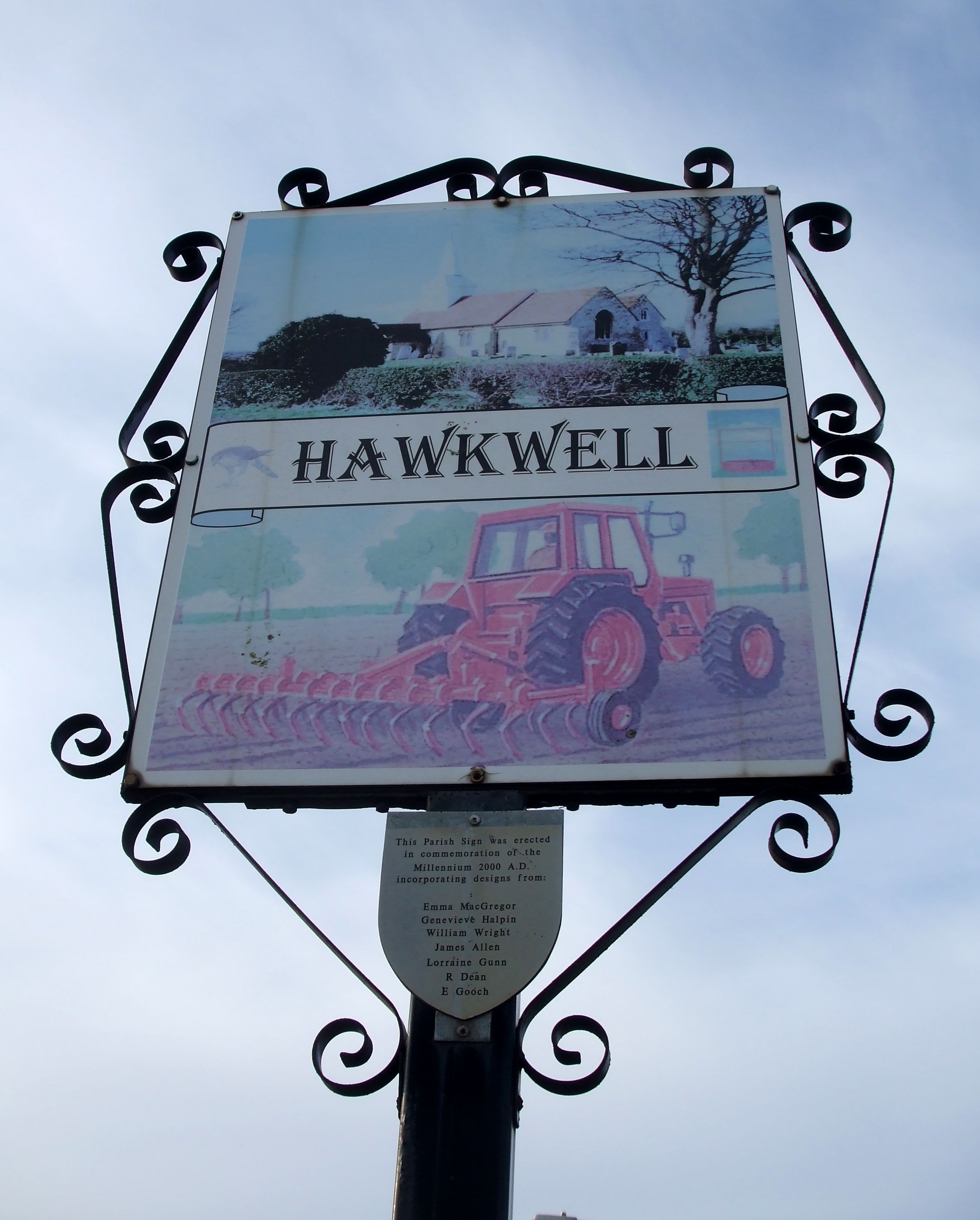
Hawkwell

Hawkwell is a village and civil parish in the district of Rochford in Essex, England. The 2001 census gave a population for the parish of 11,231, increasing...

Catholic United F.C.

Catholic United Football Club is a football club based in Southend-on-Sea, Essex, England. They are currently members of the Essex Olympian League Premier...

Nearby Amenities

Located within 500m of 51.576437,0.64916132
Check Date: 2023-05-01
Direction: both
Surface: paving_stones
Traffic Calming: table
Lat/Long: 51.5737307/0.6461454
Post Box
Brand: Royal Mail
Brand Wikidata: Q638098
Brand Wikipedia: en:Royal Mail
Collection Times: Mo-Fr 09:00; Sa 07:00
Operator: Royal Mail
Operator Wikidata: Q638098
Ref: SS9 309D
Royal Cypher: EIIR
Lat/Long: 51.5726471/0.6499682
Barrier: entrance
Lat/Long: 51.5763741/0.6478739
Cherry Orchard
Tourism: sign
Lat/Long: 51.5787068/0.6548992
Traffic Calming: table
Lat/Long: 51.5730475/0.6515147
Direction: both
Traffic Calming: choker
Lat/Long: 51.5729167/0.653071
Leisure: picnic_table
Lat/Long: 51.5766737/0.6486851
Waste Basket
Lat/Long: 51.5756327/0.6476167
Waste Basket
Lat/Long: 51.5786335/0.655292
Barrier: entrance
Lat/Long: 51.5773862/0.6496246
Barrier: entrance
Lat/Long: 51.5771116/0.650033
Bench
Lat/Long: 51.5782565/0.6514229
Barrier: entrance
Lat/Long: 51.5757484/0.6524002
Barrier: entrance
Lat/Long: 51.5762567/0.6487007
Barrier: entrance
Lat/Long: 51.5762815/0.6484732
Tourism: sign
Lat/Long: 51.5777683/0.6529902
Bench
Lat/Long: 51.5796731/0.6466536
Note: There are some blackberry bushes here
Lat/Long: 51.5769635/0.6464332
Barrier: entrance
Lat/Long: 51.575738/0.6478783
Dog Field
Lat/Long: 51.5773515/0.6478805
Addr Housename: The Maples
Addr Housenumber: 25
Addr Street: Hillside Road
Lat/Long: 51.5780534/0.6427879
Waterway: beaver_dam
Lat/Long: 51.5790845/0.6535897
Bench
Material: wood
Lat/Long: 51.5786154/0.655079
Wren Ave 10
Operator: UK Power Networks
Operator Wikidata: Q7864927
Power: substation
Ref: Q8352-8940M
Substation: minor_distribution
Lat/Long: 51.5734911/0.646543
Waste Basket
Waste: dog_excrement
Lat/Long: 51.5755283/0.6478223
Bench
Backrest: yes
Material: wood
Lat/Long: 51.5755407/0.6480376
Bench
Backrest: yes
Material: wood
Lat/Long: 51.5755124/0.6481288
Direction: both
Traffic Calming: cushion
Lat/Long: 51.5733074/0.6457726
Direction: both
Traffic Calming: cushion
Lat/Long: 51.5734227/0.6470678
Direction: both
Traffic Calming: cushion
Lat/Long: 51.5732121/0.6477627
Direction: both
Traffic Calming: cushion
Lat/Long: 51.5730233/0.6484449
Direction: both
Traffic Calming: cushion
Lat/Long: 51.5727739/0.6493842
Direction: both
Traffic Calming: cushion
Lat/Long: 51.5733349/0.6500229
Colour: yellow
Direction: 30
Inscription: GAS CAUTION
Marker: post
Material: concrete
Utility: gas
Lat/Long: 51.5776448/0.6431157
Addr Housenumber: 38
Addr Street: Nore Road
Lat/Long: 51.5760479/0.644543
Addr Housenumber: 36
Addr Street: Nore Road
Lat/Long: 51.5761332/0.6442947
Addr Housenumber: 32a
Addr Street: Nore Road
Lat/Long: 51.5762968/0.6439727
Addr Housenumber: 34
Addr Street: Nore Road
Lat/Long: 51.5762417/0.64414
Addr Housenumber: 35
Addr Street: Nore Road
Lat/Long: 51.5763511/0.6447913
Addr Housenumber: 33
Addr Street: Nore Road
Lat/Long: 51.5765806/0.644402
Addr Housenumber: 31
Addr Street: Nore Road
Lat/Long: 51.5766706/0.6441063
Addr Housenumber: 28
Addr Street: Nore Road
Lat/Long: 51.5765496/0.6430818
Addr Housenumber: 23
Addr Street: Nore Road
Lat/Long: 51.5769133/0.6433339
Addr Housenumber: 30
Addr Street: Nore Road
Lat/Long: 51.5764341/0.6433289
Addr Housenumber: 32
Addr Street: Nore Road
Lat/Long: 51.5763426/0.6436595
Addr Housenumber: 29
Addr Street: Nore Road
Lat/Long: 51.5767342/0.6439029
Addr Housenumber: 27
Addr Street: Nore Road
Lat/Long: 51.5767799/0.643687
Addr Housenumber: 25
Addr Street: Nore Road
Lat/Long: 51.5768513/0.6435173
Addr Housenumber: 47
Addr Street: Tudor Road
Lat/Long: 51.5734786/0.6444756
Addr Housenumber: 55
Addr Street: Springwater Road
Lat/Long: 51.5738648/0.6448263
Direction: both
Surface: asphalt
Traffic Calming: hump
Lat/Long: 51.5780201/0.6435989
Addr Housenumber: 94
Addr Street: Eastwood Rise
Lat/Long: 51.576827/0.6426358
Addr Housenumber: 80
Addr Street: Eastwood Rise
Lat/Long: 51.5764478/0.6422001
Addr Housenumber: 78
Addr Street: Eastwood Rise
Lat/Long: 51.5763271/0.6420847
Addr Housenumber: 3
Addr Street: Springwater Road
Lat/Long: 51.573584/0.6442471
Addr Housenumber: 4
Addr Street: Springwater Road
Lat/Long: 51.5733124/0.6441208
Addr Housenumber: 27
Addr Street: Hillside Road
Lat/Long: 51.5779913/0.6429606
Addr Housenumber: 26
Addr Street: Hillside Road
Lat/Long: 51.5777772/0.6423754
Addr Housenumber: 34
Addr Street: Bosworth Road
Lat/Long: 51.572731/0.6454833
Addr Housenumber: 40
Addr Street: Bosworth Road
Lat/Long: 51.5729118/0.6456973
Addr Housenumber: 50
Addr Street: Bosworth Road
Lat/Long: 51.5732368/0.6459663
Addr Housenumber: 58
Addr Street: Bosworth Road
Lat/Long: 51.5735363/0.6462142
Addr Housenumber: 55
Addr Street: Bosworth Road
Lat/Long: 51.5736246/0.645901
Addr Housenumber: 12
Addr Street: Wren Avenue
Lat/Long: 51.5733877/0.646756
Addr Housenumber: 20
Addr Street: Wren Avenue
Lat/Long: 51.573253/0.6472413
Addr Housenumber: 22
Addr Street: Wren Avenue
Lat/Long: 51.5732133/0.6473843
Addr Housenumber: 40
Addr Street: Wren Avenue
Lat/Long: 51.5728861/0.6485628
Addr Housenumber: 6
Addr Street: Macmurdo Road
Lat/Long: 51.5727971/0.6489219
Addr Housenumber: 12
Addr Street: Macmurdo Road
Lat/Long: 51.5725533/0.6487389
Addr Housenumber: 5
Addr Street: Macmurdo Road
Lat/Long: 51.5726389/0.6483994
Addr Housenumber: 17
Addr Street: Macmurdo Road
Lat/Long: 51.5722391/0.6480826
Addr Housenumber: 26
Addr Street: Macmurdo Road
Lat/Long: 51.5719953/0.6483202
Addr Housenumber: 12
Addr Street: Sairard Gardens
Lat/Long: 51.572116/0.649433
Addr Housenumber: 2
Addr Street: Sairard Gardens
Lat/Long: 51.5725252/0.6497461
Addr Housenumber: 1
Addr Street: Sairard Gardens
Lat/Long: 51.5726436/0.6494519
Addr Housenumber: 53
Addr Street: Wren Avenue
Lat/Long: 51.572953/0.6492142
Addr Housenumber: 43
Addr Street: Wren Avenue
Lat/Long: 51.5731043/0.6485635
Addr Housenumber: 29
Addr Street: Wren Avenue
Lat/Long: 51.5733364/0.6477185
Addr Housenumber: 23
Addr Street: Wren Avenue
Lat/Long: 51.5733997/0.6474281
Addr Housenumber: 21
Addr Street: Wren Avenue
Lat/Long: 51.5734323/0.6473334
Addr Housenumber: 5
Addr Street: Wren Avenue
Lat/Long: 51.5737502/0.6464096
Addr Housenumber: 66
Addr Street: Bosworth Road
Lat/Long: 51.5739459/0.6465982
Addr Housenumber: 70
Addr Street: Bosworth Road
Lat/Long: 51.5740878/0.6468132
Addr Housenumber: 61
Addr Street: Bosworth Road
Lat/Long: 51.5739131/0.6461987
Addr Housenumber: 63
Addr Street: Bosworth Road
Lat/Long: 51.5740011/0.6462699
Addr Housenumber: 64
Addr Street: Bosworth Road
Lat/Long: 51.5740816/0.6463351
Addr Housenumber: 67
Addr Street: Bosworth Road
Lat/Long: 51.5741539/0.6463936
Addr Housenumber: 9
Addr Street: Tudor Close
Lat/Long: 51.5740371/0.6457291
Addr Housenumber: 8
Addr Street: Tudor Close
Lat/Long: 51.5740657/0.6456572
Addr Housenumber: 7
Addr Street: Tudor Close
Lat/Long: 51.574108/0.6455507
Addr Housenumber: 6
Addr Street: Tudor Close
Lat/Long: 51.5741378/0.6454755
Addr Housenumber: 5
Addr Street: Tudor Close
Lat/Long: 51.5742998/0.6457009
Addr Housenumber: 4
Addr Street: Tudor Close
Lat/Long: 51.5743628/0.6457577
Addr Housenumber: 3
Addr Street: Tudor Close
Lat/Long: 51.5744195/0.6458089
Addr Housenumber: 2
Addr Street: Tudor Close
Lat/Long: 51.5745742/0.6453018
Addr Housenumber: 1
Addr Street: Tudor Close
Lat/Long: 51.5745318/0.6452572
Addr Housenumber: 4
Addr Street: Gravel Road
Lat/Long: 51.5740561/0.6449801
Addr Housenumber: 21
Addr Street: Gravel Road
Lat/Long: 51.5745873/0.6442968
Addr Housenumber: 37
Addr Street: Gravel Road
Lat/Long: 51.5748981/0.6433973
Addr Housenumber: 43
Addr Street: Gravel Road
Lat/Long: 51.5750448/0.6429729
Addr Housenumber: 45
Addr Street: Gravel Road
Lat/Long: 51.5750769/0.64288
Addr Housenumber: 47
Addr Street: Gravel Road
Lat/Long: 51.5751101/0.642784
Addr Housenumber: 49
Addr Street: Gravel Road
Lat/Long: 51.575152/0.6426626
The data included in this document is from www.openstreetmap.org. The data is made available under ODbL.

Have you been to Edwards Hall Park?

Leave your review of Edwards Hall Park below (or comments, questions and feedback).