Eriswell High Warren

Downs, Moorland in Suffolk West Suffolk

England

Eriswell High Warren

Lakenheath Warren Grassy heath. The area is open access land, but only between November and February due to sensitive wildlife, <a href="https://www.geograph.org.uk/photo/7383126">TL7779 : Open access sign</a>. Looking towards the Center Parcs site.
Lakenheath Warren Credit: Hugh Venables

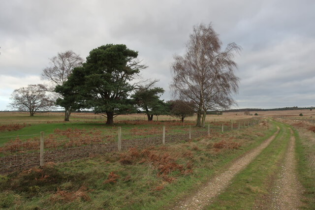
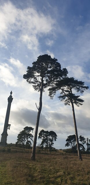
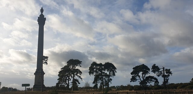
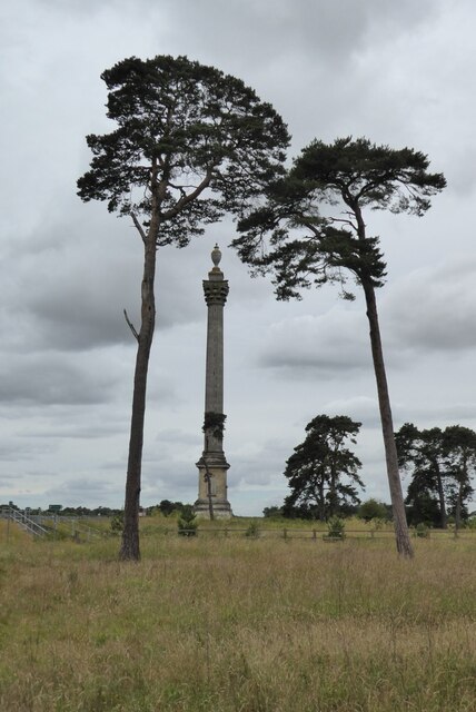
Eriswell High Warren is a picturesque area located in Suffolk, England, known for its stunning Downs and Moorland landscapes. Spanning approximately 200 acres, this region offers a diverse range of habitats for various flora and fauna species, making it an ideal location for nature enthusiasts and wildlife lovers.

The Downs of Eriswell High Warren are characterized by rolling hills, covered in lush green grasses and scattered patches of heather. These hills provide breathtaking panoramic views of the surrounding countryside, making it a popular spot for hiking and nature walks. The Moorland, on the other hand, consists of expansive open spaces, dotted with gorse bushes and bracken. This unique habitat supports a wide range of bird species, including the iconic skylarks and kestrels.

The area is also home to several protected species, such as the rare silver-studded blue butterfly and the sand lizard, both of which thrive in the diverse ecosystems found within Eriswell High Warren. The region is carefully managed to preserve its natural beauty and ensure the protection of its inhabitants.

Visitors to Eriswell High Warren can expect to experience a tranquil and serene environment, away from the hustle and bustle of city life. The area offers numerous walking trails and picnic areas, allowing visitors to immerse themselves in the natural surroundings and enjoy the peaceful ambiance.

Overall, Eriswell High Warren in Suffolk is a haven for nature lovers, providing an opportunity to explore and appreciate the beauty of the Downs and Moorland landscapes while encountering a variety of unique wildlife species.

If you have any feedback on the listing, please let us know in the comments section below.

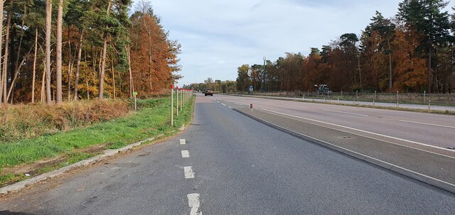
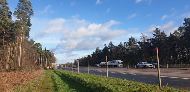
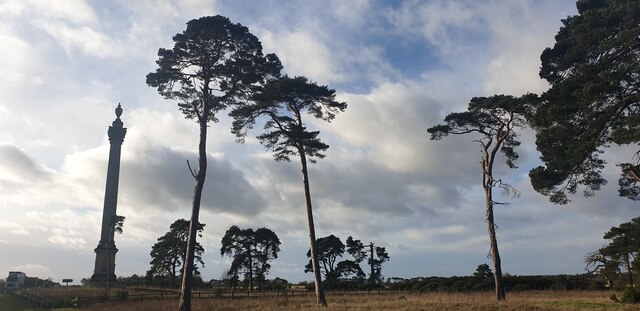
Eriswell High Warren Images

Images are sourced within 2km of 52.381293/0.61822587 or Grid Reference TL7879. Thanks to Geograph Open Source API. All images are credited.

Lakenheath Warren Grassy heath. The area is open access land, but only between November and February due to sensitive wildlife, <a href="https://www.geograph.org.uk/photo/7383126">TL7779 : Open access sign</a>. Looking towards the Center Parcs site.
Lakenheath Warren
Grassy heath. The area is open access land, but only between November and February due to sensitive wildlife, TL7779 : Open access sign. Looking towards the Center Parcs site.
Path through Lakenheath Warren Grassy heath, with the number of trees and bushes controlled. The area is open access land, but only between November and February due to sensitive wildlife, <a href="https://www.geograph.org.uk/photo/7383126">TL7779 : Open access sign</a>
Path through Lakenheath Warren
Grassy heath, with the number of trees and bushes controlled. The area is open access land, but only between November and February due to sensitive wildlife, TL7779 : Open access sign
Lakenheath Warren Grassy heath. The area is open access land, but only between November and February due to sensitive wildlife, <a href="https://www.geograph.org.uk/photo/7383126">TL7779 : Open access sign</a>.
Lakenheath Warren
Grassy heath. The area is open access land, but only between November and February due to sensitive wildlife, TL7779 : Open access sign.
Lakenheath Warren Looking towards the habitat creation area on what was conifer plantation.
Lakenheath Warren
Looking towards the habitat creation area on what was conifer plantation.
Shaker's Road through Lakenheath Warren
Lakenheath Warren With habitat creation where there was a conifer plantation.
Lakenheath Warren
With habitat creation where there was a conifer plantation.
Shaker's Road through Lakenheath Warren
Layby on the A11 west of Elveden
Elveden War Memorial This memorial is a Grade II listed structure situated on the north side of the All, commemorating WW1 and WW2.  This image is taken from the path from the layby.  The memorial is behind the photographer.
Elveden War Memorial
This memorial is a Grade II listed structure situated on the north side of the All, commemorating WW1 and WW2. This image is taken from the path from the layby. The memorial is behind the photographer.
Looking up at the Pine Trees The War Memorial is to the left.
Looking up at the Pine Trees
The War Memorial is to the left.
Looking up at the Pine Trees The War Memorial is to the left.
Looking up at the Pine Trees
The War Memorial is to the left.
Looking up at the Pine Trees The War Memorial is to the left.
Looking up at the Pine Trees
The War Memorial is to the left.
Elveden War Memorial Driving along the A11 as I approached this column I had to stop and have a closer look.  My first though was it was a monument on an estate in memory of an eminent local landowner, but no it is a war memorial erected in 1921.  Surely it will be difficult to find another as impressive as this.  The monument was designed by Clyde Francis Young, and is Grade II* listed, see: <span class="nowrap"><a title="https://historicengland.org.uk/listing/the-list/list-entry/1037610?section=official-list-entry" rel="nofollow ugc noopener" href="https://historicengland.org.uk/listing/the-list/list-entry/1037610?section=official-list-entry">Link</a><img style="margin-left:2px;" alt="External link" title="External link - shift click to open in new window" src="https://s1.geograph.org.uk/img/external.png" width="10" height="10"/></span>
Elveden War Memorial
Driving along the A11 as I approached this column I had to stop and have a closer look. My first though was it was a monument on an estate in memory of an eminent local landowner, but no it is a war memorial erected in 1921. Surely it will be difficult to find another as impressive as this. The monument was designed by Clyde Francis Young, and is Grade II* listed, see: LinkExternal link
The A11 near Elveden War Memorial
Show me another place!

Eriswell High Warren is located at Grid Ref: TL7879 (Lat: 52.381293, Lng: 0.61822587)

Administrative County: Suffolk

District: West Suffolk

Police Authority: Suffolk

What 3 Words

///eyelashes.detriment.liver. Near Lakenheath, Suffolk

Related Wikis

Weather and Horn Heaths, Eriswell

Weather and Horn Heaths, Eriswell is a 133.3-hectare (329-acre) biological Site of Special Scientific Interest east of Eriswell in Suffolk. It is a Nature...

Lakenheath Warren

Lakenheath Warren is a 588.3-hectare (1,454-acre) biological Site of Special Scientific Interest south-east of Lakenheath in Suffolk, England. It is a...

Breckland Farmland

Breckland Farmland is a 13,392.4 hectare biological Site of Special Scientific Interest (SSSI) in many separate areas between Swaffham in Norfolk and Bury...

Berner's Heath

Berner's Heath is a 236.9-hectare (585-acre) biological Site of Special Scientific Interest north-east of Icklingham in Suffolk. It is a Nature Conservation...

Elveden

Elveden is a village and civil parish in the West Suffolk district of Suffolk in eastern England. In 2005 it had a population of 270. The village is bypassed...

How Hill Track

How Hill Track is a 3.1-hectare (7.7-acre) biological Site of Special Scientific Interest east of Mildenhall in Suffolk. It is in the Breckland Special...

Elveden Hall

Elveden Hall is a large stately home on the Elveden Estate in Elveden, Suffolk, England. The seat of the Earls of Iveagh, it is a Grade II* listed building...

Eriswell Low Warren

Eriswell Low Warren is a 7.4-hectare (18-acre) biological Site of Special Scientific Interest north-east of Eriswell in Suffolk. It is a Nature Conservation...

Nearby Amenities

Located within 500m of 52.381293,0.61822587
Leisure: garden
Lat/Long: 52.3799358/0.6119256
The data included in this document is from www.openstreetmap.org. The data is made available under ODbL.

Have you been to Eriswell High Warren?

Leave your review of Eriswell High Warren below (or comments, questions and feedback).