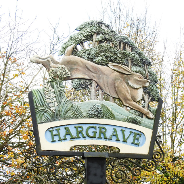
Hargrave Green

Downs, Moorland in Suffolk West Suffolk

England

Hargrave Green

New housing on New Road, Chevington On the site of a bungalow with a large garden.
New housing on New Road, Chevington Credit: Robin Webster

Hargrave Green is a picturesque village located in the county of Suffolk, England. Situated amidst the stunning downs and moorland landscapes, it offers residents and visitors a tranquil and idyllic setting to enjoy. The village is nestled within the heart of the English countryside, surrounded by rolling green hills, vast meadows, and breathtaking natural beauty.

With a population of just over 500 people, Hargrave Green retains its small and close-knit community feel. The village is known for its charming thatched cottages, traditional architecture, and well-maintained gardens. A sense of history permeates the area, with some buildings dating back centuries, adding to the village's character and charm.

The downs and moorland surrounding Hargrave Green provide ample opportunities for outdoor enthusiasts. Hikers, cyclists, and nature lovers can explore the numerous trails and paths that wind through the countryside. The vast open spaces are perfect for picnics, leisurely walks, or simply immersing oneself in the peace and tranquility of nature.

Despite its rural location, Hargrave Green is well-connected to nearby towns and cities. The village has a local bus service, ensuring convenient transportation options for residents. Essential amenities such as a village shop, post office, and a pub can be found within close proximity, catering to the daily needs of the community.

Overall, Hargrave Green offers a charming and peaceful escape from the hustle and bustle of city life. Its stunning natural surroundings, friendly community, and serene atmosphere make it an ideal place to live or visit for those seeking a slower pace of life in the heart of the Suffolk countryside.

If you have any feedback on the listing, please let us know in the comments section below.

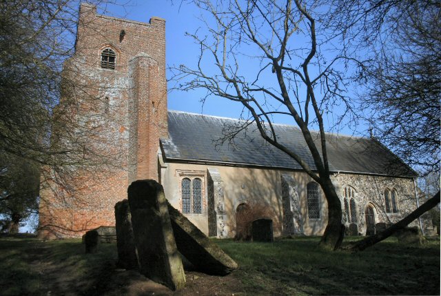
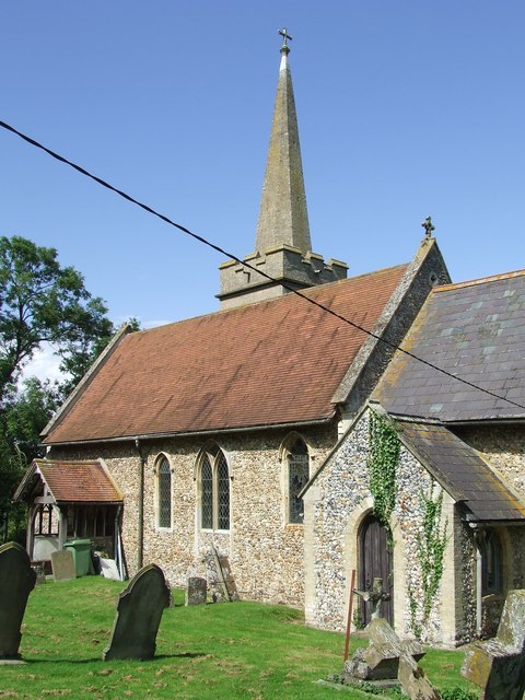
Hargrave Green Images

Images are sourced within 2km of 52.200047/0.58645193 or Grid Reference TL7658. Thanks to Geograph Open Source API. All images are credited.

New housing on New Road, Chevington On the site of a bungalow with a large garden.
New housing on New Road, Chevington
On the site of a bungalow with a large garden.
Water Tower NW of Depden: aerial 2019
Water tower west of Depden
Road northwards towards Hargrave
Wickhambrook Road, Hargrave Northwards towards the village centre.
Wickhambrook Road, Hargrave
Northwards towards the village centre.
Bury Road, Hargrave Heading out of the village towards Bury.
Bury Road, Hargrave
Heading out of the village towards Bury.
Hargrave village sign The sign features a strange looking hare from which the village gets its name.  In old Anglo-Saxon, Haragraua (Hares' Grove).
<a title="https://www.geograph.org.uk/photo/6663349" href="https://www.geograph.org.uk/photo/6663349">Link</a>
Hargrave village sign
The sign features a strange looking hare from which the village gets its name. In old Anglo-Saxon, Haragraua (Hares' Grove). Link
Hargrave village sign The sign features a strange looking hare from which the village gets its name.  In old Anglo-Saxon, Haragraua (Hares' Grove).
<a title="https://www.geograph.org.uk/photo/6663348" href="https://www.geograph.org.uk/photo/6663348">Link</a>
Hargrave village sign
The sign features a strange looking hare from which the village gets its name. In old Anglo-Saxon, Haragraua (Hares' Grove). Link
Chevington village sign The sign which is based on a horseshoe with eleven nail holes. (usually 6 to 8) depicts the Abbot, John de Norwold, who owned 460 acres of arable land in Chevington, 8 acres of meadow, 4 acres of wood and a windmill so he could collect the tythes and enjoy a life sitting about doing nothing. The sign is decorated with ears of wheat, poppies and daisies.
Chevington village sign
The sign which is based on a horseshoe with eleven nail holes. (usually 6 to 8) depicts the Abbot, John de Norwold, who owned 460 acres of arable land in Chevington, 8 acres of meadow, 4 acres of wood and a windmill so he could collect the tythes and enjoy a life sitting about doing nothing. The sign is decorated with ears of wheat, poppies and daisies.
Chevington village hall The village sign is located beside the steps up to the entrance. <a title="https://www.geograph.org.uk/photo/6767883" href="https://www.geograph.org.uk/photo/6767883">Link</a>
Chevington village hall
The village sign is located beside the steps up to the entrance. Link
Ousden village sign Ousden is a derivation of owl's den, hence the owl. Also depicted is the church of St Peter and rabbits running about in a wheatfield with poppies and other wild flowers, trees and oak leaves surrounding the whole. <a title="https://www.geograph.org.uk/photo/4293688" href="https://www.geograph.org.uk/photo/4293688">Link</a>
Ousden village sign
Ousden is a derivation of owl's den, hence the owl. Also depicted is the church of St Peter and rabbits running about in a wheatfield with poppies and other wild flowers, trees and oak leaves surrounding the whole. Link
Footpath to Great Knowles Green
Footpath to Hargrave
Between Hargrave and Chevington Typical Suffolk landscape. Not flat, but not really hilly either.
Between Hargrave and Chevington
Typical Suffolk landscape. Not flat, but not really hilly either.
Farm track near The Grove, Hargrave
Footpath along the parish boundary Follows the boundary between Hargrave (left) and Chevington.
Footpath along the parish boundary
Follows the boundary between Hargrave (left) and Chevington.
Footpath to Wickhambrook Road In gently rolling Suffolk countryside.
Footpath to Wickhambrook Road
In gently rolling Suffolk countryside.
Corner of a field A footpath to Little Knowles Green cuts across this corner.
Corner of a field
A footpath to Little Knowles Green cuts across this corner.
Show me another place!

Hargrave Green is located at Grid Ref: TL7658 (Lat: 52.200047, Lng: 0.58645193)

Administrative County: Suffolk

District: West Suffolk

Police Authority: Suffolk

What 3 Words

///breeze.barbarian.pocket. Near Bury St Edmunds, Suffolk

Nearby Locations

Hargrave Green

Related Wikis

Hargrave, Suffolk

Hargrave is a village and civil parish in the West Suffolk district of Suffolk in eastern England, located about 7 miles (10 km) away from south west of...

Chevington, Suffolk

Chevington is a village and civil parish in the West Suffolk district of Suffolk in East Anglia, England. Located around 10 km south-west of Bury St Edmunds...

Chedburgh

Chedburgh is a village and civil parish in the West Suffolk district of Suffolk in eastern England. Located on the A143 around five miles south-west of...

Ousden

Ousden is a village and civil parish in the West Suffolk district of Suffolk in eastern England. It is located around 6 miles (10 km) west of Bury St Edmunds...

Nearby Amenities

Located within 500m of 52.200047,0.58645193
Hargrave Green
Place: hamlet
Lat/Long: 52.2006637/0.5874152
The data included in this document is from www.openstreetmap.org. The data is made available under ODbL.

Have you been to Hargrave Green?

Leave your review of Hargrave Green below (or comments, questions and feedback).